Evacuation levels reduced on west side of nearly 87,000-acre Cedar Creek Fire; Highway 58 reopens
(Update: Highway 58 reopens)
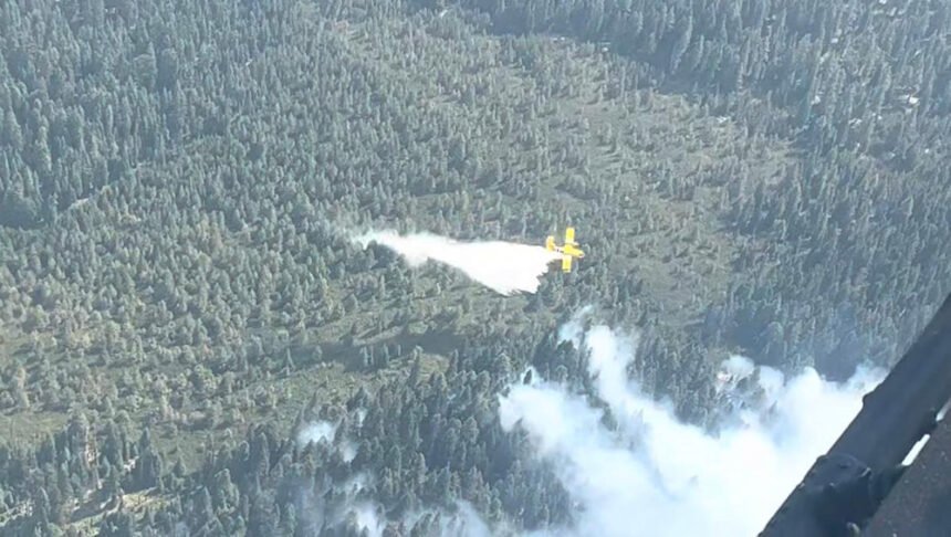
OAKRIDGE, Ore. (KTVZ) -- An army of firefighters from across the nation is helping battle the 6-week-old Cedar Creek Fire that exploded in weekend heat and winds to nearly 87,000 acres and forced evacuations, power outages and highway and forest closures.
But cooler, calmer weather has improved conditions, officials said Monday as evacuation levels were lowered, Highway 58 reopened and thick smoke poured into communities east and west of the fire.
Highway 58 reopened to traffic over Willamette Pass on Monday, ODOT said, but there are still Cedar Creek fire responders in the area. There is also work zone between mileposts 56 and 62, east of the Salt Creek Tunnel. Expect delays up to 20 minutes, the agency said, with traffic controlled by flaggers and a pilot car.
NewsChannel 21's Noah Chast visited the Mt. Bachelor command post for the east side of firefighting operations on Monday for a report coming up on Fox at 4 (program note: our 5 and 7 p.m. newscasts are pre-empted by the Emmys and our 6 p.m. newscast will air on Fox).
Here's Monday morning's update.
Cedar Creek Fire
September 12, 2022
Daily Update, 7:30 AM
Cedar Creek Fire Quick Facts
Size: 86,734 acres
Contained: 0%
Start Date: August 1, 2022
Origin: 15 miles east of Oakridge, Oregon
Cause: Lightning
Total personnel: 1,228
Resources:
75 engines 22 crews 68 heavy equipment 8 helicopters
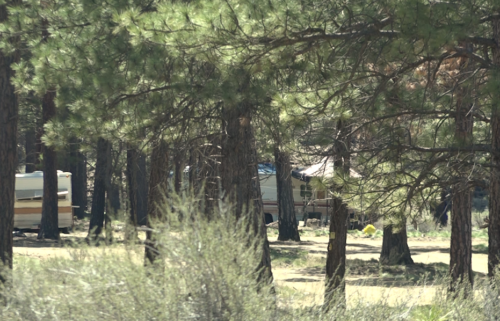
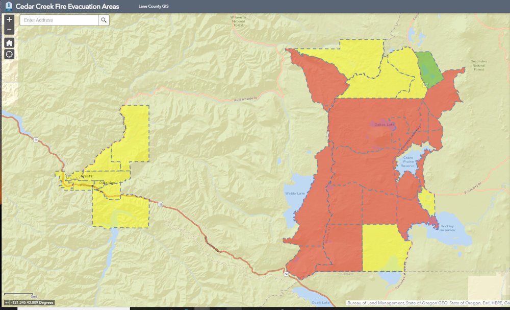
Current Situation: The Lane County Sheriff’s Office lowered some evacuation levels yesterday due to changing conditions and progress on the fire. Evacuation levels in the communities of Westfir and portions of Oakridge were lowered from Level 3 (Go Now) to Level 2 (Set). High Prairie and the areas north, east, and southwest of Oakridge were lowered as well today (see map). Fire officials will continue to work with local law enforcement to communicate fire conditions and keep the community safe. People who remain in shelters will continue to receive services provided by the Red Cross. People who have mobility limitations or are particularly sensitive to smoke are encouraged not to return to Level 2 areas.
As the wind has died down, heavy smoke is blanketing the Cedar Creek Fire area. Oakridge has been experiencing dense smoke, and with the wind switch to the northwest, smoke has created unhealthy air quality for communities east of the fire as well, including Bend. To protect yourself from smoke, avoid strenuous outdoor activities and limit your time outdoors.
Southwest of Waldo Lake, firefighters were able to hold Forest Road 5883 north of Highway 58 and the Rogue River hotshot crew was able to improve handline to tie into Forest Road 5897. A backing fire is slowing advancement on the southwestern edge. Firefighters continue to hold and improve all lines.
Today, a structural group will head to the southern portion of the fire to assist with back burns along Highway 58 and evaluate structures near Odell Lake. While crews remain focused on protecting the communities of High Prairie, Westfir, and Oakridge, fire officials recognize the relative proximity of the fire to other surrounding communities and want to be prepared to support and protect those areas.
In the east zone, efforts continue to brush the west side of the Cascade Lakes Highway to improve a fuel break and prepare for possible burn-out operations. The Cascade Lakes Highway remains closed to ensure public safety and the safety of firefighters. Infrastructure protection continues around Cultus Lake. In the southeast region of the fire, near Odell Lake, a new branch and two divisions have been added with crews deployed to brush around Highway 58. Highway 58 is closed from milepost 36 to 62. A new camp is being established near Cascade Junction to put crews closer to the southeast side of the fire. Expect to see more traffic and firefighting activity in the area.
Weather/Fire Behavior: Winds are light and steady out of the west northwest. Dry conditions were aided by good overnight relative humidity recovery and scattered light rainfall. Temperatures will be more seasonal, in the upper 60s. Some torching and spotting fire behavior is expected over the next day or so, but most activity will be creeping and smoldering.
Evacuations: Sign-up for emergency mobile alerts by going to oralert.gov. Please check with Lane County Sheriff’s Office at 541-682-4150 and Deschutes County Sheriff’s Office at 541-693-6911 for updates and changes. Go to https://bit.ly/3D51kvC to view a map.
Closures: The Deschutes National Forest and Willamette National Forest have implemented closures for the Cedar Creek Fire. Please visit Willamette National Forest and Deschutes National Forest for detailed closure orders and a joint map. A Temporary Flight Restriction (TFR) is in place. The use of drones is prohibited in the fire area, please make it safe for our firefighters to use aircraft on the fire. Pacific Crest Trail hikers should visit pcta.org for current information.
Restrictions: Fire restrictions are in place on the Willamette National Forest and Deschutes National Forest.
Smoke: For current conditions, see Fire.airnow.gov, oakridgeair.org, and LRAPA - Today's Current Air Quality. Smoke Forecast Outlooks are available at https://outlooks.wildlandfiresmoke.net/outlook.
Online: https://inciweb.nwcg.gov/incident/8307/ | https://www.facebook.com/CedarCreekFire2022/ |
YouTube: https://www.tinyurl.com/cedarcreekfireyoutube
Fire Information: 8:00 AM – 8:00 PM | Phone: 541-201-2335, Media Line: 541-327-9925 |
Email: 2022.cedarcreek@firenet.gov