Temperatures climbing above normal as we approach meteorological winter
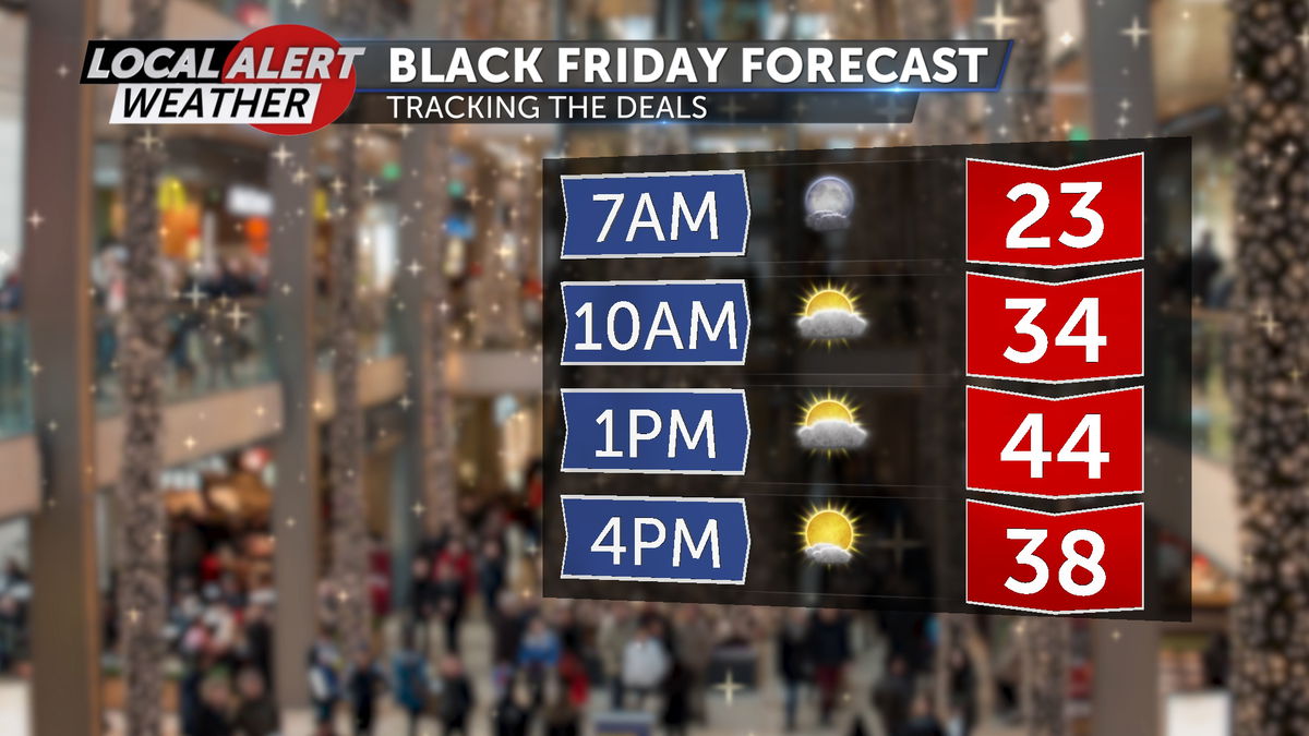
Today, highs will be in the low to mid 40s after a cold start this morning. Drier air has moved in, so frost is a little less likely this morning but there could be a few areas that have to scrape. If you’re heading out this morning to shop the holiday deals, give yourself a couple minutes to heat up your car and check for frost.

The holiday weekend remains dry and mostly clear. A ridge of high pressure is moving inland over the course of the weekend which, in turn, means our temperatures will start to rise. It won’t exactly be t-shirt weather, but highs will reach the 50s by early next week for a number of us.
Aside from the gradual incline in temperatures, the overall pattern remains mostly the same and day-to-day weather will remain pretty consistent.
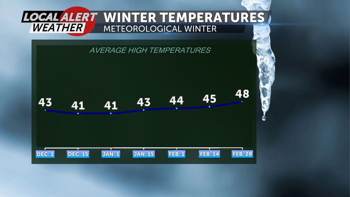
Meteorological winter starts Sunday, December 1st and will continue through the end of February. The winter solstice, which is based on the location of the earth to the sun, will occur on December 21st. That will be the shortest day and the longest night of the year.

Have a great weekend, happy holidays, and safe travels!
Don’t forget to download the KTVZ weather app to stay safe and informed.
iOS: https://apps.apple.com/us/app/ktvz-local-alert-weather-app/id1088330817
Android: https://play.google.com/store/apps/details?id=com.ktvz.android.weather&hl=en_US
