‘Atmospheric river’ turns snow to heavy rain in Cascades; Mt. Bachelor closes operations through at least Tuesday
(Update: Adding video; continued rain shuts resort for at least two more days)
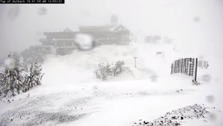
BEND, Ore. (KTVZ) – A warmer, wetter “atmospheric river” turned the heavy snow to heavy rain in the Cascades Sunday, including Mt. Bachelor, where standing water and flooding prompted its closure, just one day after opening day. The rain kept falling, and the resort later suspended operations through at least Tuesday.
“Snow turned to rain earlier and heavier than expected, and is forecasted to continue all day,” the resort’s Sunday morning update said. (Monday's update said much the same.)
“For the safety of our employees and guests, we are suspending operations today, 12/3, due to heavy rain, flooding, standing water concerns, dangerous road conditions and to preserve our snowpack,” the report continued.
The resort said Sunday evening that the heavy rain continued throughout the day and is expected through Wednesday morning.
"In order to preserve our snowpack for the season ahead, we will be limiting all disturbances on the snow surface and suspending operations through Tuesday," the 5 p.m. update said.
"We will assess conditions daily, with the goal of reopening for skiing and riding on Wednesday morning, if possible," the resort said, adding that guest bookings for Monday and Tuesday will be automatically refunded.
Mt. Bachelor is not alone. The heavy rain brings a threat of avalanches and flooding at Mount Hood, where Mount Hood Meadows postponed their weekend opening. Timberline Lodge did decide to open Sunday, but will be closed the next three days, KGW reported.
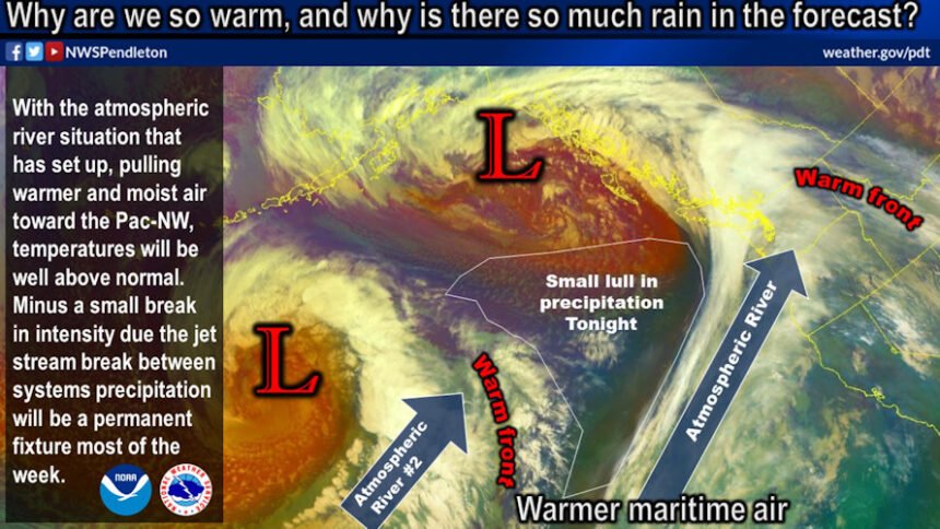
The National Weather Service in Pendleton advised Sunday, “An atmospheric river event has begun across the area and will continue through Wednesday. It will bring abundant moisture and rising temperatures to the region.”
“High temperatures by Tuesday will be 10 to 20 degrees above normal,” forecasters said. “These temperatures will cause rising snow levels through early Wednesday before snow levels decrease again.”
About 1-2 inches of rain is expected in the mountains through Monday night, with some higher amounts in the Washington Cascades. Another 1-1.5 inches, with local amounts up to 2 inches, is expected Tuesday and Wednesday. “Significant rises are expected om many area rivers and streams, though no mainstem river flooding is anticipated at this time,” the NWS said. Only the Naches River is expected to reach or exceed “action stage” by midweek, but if more rain falls, “additional rivers could reach bank-full.”
