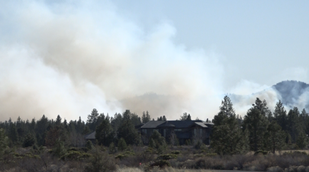
Prescribed burns planned Tuesday SE of Bend, SW of Crescent, near Paulina

(Update: Adding other burns planned for Tuesday)
Smoke will be 'very visible,' could impact neighborhoods on city's south, east side, Sunriver, Hwy. 97
BEND, Ore. (KTVZ) -- On Tuesday, fuel specialists with the Deschutes National Forest, with assistance from Bend Fire and Rescue and the Oregon Department of Forestry, plan to conduct prescribed fire operations on both national forest and private lands southeast of Bend.
The burn, about a half-mile east of the High Desert Museum, originally was scheduled for Tuesday and Wednesday, but predicted weather conditions prompted a delay, the Forest Service said Sunday.
Specialists will underburn 252 acres in total of of national forest and private lands. The prescribed burning on the private lands is being done in coordination with the private landowner, using Good Neighbor Authority.
Ignitions will begin on Tuesday and may continue Wednesday, depending on progress conditions. Ignitions will begin at about 9 a.m. and should end by 5 p.m.
Smoke and residual burning will be visible in the area for up to a week post-ignition. Subdivisions and neighborhoods on the south and east side of Bend can expect some nighttime and early morning smoke impacts after project implementation. Sunriver and the Newberry Caldera could also be impacted, if smoke settles to the south and southeast.
Smoke may also impact U.S. Highway 97. Motorists should slow down and turn on their lights if smoke impacts their visibility. Warning signs will be on the highway and, if necessary, flaggers will be used to reduce impacts to traffic.
In addition to meeting forest restoration objectives by introducing fire into a Ponderosa pine ecosystem, the underburning is occurring in the wildland-urban interface. Prescribed burning is an important preventative step in reducing potential impacts of a wildfire to Bend and critical transportation corridors, officials said.
Meanwhile, fuel specialists with the Deschutes National Forest also will be doing a prescribed burn southwest of Crescent on Tuesdasy.
Crews will underburn approximately 22 acres, located 11 miles southwest of Crescent adjacent to the Two Rivers Subdivision. Ignitions are planned to begin at 10 a.m.
Smoke will be visible from Crescent and the surrounding area during operations. Residents might see smoke to be visible up to two weeks after ignitions are complete. U.S. Highway 97 and State Route 58 will be monitored for smoke impacts and warning signs will be in placed if needed.
The objective of this prescribed burn is to reduce fuel loadings in ponderosa pine stands that are part of the Rim-Paunina project area, which is within the Walker Range Community Wildfire Protection Plan. The Walker Range CWPP assesses the risks, hazards, and mitigation and prevention opportunities associated with wildfire in the community.
On the Ochoco National Forest, meanwhile, firefighters will be burning approximately 2,033 acres near Paulina, two miles west of the old Rager Ranger Station on the Ochoco National Forest.
If conditions remain favorable, ignitions on the Upper Beaver 5 unit are expected to start at 9:00 a.m. Tuesday and take two days to complete.
Firefighters from the Ochoco National Forest and Prineville District BLM will be joined by the Prineville Interagency Hotshots.
This burn will reintroduce fire into a fire-adapted ecosystem, improve stand conditions for large and dominant trees and reduce the populations of western juniper throughout the unit.
Smoke will likely be visible from areas within the Paulina Valley and while there are no road closures expected with this burn, smoke will impact Forest Road 58 and other nearby forest roads. Visitors should expect some delays traveling through the area. Firefighters will be cooling hot spots along the perimeter for the rest of the week and the prescribed burn will be patrolled for the next several weeks.
The public can find an interactive map of prescribed burns, as well as air quality information at this link: https://www.centraloregonfire.org/wildfire-smoke-air-quality-maps-2/ To sign up for text alerts about prescribed fires and wildfires, people can text COFIRE to 888-777.
The public is encouraged to close their windows at night. The public’s health is important to the Forest Service, the agency said. While significant preventive measures are taken, many factors influence a person’s susceptibility to smoke, including severity and duration of smoke exposure and a person’s health. If individuals feel impacted by smoke, they should avoid outdoor physical exertion and remain indoors.
If people experience serious health impacts from the smoke, they should contact their doctor. For more information about smoke and health, visit the Oregon Health Authority recommendations through this link: https://www.oregon.gov/oha/PH/Preparedness/Prepare/Pages/PrepareForWildfire.aspx#health