ODF shifts wildfire risk map community meeting to virtual, open to all

SALEM, Ore.— The Oregon Department of Forestry canceled Tuesday's community information session scheduled in Grants Pass on the state's new wildfire risk mapping effort. Wednesday's information session scheduled in Medford will now be a virtual meeting only. Anyone may attend the virtual session.
Many community venues, including the Medford Public Library, are designated as community cooling shelters. Southwest Oregon has multiple days of 100-degree weather forecasted this week. With high demand for community cooling shelter capacity, ODF decided to cancel the in-person meetings. The meetings will soon be rescheduled.
The virtual meeting will be held through Zoom from 7-8 p.m. Wednesday, July 27. Join the meeting through this link: https://odf.zoom.us/j/97802419789.
Each information session will include a presentation about the map’s function and purpose, how wildfire risk is assessed, and how property owners may appeal their assigned risk class. Time will be available to address questions from community members.
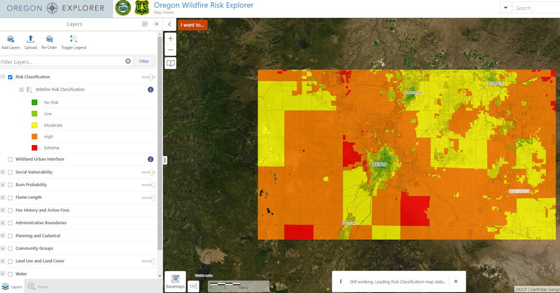
The wildland-urban interface (WUI) and statewide wildfire risk map available through the Oregon Explorer is a tool to help inform decision making and planning related to mitigating wildfire risk for communities throughout Oregon.
Representatives from Oregon State University who produced the map based on rules adopted by the Board of Forestry will also attend the sessions.
Property owners in the high and extreme risk classes have received written notice from ODF indicating the property’s risk class and whether it’s in the wildland urban interface. The notice will inform them if they may be subject to future defensible space or building code requirements and how to find information on those requirements. It will also provide information on the process to appeal a property’s risk classification.
For properties in the WUI and a risk classification of high or extreme, Senate Bill 762 requires actions to help mitigate the risk of wildfire through adoption of defensible space and home hardening building codes. Oregon State Fire Marshal is passing defensible space code requirements through a public process. Code adoption of defensible space requirements will occur in December 2022, after the map validation and appeals period is closed. Those requirements won’t apply until later. Visit OSFM’s website for more information.
The Building Codes Division (BCD) will adopt home hardening building codes through a public process. Building codes will be adopted October 1, 2022 and will be effective April 1, 2023. Visit BCD’s website for more information. Visit Division of Financial Regulation for information on insurance related to the wildfire risk map.