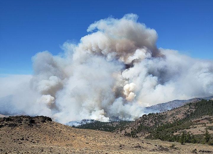
Brattain Fire grows to 20,000 acres; Paisley-area Level 3 evacuation expanded

LAKEVIEW, Ore. (KTVZ) -- The Brattain Fire burning in steep, rugged terrain 10 miles south of Paisley has grown to 20,000 acres and remains 0% contained, with expanded evacuations announced Sunday in the Paisley area.
Here's the full update for Sunday
BRATTAIN FIRE UPDATE
Incident Commander: Coley Neider
September 13, 2020
The virtual community meeting scheduled at 7:00 tonight for the Brattain Fire was canceled. A new meeting date and time has not been determined.
The Brattain fire is currently burning approximately 10 miles south of Paisley. The fire is burning in sagebrush-juniper with stringers of Ponderosa pine in steep, rugged terrain with limited access points and high winds.
Yesterday’s Operations:
Firing operations around Paisley were successful in preparation for today’s Red Flag Warning for strong, gusty winds and low relative humidity.
Today’s Operations:
Gusty erratic winds today hampered control efforts on the fire, causing numerous slop-overs and spot fires. Firefighters are battling winds and extremely dry conditions. Conditions are expected to be similar tomorrow. Firefighters continue to monitor and patrol yesterday’s firing operation to protect the community of Paisley and the surrounding area.
If you do not need to be in the area, please leave! This is for public safety and to allow firefighters to focus on their job. This includes avoiding State Highway 31 and adhering to local road closures.
Evacuations:
The Lake County Sheriff’s Office has issued the following evacuation notices:
Level 3 (Go) – All of Paisley, from Red House Lane (north of Paisley), south on Highway 31 to Valley Falls/the junction with U.S. Hwy 395; All of Clover Flat Road from the intersection with Hwy 31 (Beachler’s Corner) south to Valley Falls.
Level 1 (Be Ready) – From Red House Lane north along Hwy 31 to the intersection with Government Harvey Road/Forest Road 29.
The Red Cross has an evacuation area at the Lake County Fairgrounds in Lakeview (1900 North 4th St.). There will be fire information there as well.
Closures:
Highway 31 is now closed between Valley Falls and north of Paisley.
The Fremont-Winema National Forest issued emergency fire closure order 06-02-03-20-03 for the area east Forest Road 28 and south of Forest Road 29 (Government Harvey). Forest Road 29 is closed; Forest Road 28 remains open. Forest Road 33 is closed at the Forest Boundary south of Paisley to the junction with Forest Road 28.
Forest Road 3510, which makes the southern edge of the closure area is closed, as is Forest Road 3510-018 from Clover Flat Road to the Forest Boundary, and Forest Road 3315 at the intersection with Mill Street in Paisley. All recreation sites within the closure area are closed.
Safety:
For those in the evacuation area, it is anticipated there will be congestion on Hwy 31, fire traffic and temporary loss of power. Please use caution leaving the area.
SIZE: 20,000 acres
CONTAINMENT: 0%
CAUSE: Human
PERSONNEL: 220
Eastern Area Incident Management Team Silver – Type 2; Transitioning/ Taking Command at 0600 Monday
FIRE INFORMATION:
541-947-6243
INCIWEB:
Facebook:
www.facebook.com/SCOFMPFIREINFO
LEVEL 3 EVACUATION
Paisley
Hwy 31 & Clover Flat Road (both roads) to Valley Falls
LEVEL 1 EVACUATION
North of Paisley
SCHOOL CLOSURE
Paisley Schools – Closed September 14-15.
FIRE PREVENTION
Area firefighters are at capacity. Please be careful with anything that can throw a spark or start a wildfire!