S-503 Fire on Warm Springs Reservation at 6,200 acres; Klamath fire evacuation level lowered

(Update: S-503, Cutoff Fire updates; Klamath evacuation level reduced)
BEND, Ore. (KTVZ) – A wildfire on the Warm Springs Indian Reservation southeast of Mount Hood grew to about 6,200 acres Sunday, also bringing hazy skies to Central Oregon, while another blaze north of Bonanza in southern Klamath County grew to about 1,500 acres. Both fires threatened homes and prompted evacuation orders and warnings over the weekend.
The S-503 Fire was reported around 6 p.m. Friday on the north end of the reservation, about three miles east of Highway 26, two miles north of Quartz Butte and was eight miles north of Simnasho, Warm Springs fire officials said.
The blaze was estimated at about 250 acres as of 7 a.m. Saturday, but the day’s hot and windy weather prompted its rapid growth to an estimated 800 acres by late afternoon, according to the state’s interactive wildfires dashboard. And by 9 p.m., it had grown to 4,300 acres, according to Warm Springs Fire Management, based on updated aerial GPS data.
Fire Public Information Officer Javin Dimmick told NewsChannel 21 Monday morning the acreage estimated at 6,700 Sunday night had been revised downward to 6,200 acres after an overnight infrared flight.
Monday's update said the fire was still two miles east of Highway 26 and seven miles northwest of Simnasho. Forecasters expect temperatures in the low 90s, very low relative humidity and winds shifting from northeast to northwest Monday afternoon.
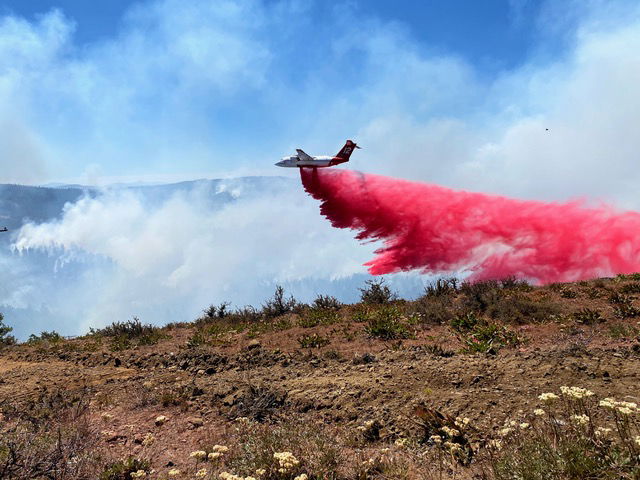
On Sunday night, he told KGW winds were pushing the fire slowly to the southwest and that air tankers, including single-engine air tankers (SEAT planes) focused on a ridge at the northern edge of the blaze, helping hand and bulldozer crews to protect homes and property to the north in the Pine Grove area, remaining a Level 2 (Get Set) evacuation notice from the Wasco County Sheriff’s Office.
The fire as of late Sunday was about two miles east of Highway 26, a half-mile south of Highway 216 and seven miles north of Simnasho. There have been no reports of injuries or burned structures, Dimmick said. The fire was burning mostly in timbered area, with a thick understory of brush, debris and dead and downed oak and pine trees.
More fresh crews have been called in and 250 to 300 firefighters were on the scene Sunday. A wind shift expected Monday could push the fire back into previously burned areas, but hotter weather and a chance of thunderstorms was in the forecast. "It's just really dry out there," Dimmick said, and that has already led to spot fires up to a mile ahead of the main fire.
The Wasco County Sheriff's Office on Saturday night had issued Level 3 GO NOW orders to homes west of the intersection of Back Walters Road and Kelly Springs. Level 2 Get Ready warnings were in place for areas previously under Level 1 (Get Ready) notices, east of Kelly Springs to Reservation Road, including Walters Corners and the community of Pine Grove.
On Sunday, the sheriff's office update said all residences West of Kelly Springs Rd/Back Walters Rd have been lowered from Level 3 to Level 2 - Get Set. All other previous evacuation areas will remain at Level 2.
The cause of the fire was undetermined, officials said.
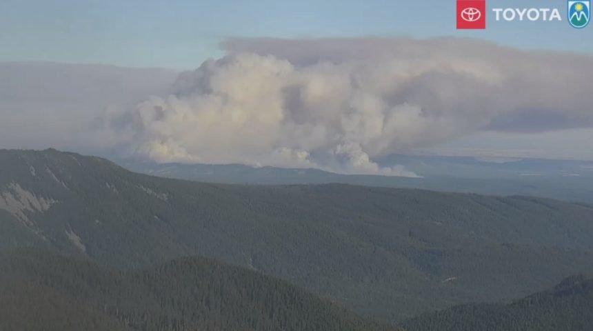
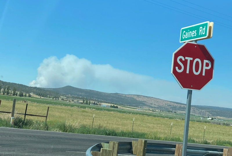
A live webcam at Mount Hood Meadows (third on the page) showed the tall, wide smoke plume Saturday evening from the S-503 Fire. It was a much lower, wider cloud of smoke Sunday evening.
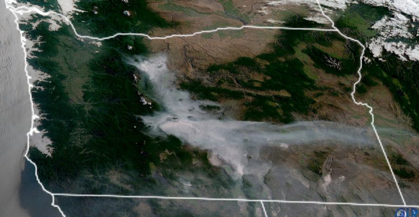
A layer of smoke was visible to the north and west from the Bend area on Saturday, and smoke moved into the region overnight, dropping air quality readings to moderate and at times unhealthy for sensitive groups.
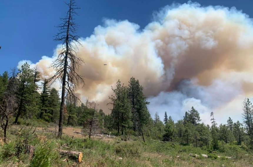
Meanwhile, in Klamath County, the Cutoff Fire was reported around 1:30 p.m. Saturday and was burning on private and BLM-protected land about six miles north of Bonanza.
It was initially estimated at about 100 acres by late Saturday afternoon and was rapidly spreading to the east, toward the Wren subdivision. By nightfall, the blaze was estimated at 1,000 acres, spreading rapidly to the southeast, and it grew to more than 1,500 acres by Monday.
The cause of that fire also was under investigation.
Here's Monday morning's update on the Cutoff Fire, which now has a Facebook page:
Fire crews work spot fires as they prepare for shifting winds
BONANZA, Ore.—Firefighters were kept busy overnight suppressing a number of small fires started by drifting embers on the southern and eastern flanks of the Cutoff Fire, six miles north of Bonanza in Klamath County. Fire lines on the northern and western portions of the fire held overnight. Today, firefighters will begin mopping up those portions of the fire, cooling hot spots. Over half of the fire’s 1,150-acre perimeter has been lined. Containment remains at 10 percent.
The fire is burning on a mix of public and private forestland and threatens approximately 125 structures.
At noon on Monday, Klamath County Emergency Management, Klamath County Sheriff’s Office, working with Incident Command for the Cutoff Fire reduced the evacuation Level 3 (GO NOW) to Level 2 (GET SET).
• Level 2 (GET SET)
East of Bly Mountain Cutoff Rd, North to Grizzly Ln, West of Hummingbird Dr, and Forest Service Rd 3812 South three miles past Keno Springs Rd.
• Level 1 (GET READY
)East of Bly Mountain Cutoff Rd, North to Hwy 140 and Kingfisher Dr, West of Hummingbird Dr, South to Grizzly Ln.
Firefighters will be challenged late today when winds are expected to pick up. A red-flag warning is in effect from 5 p.m. due to thunderstorms with associated shifting winds, with gusts possible up to 25 miles per hour. These conditions are expected to challenge control lines as the vegetation remains extremely dry, similar to mid-to-late July conditions. Thunderstorms are expected to be dry early, but may bring rain later in the evening.
A total of 250 personnel have been assigned to the fire, including ground crews, fire engines, bulldozers and other heavy equipment. About nine aircraft will continue attacking the fire today, including helicopters. Other available aircraft are single-engine air tankers and a very large air tanker. They will drop water and retardant to slow the fire’s spread and help firefighters tackle any small fires starting beyond the control lines.
A community meeting about the fire is planned for Tuesday night at 7 p.m. in Bonanza, which will be streamed live on the Cutoff Fire’s Facebook page (https://www.facebook.com/CutoffFire2021)
American Red Cross and the Klamath County Community Emergency Response Team (CERT) have set up shelter for evacuees at the Living Springs Fellowship Church (31897 Mission Stree, Bonanza). The shelter offers temporary housing, meals, first aid and a pet shelter.
ODF’s Incident Management Team 1 has been in command of the fire since Sunday night. Incident Commander Joe Hessel said the emphasis today is on safety due to the changing wind and thunderstorms: “We want to keep the fire from spreading today in that very dry vegetation, so firefighters will need to be very aware as winds move around and increase in speed.”
For the latest evacuation information, visit https://www.facebook.com/KlamathCountyGov. To sign up for Klamath County alerts, visit http://alerts.klamathcounty.org.
