C.O. fire crews make progress on 3 blazes, despite winds that brought smoke from other blazes
(Update: Saturday evening update)
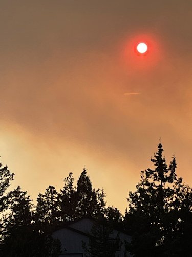
CULVER, Ore. (KTVZ) -- Breezy conditions tested fire lines Saturday afternoon, but firefighters continued to make great progress on the three large fires in Central Oregon as smoke from fires west of the Cascades blew smoke into the High Desert, again pushing air quality to "unhealthy" levels.
The Monty Fire on the Deschutes National Forest near Lake Billy Chinook was 23 acres by late Saturday. Crews and dozers have put line around the entire fire perimeter and have begun a hose lay around the preliminary containment lines to begin to mop-up. Firefighters were also supported Saturday by helicopters dropping water to cool hot spots.
The Bean Creek Fire west of the Monty Fire remains 138 acres and is 10% contained. A heavy helicopter was shared between the Bean Creek Fire and several fires on the Willamette National Forest to maximize efficiencies and assist firefighters across boundaries.
A Central Oregon Fire Management Service (COFMS) Type 3 Team will be taking over command of the Bean Creek and Monty Fires at the end of shift Sunday.
A Level 1 evacuation notice (Get Ready) issued by Jefferson County Sheriff’s Officer remains in place for houses on Montgomery Shores on the Metolius Arm. The public is asked to stay out of the area. Monty Campground on the Sisters Ranger District remains closed.
The Hole in the Ground Fire, about 1 ½ miles northeast of Hole in the Ground on the Deschutes National Forest and Lakeview District BLM-managed lands was 75% contained by late Saturday, at 310 acres.
When the fire was reported Friday morning, there were two other lighting-caused starts (incidents 780 and 784) in the same area. The quick work of several local Lake County ranchers armed with shovels kept those fires at 1/10 of an acre.
Fire managers said want to thank those individuals for their quick work on those fires, which allowed crews to focus on the fast-moving Hole in the Ground Fire. This kind of partnership with volunteer and Rural Fire Protection Districts helps protect private land assets, valuable infrastructure and the natural resources we all rely on and love.
The most important thing members of the public can do to help firefighters right now is to do their part to prevent human-caused fires. With an increasing number of acres on fire in the Pacific Northwest, fire and aviation resources are stretched thin. The public is reminded that we remain in EXTREME fire danger and public use restrictions are in place on all federally managed public lands. Do your part to prevent one more spark.
For up-to-date information on Central Oregon fires, visit www.centraloregonfire.org or www.twitter.com/CentralORFire.
Here are Saturday updates on other fires around Oregon:
Bootleg Fire Update, August 7, 2021
Location: 28 miles northeast of Klamath Falls, OR
Fireline total: 326 miles
Size: 413,765 acres (647 square miles)
42 miles active fire edge, 284 miles of contained line
Personnel: 1,124
Containment: 87%
Walrus Fire
Location 10 miles N of Bonanza
Size: 288 acres
Containment: 0%
Yainax Fire
Location: 10 miles NE of Bonanza
Size: 88 acres
Containment: 0%
Currently, the PNW2 Incident Management Team is managing the Bootleg, Walrus and Yainax Fires.
(Klamath Falls, OR) – Fire activity on the Bootleg Fire was minimal yesterday. Crews continued to monitor, patrol and mop up along the fire perimeter. As containment increases, attention now has turned to repairing dozer lines constructed in the early stages of the fire, commonly referred to as “suppression repair”. Crews have begun work to return the fireline to a more natural state, repairing the impacts on the landscape caused by fighting fire during initial and extended attack. While interior burning and smoke is expected until some kind of season-ending rain or snow event, the fire size remains unchanged for the ninth consecutive day. “Everything we do on the fire matters as we continue to put finishing touches on this landscape and focus our attention in supporting initial attack,” said Rob Allen, Incident Commander for PNW2.
Fire managers sent resources from the Bootleg Fire to the Walrus Fire and the Yainax Fire to help local agencies with suppression activities. Fire crews used a combination of handline, retardant and dozer lines to slow fire progression. Crews were able to establish dozer line around both fires and will complete water hoselays around the perimeters today. Firefighters can expect gusty winds and interior torching today. Air resources will continue to support firefighters on the ground as needed.
Evacuations: Evacuations are dynamic. The best way to view the evacuation designation boundaries and details is on the interactive map available at tinyurl.com/bootlegevac
Closures: An emergency closure order is in effect for the Bootleg Fire on the Fremont-Winema National Forest to protect public and firefighter safety. All travel or entry into the area is prohibited. The full closure order and map are available on the website under Alerts and Closures at https://www.fs.usda.gov/alerts/fremont-winema/alerts-notices
Red Cross Evacuation Shelters: For information or assistance: 1-800-Red-Cross (www.redcrossblog.org/disaster)
Smoke: Wildland fire smoke can adversely impact your health. Be aware of the smoke near you and learn about ways to mitigate smoke impacts. See the air quality near you at https://fire.airnow.gov and learn how to keep smoke out of your home at https://www.epa.gov/smoke-ready-toolbox-wildfires
Insurance Assistance: For additional information on submitting insurance claims after losing your home or property to a wildfire, please visit https://dfr.oregon.gov/insure/home/storm/Pages/wildfires.aspx or call the state’s team of consumer advocates at 888-877-4894 (toll-free).
Fire Information Public Phone: 541-482-1331
InciWeb: inciweb.nwcg.gov/incident/7609/
Facebook: www.facebook.com/BootlegFireInfo
Twitter: twitter.com/BootlegFireInfo
Hashtags: #BootlegFire #FireYear2021
Middle Fork Complex Daily Update 8/7/2021
Start Date: July 29th, 2021
Cause: Lightning
Incident Commander: Randy Johnson, Pacific Northwest Team 3
Location: Nine miles north of Oakridge, Middle Fork Ranger District, Willamette National Forest
Approx. Fire Size (acres): Gales: 2,597; Kwis: 362; Ninemile: 255; Elephant Rock: 7
Containment: 10%
Resources: Crews: 16; Engines: 19; Dozers: 5; Masticators: 3; Excavators: 1; Helicopters: 5
Total Personnel: 773
Management of the Middle Fork Complex was transferred to Pacific Northwest Team 3 at 7:00 am, August 7.
Yesterday: The Gales and Ninemile Fires experienced moderate fire activity in the morning, increasing in early afternoon as the marine layer cleared. Crews and heavy equipment were utilized to prepare existing road systems to be used as a control line around the fire. Dozers continued to establish a fire line on the western flank of the Ninemile Fire. On the Kwis Fire, crews continued to work on holding the fire and mopping up within containment lines.
Today: Working in steep and rugged terrain, hand crews and heavy equipment will continue preparing fire control lines on the Ninemile, Gales, and Elephant Rock Fires. The five helicopters assigned to the incident will assist these efforts with water drops and will support other fires in the area where feasible.
Crews will continue mopping up the Kwis Fire to strengthen the containment line that was completed earlier in the week. Crews will continue patrolling the Packard, Windfall, Symbol Rock, Devil’s Canyon, Larison Cove, Way, Warble, and Journey Fires and will mop up any hot spots as needed. Some resources from these fires will be redirected to focus their efforts on the Kwis, Ninemile, Gales, and Elephant Rock Fires.
Weather and Smoke: The temperatures today will be warmer than yesterday, with maximum temperatures between 79-84°. Winds will range from 8-12 mph, with gusts possibly reaching 20 mph. Humidity will be around 30-35% and will decrease in the coming week. There will continue to be an air quality advisory in effect for Oakridge, Oregon today. For current air quality information visit oakridgeair.org/smoke or airnow.gov.
Evacuations: Effective July 30, 2021, all homes, campgrounds and dispersed recreation along Forest Service Road 18 (Big Fall Creek Road) east of the intersection with Forest Service Road 1821, including Puma Campground and Bedrock Campground, are at LEVEL 3 (GO NOW). More information, including a map of the evacuation area, can be found at www.lanecountyor.gov.
Closures: Some National Forest System lands near the Middle Fork Complex fires are temporarily closed to provide for public safety. Please be sure to check current conditions before planning your trip to the Willamette National Forest. For more information visit www.fs.usda.gov/willamette.
ADDITIONAL FIRE INFORMATION:
Fire Information: 541-625-0849
InciWeb: https://inciweb.nwcg.gov/incident/7745/
Facebook: www.facebook.com/MiddleForkComplex
Fire: Black Butte Fire Containment: 0% Acres: 8,612
Start Date: August 3, 2021 Cause: Lightning
Location: 8 miles NE of Antelope Lookout Total Personnel: N/A
Fuels/Topography: Mixed brush, grasses, and timber Type of resources: N/A
Today: Crews from Oregon Department of Forestry (ODF), Bureau of Land Management (BLM) and Forest Service are working multiple areas of the fire, including the spots that ignited Thursday on private lands protected by ODF and lands managed by BLM. Local recourses have been busy mopping up many small fires that were started from previous storms, ranging from 2 to 12 acres, and are now helping to battle the Black Butte fire. Multiple Air Resources will continue assisting crews. Crews are engaging, with safety as the number one concern. The Infrared (IR) flight was done overnight, showing the acreage of the fire to be 8,612 acres. A Type 2 team is will transition Sunday, August 8.
Tomorrow: The High Desert Incident Command Team Type 3 will transition with the Type 2 team. The Type 2 team will take over management of the fire at 0600 on Monday, August 9. Crews will continue to work on creating and securing lines to slow the spread of the fire.
Ongoing fire activity in the Pacific Northwest is causing a limited amount of resources to be available. Each day, plans must be carefully evaluated for safety and resource protection.
Smoke: Fire management would like the public to be aware of potential smoke impacts from Black Butte Fire and others in the region. For more information regarding smoke please visit: Oregon Smoke Blog Spot, and Fire Air Now.
Closure area consists of all geographical areas within boundaries of the following description: Starting at the intersection of the Malheur National Forest Boundary and Forest Service Road (FSR) 14 and proceeding north on FSR 14 at T. 18 S, R. 34 E, Sec. 24, north to the junction with FSR 16 at T. 16 S, R. 35 E, Sec. 23, north on FSR 16 until County Road 62, at the junction with 62 go north on County Road 62 to FSR 6200918 at T. 14 S, R. 34 E, Sec. 30, to Sunshine Flat Trailhead, then east on Forest Service Trail (FST) 369 then at the junction of FST 363 and FST 369, head east on FST 363, then continue to the Horseshoe Trailhead at T. 14 S, R .35 E, Sec. 33, then south on FSR 13, at the junction of FSR 13 and FSR 16, east on FSR 16 to the Forest Boundary at T. 15 S, R. 36 E, Sec. 25, south along the Forest Boundary to T. 18 S, R. 36 E, Sec. 24, west along southern Forest Boundary to FSR 14 at T. 18 S, R. 34 E, Sec. 24. Boundary roads will remain open.
· Recreation Sites within the closure boundary:
o North Fork Malheur River Trailheads both north and south
o North Fork Malheur Campground
o Crane Crossing Trailheads both east and west
o Short Creek Guard Station
o Elk Creek Campground
o Sunshine Flat Trailhead and Trail
o Horseshoe Trailhead and Trail
o Sheep Creek Trail and Trailhead
o Little Crane Campground
Currently the Trout Farm and Crescent Campgrounds are still open to the public.
Public Safety: Please be aware of the closure area and recreation sites closed within as noted above. There will be heavy fire traffic on all roads in the fire area, please use extra caution while driving in the vicinity. The public is reminded that the Malheur National Forest is under Phase C of Public Use Restrictions. For more information on Public Use Restrictions please visit: Malheur Public Use Restrictions or call 541-575-3113.
Fire Information: Inciweb: https://inciweb.nwcg.gov/incident/7770/ Facebook: 2021 Black Butte Fire | Facebook and https://facebook.com/MalheurNationalForest/ Twitter: https://twitter.com/MalheurNF
Skyline Ridge Complex Information Saturday, August 7, 2021, at 8:30 A.M.
Firefighters begin control strategy for largest fire in Complex
CANYONVILLE, Ore.—Firefighters are fighting all the fires in the Skyline Ridge Complex with direct action to minimize their spread. That same approach is being used on the southern edge of the largest fire in the Complex – the 1,600-acre Poole Fire, about 6 miles southeast of Days Creek. The northern edge of the fire is far more challenging – three steep ridges run north to south, split by two deep canyons. At the highest point the ridges are over 2,000 feet high, with slopes of 70 to 100 percent.
After looking at the difficult terrain, fire managers and private and public landowners have agreed that the best chance of stopping the fire is to build a control line where the ridges converge at a lower elevation.
Firefighters are building control lines along existing roads on the tops of the outer east and west ridges. Controlled burns over the next several days will help strengthen those lines to prevent the fire from spreading east or west. Newly arriving resources are being directed to this effort, including 100 more firefighters who arrived yesterday. Ten helicopters continue helping suppress fires in the Complex. The second-largest fire in the Complex is the 190-acre O’Shea Fire a few miles southeast of Canyonville. Most other fires are two acres or less.
PNW Team 8 will host an in-person community meeting at Tiller Fire Station tonight at 7:30 p.m. ODF Team 1 will then host a virtual community meeting on Facebook Live Sunday at 7:30 p.m. Incident Commander Joe Hessel said, “Our highest chance for success in stopping the Poole Creek Fire with the lowest risk to our firefighters is to bring it north along the ridges, out of the canyons to a strong, defensible control line.”
