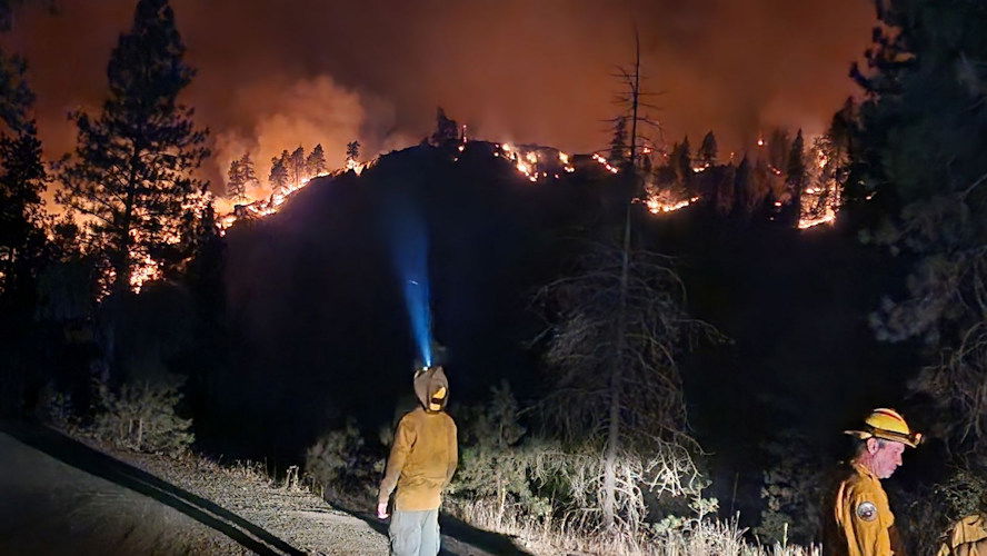
Another new NE Oregon wildfire grows fast to 10,000 acres, prompts evacuations, Conflagration Act

(Update: NE Oregon wildfire now estimated at 10,000 acres)
SALEM, Ore. (KTVZ) – Oregon Governor Tina Kotek has invoked the Emergency Conflagration Act for the fast-growing Town Gulch Fire in Baker County, estimated at 10,000 acres late Tuesday night
Tuesday night update:
Town Gulch Fire Exhibits Rapid Growth, Prompting Additional Evacuations ![]()
BAKER CITY, Ore. (Aug. 06, 2024) – Baker County Sheriff's Office has issued additional evacuation levels for areas around the Town Gulch Fire. For the most current list of Level 1, 2, and 3 evacuations, follow the sheriff’s office on Facebook (tinyurl.com/3auvka4j). Residents should sign up to receive emergency notifications through Baker County ALERT (tinyurl.com/884czdrf).
American Red Cross of Idaho and East Oregon has opened an evacuation shelter at the Lions Club of Halfway (225 Lions Street, Halfway, Ore.). For more evacuation-shelter information, call 800-853-2570.
Although overnight fire growth and activity was minimal, hot, dry, windy conditions on Tuesday contributed to the Town Gulch Fire being extremely active. Early afternoon the fire crossed to the east side of Eagle Creek and quickly spread to the southeast.
By midafternoon, the fire was estimated to be about 800 acres. It continued to progress southward in the Eagle Creek drainage to just north of New Bridge. The fire also spread eastward, crossing Forest Road 77.
As of this evening, the fire has topped the West Wall and is currently burning downslope in heavy timber toward Pine Valley. It is estimated to be 10,000 acres.
Fifteen aircraft assisted the suppression effort Tuesday, conducting both water and retardant drops. Additional ground resources arrived Tuesday morning, bringing total personnel to 112. Intense fire behavior Tuesday afternoon resulted in all resources focusing on structure protection.
Oregon State Fire Marshall (OSFM) is sending its Blue Incident Management Team (IMT) and four structural task forces to the incident to help Northeast Oregon Interagency Type 3 IMT manage this rapidly evolving fire.
--
Oregon State Fire Marshal news release:
The Oregon State Fire Marshal is mobilizing its Blue Incident Management Team and four structural task forces. The fire is burning in timber and steep, rocky terrain, with temperatures in the mid-90s.
The fire sparked on Monday eight miles northwest of Richland, Oregon and quickly grew. On Tuesday, the fire grew significantly and started threatening structures, prompting the conflagration act and the Oregon State Fire Marshal structural protection resources.
“As the Oregon fire season continues, we face another fire in tough terrain and conditions,” Oregon State Fire Marshal Mariana Ruiz-Temple said. “Our teams are working hard to protect structures, doing their best to keep fires away from communities. We are asking everyone to stay vigilant to prevent sparking a wildfire.”
The Baker County Sheriff’s Office has issued Level 1, 2, and 3 evacuations for areas around the Town Gulch Fire. For evacuation information, follow the Baker County Sheriff’s Office Facebook page. You can also find information on the Wallowa-Whitman National Forest Facebook page.
All Oregonians should do everything they can to be wildfire aware. Find tips to prevent wildfires here.
About the Emergency Conflagration Act
The Emergency Conflagration Act is invoked by Oregon Governor Tina Kotek, allowing the state fire marshal to mobilize state resources to wildfires to protect life and property.
The Conflagration Act is invoked following ORS 476.510-476.610 when Governor Kotek determines threats to life, safety, and property exist because of the fire, and the threats exceed the capabilities of local firefighting personnel and equipment.
Other new fires continue to emerge in Eastern Oregon.
The Warner Peak Fire was a lightning-caused fire detected shortly after 6 p.m. Monday. It started on the upper slope of the west escarpment south of Hart Canyon above Hart Reservoir, 4 miles east of Plush, on the Sheldon Hart National Wildlife Refuge.
The fire grew to approximately 1,500 acres overnight due to the wind, remote location and rough terrain with no containment. Currently the fire is moving east along the ridge between Stockade Creek and Goat Creek making access difficult for crews, officials said late Tuesday.
Due to a lack of road access, rappelers and helitack crew are being utilized on the west slope to look for opportunities to insert additional firefighters.
Multiple resources from throughout South-Central Oregon Fire Management Partnership are on scene with additional resources on order.
Post Meadows Campground and BarnHardy Road at Blue Sky on the Refuge are closed currently.
There are no structures threatened and no evacuation at this time.
For more information on restrictions please visit: https://www.scofmp.org/ or online on Facebook at facebook.com/SCOFMPFireInfo.