Cooler, wetter weather helps crews make more progress on remaining wildfires, ahead of a late-summer warmup


PRINEVILLE, Ore. (KTVZ) -- The recent cooler, wetter weather has been helping Oregon firefighters tackle several larger wildfires, many over a month old. But the threat of new wildfires remains high, as another warmup is due in coming days.
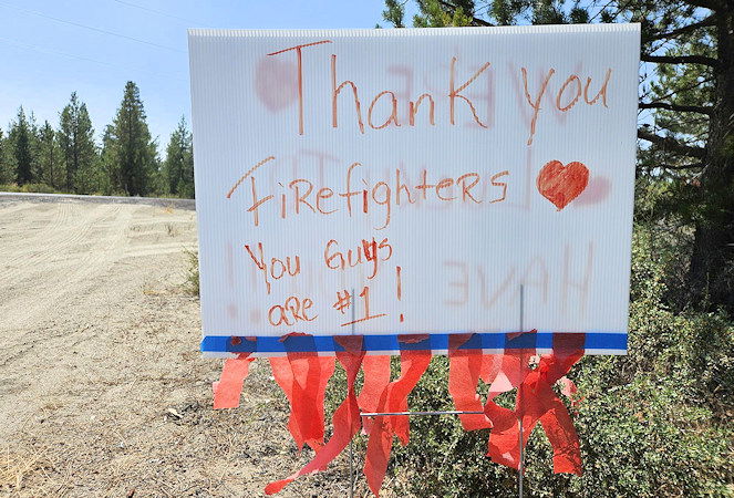
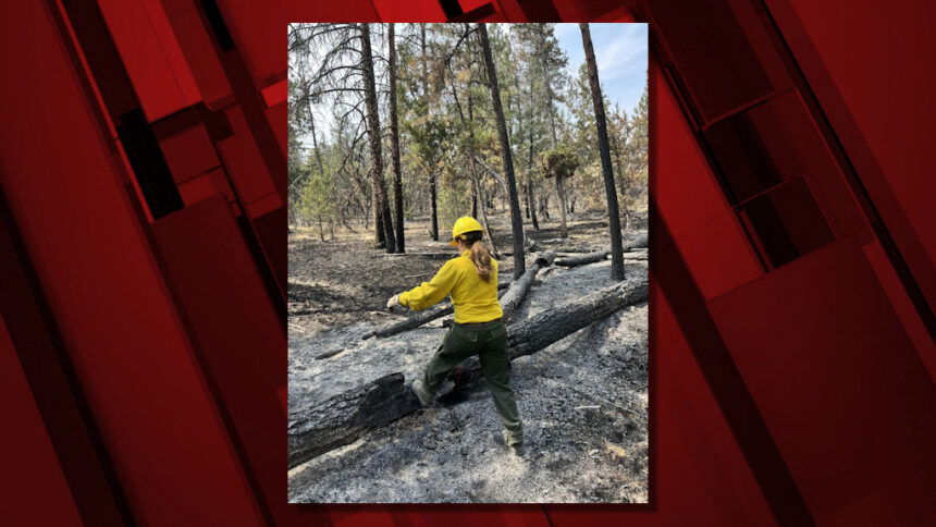
As of Sunday morning, there were still about 250 firefighters battling the remaining lightning-sparked wildfire on the Ochoco National Forest, the nearly 87,000-acre Crazy Creek Fire north of Paulina, which has been at 93% containment for the last several days and is currently estimated to reach full containment by Sept. 20.
Higher humidity and rain have made for minimal fire behavior. "The higher moisture levels are assisting in keeping heat contained to stumps, logs and roots," Sunday's InciWeb summary stated.
But the work - and threat of new wildfires - is far from over
Regionally, the Northwest Interagency Coordination Center reported Sunday that 20 large wildfires are still burning across the region, totaling nearly 400,000 acres and with over 7,100 personnel fighting them, using nearly 200 engines and 25 helicopters.
"Fire weather in the NW shows gusty west winds and rain early in the week, with warming and drying conditions returning later," Sunday's update said. "Fuel drying rates will increase, raising fire danger by late next week."
Here's Sunday morning's news release from the Ochoco National Forest about the collaborative efforts on a string of lightning-sparked fires from just over a month ago, the largest being Crazy Creek:
Collaborative Efforts Contain 16 Wildfires on Paulina Ranger District Following July 22 Lightning Bust
PRINEVILLE, Ore. (KTVZ) - On July 22, a lightning bust sparked 17 new wildfires across the Central Oregon Fire Management Service's Prairie Division, with the majority of these fires occurring on the Paulina Ranger District of the Ochoco National Forest.
Despite the challenging conditions, including a national and regional Preparedness Level (PL) of 5, which indicates that firefighting resources were already stretched extremely thin, the dedicated efforts of firefighting personnel led to the containment or control of 16 out of the 17 fires within just three days.
At the time of these starts, the entire nation was grappling with an exceptionally active fire season, making the availability of resources incredibly limited. However, the success in containing these fires was not the result of any single effort — it was the product of extensive collaboration across multiple agencies and organizations. Firefighters from the Forest Service, Bureau of Land Management, Oregon Department of Forestry and the Post-Paulina Rangeland Fire Protection Association all worked together seamlessly to address the situation.
The rapid and effective response from these united forces—ranging from the brave individuals battling the flames on the ground to the crucial support provided by dispatchers coordinating the response—resulted in the successful containment of these fires. This coordinated effort demonstrates the strength of interagency collaboration and the importance of partnerships in managing wildfire response in Central Oregon.
While there is still work to be done on the Crazy Creek Fire to reach 100% containment, it is important to recognize the remarkable success achieved on Crazy Creek and the additional 16 fires. This achievement underscores the expertise, coordination, and dedication of the entire firefighting community, whose swift actions helped prevent further escalation during an already critical time.
Though the area is currently experiencing cooler weather, it’s important not to become complacent. Fire season is still underway, and conditions can change rapidly. Visitors and residents are urged to "Know Before You Go" by checking current fire restrictions and being aware of the risks. While we cannot control the weather, we can control our actions. Remember, "Only You Can Prevent Wildfires."
For information on the Ochoco National Forest, visit www.fs.usda.gov/ochoco. For up-to-date fire information in Central Oregon, visit centraloregonfire.org/. Follow on X/Twitter @CentralORFire. Text “COFIRE” to 888-777 to receive wildfire and prescribed fire text alerts.
--
Crazy Creek Fire managers are now issuing news release updates every other day; here is Saturday's:
Crazy Creek Fire & Kitty Creek Fire Update – August 24, 2024
Acres: Crazy Creek –86,963; 93% contained Kitty Creek –73; 100% contained
Location: Crazy Creek: 5 miles north of Paulina, Oregon; 498/Kitty Creek: 7 miles south of Mitchell, Oregon
Start Date: July 22,2024 Personnel: 352 Cause: Lightening
Resources: 3 crews |11 engines | 1 bulldozers | 7 water tenders | 10 skid steers | 4 Excavators
Highlights: Cooler temperatures, higher humidity, and recent precipitation have significantly reduced fire activity.
Yesterday, crews focused on suppression repair. Today, efforts will continue with an emphasis on patrolling for remaining areas of heat and reinforcing containment lines. While conditions are currently favorable, warmer and drier weather expected next week could increase fire behavior in isolated areas. Firefighters remain vigilant and prepared to respond to any changes.
Moving forward, updates will be provided every other day, or sooner if significant changes occur. For daily updates, please visit InciWeb and follow our Facebook page.
Evacuations: The Crook County Sheriff’s Office has lowered the evacuation level from Level 3 (recommended evacuation) to Level 2 (set for evacuation) from Highway 380 north to SE Puett Road. The area north of SE Puett Road around the perimeter of the fire remains at a Level 3. The area south of Highway 380 has been lowered to Level 1 (prepare for possible evacuation). An evacuation map is available online through the Crook County Emergency Management Office website.
Weather: Today’s forecast includes highs in the mid-60s with partially cloudy skies. There is a 25% chance of rain in the morning, decreasing to 16% by the afternoon. Winds are expected from the NW at 5-10mph.
Importance of Fire Prevention: All public lands in Central Oregon, including the Ochoco National Forest, are in Stage 2 Public Use (Fire) Restrictions. All open flames, including woodstoves and charcoal briquette fires, are prohibited. In times of high fire danger, it is crucial for everyone to follow prevention measures to avoid additional strain on overburdened resources.
Closures: The Ochoco National Forest has implemented a forest closure for the eastern portion of the Paulina Ranger District.
More Information:
InciWeb: https://inciweb.wildfire.gov/incident-information/orocf-crazy-creek
Facebook: Facebook.com/CrazyCreekFire
Visit the official source for wildfire information in Central Oregon at centraloregonfire.org for wildfire updates or follow fire information on X/Twitter @CentralORfire. Call 9-1-1 to report a wildfire.
--
Here's Sunday's update on the lightning-sparked, nearly 800-acre Red Fire that's been burning for over a month in the Diamond Peak Wilderness west of Crescent Lake Junction:
Red Fire
Size: 755 acres Location: 5 miles west of Crescent Lake Junction, OR County: Klamath
Start Date: July 17, 2024 Cause: Lightning Containment: 0% Total Personnel: 198
Crescent, OR – The Red Fire is burning on the southwest slope of Redtop Mountain within the Diamond Peak Wilderness on the Deschutes National Forest. An assessment by the initial attack incident commander, local fire managers, and Forest staff determined the risk to responders was too great to continue with direct attack due to firefighter safety concerns, including a lack of escape routes and safety zones, snag hazards, and the remote location of the fire. Currently, a full suppression strategy is being implemented utilizing shaded fuel breaks. Fire managers are continually reevaluating the safest, most effective suppression strategy based on changing weather, fuel conditions, and fire behavior. Firefighter and public safety remain the management team’s highest priority in managing this fire.
Yesterday’s Activities – Fire personnel continued to improve the shaded fuel break between Crescent Lake and Summit Lake.
Today’s Activities – Fire personnel will continue work to the northwest of Summit Lake constructing the shaded fuel break along Forest Service Road FSR6010 and towards FSR 380 on the Willamette National Forest to connect with the suppression work being done by the 208 MF Fire. Log trucks and other heavy equipment will be starting work at 4:30am to support hauling operations.
Weather and Smoke – Last night the low pressure system deposited .75 inches of precipitation over the fire area. Precipitation over this period will not be enough to significantly wet the interior of larger fuels such as standing dead trees and fallen logs. The low pressure system moved out of the area this weekend and a warming and drying trend starts in the coming week.
Closures – The Deschutes National Forest emergency closure around Crescent Lake and in Diamond Peak Wilderness is still in effect. The public should note that FSR 60 is closed, and road guards have been posted for public safety. More closure information is available at: https://www.fsa.gov/alerts/deschutes/alerts-notices/?aid=89091
Evacuations – The WILDFIRE! Level 1 – BE READY to Evacuate notice issued by Klamath County Emergency Management for Crescent Lake, Odell Lake, and Crescent Junction areas remains in effect (INCENDIO FORESTAL! Nivel 1 - ESTÉ PREPARADO para evacuar de las siguientes zonas: Crescent Lake, Odell Lake, Crescent Junction). Visit www.klamathcounty.org/300/emergency-management for more information or to sign up for alerts.
Fire Restrictions – Stage 2 Public Use Fire Restrictions – which prohibit open fires, including in developed campgrounds – remain in effect for the Deschutes National Forest. The Industrial Fire Precaution Level is currently Level III “Partial Shutdown.” Visit fs.usda.gov/detail/deschutes/home/?cid=stelprdb5297376 for more information.
Drone Restrictions – Aerial firefighting is suspended when unauthorized drones (UAS) are in the area. Unauthorized drone use over a fire area poses serious risks to fire personnel and the effectiveness of wildfire suppression operations. If you fly, we can’t.