Ochoco National Forest trims Maury Mountains closure area as Wiley Flat Fire reaches 84% containment
(Update: Wednesday's fire update, containment at 84%)
PRINEVILLE, Ore. (KTVZ) — Following significant progress in firefighting efforts, the Ochoco National Forest, in consultation with fire management officials and the Crook County Sheriff’s Office, said Tuesday it has reduced the Wiley Flat Fire Area Closure in the Maury Mountains.
"This decision comes as containment lines have been strengthened, reducing the immediate threat to public safety," according to the announcement, which continues in full below:
While key areas remain closed to allow firefighters to continue their work, this reduction opens up portions of the forest for public access. Fire officials will continue to monitor the situation closely, to ensure that it remains safe for the public to return to more areas as conditions improve.
We recognize the importance of these lands to the community, especially during hunting season, and appreciate your cooperation throughout the closures. Our priority remains the safety of both the public and our firefighters, and we will only lift restrictions as it becomes safe to do so.
The reduced closure will stay in place until further progress is made and will be reassessed regularly. We ask the public to continue respecting all closure signs and stay informed on current conditions.
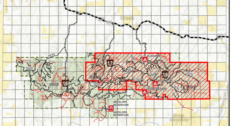
For updated closure maps and information, please visit the Ochoco National Forest website.
--
Wiley Flat Fire
Closures and Evacuation Areas Reduced
Daily Update September 18, 2024
Fire Information Phone: 541-208-7108 (8 a.m.- 8 p.m.)
Email: 2024.wileyflat@firenet.gov
Acres: Wiley Flat – 30,163 acres; 84% contained
Hawley Ridge – 793 acres; 100% contained
Location: Wiley Creek: about 10 miles southeast of Post, Oregon off Highway 380
Start Date: September 2, 2024
Personnel: 358 personnel
Resources: 8 crews |9 engines | 10 bulldozers | 15 water tenders | 5 masticators | 4 skidgens |5 excavators |2 ambulances
Highlights: Crews have completed suppression repair on the north, east, and most of the south sides of the fire, and along the indirect lines to the west. They have taken special care to restore areas along the 360 near residences and along private property, as well as restoring creeks disturbed by firefighting dozer work. Firefighters continue to secure and mop up on the direct lines on the west side of the fire. Due to all this hard work, the Wiley Flat fire is now 84% contained, and forest closures and evacuation areas have been significantly reduced. Links to updated closure and evacuation information are below.
Today’s Weather: Today we will see a mix of sun and clouds with precipitation unlikely in the area of the fire. Cool weather in the fifties will however continue to moderate potential fire behavior. Winds will be lighter with west-northwest winds gusting up to ten to twenty mph.
Evacuations: The Crook County Sherrif has lowered the evacuation areas as follows The following evacuations are in effect:
LEVEL 3: Areas inside the fire perimeter are designated Level 3 Evacuation zones.
LEVEL 2: The area encompassing one half mile from the fire perimeter is designated Level 2 evacuation zone.
The Red Cross evacuation shelter is in the Carey Foster Hall at Crook County Fairgrounds SE Lynn Blvd. Prineville, OR 97754. Information number: 1-800-RED-CROSS
Importance of Fire Prevention: All public lands in Central Oregon are in Stage 2 Public Use (Fire) Restrictions. All open flames, including woodstoves and charcoal briquette fires, are prohibited. In times of high fire danger, it is crucial for everyone to follow prevention measures to avoid additional strain on overburdened resources.
Fire Restrictions and Closures: These areas are closed to all uses, including recreational activities, for public and firefighter safety. The Ochoco National Forest has implemented temporary closures consisting of all geographical areas, including all roads, trails, and recreation sites, on Forest Service land within a portion of the Lookout Mountain Ranger District. The Bureau of Land Management has issued a temporary closure for portions of public lands in Crook and Grant Counties.
More Information:
InciWeb: https://inciweb.wildfire.gov/incident-information/orocf-wiley-flat
Facebook: Facebook.com/2024Wiley Flat Fire
Central Oregon Wildfire Information: https://centraloregonfire.org/
Lookout Mountain Ranger District Closures: https://www.fs.usda.gov/alerts/ochoco/alerts-notices/?aid=90382
BLM Crook and Grant Counties Temporary Closures: https://www.blm.gov/programs/public-safety-and-fire/fire-and-aviation/regional-info/oregon-washington/fire-restrictions
Crook County Emergency Information Map: https://crookcounty.maps.arcgis.com/apps/instant/minimalist/index.html?appid=3ddd30c1faeb455fb287dfa122d9ea5e
