Warmer, windier conditions on C.O. wildfires put up smoke but help to firm up containment lines; Highway 126 fully reopens
BEND, Ore. (KTVZ) -- Central Oregon firefighters saw more progress Friday in containing the remaining large wildfires in the region, despite some warmer and windier conditions that burned more fuel within the fire perimeters, officials said Saturday.
Another sign of progress came Friday at 6 p.m., when Highway 126 west of Sisters and south of Santiam Pass fully reopened after a period when the nearby Boulder Creek Fire had it first closed, then a use of pilot cars on a single lane. Fire officials still advise motorists' caution as firefighters and equipment are still in the area. A stretch of state Highway 242, the McKenzie Pass Highway, remains closed.
Northwest 3 Complex Incident Management Team
Lonnie Click ~ Incident Commander
Bachelor Complex, Flat Top and Firestone Fires Update
September 21, 2024
Quick Facts: Bachelor Complex
Size: 11,669 acres
Start Date: Sept 8, 2024
Location: 20 miles SW Bend, OR
Personnel: 410
Containment: 41%
Quick Facts: Firestone & Flat Top Fires
Start Date: Sept 6, 2024
Location: North of Fort Rock, OR
Personnel: 136
Firestone Size: 9,454 acres
Containment: 86%
Flat Top Size: 36,288 acres
Containment: 87%
Yesterday, the Bachelor Complex, Flat Top and Firestone Fires experienced warm, dry and breezy conditions, contributing to increased consumption of fuels within the fire perimeter. While this resulted in increased smoke production across the area, it also strengthened containment lines by reducing available vegetation between the main front of the fire and containment lines. Lucky Butte, 911, 846 and Backside Fires were monitored by air. Fire 846 in the Kwohl Butte area is about three acres. It showed increased activity yesterday, so a crew of eight rappellers were inserted late in the day.
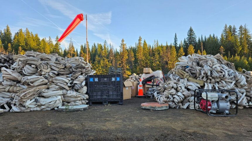
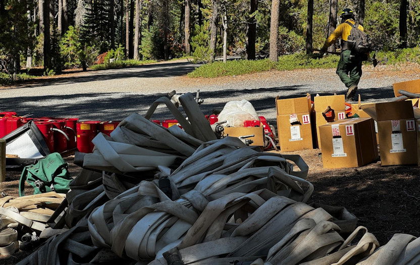
Bachelor Complex: Small strategic burning operations took place on Little Lava Fire yesterday to remove internal pockets of unburned fuels near control lines. These strategic firing operations were implemented using an Unstaffed Aerial System (UAS), commonly known as a drone, to start the ignition. Firefighters worked the northern edge of the fire making progress towards the Edison Trail 3. Along Forest Service Road 45, firefighters started dismantling hose lays, backhauling truckloads of firehose. Suppression repair work is ongoing, and firefighters will patrol and mop up any sources of heat found along control lines, as well as backhauling more hose from the fireline.
Flat Top Fire: On the northwest corner of the Flat Top Fire, a burnout operation was completed to secure the remaining open control line on the fire. In the northwest area of the fire, south of the South Lava Trailhead, an engine and dozer provided structure protection for recreation infrastructure. Today, crews will continue mopping-up, chipping brush and doing suppression repair as needed. Firefighters will continue to mop up to strengthen containment lines around the perimeter of the fire.
Firestone Fire: Mop-up continued yesterday on the Firestone Fire. Firefighters continued working in the area of the burnout along Forest Service Road 100 adding depth to strengthen the effectiveness of control lines. Today’s plan for the Firestone Fire is to continue mop-up, patrol, chipping and suppression repair where needed.
Weather and Fire Behavior: Warm and dry conditions continue. Low humidity recovery overnight and dry daytime airmass will result in another early start to the burn period today, with several hours of active burning starting mid-day. The threat of isolated torching will diminish daily, as there is less heat present under the tree canopy in the interior of the fire and adjacent to containment lines.
Closures: While evacuations have been lifted, there are two temporary emergency fire closure areas on the Deschutes National Forest. To view the updated closure orders and maps, visit: https://www.fs.usda.gov/alerts/deschutes/alerts-notices.
Facebook: https://www.facebook.com/deschutesnationalforest/
InciWeb: https://inciweb.wildfire.gov/incident-information/ordef-bachelor-complex-fires
https://inciweb.wildfire.gov/incident-information/ordef-flat-top-and-firestone-fires
YouTube: https://www.youtube.com/@CentralOregonFireInfo?app=desktop
Fire Information Line: (541) 249-9829, 8:00 a.m. to 8:00 p.m.
Smoke & Air Quality Information: fire.airnow.gov
--
Rail Ridge and Wiley Flat Fire Daily Update 9-21-24
Rail Ridge Fire
Acres: 162,345- Containment: 50% - Detection Date: Sept 2, 2024 - Cause: Lightning - Total resources: 1,406
Operational Update
Crews: 41 - Engines: 66 - Dozers: 20 - Helicopters: 13
Phone: 541-208-7111 - Email: 2024.railridge@firenet.gov
There was an uptick in interior fire activity yesterday afternoon as temperatures and relative humidities returned to normal seasonal warm and dry conditions, with gusting winds across the fire area. An increase of activity in the Black Canyon Wilderness created a visible smoke column during the early afternoon. Ongoing line construction and the establishment of shaded fuel breaks on the northern edge of the fire will ensure secure containment if fire behavior increases with similar wind and weather conditions predicted for next week.
Crews continue to strengthen suppression lines and implement suppression repair activities along the southern edge of the fire. Road repair is also ongoing on the southern portion of the fire.
Wiley Flat Fire
Acres: 30,186 - Containment: 94% - Detection Date: Sept 2, 2024 - Cause: Lightning - Total resources: 168
Crews: 3 - Engines: 3 - Dozers: 2
Phone: 541-208-7108 - Email: 2024.wileyflat@firenet.gov
Operational Update
Firefighters continue to implement suppression repair measures around the fire perimeter, working to achieve repair standards established for sensitive areas within the fire footprint, as well as repairing roads that have been impacted by fire suppression efforts. Crews continue to monitor for any residual heat.
Closures and Evacuations
Rail Ridge Evacuations: All level 1 and 2 evacuation zones have been lifted for Grant County, and level 3 zones have been downgraded to level 2 “set” status. For Crook and Wheeler counties, all evacuation statuses have been lifted.
Wiley Flat Evacuations: All areas inside the fire perimeter are designated Level 3 Evacuation zones The area encompassing approximately one-half mile from the fire perimeter is designated Level 2 evacuation zone.
For Current Evacuation Levels in all counties, please visit: https://linktr.ee/RailRidgeFire
Closures: The U.S. Forest Service and Bureau of Land Management have implemented closures for the Rail Ridge and Wiley Flat Fires. For more details and closure maps, visit https://linktr.ee/RailRidgeFire
#railridgefire2024 #wileyflatfire2024 #fireyear2024
Rail Ridge and Wiley Flat Public Information Map 9-21-24.jpg

--
Willamette Complex South & Red Fire Update
Red, 208, Moss Mountain, Coffee Pot, Tire Mountain, McKinley Creek and Chalk Fires
Date: Saturday, September 21, 2024
Fire Causes: Lightning
Email: 2024.willamettecomplex@firenet.gov
Information Phone Line: 541-208-1742
Willamette Complex South: Total Personnel: 436 | Total Willamette Complex South Acres: 23,389
InciWeb: https://inciweb.wildfire.gov/incident-information/orwif-willamette-complex-fires-south
Facebook: https://www.facebook.com/WillametteComplexFires/
Red Fire: Total Personnel: 50 | Total Red Fire Acres: 1,769
InciWeb: https://inciweb.wildfire.gov/incident-information/ordef-red-fire
Facebook: https://www.facebook.com/2024RedFireOR/
Summary
Fire growth continues to be minimal and remains within the established perimeters. While yesterday’s passing cool front helped keep things in check, the warmer, drier air trending into the days ahead may affect fire behavior and necessitate close monitoring into next week. The accumulating conifer needle-drop may fuel smoldering fires, and night-time “recovery” may moderate. Crews continue working to firm up indirect control lines and repair resources in places impacted by suppression operations.
The Chalk Fire, Coffee Pot Fire, McKinley Creek Fire, and Tire Mountain Fire retain their status as 100% contained and are in monitor-and-patrol phase. Crews are chipping, clearing brush and fireline construction materials, and repairing roads impacted by fire suppression activities. Tasks are prioritized under the advisement of resource specialists to ensure repairs and restoration are effective, scientifically sound, and protect sensitive terrain and vegetation as much as possible. Members of the public are asked to continue respecting area closures and restrictions.
Red Fire (1,769 acres, 11% containment)
The Red Fire is now 11% contained, a marked improvement, but there is the potential for fire behavior to change. Hauling and removal of slash from Forest Service Road (FSR) 6010 from Summit Lake to the southwestern corner of Crescent Lake remains a priority. Road repairs and clean-up of the shaded fuel break from Whitefish Horse Camp to Crescent Lake Sno-Park continue. Structure protection measures including portable tanks, hoses, and pumps will remain in place, given the warmer, drier weather in the most recent forecast. Fire growth remains minimal, moderately paced, and concentrated on the southeast perimeter of the fire.
208 Fire (8,969 acres, 4% containment)
Crews observed spotty smoke near the northwest corner and will continue improving holding lines from Lighthouse Rock to Summit Lake. Road repair and material chipping operations are ongoing from Campers Flat to Emigrant Butte along FSR 21. Expect heavy equipment traffic in the area.
Moss Mountain Fire (2,174 acres, 10% containment)
Slash and excess vegetation removal along primary lines northeast of Groundhog Mountain is nearing completion. Crews are making progress south of Beach Mountain near FSR 2316 and expect to connect to the existing fire-line along FSR 23 from the 208 Fire. Crews are identifying critical values at risk near the top of the mountain.
Weather and Fire Behavior
A weak cold front moved through yesterday, briefly increasing the relative humidity by 5-10%, but the expected warming trend that will usher in higher temperatures will also bring a reduction in humidity levels until another front arrives mid- to late-week. Temperatures will return to seasonal averages, with lows in the 40s and highs in the mid-60s but may spike next Tuesday or Wednesday. Expect light northwest winds and drop minimum relative humidity levels to 20 – 30%. Heavy fuels have been burning out but smoldering and creeping continue.
Closures, Fire Restrictions, and Evacuations
- For closure information, visit: https://tinyurl.com/RedFireClosures2024 & https://tinyurl.com/WillFireClosures2024.
- For fire restrictions, visit: https://tinyurl.com/DesFireRestrictions2024 & https://tinyurl.com/WillFireRestrictions2024.
- The Level 1 – BE READY to Evacuate notice remains in effect for the Red Fire. For more information or to sign up for alerts, visit: www.klamathcounty.org/300/emergency-management.
--
Willamette Complex North Update
Boulder Creek, Ore, Linton Creek, 374 and Pyramid Fires
Fire Update for Friday, September 20 through Saturday, September 21, 2024
Fire updates will now be provided for a two-day operational period, with additional information provided commensurate with fire activity.
InciWeb: https://inciweb.wildfire.gov/.../orwif-north-willamette...
Willamette Complex North Facebook Page: https://www.facebook.com/profile.php?id=61565845313387
Email: 2024.WillametteComplex.North@firenet.gov
Information line: 541-208-1262
Hours: 8 a.m. to 8 p.m.
Overview: Crews are continuing to work along OR-126 to clear vegetation and debris between mileposts 13 and 19.5 (intersection with OR-242). The work is expected to be concluded Friday evening, at which point, both lanes of OR-126 will be open to through traffic. OR-242 remains closed to all traffic between the intersection with OR-126 and the Dee Wright Observatory (mileposts 55 to 75). For current road conditions, please check Oregon Department of Transportation’s website: https://www.tripcheck.com/.
The firefighting crews appreciate your patience during these travel delays and are working to expedite the return to normal traffic patterns.
A high-pressure system has lowered the humidity levels in the fire areas, impacting the combustibility of the fuels. Incremental temperature increases are forecasted over the next several days but as the days grow shorter, north aspect vegetation is becoming less available to burn. Winds are predicted to remain around 10 mph with daytime winds shifting from east to northwest. Continued warmer and drier conditions will lead to a slight increase in fire behavior but all fires should remain within established containment lines. An increase in visible smoke is possible during warmer daytime temperatures.
Willamette National Forest Area Closures: For public and firefighter safety, fire-related closures remain in place on the McKenzie River Ranger District, as well as on the Middle Fork Ranger District. Please avoid closed areas of the forest. Source: https://www.fs.usda.gov/detail/willamette/alerts-notices/....
Boulder Creek: 511 acres, 6% contained
Located 5 miles east of McKenzie Bridge. Crews continue to masticate and chip vegetative material removed from along the fire’s edge on OR-126. Firefighters gained some containment on Thursday, and continue to extinguish areas of heat interior of the containment lines. On the northwest side of the fire, fireline construction continues to prevent fire spread from the steep terrain within Boulder Creek.
Ore: 3,475 acres, 77% contained
Located 7 miles northeast of Blue River. Crews continue mastication and chipping operations to remove fuels from the edge of the fire area. This fire will continue to be monitored for areas of heat and increased fire activity. Crews are beginning to repair non-essential firelines with tools and equipment.
Pyramid: 1,312 Acres, 98% contained
East of Middle Santiam Wilderness. Firefighters are removing hose and water pumps, and continuing with chipping and mastication of fuels. Crews are shifting focus to suppression repair of non-primary control lines.
374: 58 acres, 0% contained and Linton Creek: 1,301 acres, 0% contained
Located in the Three Sisters Wilderness. These fires are remaining within their footprints adjacent to natural barriers and a previous fire scar. While larger material is holding heat and continues to smolder, fire activity remains low. These fires are now in monitoring status.
