No homes lost overnight in Alder Springs Fire, more than 2,500 acres burned; evacuation orders in place for parts of Jefferson and Deschutes counties

(Update: adding latest evacuations, details)
CULVER, Ore. (KTVZ) -- As of Tuesday morning, evacuation orders remain in place. Oregon State Fire Marshal task forces were in place Monday evening in Crooked River Ranch. No homes were lost overnight.
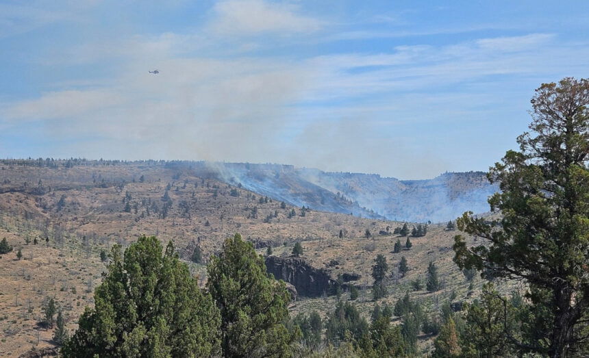
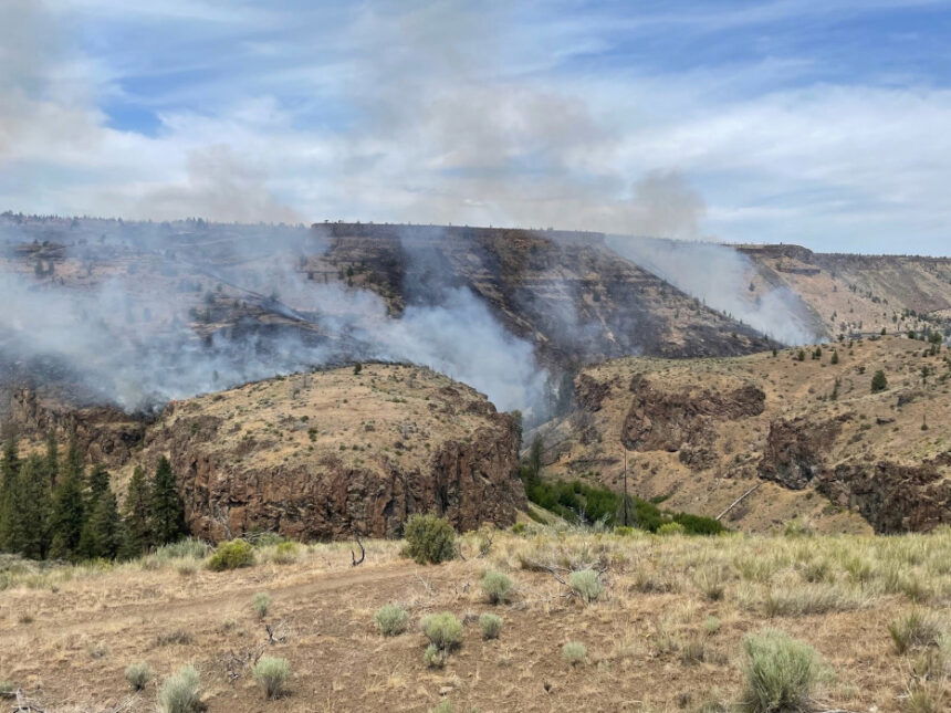
Carcass Canyon on Whychus Creek is a priority this morning as crews continue to battle the blaze, but access is challenging, according to Central Oregon Fire Info.
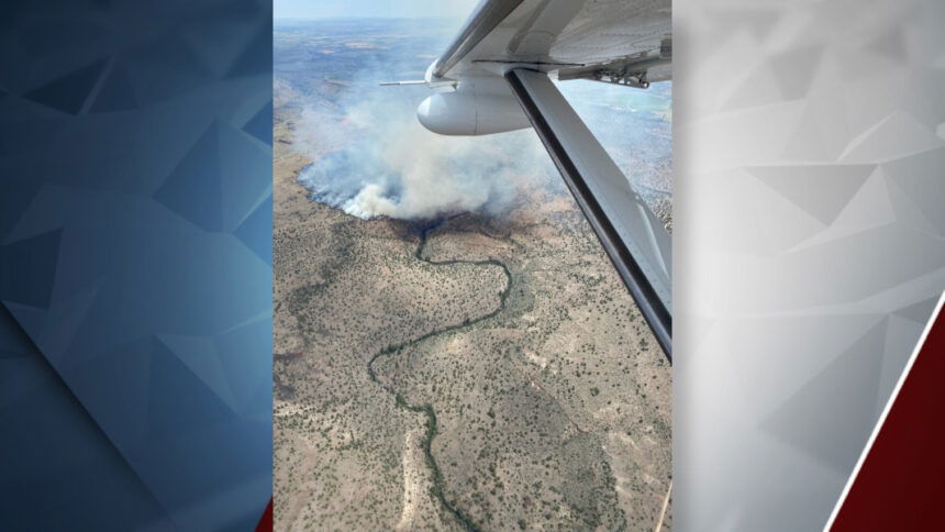
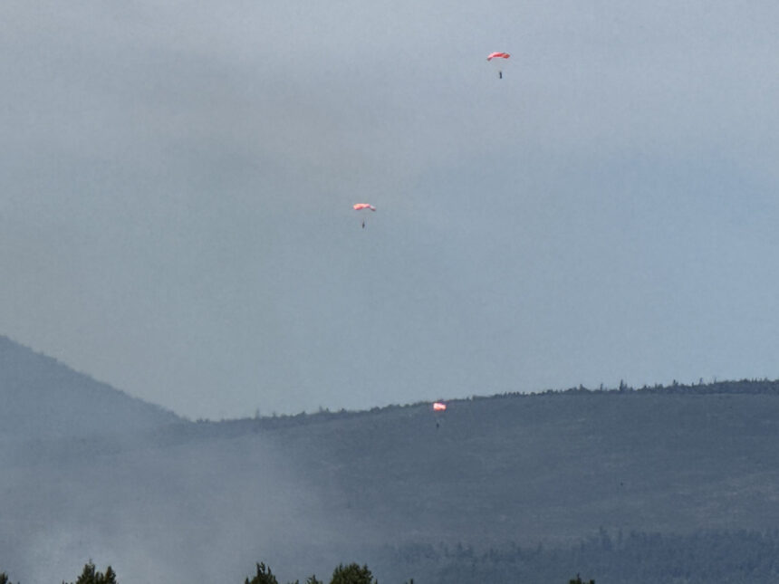
Helicopters, tankers, smokejumpers and rappelers joined forces with ground crews to tackle a fire in Jefferson Co. that broke out Monday morning and by sunset grew to 2,500 acres.
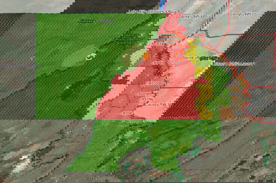
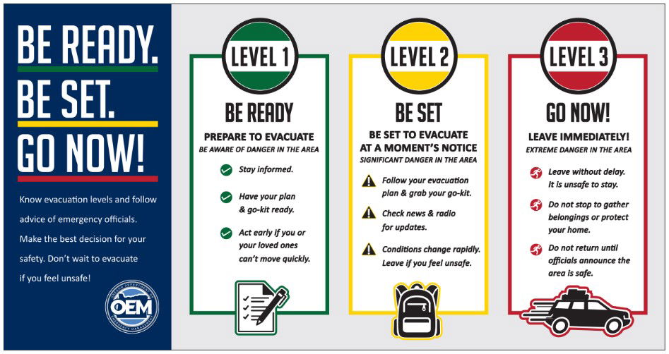
A Level 1 BE READY pre-evacuation notice was issued by Lake Billy Chinook and later a Level 2 BE SET alert near Crooked River Ranch - and then expanded to the west side of CRR, while the Level 1 area grew south into Deschutes County.
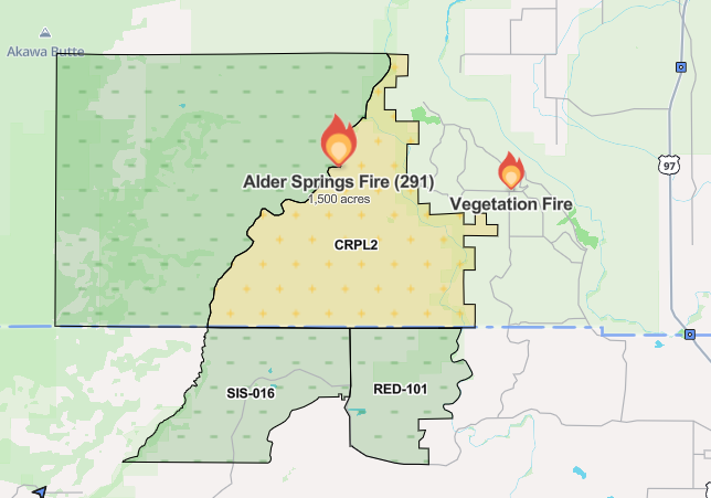
Crews responded shortly before 10 a.m. to the Alder Springs Fire (Incident 291) that Jefferson County sheriff's deputies said was located north of the Alder Springs Trailhead.
No evacuation levels were initially issued in the sheriff's office's first Facebook post about 11:15 a.m. But an update around noon said: "Lake Billy Chinook Public Lands 3 is now under a Level One Evacuation due to a fire North of Alder Springs Trailhead."
Then, just before 3 p.m., a new evacuation update: "The Crooked River Public Lands 2 South of Alder Springs has now been placed on a level TWO evacuation.
"This zone borders up to the CRR Area," the sheriff's office said. "Although this area is not in a level at this time, please be advised of the current situation. We will be keeping you as up to date as possible. Make sure you are signed up for the Everbridge alerts, and we will be working with CRR Fire to keep you as updated as we possibly can."
Watch Duty's fire report said WildCAD gave an initial size estimate of 18 acres on the fire, burning near Whychus Creek and Dry Falls, west of the Deschutes River. It was later estimated at 40 acres - and at 450 acres by 1 p.m., to 800 acres by 3:30 p.m. - and nearly doubld, to 1,500 acres an hour later.
Fire officials said the blaze was burning in grass, brush and snags. Two engines, rappellers and a helicopter were working the fire, with air tankers and another helicopter requested.
The 1 p.m. update said: "Multiple air resources, including heavy helicopters and air tankers,s are assisting firefighters on the ground.
By mid-afternoon, the resources on the fire included four engines, two 20-person crews, eight rappellers, smokejumpers and a water tender. Two more crews were requested, as well as two bulldozers and a skidgeon. Air tankers, helicopters continued to support firefighters on the ground.
Shortly after 4 p.m. Monday, the Deschutes County Sheriff's Office announced an evacuation alert to the south:
"Due to the Alder Springs Fire burning in Jefferson County, the Deschutes County Sheriff's Office has issued Level 1: BE READY evacuation notices for the area off of Holmes Road and Lower Bridge Way. A map of the evacuation zones can be viewed at deschutes.org/emergency.
Level 1: Means “BE READY“ for potential evacuation. Residents should be aware of the danger that exists in their area, monitor emergency services websites and local media outlets for information. This is the time for preparation and precautionary movements of persons with special needs, mobile property and (under certain circumstances) pets and livestock. If conditions worsen, emergency services personnel may contact you via an emergency notification system.
The sheriff's office later added that "Over the Edge Taphouse is a staging area for those with animals, you just need to bring your own portable corrals!"
Shortly before 6 p.m., the Deschutes County Sheriff's Office said: "Due to continued fire activity on the Alder Springs Fire in Jefferson County, the Deschutes County areas of NW Steelhead Falls Drive, sections of NW Dove Drive and sections of NW Quail Road in Deschutes County have been placed on Level 1: BE READY evacuation notice.
A temporary evacuation point has been established at Highland Baptist Church: 3100 SW Highland Ave., Redmond. A large animal shelter has been established at the Deschutes County Fairgrounds: 3800 SW Airport Way, Redmond
Current maps, including evacuation areas, can be found at: https://deschutes.org/emergency
Winds were challenging firefighters as they worked to keep the blaze from crossing the Crooked River to the east. The two counties were coordinating the firefighting effort and added crews.
About 5 p.m., the Jefferson County Sheriff's Office updated the map and said on Facebook: "CRR area, please be advised. Everbridge messages have been sent to all zones in the evacuation areas.
![]() Level 2: 11, 10 N, 10 S, 12, 8, 2 Middle, 2 NW, 9, 2 SW
Level 2: 11, 10 N, 10 S, 12, 8, 2 Middle, 2 NW, 9, 2 SW
![]() Level 1: 6, 7, 2 N, 3 Middle, 3 North, 2 NE, 2 E, 2 SE
Level 1: 6, 7, 2 N, 3 Middle, 3 North, 2 NE, 2 E, 2 SE
The whole west side of the ranch is in level 2. Reach out to the CRR Fire Hall for more information!"
A Central Oregon Type 3 Incident Management Team will be taking command of the fire at 6 a.m. Tuesday.
For fire information, you can visit the Central Oregon Fire Information site at: www.centraloregonfire.org
Make sure you are registered for Deschutes Alerts to receive evacuation and emergency alert and warnings in your area by going to www.deschutesalerts.org
A new fire broke out later Monday about two miles to the east, along the 6900 block of SW Shad Road in Crooked River Ranch. Numerous crews from surrounding communities were heading to the area to help fight the blazes.
Watch Duty
Farther north, an 18-acre fire, the East Log Deck Fire, was burning east of Warm Springs.
