Oregon Division of State Lands releases updated essential salmonid habitat map

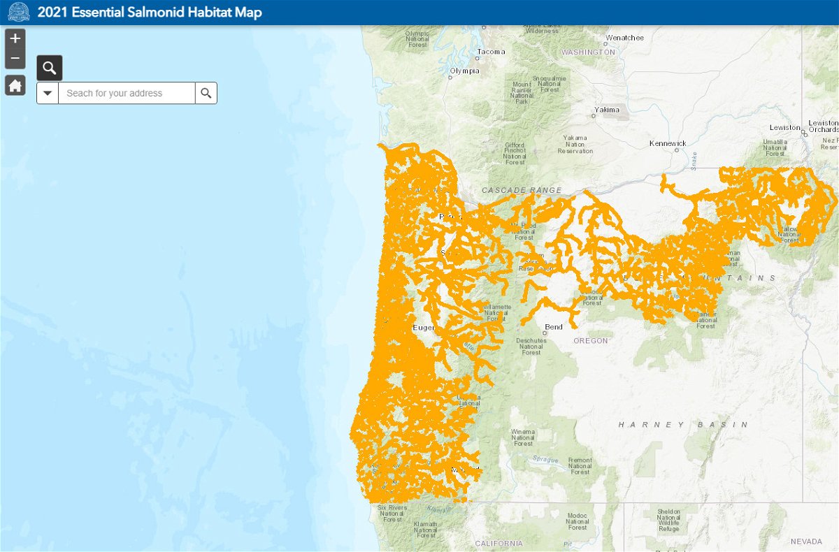
SALEM, Ore. (KTVZ) -- The state of Oregon on Friday released a newly updated essential salmonid habitat map, which shows streams where activities like building docks or adding riprap usually require a removal-fill permit.
The map identifies streams that are critical habitat for Chinook salmon, steelhead trout, and other sensitive, threatened or endangered fish species. Oregon law protects these streams by requiring a removal-fill permit for most projects that remove or add any materials. View the map and learn more.
“Knowing which streams are essential habitat helps property owners do their part to protect fish,” says Oregon Department of State Lands Director Vicki Walker. “More streams have been identified as essential, so now is a good time to check the map.”
Created using Oregon Department of Fish and Wildlife data, the updated map includes 1,700 more stream miles of essential salmonid habitat than the previous 2015 map.
Map Will Be Updated Regularly
DSL’s recent rulemaking to update the map also created a process to ensure the map reflects current ODFW data. The map will now be updated as often as yearly, in a process that includes a public review and comment period.
Stay informed about future map updates by joining DSL’s new email list for essential salmonid habitat map information. Sign up to receive emails.