FS seeks public input on West Bend Trails project: Miles of trails to be added or rerouted, unauthorized ones removed

BEND, Ore. (KTVZ) -- The Deschutes National Forest announced Thursday it's seeking public input for the next 30 days on its draft environmental assessment for the West Bend Trails project, an ambitious set of changes to improve the very popular trail system, while removing unauthorized routes that can disturb wildlife.
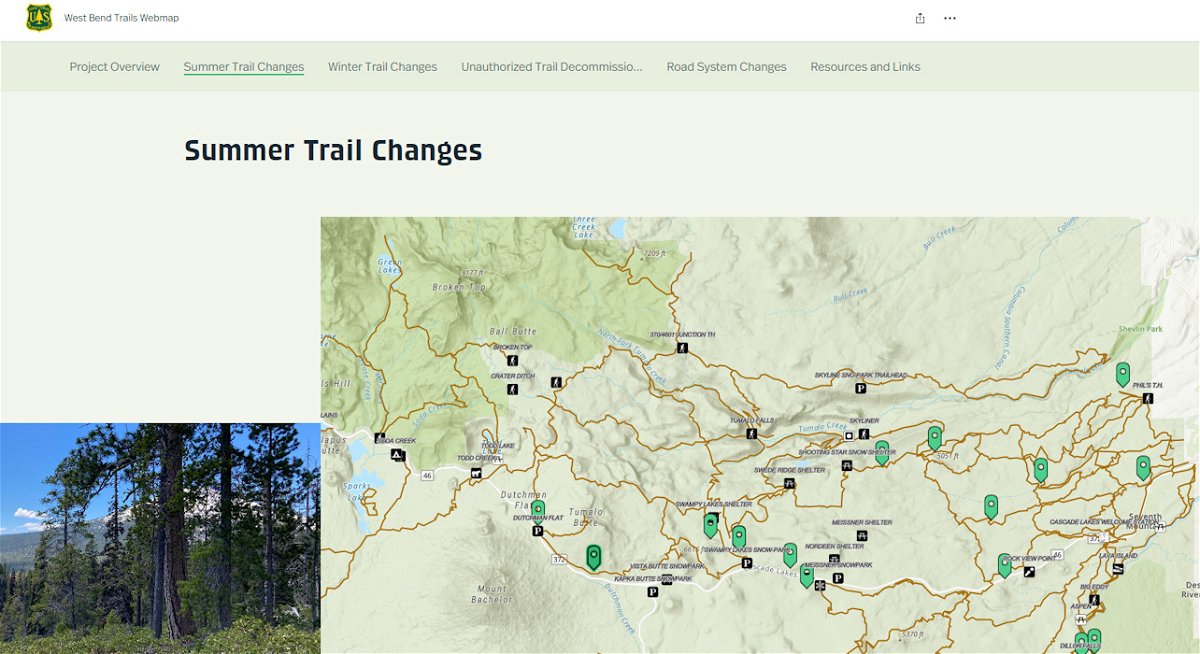
Here's the full formal announcement, with links to an interactive story map that offers more details on the proposed changes:
The goal of the West Bend Trails project is to provide quality trail-based recreation opportunities for trail users of all experience levels while minimizing disturbance and negative impacts to other resources. There is a need to improve trail alignment and sustainability and provide additional trail connectivity and opportunities for other types of trail experiences. Additionally, there is a need to minimize disturbance to wildlife through travel management and by addressing unauthorized routes.
The project area includes areas parallel to Forest Service Road 4601 (also known as Skyliner Road) from the Forest boundary to the west side of Tumalo Lake, areas parallel to Cascade Lakes Highway from the Forest Boundary to the Vista Butte parking area, areas near Kiwa Butte and FSR 4613 and FSR 4133 and near the Deschutes River along FSR 4100-292.
The Forest is proposing to reroute 8.8 miles of trail to improve confusing trail intersections and trail sustainability, as well as reduce long-term maintenance. The project would add approximately 17.5 miles of new system trail to provide better trail connectivity and additional types of trail opportunity.
The project would also balance additional trail-based recreation opportunities with Travel Management changes for approximately 35 miles of system roads. Additionally, approximately 17 miles of unauthorized trails would be decommissioned to reduce wildlife disturbance.
Specific details about the proposed trail and system road changes can be viewed here: https://storymaps.arcgis.com/stories/b74242b5ab504fec821dda37081741f9.
The draft EA can be viewed on the Deschutes National Forest website: https://www.fs.usda.gov/project/deschutes/?project=65732. Members of the public may also contact Emilie Bedard, Environmental Planner, at emilie.bedard@usda.gov to request a copy of the EA or to ask questions about the project.
The 30-day comment period began Thursday and closes on Monday, April 15. Comments received after the close of the 30-day comment period will be considered but will not have standing for objection.
Comments may be submitted electronically by sending an email to comments-pacificnorthwest-deschutes-bend-ftrock@usda.gov. Please put “West Bend Trails EA” in the subject line of your email. Comments must be submitted as part of an actual email message, or as an attachment in Microsoft Word, rich text format (rtf) or portable document format (pdf) only. Comments submitted to any email address other than the one listed above, in any other format, or that contain viruses will be rejected.
Comments may also be submitted in writing by mail and sent to Kevin Stock, District Ranger, c/o Emilie Bedard, Deschutes National Forest, 63095 Deschutes Market Road, Bend, OR 97701. Hand-delivered comments may be delivered to this address during normal business hours: Monday through Friday from 8:00 a.m. to 4:30 p.m. PST, excluding holidays.
To stay informed on this project and future project proposals, subscribe to the Deschutes National Forest’s project mailing list. Visit: https://www.fs.usda.gov/projects/deschutes/landmanagement/projects and enter your email address in the “Email Updates” field under the “Current & Recent Forest NEPA Projects” header.