The 10 best US cities for public transportation
Canva
The 10 best US cities for public transportation
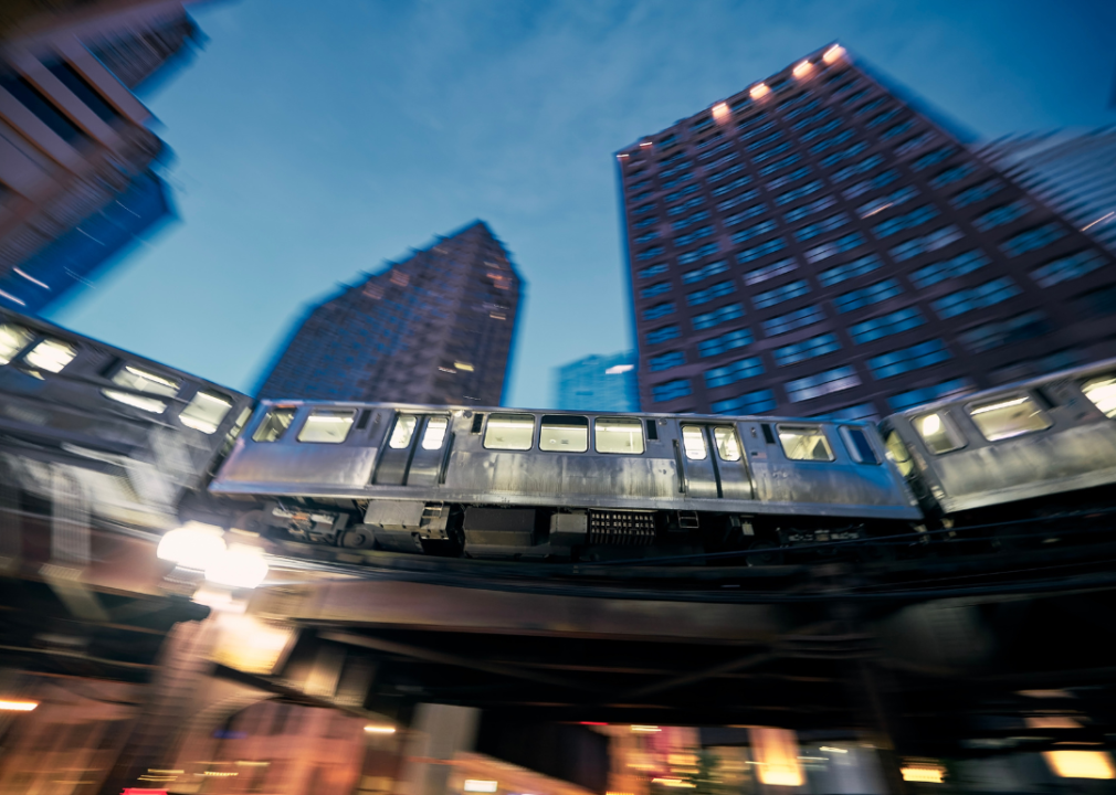
Chicago’s elevated train line at night
In this great American tableau, there exists a multitude of cities, each as diverse and vibrant as the citizens who call them home. Each city has a flavor, a soul that unfolds not just in the taste of its food or the sound of its music, but in the life that pulses through its streets. And nowhere else is that life more evident than in its public transportation.
Rent.com ranked the top 10 best cities for public transportation in the U.S. based on usage, accessibility, and cost data from ValuePenguin, Citylines.co, and the Census Bureau. From coast to coast, we scoured the nation and found the cities that make getting from A to B easier than anywhere else.
![]()
Joe Ferrer / Shutterstock
10. Minneapolis
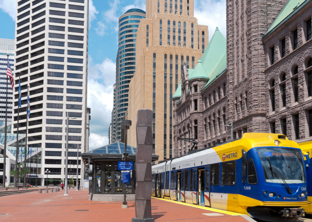
The Metro light rail line in downtown Minneapolis
Minneapolis, ah, the city of lakes, where the icy breath of the North meets the industrial charm of the American heartland. A place that defies the expectation that public transportation in the Midwest is a bit of an afterthought.
If you’ve only got a day in Minneapolis and prefer to experience the city like a local, Metro Transit is your best bet. You have two lines of the Light Rail — the Blue and the Green — interweaving through the city’s lifeblood. It’s a smoothly efficient beast, carrying with it a certain rugged charm. The Blue Line, a.k.a. the Hiawatha Line, connects the downtown area with the Mall of America, meandering through the city like a silver snake. That’s not all, it also makes a pit stop at Minneapolis-St. Paul International Airport. Handy, right? The Green Line will take you on a journey from downtown Minneapolis to downtown St. Paul, passing through the University of Minnesota. Students, professionals, tourists, you see them all — a slice of life with every stop.
Now, if you want something a bit more quaint, the Northstar Commuter Rail has a sense of old-world charm. It may be a more limited option, mainly serving the northwestern suburbs and ending in Big Lake, but riding it gives you a glimpse of the slower, quieter side of Minnesota.
Then there’s the bus system. The regular service covers the entire city and then some. The express bus will get you where you’re going faster, cutting through the city’s arteries like a hot knife through butter. But if you’re not in a hurry, the local bus service gives you a more leisurely pace.
Minneapolis, despite its frosty demeanor, has put its heart into creating a public transportation system that works. It’s efficient, yes, but it’s also a window into the soul of the city. You want to know Minneapolis? Ride the bus, take the train, watch the world go by. This city is worth more than a cursory glance: It demands to be experienced, tasted and savored.
xbrchx / Shutterstock
9. Miami
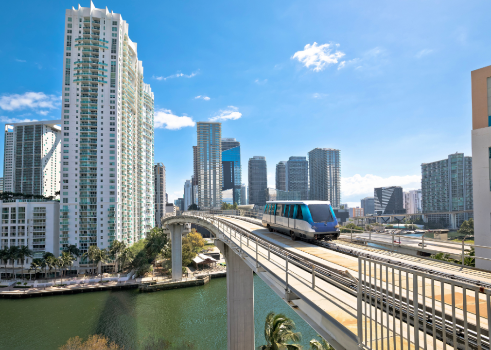
A monorail running through Miami
Miami, the pulsating, pastel-clad paradise. A veritable mélange of cultures, cuisines, and yes, a hodgepodge of public transportation options. You’ve got a mix of the typical and the distinctly local. It’s a city that does things its own way, and that ethos extends to the way folks move around en masse.
First up, there’s the Metrorail. It’s a 25-mile, elevated rapid transit system, kind of like a rail stiltwalker striding above the city. It hums and rumbles, slicing through the tropical air from Kendall to Miami International Airport through Downtown. You’ll find yourself amongst a living diorama of humanity — tourists, locals, office workers, and families, each with a story as rich as the Cuban coffee brewing in the cafe on the corner. Is it perfect? Nah. Is it efficient, clean, and air-conditioned? You bet.
Next up, you’ve got the Metrobus. A vast fleet of these contraptions, more than 600, squirming and weaving through Miami-Dade County like shiny, multi-colored snakes. It’s a more granular way to get about town. You can take a deep dive into neighborhoods the Metrorail system might not touch. It’s where you’ll find a front-row seat to the tapestry of cultures making up the Miami mosaic.
Then there’s the Metromover, a cute, electrically powered people-mover system, free of charge, that sweeps through Downtown and Brickell. It’s like something out of a sci-fi movie, only instead of being whisked off to the mothership, you’re getting dropped off at your favorite sushi joint or a Heat game.
Don’t forget the Tri-Rail, a commuter train connecting the dots between Miami, Fort Lauderdale, and West Palm Beach. It’s the spinal cord of South Florida, keeping the metropolitan regions linked and functioning.
But here’s the coolest part — the water taxis. Yes, in a city where water is as much a part of life as the sand and the sun, you can traverse Biscayne Bay by boat. These sea chariots are more than just transportation. They’re a mini-cruise through the city’s lifeblood, past the sandy beaches, the skyscrapers, the docks stacked with the type of boats you’d buy if your memoirs became best-sellers.
So there you have it — Miami, a city where getting from A to B isn’t just a necessity, it’s an adventure. Just like its food, its people, and its music, the public transportation here is a feast for the senses.
Krtz07 // Shutterstock
8. Philadelphia
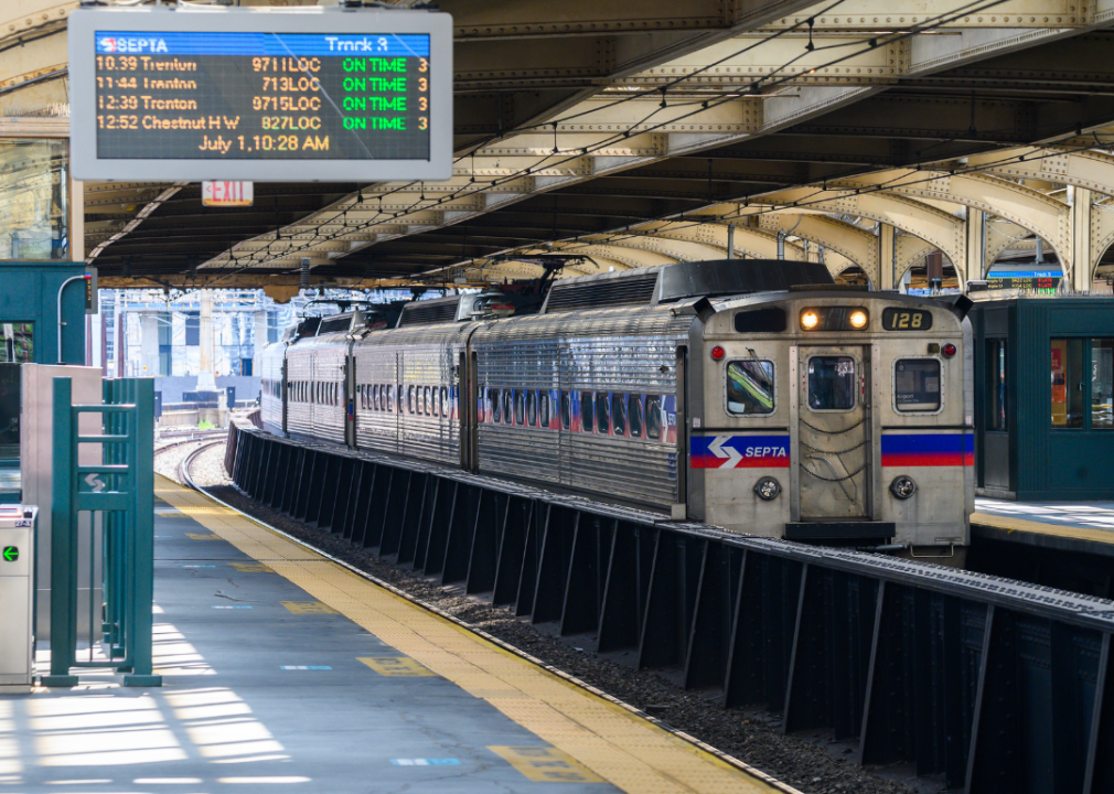
A SEPTA commuter line operating in Philadelphia
Philadelphia, where the ghosts of America’s past walk the brick-laid streets, where the cheesesteaks are greasy, robust, and darn near perfect. It’s a city whose heart beats to the rhythm of history, culture, and strength and is tied together by its public transportation. Each bus, train, and trolley is more than just a vehicle — it’s a chapter in a city-wide story, a page in a never-ending book of urban poetry.
Let’s start with the SEPTA, the Southeastern Pennsylvania Transportation Authority. It’s the main workhorse of the Philly public transportation system. To put it simply, it’s a network of buses, trolleys, and trains that crisscross the city like a finely woven Turkish rug. You’ve got more than a hundred bus routes, dozens of trolley lines, and a comprehensive subway system — it’s like the veins in Rocky’s arms, connecting every nook and cranny of this historical powerhouse of a city.
SEPTA’s subway lines, the Broad Street Line and the Market-Frankford Line, are the two main pillars. SEPTA’s BSL takes you from the stadiums up to Fern Rock, while the MFL stretches from Frankford all the way to 69th Street.
Then there’s the Regional Rail, a collection of train lines that stretch beyond the city, reaching into the farthest corners of the Philadelphia metropolitan area. This isn’t just a lifeline, it’s a bunch of lifelines, a spider web that connects Philly to its suburban orbit, making the city easily accessible to commuters from the surrounding suburbs.
Next up, let’s talk buses. SEPTA has more than 120 of these routes, rumbling their way through the city, the suburbs, and even across state lines into Jersey. They’re the workhorses of the Philly streets, the blood cells that keep the city body oxygenated.
Philly also has trolleys and boy, do they give the city an old-world charm. These electric streetcars — some operating in their own right-of-way, some mixing with regular street traffic — are like time machines on rails, harkening back to the city’s industrial past while keeping its present and always on the move.
And let’s not forget the Philly PHLASH, the seasonal downtown loop that shuttles tourists and locals alike between key destinations, from Penn’s Landing to the Philadelphia Museum of Art and a slew of interesting stops in between. It’s quick, it’s easy, it’s colorfully conspicuous and a good option for a whirlwind tour of some of the city’s top attractions.
Wangkun Jia / Shutterstock
7. Providence
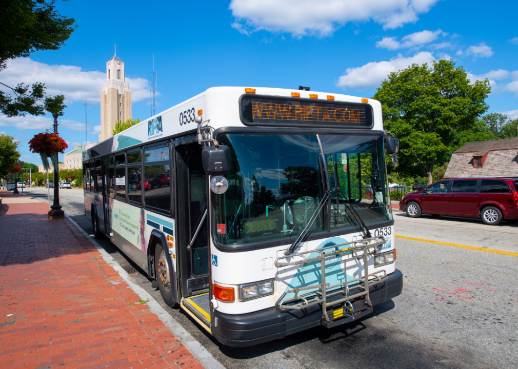
A RIPTA bus operating in Providence, Rhode Island
Providence, Rhode Island, is one of the first cities one might conjure up when thinking of idyllic New England vistas, scholars strolling down leaf-strewn walkways or the architectural poetry of the classic coastal aesthetic. It’s a city that marries the old-world charm of the East Coast with the dynamism of a modern metropolis, and the unsung hero behind it all? Its robust, yet still slightly under-the-radar, public transportation system.
Let’s start with the Rhode Island Public Transit Authority, or RIPTA. It’s not flashy but it gets the job done, like a good clam chowder. More than 50 bus routes zigzag their way across the state, with Providence as its epicenter.
Providence’s bus network isn’t just functional, it’s a socio-economic equalizer, a veritable cross-section of humanity. On a single trip, you could share a ride with students, workers, artists, pensioners, tourists, and more, each bringing a dash of unique flavor to this particular Rhode Island stew.
And let’s not forget Amtrak and the MBTA, your railways to the rest of the Northeast. The Providence Station is a major stop on Amtrak’s Northeast Corridor, connecting the city to Boston, New York, and beyond. The MBTA, or the ‘T’ as it’s known by locals, also provides commuter rail service to Boston, a vital connection for those who want a taste of Beantown without giving up the relaxed charm of Providence.
Ian Dewar Photography / Shutterstock
6. Seattle
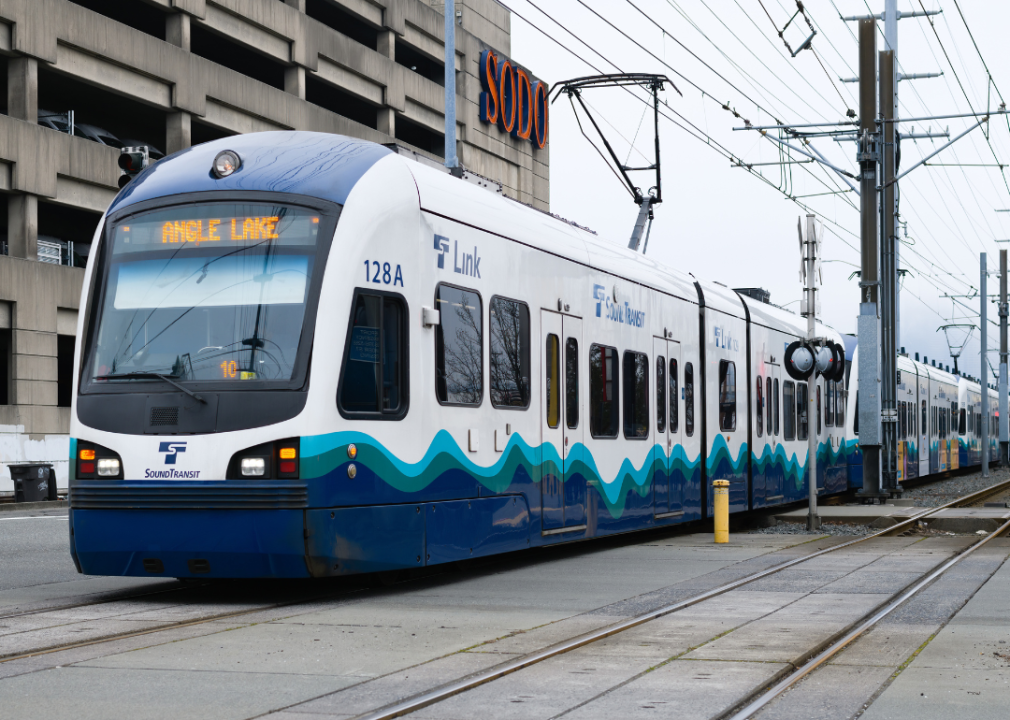
A Sound Transit light rail line operating in Seattle
A haven for grunge, coffee, tech, and rain, Seattle is a city that marches to the beat of its own drum. Tucked away in the Pacific Northwest, surrounded by water, mountains, and forests, this area is enchanted on more levels than one. But beneath the plaid shirts and the Pike Place Fish Market, there’s a public transportation system that’s as diverse and intricate as the city it serves.
First up, there’s King County Metro. These buses aren’t just practical; they’re a microcosm of Seattle, a patchwork quilt of locals and tourists, workers and wanderers, each adding a unique character to the Seattle scene. It might not always be glamorous — there’s the occasional traffic snarl or rainy day gloom — but it’s dependable. It’s the pulse of the city, the rhythm that keeps Seattle ticking like a metronome in a recording studio.
Then, there’s Sound Transit Link Light Rail. It’s like the city’s futuristic spine, connecting Seattle-Tacoma International Airport in the south to the University of Washington in the north. It’s sleek, it’s efficient and it is a godsend during rush hour. It moves through the city with a hum, a mechanical melody that sings the song of Seattle’s growth and progress.
But the real star of the show? That has to be the Seattle Streetcar. A nod to the city’s history, these modern electric trams dance their way through the city, blending the old with the new. They’re the symbol of a city that respects its past while driving headfirst into the future. And they’re super convenient for a lazy jaunt through South Lake Union or First Hill.
And of course, there’s the monorail, Seattle’s delightful anomaly. Built for the 1962 World’s Fair, this elevated train line whisks you from Westlake Center to Seattle Center, home of the iconic Space Needle, in less than two minutes.
wonderlustpicstravel / Shutterstock
5. Chicago
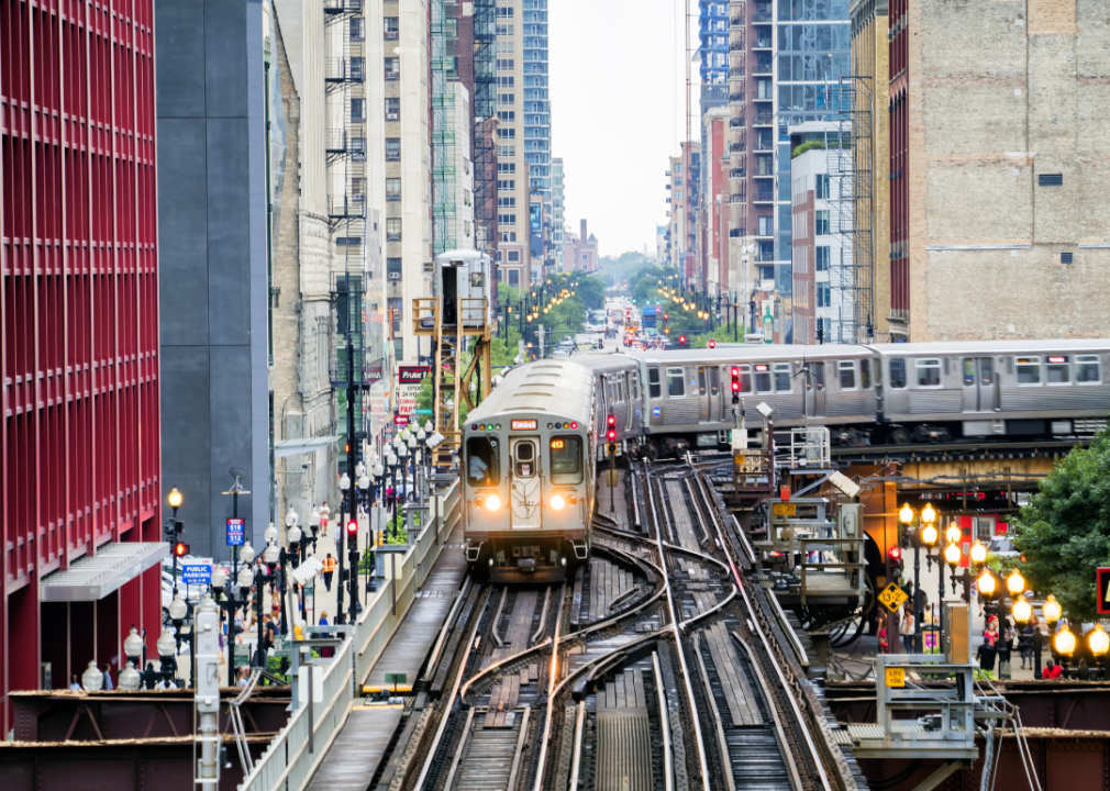
The ‘L’ Brown Line operating in Chicago’s Loop
Home of deep-dish pizza, die-hard sports fans, and a take-no-crap attitude, Chicago is a city that doesn’t just survive — it thrives, defiantly, standing tall against the icy gusts off Lake Michigan. It’s a city of neighborhoods, each one with its own story, its own flavor, all stitched together by a vast and vibrant public network of transportation.
The star of the show, no doubt, is the Chicago Transit Authority, the CTA, the backbone that keeps the city standing upright. It’s an orchestra of buses and trains that crisscross the city like a musical score, each one hitting a different note and playing a different tune.
The CTA’s elevated trains, or ‘the L’ as locals call it, are the symphony’s lead players. Eight color-coded lines rumble and screech their way through the city, above the cacophony below. From the Red Line’s journey from the North to South side, the Blue Line’s trip to O’Hare or the Brown Line’s loop around the city’s heart, they’re as much a part of Chicago’s character as the skyscrapers that pierce the city’s skyline.
And let’s not forget the buses. Over a hundred routes sprawl out across the city, reaching the corners the L can’t. They’re the unsung heroes, the rhythm section that keeps the tempo and provides the baseline on which the city moves.
Then, there’s Metra, the city’s commuter rail system. It stretches its metallic tendrils into the far reaches of the Chicago suburbs, morning and night. It’s the whisper in the dawn, the lullaby at dusk, the constant to-and-fro that keeps the Windy City spinning.
But here’s the wild card — water taxis. In a city that owes its life to Lake Michigan, you’d better believe there’s a place for boats. In the warmer months, these aquatic chariots skim the surface of the Chicago River, offering a scenic and often quicker alternative to bus or taxi travel. It’s a dose of tranquility amidst the urban clamor, a serene interlude before you dive back into the urban fray.
Chicago is a living, breathing entity, one that moves to the rhythm of the ‘L’ and the hum of the buses. Its public transportation isn’t just practical, it’s poetic. It’s a dance, a ballet of people and machines, a performance that begins anew with each rising sun. So, hop on board, tap your Ventra card, and lose yourself in the beautiful chaos that is Chicago.
Andrey Bayda // Shutterstock
4. San Francisco
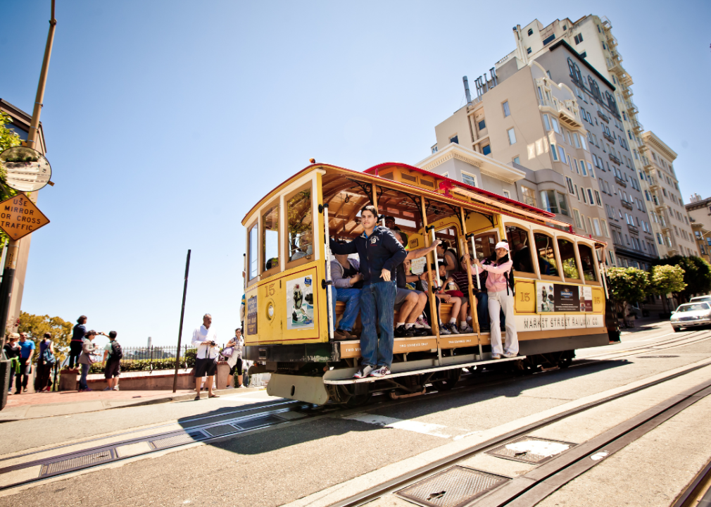
An iconic cable car running in San Francisco
San Francisco is where the tech elite brush shoulders with bohemian artists, where old-world charm coexists with futuristic ambition. It’s a city defined by its hills, its bay, and most importantly, its iconic public transportation.
Let’s start with Muni, or The San Francisco Municipal Transportation Agency. A collection of buses, trains, cable cars, and streetcars that hum and buzz their way through the city’s diverse neighborhoods. It’s as eclectic as the city it serves, a patchwork of routes and services that weave together the story of San Francisco.
The Muni Metro Light Rail is a marvel. It snakes its way beneath the city, surfacing now and again to offer glimpses of the Golden Gate Bridge, Twin Peak, and the colorful chaos of the Mission District. It’s the city’s pulse, a lifeline that connects San Francisco’s heart to its extremities.
Now for the real star of the show, the cable cars. These beautiful, antique machines aren’t just a way to get around, they’re a way to travel through time. They rattle and clatter up and down the city’s notorious hills, offering breathtaking views of the city, the bay, and the iconic skyline. There’s nothing like hanging off the side of a cable car as it ascends the crest of Nob Hill, revealing a panorama of the city below.
Not to be outdone, San Francisco also boasts a historic fleet of streetcars. The F Market & Wharves line, specifically, is a rolling history lesson of a collection of vintage streetcars from around the world, each with its own story, its own unique charm.
And let’s not forget BART— the Bay Area Rapid Transit. This commuter subway system isn’t just for the nine-to-five crowd. It’s a vital artery that links San Francisco to its neighbors — Oakland, Berkeley, Daly City, and more.
Kristi Blokhin / Shutterstock
3. Washington D.C.
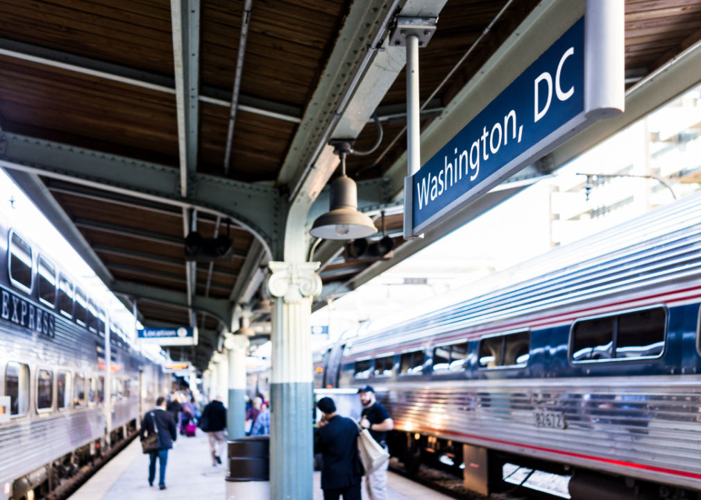
The interior of a Washington DC train station
Washington D.C. is a city that’s constantly on the world’s stage, where the decisions made within its borders echo around the globe. It’s a city of contrasts — the lofty ideals of democracy and the gritty reality of governance, the grandeur of its monuments and the hustle of its streets. And binding it all together, a public transportation system as diverse and intricate as the city itself.
The star of the show is the Washington Metropolitan Area Transit Authority, better known as Metro. As the tendrils that connect the city and avoid unexpected motorcade shutdowns, this is a popular option for locals and weekend warriors alike.
The Metrorail, D.C.’s rapid transit system, is a marvel of modern design. Its Brutalist architecture, those waffle-patterned vaulted ceilings—they’re almost as iconic as the city’s neoclassical monuments.
Then, there’s the Metrobus system, over three hundred routes reach every nook and cranny of the city. They’re the workhorses, the unsung heroes that keep the city on the move, day in and day out.
In a city where history is etched onto every street, it’s fitting that streetcars have made a comeback. The D.C. Streetcar is a nostalgic nod to the past, a link to a bygone era that’s been updated for the 21st century. It’s a charming way to explore the H Street NE Corridor and Benning Road, places where D.C.’s past, present, and future intersect in an impeccably choreographed dance.
2p2play / Shutterstock
2. Boston
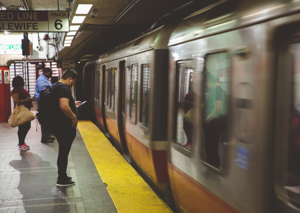
A light rail line operating out of a station in Boston
A city of scholars and sports fans, of clam chowder and wicked accents, Boston is a place where the past is always present, and nowhere is that more evident than in its public transportation system. The Massachusetts Bay Transportation Authority, or the ‘T,’ is the pulse of Boston. It’s the oldest subway system in the country, a network of trains, buses, ferries, and trolleys that link the city’s many neighborhoods and suburbs.
Let’s start with the subway. The T’s four lines offer a kaleidoscope view of the city. They cut a path from the academic oasis of Cambridge to the vibrant culture of Roxbury, from the hustle of Downtown Crossing to the cobblestones of Beacon Hill. Each station, each line tells a story, from the bustle of South Station to the ballgame buzz of Fenway.
Over a hundred and seventy bus routes meander through the city and beyond, carrying a dizzying array of Bostonians on their daily journeys. They’re the unsung heroes of the city, a fleet of blue and white that keeps Boston moving, come rain, shine, or a Nor’easter blizzard.
But let’s not forget the real MVP – the Green Line Light Rail. There’s something charmingly old-world about it, a touch of Europe in the heart of New England. They’re a window into the soul of the city, from the quiet hum of Brookline to the bustling heart of Boston College.
The MBTA isn’t just about land, either. The ferries offer a unique way to travel in the city, connecting downtown Boston to points across the harbor, like Charlestown, Hingham, and Hull. They’re a breath of fresh, salty air in the urban hubbub, a chance to see the city from a different perspective – from the quiet lapping of the Charles River.
Boston’s public transportation is a living, breathing testament to the city’s history, its culture, and its indomitable spirit. It’s a reflection of the city’s character, steadfast and resilient. A little rough around the edges? Maybe. But always moving forward. So grab a CharlieCard, hop on the T and let Boston unfold before you, one station at a time.
Stefano Politi Markovina / Shutterstock
1. New York City
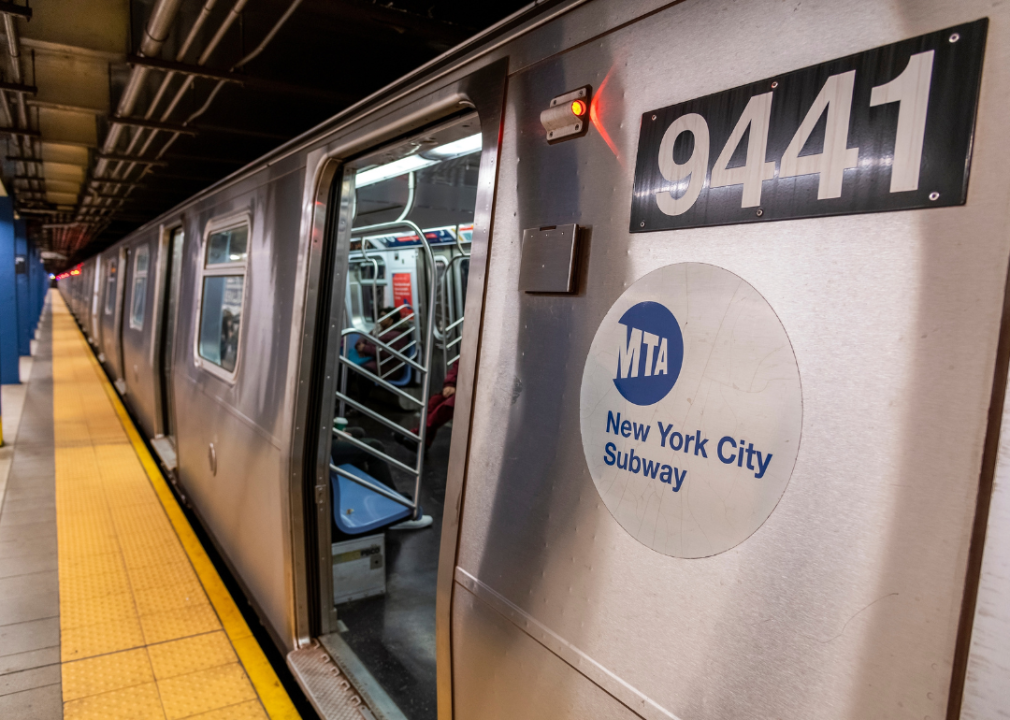
A MTA subway car in New York City
New York City, where ambition and dreams collide in a dizzying dance of noise, color, and unending movement. It’s a city of extremes. A city of towering skyscrapers and sprawling parks, of Wall Street tycoons and Broadway dreamers. And keeping it all together, a public transportation system as vast, complex, and captivating as the city itself.
The New York City subway is the city’s lifeline, the pulsating rhythm to which this metropolis moves. Twenty-four hours a day, seven days a week, the trains rumble beneath the city’s streets, connecting the far-flung corners of the five boroughs. From the tip of the Bronx to the beaches of Coney Island, from the shores of Staten Island to the nightlife of Manhattan, the subway is always working to keep the city connected.
The bus network is so vast that it feels like a city in itself. They trundle along the city’s grid, reaching the places the subway can’t, from the leafy lanes of Riverdale to the scenic streets of Red Hook.
But let’s not forget the iconic yellow cabs, racing through the city at all hours, a symbol as integral to New York as the Statue of Liberty or a hot dog from Gray’s Papaya. They’re not public transit in the traditional sense, but they’re as much a part of the city’s transportation landscape as any bus or train.
And then there are the ferries. From the Staten Island Ferry, offering the best free view of the Statue of Liberty, to the NYC Ferry network connecting Manhattan with Brooklyn, Queens, and the Bronx via the city’s rivers and bays.
New York City’s public transportation is a reflection of the city’s soul — chaotic, diverse, and always on the move. It’s not just a way to get from A to B, but a unique life experience in its own right.
These are the best U.S. cities for public transportation
There you have it, a flavorful sampling of America’s finest in public transportation. From the sun-soaked coasts of Miami to the historic charm of Boston, from the cultural hub of Chicago to the innovation of San Francisco, it’s clear that the spirit of a city lives not just in its landmarks or its cuisine, but in the subway cars, buses, trams and ferries that connect us to each other and the world.
So, whether you’re a lifelong local or an eager explorer, remember, the journey can be as important as the destination, especially when it comes to public transportation. Next time you’re in one of these cities, skip the rental car. Instead, hop on a bus, catch a train, or ride a ferry, and see what stories the city has to tell you.
Methodology
To find the best cities for public transportation, we looked at metrics related to public transportation usage, accessibility and cost.
Features were normalized and then weighted based on the following scale:
- Usage: 25 points
- Percentage of public transportation users: 25 points
- Accessibility: 50 points
- Bus lines per density: 10 points
- Public transit stations per density: 10 points
- Number of tracks: 10 points
- Transit lines per density: 10 points
- Number of transit systems: 10 point
- Cost: 25 points
- Price for a 30-day pass: 12.5 points
- Percentage of pass cost related to local mean income: 12.5 points
Transit system info was from citylines.co. Transit cost was from ValuePenguin. Bus lines were from a database of 8 million commercially available business listings. These listings may not reflect recent changes to bus line availability. Usage is from the U.S. Census Bureau.
The information included in this article is used for illustrative purposes only. The data contained herein do not constitute financial advice or a pricing guarantee for any apartment.
This story was produced by Rent.com and reviewed and distributed by Stacker Media.