Showers arrive late today and will continue through the day Wednesday
Highs today will hit the low to mid 40s and lows tonight will drop into the upper 20s and low 30s.
We are off to a dry start this morning but a surface system is approaching from off the coast and will be here later today. A warm front attached to this system is bringing rain, snow, and a chance for freezing rain. We could see some light rain and snow in some of our southern regions this afternoon, but the main event will begin overnight. With the warmer air, most of us will see rain and little snow accumulation is expected as snow levels rise to 4500ft.
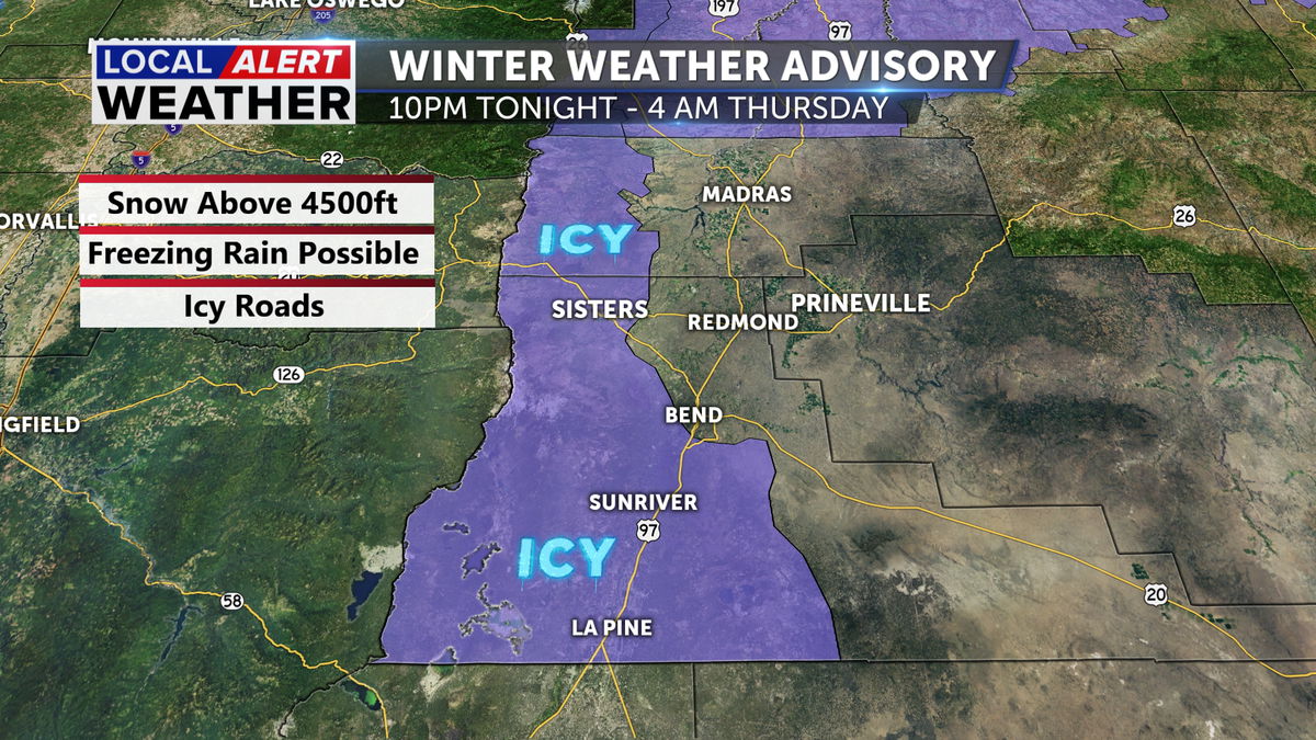
Areas like La Pine and Sunriver have a chance for freezing rain overnight. Icy roads are expected tomorrow morning.
A Winter Weather Advisory was released this morning for the eastern slopes and areas south of Bend due to ice accumulation and higher elevation snow. It is active from 10pm tonight until 4am Thursday.
Showers are expected to be off and on Wednesday. Again, mostly rain, but a mix is possible in the higher elevations early in the day. Afternoon highs will be in the 40s, keeping the majority of the daytime precipitation wet versus wintry.
Our upper level pattern will change for the second half of the week, switching a few things up for us. Mild temperatures are right around the corner! The 50s are expected to return for the weekend and continue into early next week. We are drier starting Thursday but the dry pattern doesn’t last long because rain returns Sunday.
Happy Tuesday, have a great day today!
Don’t forget to download the KTVZ weather app to stay safe and informed.
iOS: https://apps.apple.com/us/app/ktvz-local-alert-weather-app/id1088330817
Android: https://play.google.com/store/apps/details?id=com.ktvz.android.weather&hl=en_US
