NTSB: Portland pilot killed in Warm Springs jet crash was not certified to fly plane
Preliminary report indicates communication, other issues during flight
WARM SPRINGS, Ore. (KTVZ) – A Portland businessman killed in the spiraling, fiery crash of his twin-engine business jet on the Warm Springs Indian Reservation last month had tried but failed to gain certification to fly the plane, as he did that day – likely for the first time alone, federal investigators said Thursday.
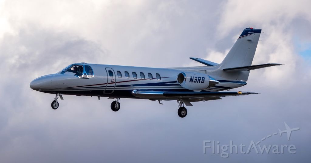
Despite a flight plan indicating two people would be aboard, Richard Boehlke, 72, was found to have been alone in the Cessna Citation C560 that crashed in the Mutton Mountains on Jan. 9 during a planned flight from Troutdale, east of Portland, to Boise.
Investigators laid out the details of numerous issues Boehlke had during the flight with directional heading and radio communications with air traffic controllers.
Boehlke, a licensed pilot, did hold type ratings to fly a Grumman G-111 Albatross and Learjet, but not for the Citation 560, the preliminary National Transportation Safety Board report issued Thursday said. Online records indicate the plane, built in 1989, was registered to Boehlke last August.
“He (Boehlke) had taken Citation 560 training toward the end of 2020 at a training facility in Arizona,” the report said. “However, the owner of the facility stated that the pilot had not performed to a level sufficient to be issued a type rating or single pilot exemption.”
“Review of historical flight data, and statements provided by acquaintances of the pilot, indicate that this was likely the first time he had flown the airplane on his own,” the report concluded.
Crews who recovered Boehlke’s remains at the crash scene also recovered the cockpit voice recorder.
Although a final NTSB investigative report with probable cause is likely one to two years away, the initial investigation indicated Boehlke was having significant trouble communicating with and following the directions of air traffic controllers. Warm Springs police earlier noted that he had been slurring his words, possibly indicating a medical issue.
Boehlke had filed an “instrument flight rules” flight plan, but the report indicated significant communication issues with the pilot, with air traffic controllers having to repeat their messages, even before takeoff.
Shortly after the flight began, controllers had confirmed radar contact and called for the pilot to turn, but radar showed he had not.
“Both the Portland approach and Troutdale tower controller made multiple attempts to contact the pilot,” the report said. “On the fifth attempt by the approach controller, the pilot responded and was provided the left heading,” and the plane began to turn left.
Moments later, the pilot, directed to a specific navigation waypoint, said he was heading in that direction, but the plane had not changed its southbound track “and was now flying directly toward Mount Hood, about 27 miles east-southeast,” the NTSB report said.
After reaching 13,000 feet altitude, the controller issued a right turn direction, and while the pilot responded correctly, “the airplane turned left,” the report said. The controller told the pilot he was flying on a northeast track and gave another heading change. The pilot began a right turn.
The Seattle controller soon gave Boehlke a low altitude alert warning, as he was just above the minimum IFR altitude for the area, just south of the 11,250-foot peak of Mt. Hood.
The controller asked Boehlke if he was having radio problems, and he replied, “No, I think it’s cleared up now, radio loud and clear,” the NTSB said. After reaching 19,000 feet, he was given a new radio frequency for Seattle Center, responded with an incorrect one and was corrected.
About 1:30 p.m., the controller alerted the pilot he was about 30 degrees right of his course to Boise, “but the pilot did not respond,” as the plane soon reached its peak altitude of 31,000 feet.
“The airplane began to descend, and remained for the next eight minutes in a spiraling and descending 1-mile radius right turn,” until the last data recording on a northwest heading, shortly before it crashed into the mountainous terrain at an elevation of 3,600 feet.
