Evacuation notice down to Level 1 near Jackpine Fire south of La Pine
(Update: Jackpine evacuation alert down to Level 1)
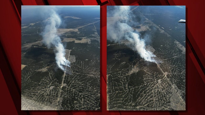
La PINE, Ore. (KTVZ) – Firefighters continued to hold the 180-acre Jackpine Fire south of La Pine within its perimeter and brought the blaze to 25% containment. Meanwhile, crews also made good progress on the Wickiup and Round Mountain fires near Wickiup Reservoir.
And on Tuesday, the Deschutes County Sheriff's Office said:
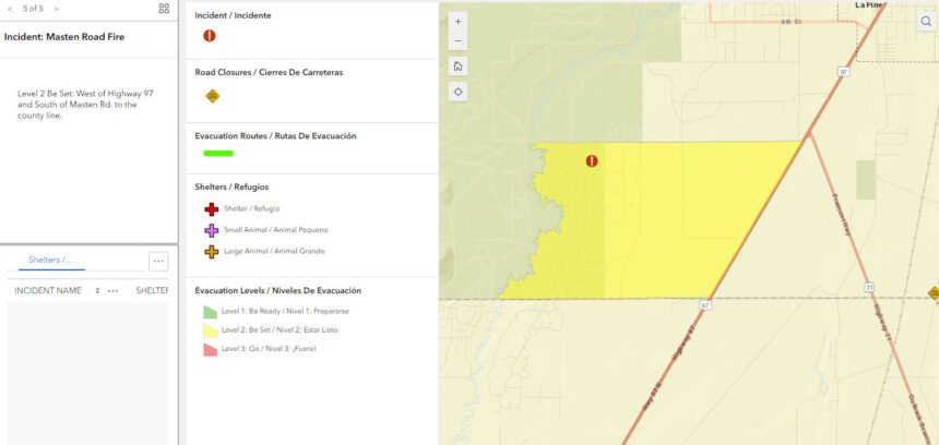
"After consultation with the Incident Commander of the Jackpine Fire, the Deschutes County Sheriff's Office is lowering all evacuation levels around the Jackpine Fire to Level 1: Be Ready. This includes the area west of Highway 97, south of Masten Rd., east of the Little Deschutes River to the county line."
Crews on the blaze spent Sunday "strengthening perimeter lines and using water to extinguish hot spot," a Sunday evening update said.
On Monday, officials said:
"After consultation with the Incident Commander of the Wickiup and Round Mountain Firs, the Deschutes County Sheriff's Office is lowering all evacuation levels around the Wickiup Fire to Level 1: Be Ready. This includes the Haner Park area and the Deschutes National Forest between Forest Service Road 4262 and Forest Service Road 44, south of South Century Drive (FS 42) and Burgess Road (FS 43).
"There is a forest closure in effect for that area for community and firefighter safety."
Here's Monday's update on the Jackpine, Wickiup and Round Mountain fires:
Central Oregon Interagency Dispatch Update – July 21, 2024
Firefighters continue to make good progress on the Wickiup and Round Mountain fires burning on the Deschutes National Forest. The Round Mountain and Wickiup fires are burning approximately seven miles northwest of La Pine and just north of Wickiup Reservoir. A Central Oregon Type 3 Team is managing both incidents.
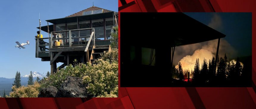
All lines held overnight on the Wickiup and Round Mountain Fires. Today, firefighters will continue to use equipment and water to secure and strengthen lines to keep the fires in their current footprint. Thus far, firefighters have been able to protect the Round Mountain Lookout. The Wickiup Fire remains 168 acres and is now 40% contained. The Round Mountain Fire remains 108 acres and is now 10% contained.
Resources on the Wickiup and Round Mountain fires include 3 hand crews, 7 engines, 3 dozers, 3 skidgeons, 2 water tenders, 4 fallers, and overhead resources. Both fires are under investigation.
The Deschutes County Sheriff’s Office has issued Level 3 (Go Now), Level 2 (Get Set) and Level 1 (Be Ready) evacuation notices north of Wickiup Reservoir. An interactive map of evacuations is available here.
· Level 3 (Go Now): National Forest area north of Wickiup, Forest Service Road 4262 and Forest Service Road 4380 and south of Forest Service Road 42 (South Century Drive)
· Level 2 (Be Set): National Forest area between Road 4380 and the Deschutes River including Bull Bend and Wyeth Campgrounds and private inholdings along the west side of the river at Haner Park
· Level 1 (Be Ready): Haner Park subdivision east of the Deschutes River
The Deschutes National Forest has issued area emergency closures for both the Wickiup Fire and the Round Mountain Fire. Bull Bend and Wyeth Campgrounds and Tenino Boat Launch are currently closed. North Twin Lake Campground remains closed and is being used to support firefighting operations.
As of Sunday night, the Jackpine Fire was 180 acres and 25% contained. Transfer of command to the Southern Area Gray Type 3 Incident Management Team occurred last night at 8 p.m. Future information about this incident will be provided in their daily updates.
Visit the official source for wildfire information in Central Oregon at centraloregonfire.org for wildfire updates or follow fire information on X/Twitter @CentralORfire. Call 9-1-1 to report a wildfire.
--
Earlier information:
Officials said earlier Saturday afternoon that firefighters had been successful so far in holding the fire in its existing footprint.
Jaimie Olle, public information officer for the Central Oregon Fire Management Service, said Saturday, "They have hose lines in and around the fire and will continue to construct those today, and that will aid firefighters in providing water as they continue to knock down hotspots and secure the perimeter of the incident. The goal for today is to keep the fire within its existing footprint."
Olle added. "We want to make sure that folks, as they're out and about, whether they're driving, recreating, are really taking that extra attention to make sure that they are not the next spark that causes the next wildfire. When we think about driving, that's making sure that we're not parking or driving on dry vegetation."
Last year in July, Central Oregon Interagency Dispatch Center recorded 68 fires that burned more than 5,000 acres. So far this July, there's been 50 fires consuming more than 85,000 acres.
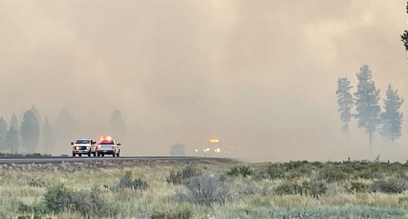
ODOT said a four-mile stretch of the highway from milepost 169 to 173, had reopened Saturday morning, but advised drivers that "wildfires are still active in the area, affecting visibility. Travelers are advised to use caution. Crews will continue to monitor and will close the highway if necessary. Watch out for crews working in the area." Get the latest conditions on our TripCheck page.
Holsey had said in a 5:30 p.m. Friday update the fire was 30% contained (later dropped to zero). They had moved to a second alarm for structural protection,, bringing in two task forces from resources around the county, and the Level 2 evacuation notice was still in effect.
Central Oregon fire officials said shortly before 6 p.m. the fire had grown to an estimated 20 acres, and later to 50 acres, burning on Prineville District BLM and private lands.
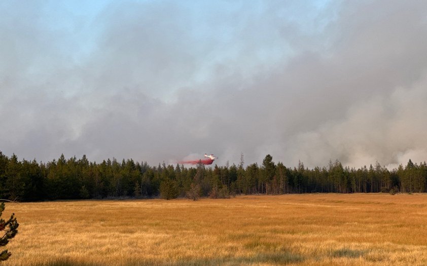
"Firefighters on the ground continue to use helicopters and air tankers to slow the fire's spread while they work on constructing dozer line around the perimeter of the fire," they said.
To the south, the Klamath County Sheriff's Office issued a Level 1 BE READY evacuation notice for both sides of Highway 97 south of the county line, including Antilope Meadow and Long Prairie.
