C.O. crews fight over 25 lightning-sparked fires; 3,000-acre Durgan Fire near Paulina brings evacuations, road closures


(Update: Tuesday update)
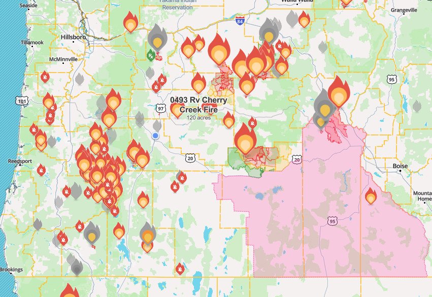
BEND, Ore. (KTVZ) – Thunderstorms moving across Central Oregon Sunday brought lightning that sparked more than 25 fire starts around the region that firefighters were still busy busy responding to Tuesday, many stopped small but one that quickly grew to about 3,000 acres northeast of Paulina and prompted evacuations and road closures.
Here's the full update issued around Tuesday by Central Oregon fire officials:
Central Oregon Interagency Dispatch Update – July 23, 2024
Central Oregon — Yesterday firefighters in Central Oregon responded to over 25 new reported fire starts. Firefighters had great success keeping most fires under an acre. A few fires quickly grew under continued hot and dry conditions.
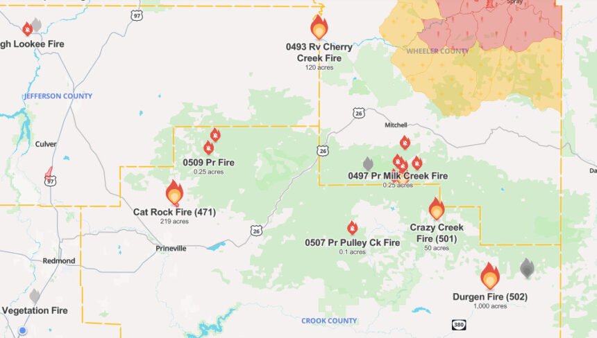
The Durgan Fire, which started on private lands adjacent to the Ochoco National Forest approximately six miles northeast of Paulina quickly grew yesterday to an estimated 3,000 acres with active fire behavior. Firefighters on scene include Post-Paulina Rangeland Fire Protection Association (RFPA) and federal resources. Today firefighters are constructing line around the perimeter of the fire and looking at places where rocky outcroppings can be used as potential control features. Federal resources are currently in unified command with the Crook County Emergency Management. The fire is 0% contained.
At 8 p.m. last night the Crook County Sheriff’s Office shared the following update: “According to incident command at the scene of the fire, the evacuation levels have changed. South of the forest boundary on Beaver Creek Road is now at a level 2 evacuation status. Everything east of Big Summit Prairie to the county line and south to the forest boundary will remain at level 3 evacuation. The roadblock at Ochoco Ranger Station will be removed soon. The roadblock at Beaver Creek Road and Paulina Highway will be moved to the forest boundary.” For additional updates from the Crook County Sheriff’s Office visit facebook.com/CrookCountySheriff.
The Crazy Creek Fire, burning on the Ochoco National Forest five miles east of Big Summit Prairie near Crazy Creek, is estimated at 700 acres and is 0% contained.
The Pulley Creek Fire, burning on the Ochoco National Forest, approximately 1 mile southwest of Big Summit Prairie, is currently estimated at 11 acres and 0% contained. Firefighters completed dozer line around the perimeter of the fire last night and will work on securing lines today.
Firefighters are also engaged in suppressing a few small fires burning north of Big Summit Prairie.
Firefighters continue to make good progress on the Wickiup and Round Mountain Fires burning on the Deschutes National Forest. The Round Mountain and Wickiup Fires are burning approximately seven miles northwest of La Pine and just north of Wickiup Reservoir. A Central Oregon Type 3 Team is managing both incidents.
Firefighters are continuing to mop up hots spots and secure the perimeter’s of both fires. The Wickiup Fire remains 168 acres and is now 50% contained. The Round Mountain Fire remains 108 acres and is now 20% contained.
Yesterday the Deschutes County Sheriff’s Office decreased evacuation notices around the Wickiup Fire to Level 1 (Be Ready). This includes the Haner Park area and the Deschutes National Forest between Forest Service Road 4262 and Forest Service Road 44, south of South Century Drive (FS 42) and Burgess Road (FS 43).
The Deschutes National Forest has issued area emergency closures for both the Wickiup Fire and the Round Mountain Fire. Bull Bend and Wyeth Campgrounds and Tenino Boat Launch are currently closed. North Twin Lake Campground remains closed and is being used to support firefighting operations.
Visit the official source for wildfire information in Central Oregon at centraloregonfire.org for wildfire updates or follow fire information on X/Twitter @CentralORfire. Call 9-1-1 to report a wildfire.
--
Earlier info:
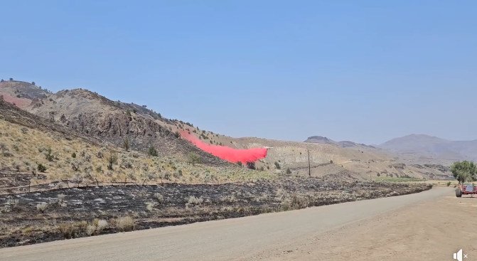
The largest of the new blazes, the Durgan Fire, had burned roughly 3,000 acres by 7:30 pm. about six miles northeast of Paulina in the Wolf Creek area, Central Oregon officials said. Firefighters on the scene included resources from the Post-Paulina RFPA and Forest Service, supported by aerial resources, including air tankers.
"The last update from firefighters indicated that the fire is currently moving NE," an update around 7:30 p.m. stated.
The Crook County Sheriff's Office said, "According to incident command at the scene of the fire, the evacuation levels changed Monday evening. South of the forest boundary on Beaver Creek Road is now at a Level 2 (BE SET) evacuation status. Everything east of Big Summit Prairie to the county line and south to the forest boundary will remain at Level 3 (GO NOW) evacuation."
"The roadblock at Ochoco Ranger Station will be removed soon," it said. "The roadblock at Beaver Creek Road and Paulina Highway will be moved to the forest boundary."
The Ochoco National Forest said on its Facebook page the Sugar Creek and Wolf Creek campgrounds were being evacuated, along with the Salters Cabin Horse Camp.
Crook County Undersheriff Bill Elliott advised in a Facebook post late Monday afternoon about evacuations and road closures from Ochoco Ranger Station up and at SE Beaver Creek Road and Paulina Highway.
Elsewhere, firefighters responded to the Crazy Creek Fire burning near the creek of that name, east of Big Summit Prairie. A helicopter was supporting crews on the ground working that fire, which had grown to about 500 acres by 7:30 p.m. and was zero percent contained.
"Firefighters are currently holding the western flank in a scabland, a place with rocky features and minimal vegetation," officials said.
Crews also were on scene of the new Pulley Creek Fire, which initially was reported as five acres "but is likely growing as fire behavior continues to remain very active," officials said.
Elsewhere, the Jefferson County Sheriff's Office reported a fire on Monday near Ashwood and the Wheeler County line burned about 120 acres before it was contained, though a Level 1 BE SET evacuation alert remained in place.
Jefferson County deputies also responded to a fire Monday afternoon in Warm Springs, along Old Mill Road west of the Deschutes River, that prompted a Level 1 evacuation along NW 17.
Earlier Monday, officials said the new Cherry Creek Fire had burned about 120 acres south of the John Day River and 16 miles northwest of Mitchell. A local range protection association and BLM resources were on the scene Monday morning, along with four single-engine air tankers (SEAT planes).
That fire was reported contained by 8 p.m.
Most of the reported incidents overnight were located on the Ochoco National Forest north of Big Summit Prairie, Central Oregon fire officials said. A reconnaissance flight Monday morning looked for additional starts across Central Oregon.
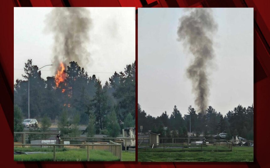
Bend Fire & Rescue responded to three fires in the area from Sunday's storms, the largest that burned about a half-acre off U.S. Highway 97 near 61st Street north of Bend.
Bend Deputy Fire Marshal Cindy Kettering said the fire reported just before 5:30 p.m. south of 61st Street was the largest of three lightning-sparked blazes Bend Fire & Rescue crews responded to Sunday evening. The other two were single-tree fires in rural southeast Bend.
A National Weather Service spotter near Deschutes River Woods reported half-inch hail as the storm moved north toward Redmond.
The NWS warned shortly before 6 p.m. of a strong thunderstorm near Redmond and Terrebonne, moving north at 30 mph, with winds gusting to 40 mph and half-inch hail. They recommended, if outdoors, to consider seeking shelter inside a building.
That's just what happened to thousands of music-lovers attending the closing night of this weekend’s FairWell Festival at the Deschutes County Fairgrounds in Redmond.
Festival officials announced a weather delay and said on their website, “Due to an approaching storm, performances have been suspended momentarily. We expect this to be a temporary delay. Please head to the First Interstate Bank Center and await further updates.”
Someone told NewsChannel 21 about the event suspension and said, "Hope it passes quick ... hot in here!” And later, festival organizers said the event had resumed.