Little Lava Fire grows a bit due to ‘moderate fire activity,’ crews ‘fight fire with fire’ with burnouts to contain blazes
(Update: Sunday's fire updates)
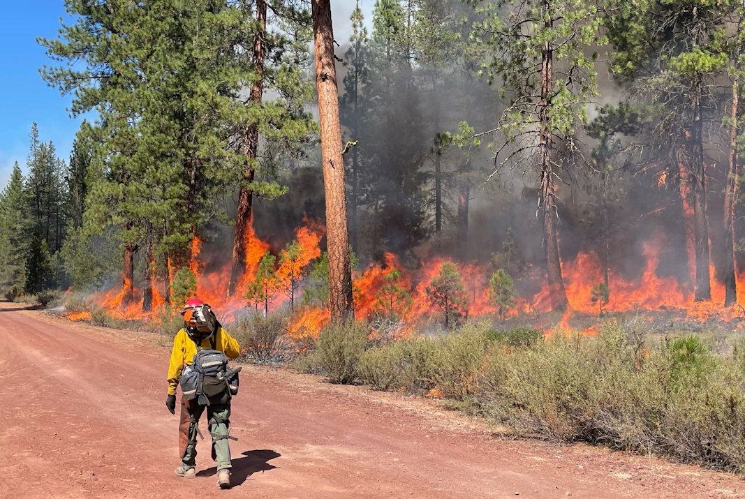
BEND, Ore. (KTVZ) -- About 800 firefighters kept busy in Sunday's cool, cloudy weather building and securing containment lines and conducting burnout operations on the Little Lava, Flat Top and Firestone fires, officials said.
The Deschutes National Forest advised Sunday that firing operations were underway on the Flat Top Fire, south of Forest Service Road 24. Firefighters planned to work along the road north toward Willow Butte.
"Fighting fire with fire, this suppression tactic is used to remove unburned fuels between constructed line, a natural feature or a road and the fire's edge," they said.
Bachelor Complex, Flat Top and Firestone Fires Update
September 15, 2024
Quick Facts: Bachelor Complex
Size: 10,801 acres Start Date: Sept 8, 2024
Location: Mt Bachelor, 20 miles SW Bend, OR
Personnel: 520
Quick Facts: Firestone & Flat Top Fires
Firestone Size: 9,188 acres Start Date: Sept 6, 2024
Location: North of Fort Rock, OR
Flat Top Size: 34,985 acres Personnel: 283
Yesterday, firefighters continued to construct firelines, conduct strategic firing operations, and mop up on the Bachelor Complex, Flat Top, and Firestone Fires. The Bachelor Complex did have an increase in acreage due to some moderate fire activity and burnout operations near Sheridan Mountain and Road 4528 and Lolo Butte near Road 4030 to secure the eastern flank of the Little Lava Fire. The Lucky Butte Fire near the Cascade crest continues to be monitored and has not experienced any significant growth. Mop up continues on the Backside and 911 Fires. On the Flat Top Fire, firefighters were able to perform strategic firing operations to help secure fireline along the western flank south of Willow Butte and the northeast corner from FSR 410 towards FSR 470 and FSR 18. During burnout operations on the north end of the fire, aerial and ground resources stopped forward progression. of a spot fire from the burnout. Crews also worked night shifts to patrol and secure these areas.
Bachelor Complex: On the Little Lava Fire, crews will continue to perform burnout operations as needed to secure the south flank of the fire. Firefighters will continue fireline construction on the north flank of the fire and scout for opportunities to establish and connect control line to Edison Trail north of the Little Lava Fire perimeter. Improving control lines and conducting mop-up on the Backside and 911 Fires will continue. The Lucky Butte Fire will continue to be monitored.
Flat Top Fire: Burnout operations near Willow Butte and the northeast corner of the fire from FSR 410 towards FSR 470 and FSR 18 will continue today. Crews will mop-up and secure firing operations from yesterday.
Firestone Fire: Firefighters will continue mop-up operations on south and west flanks of the fire, prepare FSR 22 for burnout operations and construct fireline on the north flank.
Weather and Fire Behavior: The Bachelor Complex may receive a 10% chance of rain with Firestone and Flat Top fires likely to see a 40% chance of rain and possible thunderstorms this afternoon. Wind is expected to shift from the west to a north-northeasterly direction with possible wind gusts up to 22 mph. The Bachelor Complex is expecting high temperatures in the 50s and the Firestone and Flat Top Fires in the 60s.
Evacuations: Emergency management and fire officials are reevaluating evacuation levels daily. Level 3 evacuations mean “Go Now,” Level 2 means “Be Set” and Level 1 means “Be Ready.” To view current evacuation levels, please visit the Deschutes County Emergency Information Interactive Map at: http://www.deschutes.org/emergency. For Lake County evacuation information, please visit: https://www.lakecountyor.org/flat_top.php.
Closures: There are two emergency closure areas on the Deschutes National Forest for these fires. View the updated closure orders and maps on the Deschutes National Forest site at: https://www.fs.usda.gov/alerts/deschutes/alerts-notices.
Facebook: https://www.facebook.com/deschutesnationalforest/
InciWeb:
https://inciweb.wildfire.gov/incident-informa tion/ordef-bachelor-complex-fires
https://inciweb.wildfire.gov/incident-information/ordef-flat-top-and-firestone-fires
YouTube: https://www.youtube.com/@CentralOregonFireInfo?app=desktop
Fire Information Line: (541) 249-9829, 8:00 a.m. to 8:00 p.m.
Smoke & Air Quality Information: fire.airnow.gov
--
--
Wiley Flat Fire Daily Update September 15, 2024
Mop Up and Suppression Repairs Continue
Fire Information Phone: 541-208-7108 (8 a.m.- 8 p.m.)
Email: 2024.wileyflat@firenet.gov
Acres: Wiley Flat – 30,154 acres; 69% contained
Hawley Ridge – 793 acres; 100% contained
Location: Wiley Creek: about 10 miles southeast of Post, Oregon off Highway 380
Start Date: September 2, 2024
Personnel: 678
Resources: 20 crews |22 engines | 17 bulldozers | 14 water tenders | 5 masticators | 5 skidgen | 3 excavator | 4 ambulances | 1 helicopters
Highlights: Firefighters made good progress securing and mopping up control lines along the west and southwestern sides of Wiley Flat Fire yesterday. They worked into the evening burning out small patches of interior unburned vegetation to further secure control lines on the southwest side of the fire. Crews and heavy equipment also focused on suppression repairs on the Hawley Ridge Fire and along the east side of Wiley Flat Fire. They will continue suppression repairs on the Hawley Ridge Fire and along the Wiley Flat Fire’s eastern and northern direct lines and all indirect lines.
Weather:
• Today: A low-pressure system will move into the area increasing the chance of rain this afternoon and evening. Skies will remain cloudy with highs near 60, and minimum humidity will reach 60 percent. Winds will be from north to northwest at 5 to 10 mph with 15 mph gusts.
Evacuations: The following evacuations are in effect:
LEVEL 3: SE Maury Road west to SE Newsome Creek Road from Crooked River south to the Forest boundary.
LEVEL 2: SE Newsome Creek Road west to SE Conant Basin Road area south of Crooked River. SE Maury Road east to SE Camp Creek Road from Hwy 380 south to Forest Boundary.
An evacuation map is available online through the Crook County Emergency Management Office website.
The Red Cross evacuation shelter is in the Carey Foster Hall at Crook County Fairgrounds SE Lynn Blvd. Prineville, OR 97754. Information number: 1-800-RED-CROSS
Importance of Fire Prevention: All public lands in Central Oregon are in Stage 2 Public Use (Fire) Restrictions. All open flames, including woodstoves and charcoal briquette fires, are prohibited. In times of high fire danger, everyone must follow prevention measures to avoid additional strain on overburdened resources.
Fire Restrictions and Closures: These areas are closed to all uses, including recreational activities, for public and firefighter safety. The Ochoco National Forest has implemented temporary closures for the Paulina and Lookout Mountain Ranger Districts. The Bureau of Land Management has issued a temporary closure for portions of public lands in Crook and Grant Counties.
More Information:
Smoke Outlook: https://outlooks.airfire.org/outlook/929bfe8f
InciWeb: https://inciweb.wildfire.gov/incident.../orocf-wiley-flat
Facebook: Facebook.com/2024Wiley Flat Fire
Central Oregon Wildfire Information: https://centraloregonfire.org/
--
Shoe Fly Fire
ODF Team 1 plans for transition
MITCHELL, Ore. – Crews are expected to complete mop up and suppression repair of the Shoe Fly Fire today. The remaining mop up work is near Baldy Mountain, where efforts will focus on gridding for any remaining heat. Suppression repair work near Baldy Mountain and in the Peggy Butte area will be completed today as well.
Final backhaul of hose and equipment to the Incident Command Post to be returned to fire cache will occur today. As firefighters complete mop up on the fireline today, the fire camp west of Mitchell will be disassembled.
Incident Commander Joe Hessel extended his thanks to the local community and landowners for the support over the last 14 days as more than 1,000 firefighters were based in Mitchell. “We appreciate all you have done to welcome us into your community. Thank you!”
The weather forecast includes a slight chance of showers beginning late afternoon. Seasonal temperatures with highs in the low 60’s are expected for the next several days. However, fuels are still extremely dry and receptive to fire, follow current fire restrictions and use caution with any ignition source.
Today at 6:00 p.m. management of the fire will be transferred back to ODF’s Central Oregon District. The fire will continue to be patrolled by five engines with two overhead managers for the next several days to ensure there is no heat or flames near the fireline. Smoke may be visible from fuels burning in the interior of the fire until fall rains come.
This will be the last update for the Shoe Fly Fire. Questions related to the Shoe Fly Fire can be directed to the Central Oregon District’s John Day Unit, 541-575-1139.
--
Rail Ridge Fire September 15, 2024 9:30 a.m. Update:
Rail Ridge Fire Quick Facts
Acres: 162,278
Containment: 25%
Cause: Lightning
Total resources: 1,252
Contact us
Phone: 541-208-7111
Email: 2024.railridge@firenet.gov
Facebook: Rail Ridge Fire - Oregon 2024
Inciweb: https://inciweb.wildfire.gov/incident-information/orocf-rail-ridge
LinkTree: https://linktr.ee/RailRidgeFire
Closures and Evacuations
Closures: The U.S. Forest Service and Bureau of Land Management have implemented partial closures because of the Rail Ridge and Crazy Creek fires, for all uses. For more details and closure maps, visit the Ochoco National Forest, Malheur National Forest, and BLM web pages.
Evacuations: Shelters are available to evacuees. For up-to-date evacuation information, please visit:
- Grant County: Grant County Emergency Management Facebook page.
- Crook County: Crook County Emergency Management website and Crook County Sheriff’s Office Facebook page.
- Wheeler County: Wheeler County Sheriff’s Office Facebook page.
Operational Update
Oregon State Fire Marshal (OSFM) resources have demobilized from the Rail Ridge Fire. These crews conducted suppression alongside wildland partners, protected structures, triaged nearly 500 structures and fulfilled structure prep needs throughout the incident area. These efforts, in conjunction with the progress made by wildland resources, have helped mitigate the risk to structures and allowed many residents to return to their homes.
California Incident Management Team 10 will take over ongoing structural protection efforts, in addition to the wildland mission. Local resources also remain available to assist if needed. OSFM is available to return if there is an imminent threat to structures that exceeds the capabilities of existing resources.
OSFM would like to extend their appreciation to the local communities and agencies for their ongoing support and cooperation throughout this challenging time.
Today, crews will take advantage of the cooler, wetter weather and take an aggressive, direct approach where possible to minimize fire growth throughout the fire area where safe to do so. Firefighters will be engaged in active mop up of any heat sources that could threaten containment while also monitoring and patrolling.
Yesterday’s sunny, dry conditions brought an increase in fire activity and smoke production throughout much of the Rail Ridge Fire. In the fire’s northeast corner around Chrome Ridge, firefighters called on air resources, including single engine air tankers, to help douse the flare ups. The fire remained within containment lines.
Along the northern edge, crews made good progress mopping up around Guyon and South Fork basins south of Dayville.
To the west and northwest, heavy equipment was used to connect containment lines in the roadless area to the Battle Creek Road system while crews worked to improve roads and create shaded fuel breaks using Forest Road 583 and 582 heading toward Wolf Mountain.
On the fire’s southeastern edge, firefighters built direct containment line from Sugarloaf Mountain to the South Fork of John Day River while crews mopped up and patrolled from there west toward Suplee and north along the 58 Road.
Weather
Today starts a period of cooler, moister air and increased chance of showers. Winds remain terrain driven with gusts to 25 mph at higher elevations.
While any precipitation will aid in the fire fight, forecasted amounts are not significant enough to put the fire out and are not considered to be “season ending.”
With the approaching frontal system, thunderstorms are possible and firefighters will be on the lookout for gusty, erratic winds that might develop as a result.
--
Willamette Complex North Update
Boulder Creek, Ore, Linton Creek, Pyramid, 374, and Roundtop Fires
Date: Sunday, September 15, 2024
Willamette Complex North Facebook Page: https://www.facebook.com/profile.php?id=61565845313387
Email: 2024.WillametteComplex.North@firenet.gov
Information line: 541-208-1262 Hours: 8 a.m. to 8 p.m.
Overview: There was minimal fire activity overnight, with fires holding within containment lines. The Boulder Creek Fire remains the priority for fire crews. Containment increased on the Ore Fire. Heavy fuels continue to show fire activity. Periods of sun could increase fire movement and create smoke. The forecast is for patchy clouds and light rain with highs around the mid-60s in the fire area. Tomorrow California Complex Incident Management Team 13 hands over command of the Willamette Complex North to Northern Rockies Complex Incident Management Team 6. It has been about one week since four fires were added to the North Complex, and CACIIMT 13 wants to thank firefighters, support crews, and the Willamette National Forest for the hard work and dedication to safely contain the fires with no structures lost.
Boulder Creek Fire Evacuation Notices
LEVEL 3 (GO NOW) EVACUATION NOTICE: Scott Creek Road
LEVEL 1 (BE READY) EVACUATION NOTICE:
South of Highway 126 from milepost 53.5 east to Scott Creek Road and Horse Creek Road east of Foley Springs, Foley Springs, Forest Service Road #302, Belknap Springs Road South, Camp Yale Road, Yale Lane, North of Highway 126 East from the east end of Drury Lane to the end of North Belknap Springs Road
Evacuation Notice Source: Visit www.LaneCountyOR.gov or use this link.
Boulder Creek: 511 acres, 0% contained
Located 5 miles east of McKenzie Bridge. There is still heat in the fire area near OR 126. Crews continue to prevent the fire from crossing OR 126 and impacting the Scott Creek Road system. Hand crews are connecting dozer line to further secure the fire.
Ore: 3,474 acres, 76% contained
Located 7 miles northeast of Blue River. Containment went up thanks to work on the ground. Minimal fire activity. Chipping and removal of fuels continues.
Linton Creek: 1,301 acres, 0% contained
Located in the Three Sisters Wilderness northeast of Eileen Lake. Fire activity popped up in areas previously hit by lightning strikes from a recent storm. Those spots have been lined and are not expected to expand.
Pyramid: 1,311 Acres, 98% contained
East of Middle Santiam Wilderness. The Pyramid is holding within control lines. Chipping of burnable fuels remains the focus as the fire nears full containment.
374: 58 acres, 0% contained
This fire is also in the Three Sisters Wilderness, northwest of Packsaddle Mountain. 18 smokejumpers are now assigned to the fire. They continue to improve trail systems to create a box around the fire.
Roundtop: Less than one acre, 100% contained
Near the 374 Fire and Little Roundtop Mountain. No heat detected.
Road Closures: OR 126 is now open to one-lane traffic between mileposts 13 and 19.5 (intersection with OR 242). OR 242 remains closed to all traffic indefinitely between the intersection with OR 126 and the Dee Wright Observatory (mileposts 55 to 75), in the area of the Linton Creek Fire. Use an alternate route; do not divert onto forest roads to avoid closures. Check for updates at: https://tripcheck.com/
Willamette National Forest Area Closures: Due to increased fire activity in the McKenzie River Ranger District, the Linton Creek Fire closure area was expanded to include Boulder Creek, 374, Roundtop, as well as other fires on the Middle Fork Ranger District including Young Grasshopper and Lowell Creek fires. Source: https://www.fs.usda.gov/detail/willamette/alerts-notices/?cid=fseprd552029.
--
Willamette Complex Fires - South
Publication Type: News - 09/15/2024 - 08:47
Willamette Complex South & Red Fire Update
Red, 208, Moss Mountain, Coffee Pot, Tire Mountain, McKinley Creek and Chalk Fires
Date: Sunday, September 15, 2024
Fire Causes: Lightning
Email: 2024.willamettecomplex@firenet.gov
Information Phone Line: 541-208-1742
Willamette Complex South: Total Personnel: 538 | Total Willamette Complex South Acres: 23,309
InciWeb: https://inciweb.wildfire.gov/incident-information/orwif-willamette-complex-fires-south
Facebook: https://www.facebook.com/WillametteComplexFires/
Red Fire: Total Personnel: 58 | Total Red Fire Acres: 1,751
InciWeb: https://inciweb.wildfire.gov/incident-information/ordef-red-fire
Facebook: https://www.facebook.com/2024RedFireOR/
Summary
As fire behavior moderates, firefighters focus on the backhaul of fire equipment no longer needed, mop up of existing firelines, and suppression repair. Traffic and heavy machinery on area roads is expected to increase. Minimal fire movement is anticipated in the coming days, but crews remain diligent in monitoring fire activity and responding to changes in conditions accordingly.
Red Fire (1,758 acres, 0% containment)
Crews continue to evaluate the need for structure protection along Crescent Lake and will remove pumps and hoses as conditions warrant. The hauling and removal of slash near the southeast edge of the fire continues. Road repair work on Forest Service Road (FSR) 60 is completed.
208 Fire (8,912 acres, 0% containment)
Firefighters continue chipping and snagging operations to connect existing fireline around the fire. Containment percentages are expected to increase as crews build depth in their mop-up and reinforce existing lines along FSR 2149 near Pioneer Gulch.
Moss Mountain Fire (2,155 acres, 10% containment)
Crews continue work to construct fireline, using heavy equipment to remove combustible materials and impede the spread of fire. Chipping and mastication operations continue along FSR 23 near Groundhog Mountain to improve and clean up primary lines. Fire behavior within the existing fire perimeter remains minimal.
Chalk Fire (5,992 acres, 100% containment)
The Chalk Fire reached 100% containment yesterday afternoon. Crews continue to work with forest resource advisors on suppression repair plans. Hauling of slash and debris off the fireline by heavy equipment is ongoing.
Weather and Fire Behavior
Warmer, sunny conditions yesterday allowed for a slight uptick in fire behavior during the afternoon, but little to no growth was observed. Light rain fell across the fire area Saturday night and is forecasted to continue into Monday. The return of cloud cover and higher humidity will reduce already minimal fire behavior. Mostly creeping and smoldering fire behavior is anticipated. Additional precipitation is expected this week, with the extended forecast calling for a more typical fall weather pattern to continue with a strong storm system coming in on Tuesday.
Closures, Fire Restrictions, and Evacuations
- For closure information, visit: https://tinyurl.com/RedFireClosues2024 & https://tinyurl.com/WillFireClosures2024.
- For fire restrictions, visit: https://tinyurl.com/DesFireRestrictions2024 & https://tinyurl.com/WillFireRestrictions2024.
- For current Temporary Flight Restrictions (TFR), visit: http://tfr.faa.gov.
- The Level 1 – BE READY to Evacuate notice remains in effect for the Red Fire. For more information or to sign up for alerts, visit: www.klamathcounty.org/300/emergency-management.
