52,000-acre Telephone Fire in Harney County nearly one-third contained; Conflagration Act brings in more crews
SALEM, Ore. (KTVZ) — Governor Tina Kotek invoked the Emergency Conflagration Act for the eighth time of the fire season last Thursday evening in response to the now-52,000-acre Telephone Fire in Harney County, because. The resources necessary for protecting life and property from the fire are beyond local capabilities.
Harney County Judge Hart requested assistance with life, safety, and structural fire protection and the state fire marshal concurred with that request, the governor's office said Monday.
“I continue to be alarmed by how quickly this fire season has escalated,” Governor Kotek said. “To date, I have deployed the National Guard, requested and received approval from the Federal Emergency Management Agency (FEMA) for seven Fire Management Assistance Grants, requested a Secretarial Disaster Declaration from the United States Department of Agriculture (USDA) for agriculture recovery needs, and this marks my eighth use of the Emergency Conflagration Act this year. I want to thank our firefighters for their tireless work on the Telephone Fire and fires across the state, as well as the many partners that have come in to aid our communities.”
Oregon is utilizing every resource available to fight the wildland fires blazing across our state. The Governor has declared a Statewide Emergency, which streamlines cooperation between agencies and localities to marshal every resource at our disposal. State agencies are working with local communities to continuously assess what state and federal resources are needed. At the Governor’s direction, the National Guard has two Medevac crews and two bucket crews, as well as four 22-person hand crews supporting wildfire operations.
The Governor requested and the Federal Emergency Management Agency (FEMA) approved seven Fire Management Assistance Grants.
Recovery starts the moment a wildfire breaks out, and the Governor is committed to not only protecting Oregon’s cattle, crops, and property, but also to supporting the agricultural community recover as quickly as possible.
The Governor has requested federal disaster recovery support through:
- Secretarial Disaster Designation for Baker, Coos, Crook, Curry, Deschutes, Douglas, Gilliam, Grant, Harney, Hood River, Jackson, Jefferson, Klamath, Lake, Lane, Linn, Malheur, Morrow, Umatilla, Union, Wallowa, Wasco, and Wheeler. The Secretarial Disaster Designation allows the state to request federal assistance when weather conditions disproportionately harm an agriculture industry.
- Federal Lands Grazing Permits for alternative grazing areas and flexibility in grazing schedules to accommodate recovery across National Forest System lands.
- Weed-Free Forage emergency waivers for the use of non-certified weed-free forage necessary for soil stabilization and livestock feeding.
The Governor has also requested that the USDA work closely with state and local offices to expedite relief through the federal programs that address a broad array of agricultural and recovery needs.
A link to Executive Order 24-19 can be found here for the Telephone Fire.
Following ORS 476.510-476.610, Governor Kotek determined that a threat to life, safety, and property exists due to the fire, and the threat exceeds the firefighting capabilities of local firefighting personnel and equipment. The governor’s declaration allows the state fire marshal to mobilize resources through the Oregon Fire Mutual Aid System to support local fire service agencies on scene. This conflagration is declared only for the Telephone Fire threatening structures in Harney County.
The Oregon State Fire Marshal (OSFM) Green Incident Management Team will be entering into unified command with the Complex Incident Management Alaska Team 1. The OSFM Green Incident Management Team was briefed at 9:00 pm on August 1.
--
Falls and Telephone Fires Update for Aug 5, 2024
Telephone Fire Quick Facts:
Size: 52,130 Start Date: July 22, 2024 Location: 12 miles NE of Burns, OR
Containment: 31%. Total Personnel: 412 personnel Cause: Lightning/Natural
Resources Assigned: 13 hand crews, 29 engines, 7 bulldozers, 11 water tenders, 5 skidders
Falls Fire Quick Facts:
Size: 146,250 Start Date: July 10, 2024 Location: 13 Miles NW of Burns, OR
Containment: 75% Total Personnel: 754 Cause: Human-caused, under investigation
Structures Triaged: Residences: 386; Commercial: 119 Outbuildings: 760
Resources Assigned: 33 hand crews, 41 engines, 16 bulldozers, 23 water tenders, 6 masticators, 8 skidders
Sand Mountain Fire Quick Facts:
Size: 5,958 Start Date: July 25, 2024 Location: 17 miles SW of Seneca, OR
Containment: 0% Total Personnel: Staffed by Falls Fire personnel Cause: Lightning/Natural
Other Fires Quick Facts:
Whiskey Mountain: 4,345 acres; Cow Creek: 86 acres; Parasol: 485 acres; Poison: 1,047 acres; Ritter: 461
Total Personnel: Staffed by Falls Fire personnel.
Aerial resources assigned: 2 Type 1 helicopters and One Type 1 Uncrewed Aircraft System (UAS) assigned and available to all fires in the area.
Community Meetings Scheduled:
Tuesday, August 6 at 7 pm, at the Harney County Chamber of Commerce in Burns
Leaders of the Alaska Incident Management Team will be in Burns for a community meeting to provide an update on the Telephone Fire, Falls Fire, and several other fires we are working to suppress in the area. The meeting will also be shared on the Malheur National Forest Facebook page, as well as the Falls and Telephone Fires Facebook page.
Priorities for Monday, August 5:
- Initial Attack (IA): The potential for new fire starts in the area remains significant, and firefighters remain vigilant and focused on IA, ready to respond to any new threats
- Northwest side of the Telephone Fire
- Northwest side of the Falls/Sand Fire
- East side of the Telephone Fire
Fire Summaries:
Telephone Fire:
With containment line around the majority of the east side of the fire and tie-in to Pine Creek on the northeast corner of the fire complete, crews are focusing on mop up operations and increasing depth into the containment area. In parts of the northeast corner, as much as 50 feet of containment within the line has been attained, and crews will continue increasing depth today. A portion of the southeast part of the fire near Poujade road north of dozer line, which had been a concern, is now looking really good, with direct line complete, and great mop up work being done by Oregon National Guard crews to secure line. Today, crews will continue securing line around unburned pockets of fuel. The southwest portion of the fire is looking good, and on the northwest side, hotshots along with aerial resources doing retardant drops have made good progress catching a slopover from a few days ago, keeping its footprint small.
The most active part of the fire lately has been west of the 28 road, and great progress was made in this area yesterday. Dozer line was added along the 2820 road and power line off King Mountain. Today, hotshot crews will continue securing a slopover, working from King Mountain to tie into the 600 road in the Trout Creek area. On the northwestern side, hotshots and aerial resources continue working to minimize spread of the fire. Crews are scouting this area for opportunities to tie into road systems to go direct where available. Crews will also continue to address the slopover across the 2820 road. In the northwest corner, hotshots and aerial resources dropping retardant have been working to minimize the spread of fire with positive results. An Uncrewed Aircraft System (UAS) flew last night to look for heat in the fire area, and there appeared to be none within the existing footprint.
As our crews work along the 28 road, they are working in close partnership with the Burns Paiute Tribe. The leader of the Burns Paiute Tribe, along with Agency Administrators and Alaska Incident Management Team 1 have had numerous meetings to discuss the best strategies to reduce the impact to values that are culturally important to the Burns Paiute Tribe. Our Resource Advisors are currently hosting Tribal Cultural Resource Technicians (CRTs), escorting them to the line each day to be a part of our day-to-day operations, working with us to minimize cultural impacts in the fire areas.
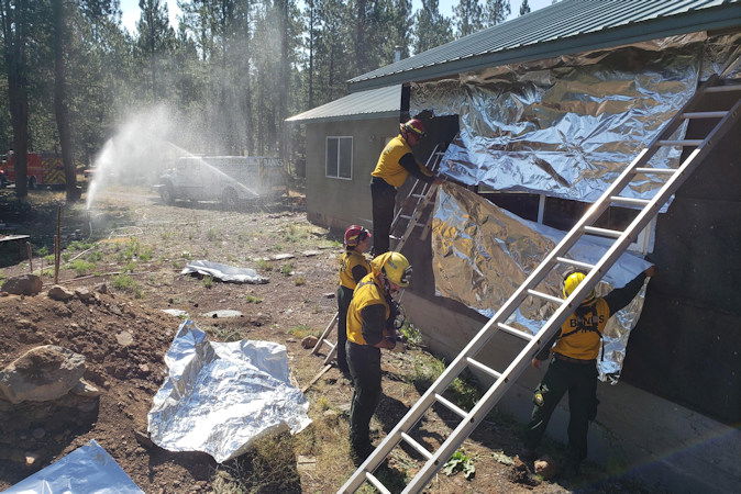
Firefighters have made tremendous progress on the fire, task forces have completed structure protection measures, and evacuation levels have begun to diminish. Due to that progress, this morning the remaining Oregon State Fire Marshal (OSFM) task forces and its Green Incident Management Team will be returning to their home agencies.
Hundreds of firefighters remain on the Telephone Fire and are dedicated to continuing their great progress. Additionally, Alaska Incident Management Team 1 has structural protection capabilities should fire activity increase. The OSFM Green Team and all of its structural firefighters would like to thank the communities impacted by the Telephone Fire for their support and hospitality.
Falls/Sand Fires:
Crews made great progress yesterday on the Falls Fire. Crews have continued to monitor and patrol the southern portion of the Falls Fire, and are increasing mop up depth along the Whiskey Mountain Fire, backhauling equipment which is no longer needed, including over 7 miles of hose. On the northwest edge of the Sand Fire, crews were successful Sunday on securing slops and securing line. On the south side of Gilbert Ridge from the 3150 to 3160 roads, crews have finished laying hose and are in mop up status, continuing today. A recent slopover in the Myrtle Creek area was addressed and is holding well. Crews will begin small-scale ignition operations today along the 31 road, if conditions allow, to reduce burnable vegetation and increase containment along this corner of the fire. This will be a multi-day operation, and additional crews will assist.
Residents along the northwest side of the Falls/Sand Fires should be aware of the Crazy Creek Fire, on the Ochoco National Forest, it is located 16 miles north of Paulina, Oregon, and is 64,288 acres as of August 4. Given the current fire conditions in the area, stay alert in case conditions should change. More information on the Crazy Creek Fire can be found at: https://inciweb.wildfire.gov/incident-information/orocf-crazy-creek.
Poison Fire: There was no movement on the Poison Fire despite yesterday’s weather. Crews are continuing to clean up pockets of fuel to more deeply secure the control line.
Weather: Seasonably hot and dry conditions will continue across the fires as high pressure remains over the region. Light winds in the morning will give way to west to southwesterly winds in the afternoon with gusts to 20 mph possible. Overnight temperatures will be mild with moderate humidity recovery.
Evacuations: Aug. 4 Evacuation Update: With the continued progress on the Falls and Telephone Fires 2024, the Harney County Sheriff’s Office is lowering evacuation levels in some areas. Refer to the map here https://bit.ly/FallsFireEvac
Downgrading from Level 3 to Level 2 (Be Set): Zone 025A & 025B: South from the Grant/Harney County line to Crane Flat then east to where Hog Flat meets the Malheur River and south to Zone 049C
Downgrading from Level 2 to Level 1 (Be Ready): Zone 052, east of House Butte (which is in Zone 025B), north of Highway 20, includes Kimball Flat and Drewsey area
Downgrading to No Level: Stinking Water Mountain
For the most accurate evacuation information, please visit the Harney County Sheriff’s evacuation map here: https://bit.ly/FallsFireEvac, or the Grant County Emergency Management Facebook page: https://www.facebook.com/profile.php?id=100068819321423.
Closures: A closure is in effect for the two portions of the Malheur National Forest that run west of 395B, north of Mt. Vernon and south of Long Creek, in the Fox Valley area, including all roads, trails, and camping locations within the fire closure area. A detailed map of the closure if included and available on the Malheur National Forest website (https://www.fs.usda.gov/malheur/) and offices.
Investigation: U.S. Forest Service fire investigators are seeking the public’s assistance with any tips or information pertinent to the start of the Falls Fire on the Malheur National Forest. Please submit any information that could assist fire investigation efforts to SM.FS.R6TipHotLine@usda.gov.
Temporary Flight Restriction (TFR): TFRs in the area have been changing; pilots should check the latest information on the Federal Aviation Administration TFR website prior to flying: https://tfr.faa.gov/tfr_map_ims/html/index.html
Facebook: https://www.facebook.com/p/Falls-Fire-2024-61562126623985/
Falls Fire InciWeb: https://inciweb.wildfire.gov/incident-information/ormaf-falls-fire
Telephone Fire InciWeb: https://inciweb.wildfire.gov/incident-information/ormaf-telephone-fire
Fire Information Line: 541-208-4370, staffed 8 a.m. to 8 p.m.
Email: 2024.Falls@firenet.gov
Harney County non-emergency evacuation questions: 541-589-5579
Air quality questions: 541-573-2271. Air quality information, searchable by zip code: https://fire.airnow.gov/
Smoke Outlooks: https://outlooks.airfire.org/outlook
