Stray showers today, possible thunderstorms Saturday
Showers will slide through the region today, but don’t expect to see much. The dry nature of the air at the surface will allow evaporate most of the rain before it makes it to the ground. Sky conditions overnight will variable, with a mix of clouds and clear skies.
Friday is the set-up day for the rainy day on Saturday. There will be partly to mostly cloudy skies and highs in the middle 60s.
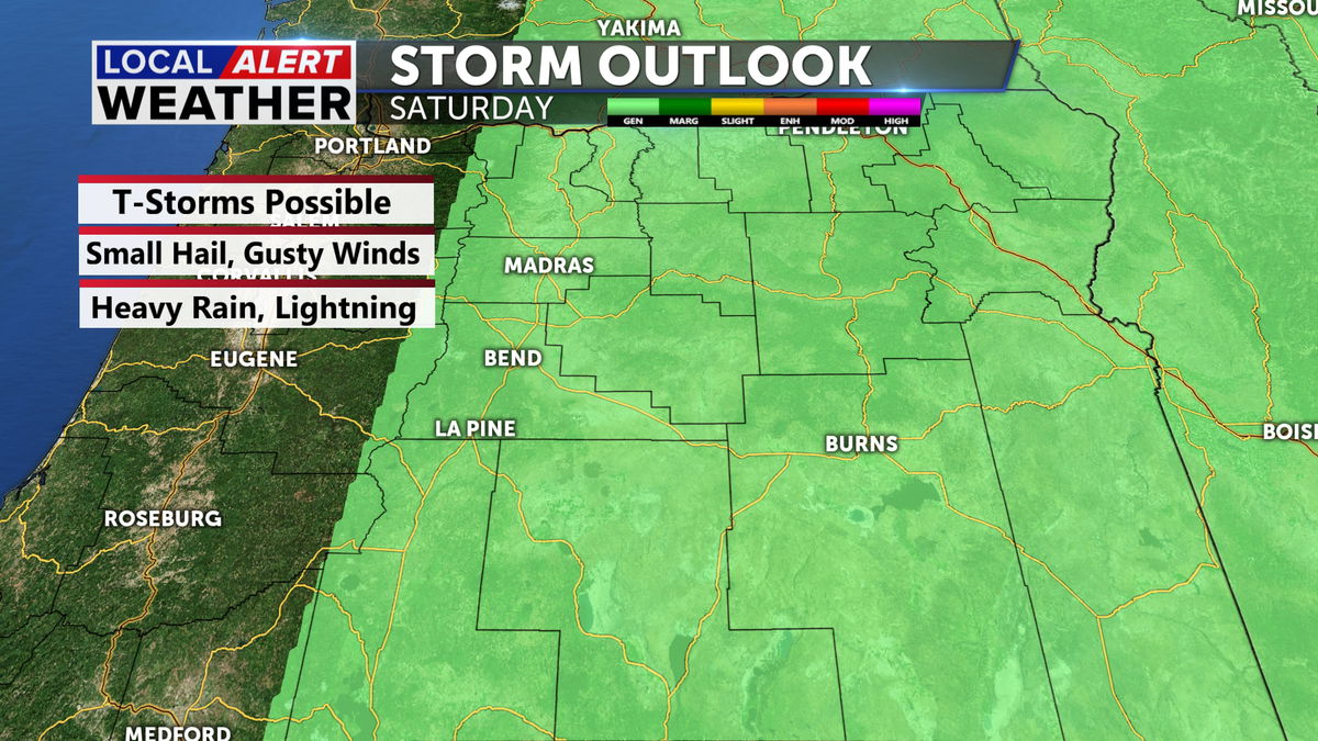
Saturday will be the rainy day as scattered showers and a few thunderstorms are expected. The Storm Prediction Center has placed the Tri-Counties under the “General Thunderstorm” category Saturday, which means spotty storms are possible, but will not reach severe levels. For this reason we have issued a Local Alert Weather Day for Saturday.

We have two levels of “Alert Days” which will help you prepare for the inclement weather. Saturday is going to be a “yellow” alert day, meaning the weather is going to be inconvenient and slightly impactful. Prepare for the rain and be alert for thunderstorms but severe weather is not on the table. If Severe weather were likely, we would be in “red” alert day mode.
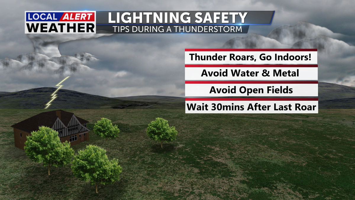
And always remember the rule of Lightning Safety... when thunder roars, go indoors.
The showers and storms are expected in the morning and again in the afternoon as a cold pool of air arrives in Oregon. The chance for some mountain snow is also on the table as the cold pool of air will bring us snow levels to about 5000 feet. Not much will accumulate, but if you are traveling through the passes, expect some slushy roads at times Saturday and Sunday.
Sunday still experience some wet weather, but generally most of the rainy conditions are Saturday. Sunday may see a bit more snow before sunrise in some locations like La Pine or Sisters, but I don’t expect much along 97.
A mix of clouds and sunshine Monday with highs near normal in the upper 60s. Tuesday may see a passing shower, but very low chance of that is being advertised by the models at this time. We will fine tune that portion of the forecast when we get closer to the date.
Please stay safe.
Don’t forget to download the KTVZ weather app to stay safe and informed.
iOS: https://apps.apple.com/us/app/ktvz-local-alert-weather-app/id1088330817
Android: https://play.google.com/store/apps/details?id=com.ktvz.android.weather&hl=en_US
