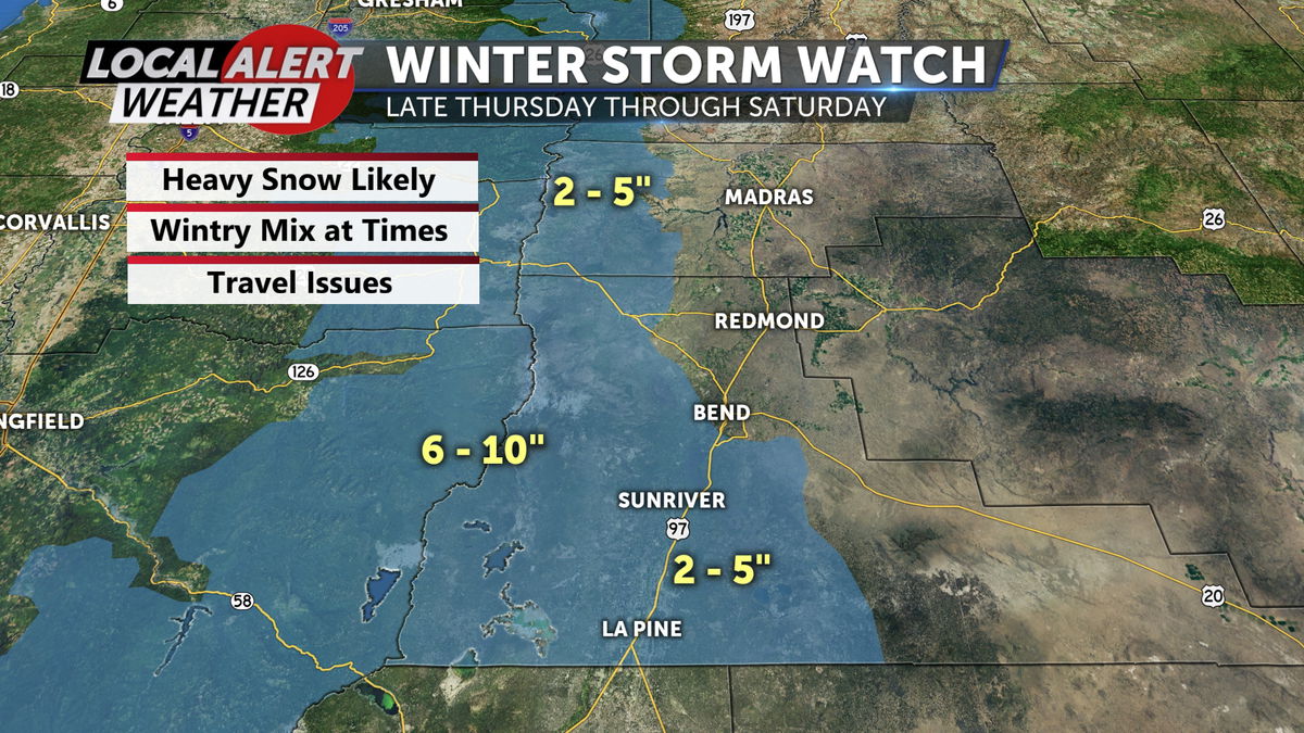
Enjoy the mild pattern, Winter Storm Watch begins Thursday afternoon
A Winter Storm Watch has been issued by the National Weather Service for western portions of Deschutes and Jefferson Counties. This goes into effect Thursday evening and will last through Saturday afternoon. Heavy mountain snow, wintry mix at lower elevations, gusty winds and icy roads. Should be updated to a Warning or Advisory tomorrow.
The high pressure cell that continues to keep the area under sunny skies and clear conditions is about to move on. The replacement will be a combination of rain and snow that will start Friday and linger into the first part of next week.
The temperatures Thursday will be expected to top out in the low 50s as the final period of dry and mild days comes to a close. The day will start out sunny, but as the day moves along the clouds will move in ahead of what will be a very active weather weekend.
Friday the snow will be falling in the morning so we need to prepare for the slick roads and reduced visibility. The snow will be fairly steady then transition to a mix of rain and snow north of Sunriver. The accumulations will be in the 1 – 3” range south of Lava Butte, but little to nothing north of that location.
Friday night into Saturday morning the area will be dealing with more snow as the cold night air returns. Some spots may not completely transition to all snow, but most should wake up to more snow Saturday morning. The snow will linger into the mid-morning or early afternoon before tapering off in the late day time frame.
The break from the snow will be short lived as another round of steady snow will arrive Sunday morning. The snow will be generated around an area of low pressure to our south and that should bring in the snow most of the day. Accumulations are not yet etched in stone, but I expect to see at least 2 – 4” across the region on Sunday.
Snow will linger in the southern tier of the region Monday as the low pulls away. Partial clearing is expected on Tuesday, but a stray snow shower is possible to return on Wednesday.
Please stay safe.
Don’t forget to download the KTVZ weather app to stay safe and informed.
iOS: https://apps.apple.com/us/app/ktvz-local-alert-weather-app/id1088330817
Android: https://play.google.com/store/apps/details?id=com.ktvz.android.weather&hl=en_US
