Strong and possibly severe storms expected into the evening
There is the threat of severe storms in Central Oregon today as a robust area of low pressure moves toward the coast. The line of storms that will produce the most damage will be west of the Cascades, but the Tri-Counties are still going to be impacted by strong or severe storms.
The Storm Prediction Center has placed the area under the “Marginal Risk” category for severe weather. The main threat to the area will be hail and wind. To be considered a severe thunderstorm a storm must generate 1” diameter hail and or have gusts to 58 mph and have the ability to generate a tornado. Today there may be some storms strong enough to get us to those levels, but probably not any tornadic cells east of the Cascades.
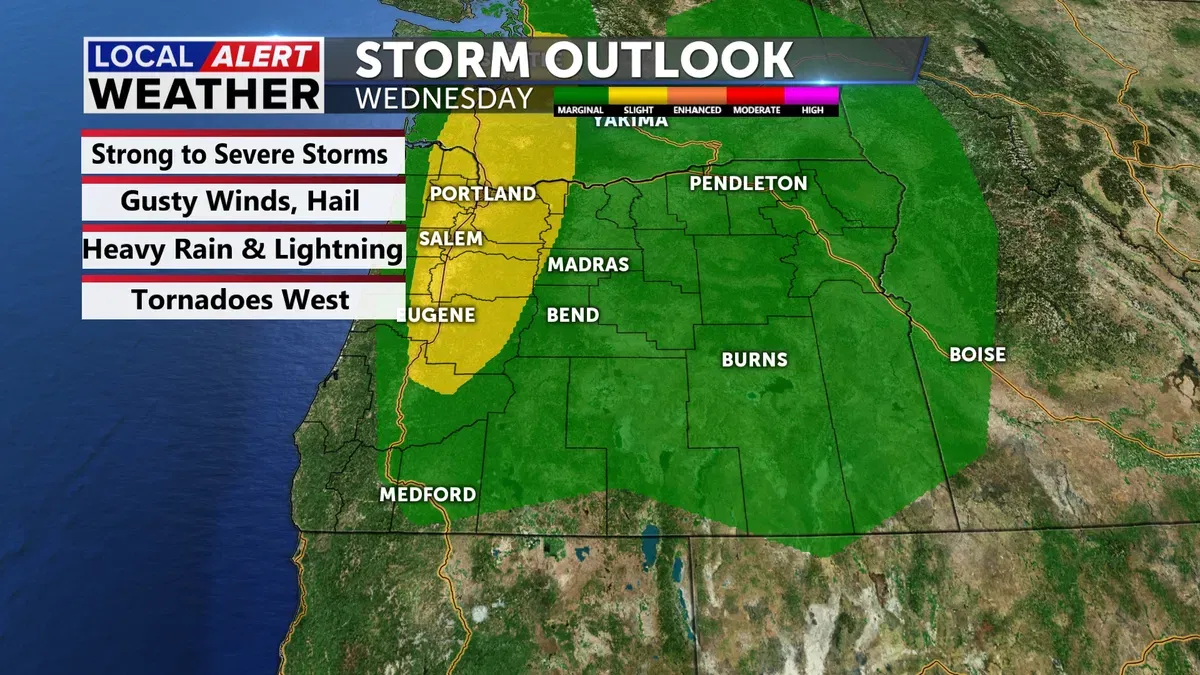
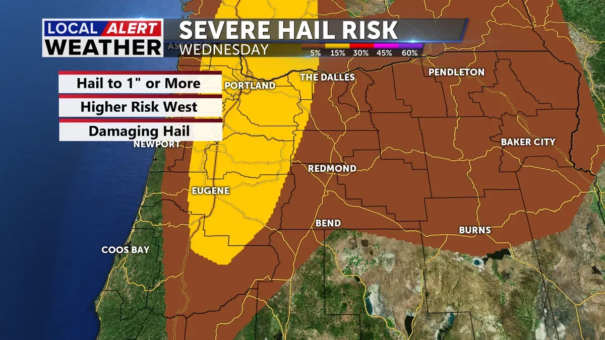
West of the Cascades the storms are expected to be much more intense with hail possible to 2” or more and a very low, but not zero chance of generating a tornado. If you have plans tonight to head to the valley, be prepared for very dangerous weather. Best to hold off until Thursday if you can.

A Severe Thunderstorm Watch is in place for areas shaded in light red. This is until 9 pm as there is a chance for 2" hail and 70 mph winds. A tornado is not off the table. We are not included in the watch but are close enough to stay alert and aware. We are expecting hail and gusty winds along the east face of the Cascades, just not as robust as those to the west.

Our area is on the fringe of the strong storms, but since we are close enough, we need to be weather aware today.
Prepare your home and car for gusty winds as well as the hail. Hail can do significant damage to the siding of your house and also your vehicle. Place your car in the garage or a carport if you can. Batten down the hatches for the windy weather as well.
The timing of the storms will be mid to late afternoon and into the evening.
Thursday will be another rainy day, but not as intense as the region will be much cooler. The heat is a key ingredient to the development of strong storms and today we will be warm, but Thursday we should be about 20° cooler. A rogue thunderstorm is possible tomorrow, but we should see mainly rain in the High Desert and some wet snow over the Cascades.
The wet patten continues into Friday with off and on rain showers and snow on the mountains. We may see some snow in La Pine and Sisters as they will be cold enough to get some wet flakes. Otherwise, I expect mostly rain.
We are also concerned later this week with the potential for minor flooding. The rain tonight and through Friday will push the creeks and streams to bank full in some areas. Also, the snow is melting now, adding to the water table. If you plan on recreating on area waterways, be advised that the water is going to be moving quickly and it is still very cold.
Please stay safe.
Don’t forget to download the KTVZ weather app to stay safe and informed.
iOS: https://apps.apple.com/us/app/ktvz-local-alert-weather-app/id1088330817
Android: https://play.google.com/store/apps/details?id=com.ktvz.android.weather&hl=en_US
