As firefighters make more progress on C. Oregon wildfires, the costs pile up
In just over a week, the cost to fight 4 large C.O. fire has hit $11.3 million
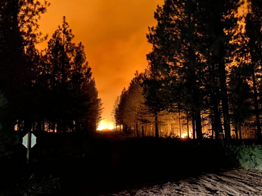
BEND, Ore. (KTVZ) -- Despite another day of red flag warnings for extreme fire behavior, a growing army of firefighters continued to make good progress Tuesday on containing several large Central Oregon wildfires.
But as always, the costs rise as containment does.
According to the National Interagency Fire Center's daily situation report, the cost to date of fighting Central Oregon's four largest fires already has topped $11.3 million, including $4.4 million on the Green Ridge Fire, $3.8 million on the Frog Fire, $2.3 million on the P-515 Fire and $745,000 on the Lionshead Fire.
Here's Tuesday morning's updates, first on the Green Ridge Fire:
Green Ridge Fire
August 25, 2020 AM Briefing
Size as of IR flight: 4,348
Containment: 13 %
Start Date/Time: August 16, 2020
5:05 p.m.
Location: Camp Sherman, OR
Cause: Lightning
Personnel: 741
Assigned Resources:
Hand Crews: 20
Engines: 18
Dozers: 5
Water Tenders: 8
Other Heavy
Equipment: 7
Assigned Aircraft: 6
Structure Task Forces: 0
Injuries: 0
Structures
Threatened: 108
Structures
Damaged: 0
Structures
Destroyed: 0
Evacuations: Level 1 issued for areas
on east and west sides
of fire
For the most current evacuation information,
contact the Incident Management Team
Information Section
(541) 604 8461
staffed 8:00 a.m. to 9:00 p.m. daily
Camp Sherman, Ore. -- With fire lines holding for the second day in a row, firefighters will continue to focus on the demanding task of mopping up. The fire is staffed with 20, 20-person hand crews that will improve the existing lines, locate and deal with hazard trees, grid and patrol for spot fires, and mop up any hot spots within 25 feet of the existing hand and dozer lines. Engine crews will mop up areas accessible by road and firefighters will work to get hoselays around the rest of the fire to bring water to the mopup efforts.
Cloud cover and cooler weather will help to slow fire spread and decrease fire intensity. As fire crews progress with mopup, less smoke will generally be visible, and the local community should start to see improvement in the air quality. Over the next several days, residents can still expect to see small columns of smoke as pockets of unburned fuel on the interior of the fire are consumed.
Wind continues to impact suppression efforts and crews constantly patrol and suppress spot fires caused by embers blowing outside the line. A Red Flag Warning has been issued for thunderstorms, dry lightning and gusty winds. Although the Sisters Ranger District is excluded from the warning, storms passing nearby could still affect fire behavior with winds in excess of 20 mph.
The Oregon Department of Forestry, Incident Management Team 3, livestreamed a virtual public meeting last night. The overview of the current situation including updates on the fire’s condition, predicted weather and fire behavior, and operations strategies for the next several days was recorded and will be available on the Green Ridge Fire Facebook page for anyone who missed the meeting.
The Level 1 Evacuation notices for residences around the fire remain in place. The Deschutes National Forest, Sisters Ranger District, expanded the Forest Area Closure to the north and east of the fire. FS Road 14 and associated campgrounds remains open. For information about evacuation notices and Forest Area Closures go to: https://inciweb.nwcg.gov/incident/7012/
ODF Team 3 remains committed to the safety of the public and wildland fire personnel. All fire personnel are expected to follow recommendations from the Centers for Disease Control for preventing the spread of COVID-19.
Frog Fire Update
Northwest Incident Management Team 8, Incident Commander, Doug Johnson
August 25, 2020 - 9:00 AM
The safety of the public and all wildland fire responders is always the number one priority for all wildland fire agencies. To keep firefighters and communities healthy and safe, all firefighters are asked to follow recommendations from the Centers for Disease Control and Prevention to reduce the spread of illness. This also includes limited entry into the incident command post and spike camp. Please see the websites below or contact the Frog Fire information center at 541-670-0812 for further fire information.
General Updates: The Red Flag warning for thunderstorms and gusty winds over the Frog Fire continues until 11 p.m. this evening. Yesterday’s storms skirted to the south of the fire. According to Operations Planning Section Chief trainee Mike Aizpitarte, “Crews are safely making great progress widening the black we have around the fire.”
The Frog Fire has been burning for over a week, producing hazards to firefighters including weakened trees, loose and rolling debris which could hold burning embers. The steep and rugged terrain on the western side of the fire has hose lays providing water to cool hot spots as mop up progresses. New hose lays are being added where needed. The fire is creeping and smoldering with some isolated torching. Estimated acreage is 3,956 with 40% containment. Any acreage change is due to more accurate mapping practices.
Acreage: 3,956
Containment: 40%
Fire Information: 541-670-0812 (8:00 am to 9:00 PM)
E-mail: FrogWildFire2020@gmail.com
Information Websites:
Twitter: @CentralORFire
Blog Site: http://www.centraloregonfire.org
Inciweb: http://inciweb.nwcg.gov/incident/7036/
Smoke: http://oregonsmoke.blogspot.com
Weather: Red Flag warning today for thunderstorms and gusty winds until 11 p.m. A few light showers this morning with the greatest chance of thunderstorms occurring in the afternoon. Temperatures 82-87, minimum Rh 17-22%, winds 3-5mph from the south/southwest changing to 7-12 mph from the northwest in the afternoon
Air Quality: Prineville, Redmond and Bend remain at a moderate level. Moderate air quality is acceptable; however, people who are unusually sensitive could experience respiratory symptoms and may need to take precautionary measures. Smoke sensitive individuals are advised to stay inside whenever possible. A detailed smoke forecast for Oregon is available at oregonsmoke.blogspot.com.
Resources-487: 3-type 2 initial attack crews, 11-type 2 crews, 1-light helicopter, 22-engines, 3-skidgines, 4-dozers, 9-water tenders, and miscellaneous overhead
Evacuations: None
Closures: Several road closures and an area closure have been implemented near the Frog Fire.
The Crook County Sheriff’s Office has closed the following roads:
On the south end:
· Roberts Road at Bear Creek
· Klootchman Creek Road at Bear Creek
· Salt Creek at Roberts Road
On the north end:
· Forest Service Road 16 at the junction of Forest Service Road 1610
A temporary area closure has been implemented by the Ochoco National Forest. For a full description and map of the area closure, please see the above Inciweb link.
Temporary Flight Restrictions: For the safety of firefighters and aircraft fighting the Frog Fire, a temporary flight restriction has been placed over the fire area. Please consult the Notice to Airman for specifics.
Warm Springs Fires Update-August 25, 2020
Incident Commander: Eric Knerr, Northwest Team 7
Fire Information: 971-277-5075
Quick Facts
Incident Summaries
P-515 / Lionshead
Approximate
Size in Acres: 4,462 ac./2,4
ac.
Fire
Containment: 35% / 8%
Incident
Commander Eric Knerr
Resources
on the fire:
Crews: 17
Helicopters: 7
Engines: 18
Water Tenders: 4
Dozers: 9
Masticator: 10
Total
Personnel: 643
Jurisdiction: Confederated Tribes
of Warm Springs
Oregon Smoke Blog
http://oregonsmoke.blogspot.com/
Inciweb
https://inciweb.nwcg.gov/incident/7050/
Warm Springs, Oregon: This update is for the P-515 Fire and
Lionshead Fire burning on the Warm Springs Reservation. Both fires
are being managed for full suppression.
Current Situation: Yesterday, firefighters on the P-515 Fire improved
the fire line by extinguishing and removing burning material along the
line, felling snags, and moving logs to reduce their potential to roll
downhill (mop up). Crews continue to secure and strengthen fire lines
on the north, south, and west ends of the fire. On the east flank,
firefighters secured the last mile of line overnight by eliminating
unburnt fuels between the fire’s edge and containment line through
burn operations.
Yesterday, crews on the Lionshead Fire used aviation assets on the
southern flank after the smoke cleared to support on-ground efforts.
Dozers were used on the north side of the fire to go both direct and
indirect to extend the fire line to the west towards Lionshead Peak.
Firefighters located a spot fire on the southerm flank and were able to
contain that spot.
P-515 Fire: Today, resources plan to focus their mop-up efforts on
concentrated sources of heat along the southern and northern
perimeter of the fire. Resources will work on the western flank to
better secure the fire line.
Lionshead Fire: Resources will conduct direct and indirect operations
to improve the P-440 road in preparation for burning out the northern
flank and prepping the eastern flank to secure the fire line. Crews will
continue road prep with masticators and hand work along the southern
perimeter of the fire. A masticator is a machine used to grind, chip, or
break apart fuels such as brush, small trees and slash into small pieces.
Weather and Fire Behavior: Light winds with temperatures in the upper 70’s is forecast for today. Lower elevations will see more humidity than in past days. Persistent burning conditions will be evident with dry
fuels resistant to fire suppression. Firefighters may see short runs on steep slopes and torching with spot fires to a quarter mile.
Closures: Trout Lake Road at pavement end; Road B140 at Potter’s Pond; Road B210 and Road P-500.
All trails south of Trout Lake, west of M-120 Metolious Bench, east of Mt. Jefferson, and north of J-195 will be closed to the public. Also, Tenino Road (P-200) will be closed to the public, only fire personnel and residents are
allowed on Tenino Road (P-200).
Evacuations: A Level 1 Evacuation (Get Ready) is in effect for residents on Trout Lake Road west of US-26.
COVID-19: Precautionary measures have been implemented to prevent the spread of COVID-19. These measures include daily temperature screenings, mandatory use of face coverings, social distancing, and implementing more
virtual work. Public and firefighter safety are a top priority.
Prevention Message: Reduce wildfire risk, know your local fire restrictions.
Steet Mountain Fire/Laurel Fire
August 25, 2020 9:00 am
Oregon Department of Forestry IMT 2
Chris Cline, Incident Commander
@ODF_COD
Email contact—SteetMtnComplex.LaurelFire@gmail.com
Public Information Line: (541) 604-8483
Steet Mountain Fire—https://inciweb.nwcg.gov/incident/7039/
Laurel Fire—https://inciweb.nwcg.gov/incident/7037/
https://www.facebook.com/ODFCentralOregon
Size:
Steet Mtn Fire 701 Acres
Laurel Fire 1,257 Acres
Containment:
Steet Mtn Fire 75% Combined
Laurel Fire 30%
Start Date: August 18th, 2020
10:00pm
Location:
Steet Mtn Fire Near Monument
Laurel Fire 6 miles S of Spray
Cause: Lightning
Est. Cost: $1,532,000
Personnel: 340
Resources: 1 Camp Crew
10 Hand Crew
16 Engines
5 Dozers
5 Water Tenders
3 Skidders
Aircraft: 1 - Type 2 Helicopter
2 - Type 3 Helicopter
Evacuations: None
Structures
Threatened:
4—hunting cabins on
Laurel fire
Structures
Damaged: 0
Structures
Destroyed: 0
Closures: None
Fire Summary:
Lower temperatures and higher relative humidities yesterday allowed
for continued good progress across all fires. Fire crews will continue to
strengthen control lines, extinguish hot spots, and mop up.
More accurate mapping has updated the Laurel Mountain Fire to 1,257
acres, and the Steet Fires held at 701 acres.
Air resources will continue to provide support to ground crews with
water drops as conditions allow. Smoke and adverse weather conditions can hinder air operations.
A fire weather watch is in effect for Central and Northeast Oregon
through this evening. Abundant lightning and gusty outflow winds
could impact fire suppression efforts, challenging fire crews as they
work to strengthen fire lines.
Smoke from California and local fires remain in the region. People who
are sensitive and may experience respiratory symptoms may need to
take precautionary measures. Smoke sensitive individuals are advised
to stay inside whenever possible. For updated smoke information go
to: oregonsmoke.blogspot.com
Suppression efforts are helped with continued support provided by the
local communities. Firefighter and public safety are our highest priority
during this incident, including COVID mitigation. The incident command post and fire camp are closed to the public to ensure safety of
the public and the Firefighters.
Steet Mountain Fire/Laurel Fire
August 25, 2020 9:00 am
Oregon Department of Forestry IMT 2
Chris Cline, Incident Commander
