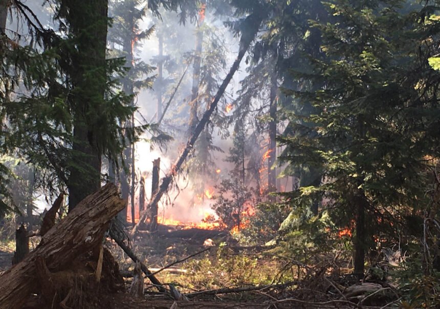
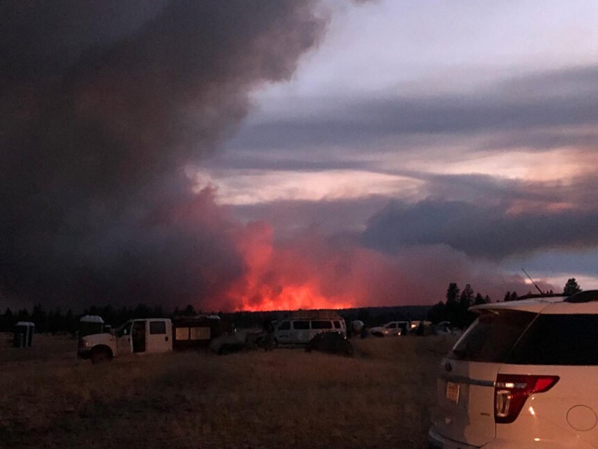
Green Ridge Fire 1% contained; Frog Fire 30% contained


(Update: Adding video, Frog Fire Saturday evening update)
BEND, Ore. (KTVZ) -- A week of hard work paid was paying off Saturday for hundreds of firefighters battling several large wildfires burning on the High Desert. Here are Saturday's updates, including word of a good day on the lines of the Green Ridge, as well as the Frog, Warm Springs and other fires:
Frog Fire Update
Northwest Incident Management Team 8, Incident Commander, Doug Johnson
August 22, 2020 - 9:00 PM
The safety of the public and all wildland fire responders is always the number one priority for all wildland fire agencies. To keep firefighters and communities healthy and safe, all firefighters are asked to follow recommendations from the Centers for Disease Control and Prevention to reduce the spread of illness. This also includes limited entry into the incident command post and spike camp. Please see the websites below or contact the Frog Fire information center at 541-670-0812 for further fire information.
General Updates: Critically needed firefighting resources are arriving to bolster the suppression efforts of the Frog Fire. Another day of favorable weather has allowed firefighters to move towards suppression objectives. Firefighters will remain vigilant, paying close attention to any changes in the weather.
Crews working in the northeast flank of the fire constructed direct and indirect handline. These firefighters also prepped a contingency line east of the direct handline. On the south flank, crews continue to secure and hold the line while completing mop-up operations. Firefighters in the northwest constructed direct and indirect lines to contain the fire in its footprint. The night shift will patrol and mop-up as needed. The structure protection group has completed their assessment and are on stand-by. Air resources are available to assist if needed including a Blackhawk helicopter from the Oregon National Guard.
Acreage: 3,997
Containment: 30%
Fire Information: 541-670-0812 (8:00 am to 9:00 PM)
E-mail: FrogWildFire2020@gmail.com
Information Websites:
Twitter: @CentralORFire
Blog Site: http://www.centraloregonfire.org
Inciweb: http://inciweb.nwcg.gov/incident/7036/
Smoke: oregonsmoke.blogspot.com
Weather: Clear with temperatures ranging from 50-55 degrees with west winds up to 5-10 mph shifting into the night to the northwest at 5 mph. Relative humidity will range from 53-58%.
Air Quality: An Air Quality Advisor has been ordered and will arrive. The Air Resource Advisor will produce air quality products for Central Oregon communities. With multiple large fires in the region air quality may become an issue. Our air resource advisors use advanced smoke forecasting models to give advance notice to communities ahead of degraded air quality from wildfire smoke. Detailed smoke forecasts for Oregon are available at oregonsmoke.blogspot.com
Resources-422: 1-type 1 hand crew, 3-type 2 initial attack crew, 9-type 2 crews, 1- light helicopter, 1-medium helicopter, 1- heavy helicopter, 14-engines, 2-skidgine, 6-dozers, 9-water tender, and overhead.
Evacuations: None
Closures: Several road closures and an Area Closure have been implemented near the Frog Fire.
The Crook County Sheriff’s Office has closed the following roads:
On the south end:
· Roberts Road at Bear Creek
· Klootchman Creek Road at Bear Creek
· Salt Creek at Roberts Road
On the north end:
· Forest Service Road 16 at the junction of Forest Service Road 1610
A temporary Area Closure also has been implemented by the Ochoco National Forest. For a full description and map of the Area Closure, please see the above Inciweb link.
Temporary Flight Restrictions: For the safety of the firefighters and aircraft fighting the Frog Fire, a temporary flight restriction has been placed over the fire area. Please consult the Notice to Airman for specifics.
Northwest Interagency Incident Management Team 10
Green Ridge Fire Update
August 22, 2020 – 6:30 pm
Incident Commander Alan LawsonAgency Jurisdiction: Oregon Department of Forestry/USFS-Deschutes National Forest
Email: 2020.GreenRidge@firenet.gov
Facebook: https://www.facebook.com/NorthwestTeam10
Twitter: @CentralORfire
Green Ridge Fire Information: https://inciweb.nwcg.gov/incident/7012/
Central Oregon Fire Information: www.centraloregonfire.org
Fire Information Number: (541) 604 8461; staffed 8:00 a.m. to 9:00 p.m. daily
Date Started: August 16, 2020
Acres: 4,169
Cause: Lightning
Containment: 1% containment
Oregon Department of Forestry (ODF) Team 3 will take over management of the Green Ridge Fire tomorrow at 6:00 a.m. This Type 1 Team, led by Incident Commander Link Smith, shadowed the outgoing Northwest Incident Management Team (IMT) 10 today to ensure a smooth transition. ODF is assuming command of the fire due to the large number of acres of ODF-protected lands within and adjacent to the fire’s perimeter.
Northwest Team 10 Incident Commander Alan Lawson would like to thank our cooperators, stakeholders, the communities of Sisters and Camp Sherman, and the outlying communities and property owners for their cooperation in this firefighting effort. In particular, we would like to thank the Sisters School District and the Sisters Middle School for allowing the team to use their property as our Incident Command Post. Although we are already in a difficult fire season, especially with COVID-19 restrictions, it is the cooperation such as we have experienced here that has enabled us to meet firefighting objectives in a safe and efficient manner.
The past week was challenging to firefighters because strong westerly winds drove the fire east into state timberland, while threatening communities both northeast and west of the fire.
Today, firefighters took advantage of good weather and mild winds to make significant progress holding and improving the fireline. Air support aided hand crews in this effort. Crews along the western slope of Green Ridge completed a 1-acre burnout operation to clean up the northwest line.
More resources arrive tomorrow with the new team, including five additional 20-person crews and five engines. ODF Team 3 will continue to aggressively manage this fire to protect the public, state lands and private development. Public and firefighter safety remains the top priority while working within CDC guidelines to protect from COVID-19.
Current Evacuation Notices and Forest Area Closures: https://inciweb.nwcg.gov/incident/7012/
| Quick Facts Incident Summaries P-515 / Lionshead | |
| Approximate Size in Acres: | 3,615 ac./ 836 ac. |
| Fire Containment: | 10% / 0% |
| Incident Commander | Eric Knerr |
| Resources on the fire: | Crews: 14 Helicopters: 1 Engines: 23 Water Tenders: 4 Dozers: 2 |
| Total Personnel: | 494 |
| Jurisdiction: | Confederated Tribes of Warm Springs |
| Oregon Smoke Blog http://oregonsmoke.blogspot.com/ | |
| Inciweb https://inciweb.nwcg.gov/incident/7050/ https://inciweb.nwcg.gov/incident/7049/ |
Update-August 22, 2020
For Immediate Release
Incident Commander: Eric Knerr, Northwest Team 7 Fire Information: 971-277-5075
Warm Springs, Oregon This update is for the P-515 Fire and Lionshead Fire burning on the Warm Springs Reservation. Both fires are being managed for full suppression. The Quartz Butte Fire is in mop-up with no new fire activity to report.
Current Situation: In spite of the strong winds yesterday, the P-515 Fire was held within the current footprint. Retardant and helicopter bucket work assisted firefighters in keeping the P-515 Fire from advancing further to the east. An Oregon State Fire Marshal’s Task Force remained focused on protecting threatened residences along County Line Road (Trout Lake Road).
Yesterday, the strong westerly winds pushed the Lionshead Fire down the Whitewater River Canyon. Aviation resources, engines and crews were able to hold the fire west of the J-100 Road and north of the Whitewater River.
P-515 Fire: Crews will continue to build and improve direct and indirect containment lines on the south, west and north flanks. Firefighters are looking for opportunities to capitalize on the work completed last night and tie the lines from the northeast and east flanks of the fire.
Lionshead Fire: Firefighters are preparing the J-440 Road to keep the fire from advancing to the north and the J-100 road is the planned containment line on east. The team plans to utilize the river to keep the fire from spreading further south.
Weather and Fire Behavior: Dry conditions are expected through the weekend with generally light winds. The change in winds could influence fire direction and spread. The fires may see high rates of spread on steep wind facing slopes. Due to abundant dry fuels, difficult terrain, and breezy winds, the Lionshead Fire may see active fire behavior with spotting today.
Road Closures:
- Trout Lake Road at pavement end;
- Road B140 at Potter’s Pond;
- Road B210 and Road P-500.
Evacuations: A Level 1 Evacuation (Get Ready) is in effect for residents on Trout Lake Road east of US-26.
COVID-19: Northwest Team 7 Incident Management Team has implemented precautionary measures to prevent the spread of COVID-19 in both fire camp and the surrounding community. These measures include daily temperature screenings, mandatory use of face coverings, social distancing, and implementing more virtual work. Public and firefighter safety are a top priority.
Steet Mountain Fire/Laurel Fire
August 22, 2020 9:00am
Oregon Department of Forestry IMT 2
Chris Cline, Incident Commander
@ODF_COD
Email contact—SteetMtnComplex.LaurelFire@gmail.com
Public Information Line: (541) 604-8483
Steet Mountain Fire—https://inciweb.nwcg.gov/incident/7039/
Laurel Fire—https://inciweb.nwcg.gov/incident/7037/
www.facebook.com/ODFCentralOregon
Size:
Steet Mtn Fire
Laurel Fire
1,076 Acres
1,280 Acres
Containment:
Steet Mtn Fire
Laurel Fire
45% *combined
10%
Start Date: August 18th, 2020
10:00pm
Location:
Steet Mtn Fire
Laurel Fire
Near Monument
6 miles S of Spray
Cause: Lightning
Est. Cost: $570,000
Personnel: 278
Resources: 7 hand crew
13 Engines
6 Dozers
2 Water Tenders
2 Skidders
Aircraft: 1 - Type 1 Helicopter
2 - Type 2 Helicopter
2 - Type 3 Helicopter
Evacuations: None
Structures
Threatened:
4—hunting cabins on
Laurel fire
Structures
Damaged: 0
Structures
Destroyed: 0
Closures: None
Fire Summary:
Good progress was made across all the fires yesterday. The addition of
resources, including local RFPA resources, helped in the suppression
effort and kept the fires from significant growth during extreme conditions in the afternoon.
ODF discovered a new fire near the Steet Mountain Fire. The Threemile Fire is approximately 25 acres and is being managed in this group of
fires. Strong initial attack under extreme fire conditions helped keep
the Threemile Fire at 25 acres.
More accurate mapping has updated the Laurel Fire at 1,280 acres.
This fire is burning on lands managed by Prineville BLM, rangeland and
ODF protected private lands six miles south of Spray in Wheeler County.
Limited access to the fires, combined with dusty road conditions, have
made it difficult to get water, crews, and other resources directly to the
fire lines. These factors slowed the overall progress in suppression
efforts.
Cooler temperatures are expected across the fires today. Winds are
expected to be lighter than yesterday’s afternoon winds. These conditions should help the fire crews make progress.
The local communities have been very supportive during our suppression efforts. We continue to make Firefighter and public safety our
highest priority during this incident, including COVID mitigation. Personnel will be following Center for Disease Control guidelines to limit
personal interactions both within camp and with the local community.
The incident command post and fire camp are closed to the public to
ensure safety of the public and the Firefighters.
Oregon Department of Forestry IMT 2
Chris Cline, Incident Commander