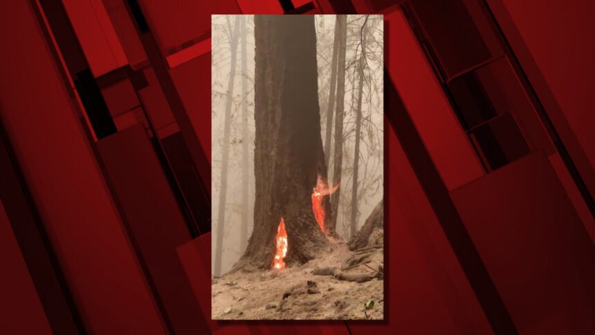
Signs of recovery: Fires still being fought, but Hwy. 126E, parts of PCT, forests reopen
As containment figures climb on the remaining wildfires that tore through much of Oregon, there were signs Thursday of progress in recovery efforts, from partial reopening of the Pacific Crest Trail and some other forest areas to plans to reopen Highway 126E in the McKenzie Valley, in limited fashion.
The death toll from the major wildfires held at nine on Thursday, according to the daily update from the Oregon Office of Emergency Management, but the number of missing people dropped significantly, from nine to three.
The state reports that 3,124 homes were destroyed, including 1,069 single-family homes, 1,858 manufactured homes and 197 multi-family homes. Another 1,403 other structures also were destroyed.
More than 2,400 people are still being sheltered, while more than 6,000 people have signed up for individual assistance from FEMA, with $14.1 million already approved.
Here's Wednesday's Oregon Department of Forestry summary of the situation on the six remaining major fires:
| Fire name | Acres burned | Containment | Location |
| Lionshead | 204,355 | 35% | 20 miles W of Warm Springs |
| Beachie Creek | 192,848 | 58% | 15 miles N of Detroit |
| Holiday Farm | 173,094 | 65% | 3 miles W of McKenzie Bridge |
| Riverside | 138,029 | 37% | 2 miles SE of Estacada |
| Archie Creek | 131,542 | 73% | 20 miles E of Glide |
| Slater | 44,286 in Oregon | 40% | 6 SE of Cave Junction (also in No. California) |
ODOT announced Thursday that OR Highway 126, the McKenzie Highway, opens for travel in the fire zone between milepost 27.55 and milepost 38 beginning on Friday at noon.
However, the agency added, "Through travelers should continue to take alternate routes, as hazards remain and recovery work continues."
There will be pilot car guided caravans Friday morning between the road closure points, on the west end two miles east of Vida at milepost 27.55 to east of Finn Rock at milepost 38, one direction at a time.
- 8 a.m. west to east
- 9 a.m. east to west
Travelers should prepare for lengthy delays at multiple work zones as crews continue recovery work. There is the potential for falling trees and rocks, debris remains on the side of the road, guardrail is missing, and over 400 signs need to be replaced.
The speed limit has been reduced to 45 mph between mileposts 28 and 38. Extra patrols will enforce the new speed restriction.
For the latest information on road conditions, visit TripCheck.com or call 5-1-1.
Meanwhile, Deschutes National Forest officials have rescinded the forest-wide Pacific Crest Trail closure that was put in place to provide for public safety during the numerous wildfires following the Labor Day wind event.
The Pacific Crest Trail (PCT) is now open from the Deschutes National Forest’s southern border at Windigo Pass north to Santiam Pass.
The PCT remains closed north of Santiam Pass due to the Lionshead Fire Closure as fire suppression activities are still occurring in that area.
In addition, increased moisture and cooler temperatures have allowed the Willamette National Forest to open recreation areas and rescind public restrictions on campfires.
Here's the details, in their news release:
Many recreation sites outside of the fire closure areas have reopened as of Sept. 25. Additionally, effective Friday at 12:01 a.m., public restrictions on campfires will be rescinded due to increased moisture and cooling temperatures.
While some sites are open, some areas may not have serviced bathrooms or trash pickup as we work towards fire recovery and trail surveys after the windstorm. Visitors should be prepared to find debris and possibly downed trees on lesser used roads and should be aware of possible hazards, such as hanging tree limbs, in forested areas.
“Our employees and partners are working together to clean up recreation sites for your safety and access,” said Willamette National Forest Supervisor Dave Warnack. “Please be prepared and maintain your situational awareness while in the woods.”
The current Industrial Fire Precaution Level (IFPL) is Level 2 on the Willamette National Forest, and the fire danger level is moderate. During an IFPL 2, personal firewood cutting may resume; however, chainsaw use is not allowed from 1 p.m. to 8 p.m., and must be followed by a one-hour fire watch after equipment is shutdown.
Fire officials would like to remind people to continue being diligent with possible ignition sources. Human-caused wildfire starts can exhaust local firefighting and emergency resources as many firefighters and other employees remain engaged on active fires.
Visitors should “Know Before You Go, and use TripCheck.com for info about highway closures, as Hwy 22, 126 and 242 currently have closures in place that may affect your access to recreation areas. Willamette National Forest offices are still conducting public business by phone, email, and web-based transactions due to COVID-19. Call the Supervisor’s Office or your local ranger station from 8 a.m. – 4:30 p.m., or send an email to SM.FS.mf@usda.gov if you need additional information or assistance.
Visit their website at https://go.usa.gov/xGpeV to view the updated closure order and for a list of recreation areas inside of the fire closure area that remain closed. Follow on Facebook and Twitter @WillametteNF for the latest updates.
