Prescribed burn to conclude west of La Pine; another planned south of Crescent
Smoke to be visible in La Pine area, near Hwys. 97-58 junction
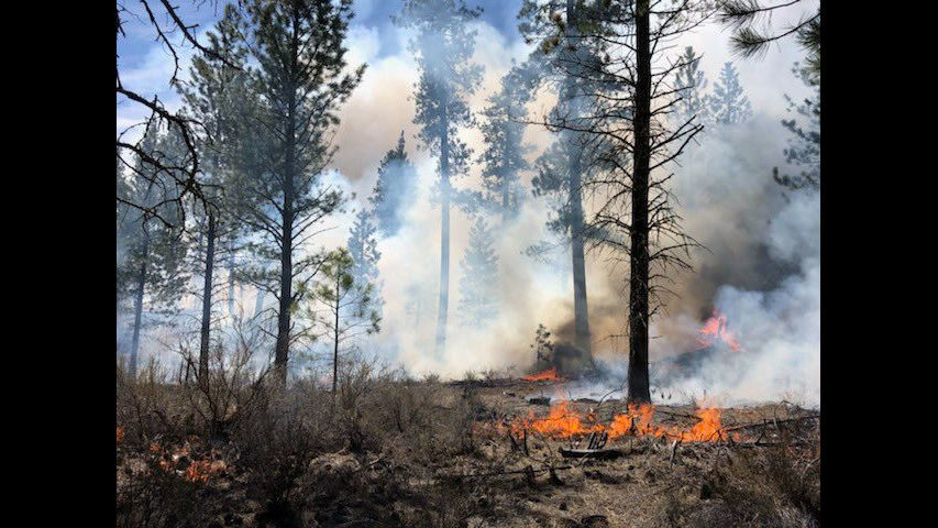
La. PINE, Ore. (KTVZ) -- Fuel specialists with the Deschutes National Forest plan to conduct a prescribed burn Monday on about 90 acres of forest lands located seven miles west of La Pine, along both sides of Burgess Road (Deschutes County Road 43).
This burn will complete the unit, which they started last Friday. Ignitions will begin at approximately 10 a.m., with operations ending at 6 p.m. Following the burn, specialists will patrol and monitor the area.
During the operations, smoke will be visible to residents of La Pine and the surrounding area, including the subdivisions of Wild River and Ponderosa Estates.
Residents can expect nighttime and early morning smoke impacts following the burn. If needed, due to smoke on the roadway, flaggers will be used on Burgess Road. Smoke and residual burning will be visible in the area for up to a week post ignition.
The objective of this prescribed burn is to reduce fuel loadings in Ponderosa pine stands to allow future fires to burn with less intensity. This will reduce the potential impacts of a wildfire coming into the La Pine community.
Also, beginning Monday and continuing through Tuesday, fuel specialists with the Deschutes National Forest will conduct prescribed fire operations south of Crescent. These burns will be highly visible from U.S. Highway 97.
One burn unit is located about three miles northeast of the Highway 97-Oregon Highway 58 junction. The other three units to be burned are directly adjacent to Highway 97, about a half-mile from the junction.
Across the four units, crews will underburn about 260 acres, with ignitions lasting two days. Ignitions will begin around 10 a.m. both days, depending upon weather conditions. Crews will be monitoring the burn for several days following completion.
Smoke and active burning will be visible from Highway 97 before the junction with Highway 58. Smoke will also be visible along Highway 58 as travelers get close to the junction with U.S. Highway 97. Flaggers and warning signs will be in place to assist motorists. Motorists should slow down if smoke is affecting visibility on the highway. Smoke will be visible in the area for up to two weeks post ignition.
The prescribed burn is within the Walker Range Community Wildfire Protection Plan. The goal of the burn is to reduce undesired effects of a wildfire within the area and to facilitate a low-intensity frequent fire regime.
The public is encouraged to close their windows at night and if smoke is on the roadway, turn on headlights and slow down while traveling through smoky areas. The public’s health is important to the Forest Service, the agency said.
While significant preventive measures are taken, many factors influence a person’s susceptibility to smoke, including severity and duration of smoke exposure and a person’s health. If individuals feel impacted by smoke, they should avoid outdoor physical exertion and remain indoors. If people experience serious health impacts from the smoke, they should contact their doctor. For more information about smoke and health, visit the Oregon Health Authority recommendations through this link: http://www.oregon.gov/oha/PH/Preparedness/Prepare/Pages/PrepareForWildfire.aspx#health
