Crews reach 20% containment of 5,971-acre Grandview Fire; Darlene Fire at 686 acres, 5% contained
(Update: New Darlene Fire numbers)
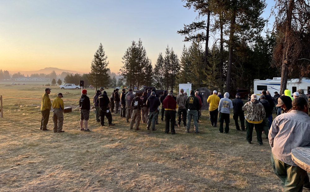
SISTERS, Ore. (KTVZ) – With no additional growth and minimal fire activity, crews on the nearly 6,000-acre Grandview Fire northeast of Sisters have been able to focus all efforts on mopping up the perimeter of the fire to increase containment to 20 percent, officials said late Thursday.
Since the fire began on Sunday, firefighters have been focused on suppressing the blaze, which remains at 5,971 acres. Crews have worked around the clock to hold and improve preliminary containment lines around the perimeter and Thursday were able to get a hose lay around the entire fire perimeter to begin or continue mop-up operations.
Mop-up is the tedious process of ensuring that everything within 150-300 feet of the fire perimeter is cool to the touch so embers cannot escape and reignite the fire. Crews will work on this next phase of suppression until full containment is achieved.
A Red Flag Warning was set to expire Thursday at 11 p.m. Predicted low relative humidity and winds between 5-15 mph (gusts to 20 mph) out of the west could challenge containment lines on the fire’s eastern edge. Crews will continue to build and strengthen containment lines and monitor and rapidly respond to any spot fires that may emerge outside the lines.
Firefighters successfully stopped three spot fires that jumped lines Wednesday during the Red Flag Warning of extreme fire behavior.
Two Oregon Army National Guard helicopters are arriving Thursday and will begin working Friday to support ground crews and four privately contracted helicopters. This extra assistance will aid firefighters in keeping the Grandview Fire inside the established containment lines.
For up-to-date information on the Grandview Fire, visit:
https://inciweb.nwcg.gov/incident/7651/ or Centraloregonfire.org.
There are evacuation notices in place issued by the Jefferson County Sheriff’s Office and Deschutes County Sheriff’s Office. Please follow their guidance. A map of the evacuation zones and levels is at: https://deschutes.maps.arcgis.com/apps/PublicInformation/index.html?appid=f9de45337eb043fca432548f91d03ad6
Jurisdictional agencies tied to the fire include Oregon Department of Forestry Central Oregon District and Ochoco National Forest, Crooked River National Grasslands.
The Deschutes and Ochoco National Forest and Crooked River National Grassland said Thursday they have issued a temporary area closure around the Grandview Fire, burning about 10 miles northeast of Sisters.
For the safety of the public, the Deschutes National Forest, Sisters Ranger District and the Ochoco National Forest, Crooked River National Grassland will temporarily close all Forest Service-managed roads, trailheads and trails within the Grandview Fire perimeter.
Road closures along the perimeter and outside of the closure area are as follows:
1. Forest Road 2050 from Indian Ford Road to its intersection with Forest Road 2055
2. Forest Road 2055 from Forest Road 2050 to its intersection with the west line of T13S, R11E, Section 18.
3. Wilt Road from Buffalo Road north to the County line.
4. Forest Road 6330 from Holmes Road north to the County line.
Darlene Fire Thursday update (late Thursday:
Fire Information Phone Line: 425-324-1267 (7am - 7pm)
Email: darlenefireinfo@gmail.com
InciWeb: https://inciweb.nwcg.gov/incident/7665/
Facebook: https://www.facebook.com/deschutesnationalforest
Twitter: https://twitter.com/CentralORFire
Acres: 686
Number of Personnel: 201
Percent Containment: 5%
Cause: Under Investigation
Date/Time Detected: July 13, 2021, 1:30 p.m.
Origin/Location: La Pine, Oregon
La Pine, OR - Northwest Incident Management Team 6 assumed command of the Darlene Fire at 6:00 a.m. today. They are working with agency direction and leader’s intent from the Bureau of Land Management, US Forest Service, Oregon Department of Forestry and the Walker Range Forest Protective Association.
Yesterday the northern half of the Darlene Fire area had spot fires that were caught and the eastern portion of the fire was plumbed with fire hose line. A spot fire went beyond the perimeter and was extinguished. Some of the western side of the fire was also plumbed.
Crews worked on the fire until midnight last night until no active movement was happening.
There is a Red Flag Warning expired at 11:00 p.m. Thursday night. Winds will be from the southwest switching to northwest in the afternoon with sustained speeds of 20-25 mph. Temperatures are predicted to be 83 to 86 degrees.
Today’s operations will include strengthening the containment lines along the fire perimeter and watching for any spot fires which could occur outside of the established lines. Dust continues to be an issue on unpaved roads. Exercising caution when driving and reducing speeds helps minimize the amount of dust that kicks up impeding visibility. Be aware of fire personnel on the roads and stay away from the Level 3 Evacuation area.
Evacuation status as of 8 a.m. July 15th:
https://www.deschutes.org/sheriff/page/emergency-information
Level 3: Go Now Residences on Darlene Way south of La Pine to the Deschutes/Klamath County line, and along Old Ice Cave Road.
Level 2: Be Set Areas south of the Deschutes/Klamath County line including the Sun Forest Estates, Split Rail subdivision and Antelope Meadows.
Closures and Fire Restrictions:
Bureau of Land Management/US Forest Service: Effective July 12, 2021, all open fires, including charcoal fires, are prohibited on all lands administered by the Deschutes National Forest, the Ochoco National Forest and Crooked River National Grassland, and the Prineville District, Bureau of Land Management (BLM). There are no exceptions for developed or hosted campgrounds.
These restrictions also apply to Wilderness Areas on the Deschutes National Forest, the Ochoco National Forest, and the Prineville District BLM. In addition, all the units have moved to an Industrial Fire Precaution Level 3. Commercial and private firewood cutting is no longer permitted on any of these lands under an IFPL 3. These units will be moving to an IFPL 4 as of Saturday morning at 12:01 a.m.
Oregon Department of Forestry: ODF Central Oregon is in Regulated Closure. Information is available at www.odfcentraloregon.com.
Walker Range: Walker Range is also in Regulated Closure www.walkerrange.org
Bootleg & Log Fire Update July 15, 2021
Location: 28 miles northeast of Klamath Falls, OR
Size: 227,234 acres
Containment: 7%
Personnel: 1,716
(Klamath Falls, OR) – Firefighters reported another day of extreme fire behavior including torching, running, and frequent spotting ahead of the main fire including growth into the Gearhart Wilderness and north towards Lake Henry. The Log Fire, located 8 miles southwest of Summer Lake, continued to spread to the east driven by steady west winds and is now 4,830 acres. Large pyrocumulus clouds developed over the eastern portion of the fire during the afternoon and are possible again today. Throughout the night, crews continued working in the greater Fuego Mountain area as well as to the southeast along the 34 Road, improving existing containment lines.
“This fire is going to continue to grow – the extremely dry vegetation and weather are not in our favor,” said Joe Hessel, Incident Commander for ODF Team 1 Incident Management Team. “We are going to continue to prepare lines, protect structures, and move resources as we can around the fire’s edge.”
With continued west winds predicted, firefighters will continue to work to hold the fire to the 34 Road to prevent further eastern and southern spread. Heavy beetle killed timber and active fire behavior will present challenges in keeping the fire north and west of this road. Crews will continue to work on strengthening their existing line as well as scout for potential contingency lines. Structure protection groups are in place along the fire to help reduce risk to area homes.
Community Meeting: Please join us for a virtual community meeting Friday July 16, 2021 at 6:30pm at www.facebook.com/BootlegFireInfo.
Evacuations: Evacuations are rapidly changing due to the nature of this wildfire. Please visit tinyurl.com/bootlegevac for an interactive map of evacuation level in Lake and Klamath Counties.
Closures: The Fremont-Winema National Forest is closed to the public in the fire area. Map and full order available at inciweb.nwcg.gov/incident/7609/.
Smoke: Heavy smoke expected July 15, 2021 with widespread impacts to communities and State Route 140 in Oregon between Chiloquin and Bly. Full report at: fires.airfire.org/outlooks/southcentraloregon.
Fire Information Public Phone: 541-482-1331
Inciweb: inciweb.nwcg.gov/incident/7609/Facebook: www.facebook.com/BootlegFireInfo Twitter: twitter.com/BootlegFireInfo Hashtags: #BootlegFire #FireYear2021
---
Bruler Fire Update for Thursday, July 15
Sweet Home, Ore. – Northwest Incident Management Team 13 assumed command of the Bruler Fire yesterday at 7:00 am. Firefighters were able to take advantage of lighter winds and cooler temperatures to expand previously established dozer lines on the east side of the fire, increasing the depth of containment line between burned and unburned fuels. Line has been constructed around the entire Bruler Fire perimeter with the completion of dozer lines on the west side of the fire.
The Bruler Fire is now estimated to be 155 acres; however, this does not represent growth within the fire perimeter since yesterday. The increase in size is due to better mapping in the rugged terrain from an infrared areal flight.
Additional firefighting resources arrived at the Bruler Fire yesterday and were successful in keeping the fire within the established perimeter. Firefighters continue to address smoldering snags and trees by directly attacking these areas. Assigned resources on the Bruler Fire include fallers, hand crews, dozers, engines and a type 2 helicopter.
Today, firefighters will begin identifying locations to conduct hose lays. Additionally, firefighters will begin mopping up to increase the probability that the fire will stay within its currently established footprint. Mop-up of the fire perimeter is expected to take several weeks due to the rugged terrain and the dry fuels. Complete mop up is not possible due to the rugged terrain and hazards to firefighters interior to the fire. Mop up and patrol will continue well into the summer.
“We’re working to increase the probability that the Bruler Fire stays within its current footprint during this critical timeframe,” said Incident Commander Brian Gales. “I want to thank the public for their support of the firefighters in the community.”
WEATHER AND FIRE BEHAVIOR: Today, the weather will be cooler, with a marine layer increasing relative humidity through the late morning. Winds are forecast to be light, leading to moderate temperatures and seasonal fire behavior. Temperatures are expected to stay moderate through the weekend leading to a lower probability of fire spread.
SMOKE: Air quality in the and around the communities of Detroit and Sweet Home continues to be listed as “good”. Light winds from the southwest are keeping smoke from the Bruler Fire and surrounding larger fires to the east.
CLOSURES: A large closure area has been established to maintain firefighter and public safety. This closure encompasses large portions of Forest Service lands south of Detroit Lake, west of Highway 22 and north of Highway 20. The closure also includes the Middle Santiam Wilderness, Daly Lake, Tule Lake and the trail network known as the Old Cascade Crest trail system. The closure is posted to the Willamette National Forest webpage. Such a large closure area is necessary to ensure that firefighters can focus on managing the fire and not needing to evacuate visitors should conditions on the fire change rapidly. A Bureau of Land Management (BLM) closure area is also in place for lands along the Quartzville Scenic Byway/Quartzville road including Yellowbottom Campground,Old Miner’s Meadow Group Site, and nearby dispersed camping areas. Visit InciWeb for more information about closures in the area. We appreciate the support of the public in allowing us to stay focused on firefighting and we will reduce the closure area as soon as we can.
Public information: Facebook: facebook.com/brulerfire2021
E-mail: 2021.bruler@firenet.gov
Phone: 541-223-9601, 8 a.m. to 8 p.m. Inciweb https://inciweb.nwcg.gov/incident/7663/ Oregon Smoke Blog http://oregonsmoke.blogspot.com/p/air-quality-now.html
Containment lines are holding on wildfire in the Tillamook State Forest
Oregon Dept. of Forestry - 07/15/21 3:27 PM
FOREST GROVE, Ore. – The firelines firefighters dug to control the Game Hog Creek Fire burning in the Tillamook State Forest have held. About 80 ground crew are engaged on the wildfire. They have been aided by helicopters assisting with air drops onto the fire, which is in a steep, inaccessible area of the forest.
More precise mapping shows the fire, which is about 22 miles northwest of Forest Grove, has burned a little over 130 acres.
Temperatures overnight are expected to drop somewhat, which will help retain moisture in the air. Cooler air off the ocean is expected to move inland over the fire on Friday, which should also aid firefighters.
Most of the Tillamook State Forest remains open to visitors with the exception of Drift Creek and Idiot Creek forest roads and the Fear and Loaming mountain bike trail due. These are closed due to fire activity in the area. Rogers Camp trailhead is being used as a staging area for firefighters and is also closed to the public. Highway 6 and 26 to the coast remain open and unaffected by the fire, which is entirely within the state forest.
Cause of the fire is still under investigation.
