Oregon wildfire updates: Grandview Fire 20% contained; Bootleg Fire tops 241,000 acres
(Update: Adding new 9,000-acre Elbow Creek Fire in NE Oregon)
SISTERS, Ore. (KTVZ) -- Here are Friday's updates on wildfires burning in Central Oregon and around the state.
GRANDVIEW FIRE IN CENTRAL OREGON IS NOW 20 PERCENT CONTAINED
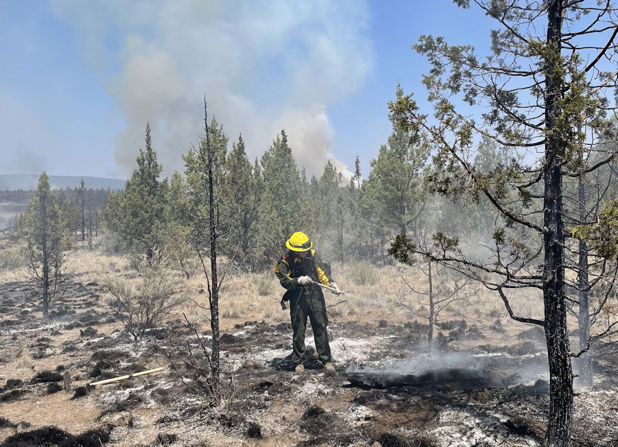
SISTERS, Ore. – A Red Flag Warning over the fire area expired at 11 p.m. last night with overnight temperatures dropping into the 40s and humidity recovering to reduce fire activity. The fire did not grow yesterday. It remains at 5,971 acres and is 20% contained.
Overnight crews used infrared equipment to identify hot spots near the fire lines that the day shift will extinguish. Crews also worked to improve roads around the fire to reduce dust and improve access.
Two Oregon National Guard helicopters will support ground crews today. This extra assistance will aid firefighters in keeping the Grandview Fire inside the established containment lines.
Temperatures will be lower over the fire, with highs in the 80s and winds out of the northwest at 5-9 mph and gusts to 15 mph. These better weather conditions will allow crews to continue to build and strengthen containment lines by cutting back or removing fuel on the perimeter, extinguishing hot spots near the fire line and remove hazard trees. This will allow crews to start mopping up deeper into the fire perimeter.
Two task forces of structure fire engines and a structural hand crew will continue working around homes in the fire area. Due to great progress firefighters have made on the fire the Oregon State Fire Marshal’s Office will be demobilizing their remaining fire crews at the end of the day.
For up-to-date information on the Grandview Fire, visit: https://inciweb.nwcg.gov/incident/7651/ or Centraloregonfire.org
There are evacuation notices in place issued by the Jefferson County Sheriff’s Office https://arcg.is/D9OPi and Deschutes County Sheriff’s Office https://deschutes.maps.arcgis.com/apps/PublicInformation/index.html?appid=f9de45337eb043fca432548f91d03ad6. Please follow their guidance.
Jurisdictional agencies tied to the fire include Oregon Department of Forestry Central Oregon District and Ochoco National Forest, Crooked River National Grassland.
Darlene Fire Daily Update – July 16, 2021
Fire Information Phone Line: 425-324-1267 (7am - 7pm)
Email: darlenefireinfo@gmail.com
InciWeb (Incident Website): https://inciweb.nwcg.gov/incident/7665/ Facebook: https://www.facebook.com/deschutesnationalforest
Twitter: https://twitter.com/CentralORFire
Acres: 686
Number of Personnel: 201
Percent Containment: 5%
Cause: Under Investigation
Date/Time Detected: July 13, 2021, 1:30 p.m.
Origin/Location: La Pine, Oregon
La Pine, OR - On the Darlene Fire yesterday, crews laid more hose around the perimeter of the fire and mopped up within the fire lines. They continue to secure the areas around structures as well. Fire operations today will include strengthening the containment lines and watching for any spot fires that could occur outside of the established lines.
Today’s temperatures are predicted to be in the low to mid 80s. Winds will be from the southwest switching to northwest in the afternoon again. Relative Humidity (RH) is coming back up with good recoveries at night, helping decrease fire behavior. Fuel moistures are still at record lows, especially for July, and firefighters will continue to watch for any spot fires that could ignite and spread rapidly.
Tonight, there will be a community meeting at the La Pine Park and Recreation District, 16405 1st St., at 6:00 p.m. The meeting will be streamed live on the Deschutes National Forest’s Facebook page https://www.facebook.com/deschutesnationalforest.
Evacuations: https://www.deschutes.org/sheriff/page/emergency-information
Level 3: Go Now Residences on Darlene Way south of La Pine to the Deschutes/Klamath County line, and along Old Ice Cave Road.
Level 2: Be Set Areas south of the Deschutes/Klamath County line including the Sun Forest Estates, Split Rail subdivision and Antelope Meadows.
Closures and Fire Restrictions:
Bureau of Land Management/US Forest Service: All open fires are prohibited. All the units are at an Industrial Fire Precaution Level 3 (IFPL 3). Commercial and private firewood cutting is no longer permitted. These units will be moving to an IFPL 4 as of Saturday morning at 12:01 a.m. Information is available at https://www.fs.usda.gov/alerts/deschutes/alerts-notices.
Oregon Department of Forestry: ODF Central Oregon is in Regulated Closure. Information is available at www.odfcentraloregon.com.
Walker Range: Walker Range is also in Regulated Closure www.walkerrange.org.
Bootleg Update July 16, 2021
Location: 28 miles northeast of Klamath Falls, OR
Size: 241,497 acres
Containment: 7%
Personnel: 1,921
(Klamath Falls, OR) – For the fourth day in a row, firefighters withdrew from leading edges of the Bootleg Fire as extreme fire conditions fueled expansive fire growth. In the late afternoon, a large pyrocumulus cloud ‘collapsed’ further spreading embers to the east of the main fire and prompting additional evacuation notices for the communities of Summer Lake and Spring Lake in Lake County. Crews worked through the night to get dozer lines around spot fires over the 34 Road to the southeastern edge of the fire. To the north, crews continued to work against very active surface fire, spotting up to a half mile ahead of the main fire, and dry southern winds.
“The Bootleg Fire perimeter is more than 200 miles long- that’s an enormous amount of line to build and hold,” said Rob Allen, Incident Commander for the Pacific Northwest Area Incident Management Team 2. “We are continuing to use every resource from dozers to air tankers to engage where it’s safe to do so especially with the hot, dry, windy conditions predicted to worsen into the weekend.”
On Thursday, firefighters made excellent progress on the southern edge of the fire as winds pushed the fire back into itself. On the fire’s western edge, firefighters continue to successfully hold the existing containment lines and are patrolling for any remaining hotspots near the fireline. In addition, several crews will continue working to protect and wrap houses towards Paisley and Summer Lake as a precaution ahead of potential fire growth toward those communities over the coming days. Additional structural firefighters will arrive today to assist the east side of the fire with structure protection.
Community Meeting: Friday July 16, 2021 at 6:30pm at www.facebook.com/BootlegFireInfo. A recorded version will also be available on our new YouTube channel.
Evacuations: Visit tinyurl.com/bootlegevac for an interactive map of current evacuation levels.
Closures: Area closures in the Fremont-Winema National Forest at inciweb.nwcg.gov/incident/7609/.
Smoke: Smoke impacts anticipated to Silver Lake, Paisley, and the greater Harney Basin. Full report at: fires.airfire.org/outlooks/southcentraloregon.
Jack Fire Update - July 16
Fire information: The Jack Fire is currently estimated at 16,667 acres and is 25% contained. North of Hwy. 138 resources continue to successfully hold the fire within the planned containment lines. Firefighters are working to clear vegetation on the remaining portion on the containment line on the northern perimeter. As mop-up is completed, crews will be shifted to different parts of the fire to help with suppression efforts.
South of HWY 138, firefighters aided by air resources have established containment lines along the eastern and western perimeter of the fire. Crews will continue bringing line down and around the southern edge of the fire with the goal of completing line construction within the planned containment area. Resources are using a combination of hand and dozer line supported by water drops and fire suppressant to establish the remaining containment line. Firefighters will burn away vegetation when needed to maintain the line.
Structures: Structures continue to be monitored by firefighters from NW Team 9.
Aviation: Air assets provide ground resources with water and retardant drops to limit the spread of the fire and to help establish and hold containment lines.
Evacuations: Effective Wednesday, July 14, 2021, at 5:30 pm, the following changes have been made to the evacuation levels issued last week.
- LEVEL 2 "BE SET" evacuation for all residences and businesses located between milepost 43 and 51 on Highway 138E, including the Dry Creek Community is in effect.
- All residences and businesses located between milepost 38 and 43 on Highway 138E, including the Steamboat Inn and all residences located on Brindle Bug Road and Steelhead Caddis Road, are in a Level 1 "Be Ready" evacuation level.
- All residences and businesses located between milepost 51 and 55 on Highway 138E are in a Level 1 "Be Ready" evacuation level.
- All residences and businesses located between milepost 55 and 60 on Highway 138E, to include the Slide Creek Village, Toketee Village and Clearwater Village, are no longer under a formal evacuation notice.
A current evacuation map can be found at www.dcso.com/evacuations The Sheriff's Office will continue to work with county commissioners, fire managers and agency partners to ensure public safety.
Closures: Highway 138E remains closed as ODOT geologists and tree fallers are working to clear the highway of hazards for a possible re-opening by this weekend. Residents who have been evacuated and can show valid photo identification proving their address may be escorted through the highway closure by ODOT personnel. Failure to provide proof of valid proof of residency, will result in a denial of entry past the road closure. Please visit the Douglas County Sheriff’s Office interactive evacuation map: www.dcso.com/evacuations
State highway 138E from Steamboat Creek to mile post 55 is closed to vehicle traffic. Steamboat Inn is also closed. Oregon Department of Transportation has set an eastside ‘soft closure’ checkpoint at Lemolo Lake junction to allow for local access into nearby recreation areas, including Lemolo Lake. Please visit https://tripcheck.com/ for updates on road closures.
The Umpqua National Forest has issued closure orders around the Jack Fire. The full closure order and map can be viewed on at www.fs.usda.gov/umpqua and on the Jack Fire Facebook page.
Weather: Today will be sunny with smoke. Smoke is expected to clear off in the afternoon. Temperatures will be in the low to mid 80’s with light winds out of the northeast.
Jack Fire Statistics:
Acres: 16,667
Containment: 25%
Personnel: 745
Date of Ignition: 7/5/2021
Cause of Fire: Under Investigation
Structures Threatened: 243
Injuries: 4
Aircraft: 5 Dozers: 6 Engines 33
Bruler Fire update for Friday, July 16:
Sweet Home, Ore. – Firefighters took advantage of cooler temperatures and higher humidity to complete additional direct and indirect line around the Bruler Fire yesterday. Additional resources arrived on the fire, allowing firefighters to identify and mop up a spot fire that occurred to the northeast of the established fire perimeter. The spot fire has been completely lined and cold trailed, which greatly reduces the likelihood of future spread from this location. The dense tree canopy can make it difficult to detect hot spots without firefighters on the ground near the fire watching for smoke. A helicopter is assigned to the Bruler Fire, ready to respond to hot spots and new starts within the fire area.
The Bruler Fire is estimated to be 156 acres with the addition of the spot fire and more accurate mapping. Today, firefighters will take advantage of moderate weather conditions to mop up and cold trail around the fire. Mop up includes using hoses to add water to remove heat from burned areas. Cold trailing is a time-consuming process that verifies the ground is cold to the touch. This labor-intensive job involves walking the entire fire perimeter and feeling the ground for hot spots and embers. Fallers will also remove hazard trees and snags to reduce the probability of fire spread beyond the established perimeter, and to increase safety from them falling.
Such a large closure area is necessary to ensure that firefighters can focus on managing the fire and not needing to evacuate visitors should conditions on the fire change rapidly. We appreciate the support of the public in allowing us to stay focused on firefighting and we will reduce the closure area as soon as we can. “While we are making great progress, the fire is not contained,” said Agency Administrator Nikki Swanson.
“I’m pleased that the firefighters were able to take advantage of cooler weather and higher humidity to quickly respond to the spot fire yesterday,” said Incident Commander Brian Gales. “Firefighters are ready to quickly respond to any new activities that occur in the area.”
WEATHER AND FIRE BEHAVIOR: Today, the weather will again be cooler, with a marine layer increasing relative humidity and clouds. Winds are forecast to be light, with gusts up to 10 mph on ridge tops. Temperatures are expected to stay cooler through the weekend until a high pressure system arrives early next week, which will bring warmer temperatures.
SMOKE: Air quality in and around the communities of Detroit and Sweet Home continues to be listed as “good”. Light winds from the west are keeping smoke from the Bruler Fire and surrounding larger fires to the east.
CLOSURES: A large closure area has been established to maintain firefighter and public safety. This closure encompasses large portions of Forest Service lands south of Detroit Lake, west of Highway 22 and north of Highway 20. The closure also includes the Middle Santiam Wilderness, Daly Lake, Tule Lake and the trail network known as the Old Cascade Crest trail system. The closure is posted to the Willamette National Forest webpage.. A Bureau of Land Management (BLM) closure area is also in place for lands along the Quartzville Scenic Byway/Quartzville road including Yellowbottom Campground, Old Miner’s Meadow Group Site, and nearby dispersed camping areas. Visit InciWeb for more information about closures in the area
| Public information: Facebook: facebook.com/brulerfire2021 E-mail: 2021.bruler@firenet.gov Phone: 541-223-9601, 8 a.m. to 8 p.m. | InciWeb https://inciweb.nwcg.gov/incident/7663/ Oregon Smoke Blog http://oregonsmoke.blogspot.com/p/air-quality-now.html |
MORE HELICOPTERS ON THE WAY TO HELP WITH THE GAME HOG CREEK FIRE
FOREST GROVE, Ore. – Steep terrain where the Game Hog Creek Fire is burning in the Tillamook State Forest has made it difficult for firefighters to deepen their control lines encircling the fire. Yesterday the fire pushed through those lines to burn three more acres.
A helicopter has been helping with air drops of water onto the fire. It will be joined by another helicopter today, with an additional helicopter also expected on Saturday. The water they drop will help cool hot spots so that embers in the interior of the fire have less chance of being blown across control lines.
About 80 ground crew remain engaged on the wildfire, which is entirely within the state forest in timber and slash. Their goal today is to extend control lines down to Elk Creek.
Cooler air from the ocean has moved over the fire today, which should aid firefighters.
The Tillamook State Forest remains open to visitors with the exception of Drift Creek and Idiot Creek forest roads and the Fear and Loaming mountain bike trail. These are closed due to fire activity in the area. Rogers Camp trailhead is being used as a staging area for firefighters and is also closed to the public. Highway 6 and 26 to the coast remain open and unaffected by the fire. No evacuations are associated with this fire.
Cause of the fire is still under investigation.
ELBOW CREEK FIRE, ESTIMATED AT 9,000 ACRES, PUSHES TO THE NORTHEAST; AN ODF INCIDENT MANAGEMENT TEAM HAS BEEN ORDERED
PENDLETON, LA GRANDE, VALE, and BAKER CITY, Ore. - Firefighters continue battling the Elbow Creek Fire located in the Grande Ronde River drainage near Mud Springs, approximately 31 miles southeast of Walla Walla, Washington. The fire is burning on both sides of the Grande Ronde River and is on or threatening Umatilla National Forest lands, Wallowa-Whitman National Forest lands, Vale District Bureau of Land Management lands and Oregon Department of Forestry protected lands.
The Elbow Creek Fire is now estimated to have burned 9,000 acres. The fire was reported on Thursday, July 15 and is burning in grass and timber. Winds and hot temperatures contributed to active fire behavior and growth yesterday, pushing the fire rapidly to the northeast. The movement of the fire prompted the Wallowa County Sheriff’s office to evacuate the communities of Eden Bench and Troy. Firefighters, aided by aerial resources, focused suppression efforts on protecting structures in the area and establishing containment lines to slow the spread of the fire. The cause of the fire is under investigation.
The fire continues to spread to the northeast. Today firefighters will focus on establishing access points to the fire and securing an anchor point where firefighters can build containment lines, utilizing aircraft to slow fire spread where needed. Resources on scene include hand crews, dozers, multiple engines and water tenders. Additional firefighting resources are arriving today, including resource support from the Lick Creek Fire, burning on the Pomeroy Ranger District. The Forest has ordered a Type 1 Oregon Department of Forestry Incident Management Team and will inbrief the team on Saturday.
The Level 3 evacuation notice is still in effect for community members that live at Eden Bench and Troy, as well as along Wild Cat Road, Powwatka Road and the 500/501 Road up to the 763 Road. A Level 3 means those within the evacuation area should leave immediately. Additional information regarding evacuations is available through the Wallowa County Sheriff’s Office at (541) 426-3131 or by monitoring the Wallowa County Sheriff’s Office Facebook.
Hot and dry conditions are expected to persist throughout the week. Fire officials want to remind everyone that the current fire danger rating remains at EXTREME.
Due to extreme wildfire activity and the concern for the safety of the public the entirety of the Umatilla National Forest has been temporarily closed. Additional information regarding this area closure is available at: https://bluemountainfireinfo.blogspot.com/2021/07/umatilla-national-forest-lands.html.
The latest fire information can be found by visiting the Blue Mountains Fire Information Blog
(http://bluemountainfireinfo.blogspot.com/). To receive updates on fires in the Blue Mountains, follow our blog at http://bluemountainfireinfo.blogspot.com/.
