Bootleg Fire grows to more than 364,000 acres; containment up to 30%
BEATTY, Ore. (KTVZ) – The 2-week-old Bootleg Fire in southern Oregon grew to more than 364,000 acres Monday, but the 2,250 personnel on the lines also pushed the massive blaze to 30% containment, officials said Monday night.
Here's the earlier, morning update:
Bootleg Fire Daily Update Monday, July 19
Location: 28 miles northeast of Klamath Falls, OR
Size: 303,791 acres (est.)
Personnel: 2,181
Containment: 25%
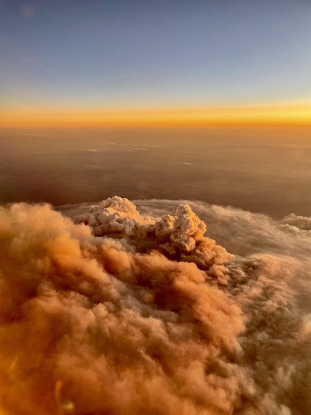
Yesterday was the ninth day in a row with such extreme fire behavior that firefighters moved to safety zones and looked for opportunities to re-engage. Please note: the fire map issued today does not reflect the actual fire perimeter as the infrared data collection flight was not performed due to aircraft mechanical issues.
There was active fire all night on the southeastern corner. A fire slop over across the 28 Road is estimated to be over 2,500 acres in the Elder Creek area. Firefighters worked through the night to limit growth. On the north edge, firefighters disengaged when the fire aggressively moved past retardant lines three to four miles north toward Long Creek. The Nature Conservancy station at Sycan Marsh was evacuated and firefighters provided structure protection. Fire activity on the Log Fire was moderated by heavy smoke cover (shading from smoke cover results in lower fire intensity) and firefighters were successful in limiting southeast growth toward Summer Lake with dozer lines.
“We are running firefighting operations through the day and all through the night,” said Joe Hessel, Incident Commander. “This fire is a real challenge, and we are looking at sustained battle for the foreseeable future.”
Weather today will add the possibility of thunderstorms to the dry, hot, and windy conditions, with fire growth expected to the north, east, and southeast. Today, crews will work to contain the slop over the 28 Road and scout for contingency lines. Crews are also managing smaller areas of fire outside of the containment lines.
The southeast flank of the fire from Preacher Flats to Mitchell Monument remains in patrol status. More firefighters have shifted to the north to support fire efforts near Silver Lake. Firefighters on the Log Fire continue line improvements to attempt to protect ranches and the Summer Lake community.
Firefighters are preparing secondary fire lines in all areas of fire growth. The southwestern flank of the fire continues to hold. It is imperative property owners use caution when returning; there are lingering hot spots and fire-weakened trees. The public may see smoke as fuels continue to burn within the fire perimeter. Please use an abundance of caution around these areas.
Community Meeting: Monday, July 19, at 7:00 p.m. at the Gearhart Elementary School (61100 Metler St, Bly, OR 97622).
Evacuations: Evacuations are rapidly changing due to the nature of this wildfire. Please visit tinyurl.com/bootlegevac for an interactive map of evacuation level in Lake and Klamath counties. Two Red Cross Evacuation Shelters are Open 24/7: Klamath County Fairgrounds at 3531 S 6th St. Klamath Falls, Oregon and Daly Middle School 906 S 3rd St. Lakeview, Oregon for information or assistance: 1-800-Red-Cross and FB @RedCrossCascades
Closures: The Fremont-Winema National Forest is closed to the public in the fire area. Map and full order available at inciweb.nwcg.gov/incident/7609/.
Smoke: Smoke impacts will be high in areas north, northeast, and east of the fire, especially in the vicinity of Silver Lake, Summer Lake, and Paisley. See: fires.airfire.org/outlooks/southcentraloregon.
Fire Information Public Phone: 541-482-1331
Facebook: www.facebook.com/BootlegFireInfo
Twitter: twitter.com/BootlegFireInfo
Hashtags: #BootlegFire #FireYear2021
Jack Fire July 19 2021 Daily Update
Fire Update: Monday, July 19, 2021
SAFETY on Hwy 138: For the safety of firefighters and the public, please be aware of increased fire traffic and follow posted speed limits along Highway 138.
Fire information: The Jack Fire is currently estimated at 17,994 acres and is 50% contained. North of Hwy. 138, Along the northern flank, firefighters deepened the control line, and will continue mop-up and securing line. On the eastern flank, crews will complete burnout operations for increased depth of fire lines. Fallers are removing snags and at-risk trees to make roads safe to travel and crews continue to monitor fire behavior along North Umpqua River.
South of Hwy 138, firefighters have prepared control lines and burned vegetation to create a secure control line on the west and southwest flanks. On the south and southeast east flank, crews will utilize heavy equipment and fallers to clear and brush out roads used as control lines. Crews will also be scouting for alternative lines to tie into existing hand line. Contingency line construction will continue with the primary focus to utilize existing roads as much as possible. Fallers plan to remove snags and put in shaded fuel breaks. A shaded fuel break involves removal of shrubs and smaller ladder fuels from under larger trees.
Structures: Crews continue to mop-up and patrol around structures in Dry Creek area and around Horseshoe Bend Campground.
Aviation: Air support today includes two Heavy Type 1 helicopters with buckets and one Heavy Type 1 helicopter with a tank along with one light Type 3 helicopter. Air assets provide ground resources with water and retardant drops to limit the spread of the fire and to help establish and hold containment lines.
Closures: For your safety and the safety of others, the Umpqua National Forest closure orders remain in effect. The full closure order and map can be viewed on at www.fs.usda.gov/umpqua and on the Jack Fire Facebook page.
Evacuations: Effective Wednesday, July 14, 2021, at 5:30 pm, the following are evacuation levels issued:
•LEVEL 2 "BE SET" evacuation for all residences and businesses located between milepost 43 and 51 on Highway 138E, including the Dry Creek Community is in effect
•All residences and businesses located between milepost 38 and 43 on Highway 138E, includingthe Steamboat Inn and all residences located on Brindle Bug Road and Steelhead Caddis Road, are in a Level 1 "Be Ready" evacuation level.
•All residences and businesses located between milepost 51 and 55 on Highway 138E are in a Level 1 "Be Ready" evacuation level.
•All residences and businesses located between milepost 55 and 60 on Highway 138E, to include the Slide Creek Village, Toketee Village and Clearwater Village, are no longer under a formal evacuation notice.
A current evacuation map can be found at www.dcso.com/evacuations The Sheriff's Office will continue to work with county commissioners, fire managers and agency partners to ensure public safety.
Weather: Partly cloudy skies today with temperatures 85-90 degrees. Winds east northeast in the morning changing to west northwest in afternoon. The Incident Team meteorologist noted the last significant rainfall in this area was June 14 when 3/4" rain fell over 24 hours.
Jack Fire Statistics:
Acres: 17,994
Containment: 50%
Personnel: 763
Date of Ignition: 7/5/2021
Cause of Fire: Under Investigation
Structures Threatened: 243
Injuries: 6
Aircraft: 4 Dozers: 6 Engines 34
ELBOW CREEK FIRE REPORTED AT 16,432 ACRES AND IS 10 PERCENT CONTAINED
News Release from Oregon Dept. of Forestry
Posted on FlashAlert: July 19th, 2021 11:48 AM
Downloadable file: Elbow Creek Fire briefing map.
Wallowa, ORE. – Two days of fire growth not previously captured by infrared mapping now shows the fire at 16,432 acres. Containment is estimated at 10 percent.
The arrival of Oregon Department of Forestry’s Incident Management Team brings in additional overhead capacity and firefighting resources. There is a total of 343 firefighters and overhead personnel on the incident with additional crews on order.
Crews continued to manage northside lines of the fire perimeter successfully. Growth occurred on the southwest side with winds out of the northeast pushing the fire through the canyons. Steep and rocky terrain continues to be challenging in the canyons of the Grande Ronde River. With a limited number of crews, the incident management team will focus efforts in the most challenging areas along the southwestern portions of the fire in the Grossman Creek Drainage. Dozers are also being utilized in this area along the top of canyon shelves where they can be more effective. The eastern edge of the fire is holding and has transitioned to mop-up operations.
A Red Flag Warning is in effect for the general area with the potential for abundant lightning. Thunderstorm activity could also bring erratic winds, further challenging fire suppression actions.
Another concern facing firefighters is the continued threat of COVID-19. The incident management team is doing all it can to prevent a covid outbreak by limiting the number of participants in briefings and meetings, promoting healthy hygiene, and even substituting fist bump greetings in lieu of handshakes.
Level 2 and 3 evacuation notifications by the Wallowa County Sheriff’s Office remain unchanged. Additional information regarding evacuations is available on the Wallowa County Sheriff’s Office Facebook page (www.facebook.com/Wallowa-County-Sheriffs-Office-147212815486187).
Closures are also in place surrounding the fire. Due to fire activity on both sides of the Grande Ronde River corridor, the river is closed at Minam State Park. Any rafters that arrive into the fire area will be safely evacuated in coordination with Wallowa County Search and Rescue. Due to extreme wildfire activity and the concern for the safety of the public the entirety of the Umatilla National Forest has been temporarily closed. For more information visit https://www.fs.usda.gov/umatilla.
Elbow Creek Fire Information: 541-805-2784 (7 a.m. - 9 p.m.)
Email: ElbowCreek.information@gmail.com
Facebook: www.facebook.com/ElbowCreekFire
InciWeb: inciweb.nwcg.gov/incident/7672/
Bruler Fire update for Monday, July 19
Sweet Home, Ore. – Firefighters took advantage of the light winds and relatively high humidity to remove fuels around the Bruler Fire perimeter. Mop up work continued along the south side of the fire. Sprinklers were strategically placed along the west and east side of the fire to aid in suppression of hot spots. Containment is now listed at 10%.
Fire activity increased on the northwest and southwest corners of the fire yesterday. A helicopter dropped water on the fire to prevent it from escaping control lines. Additionally, a small spot fire was controlled outside the fire perimeter.
Today, firefighters will continue to place sprinklers on the south side of the fire. Engines and firefighters will conduct mop up activities on the north and south side of the fire, leading to future sprinkler placement.
Additional heavy equipment, including masticators, dozers and bunchers will begin arriving at the fire today. The west side of the fire has a large fuel load and this heavy equipment will help to mitigate hazards for firefighters and the public.
A large closure area is necessary to ensure that firefighters can focus on managing the fire and not needing to evacuate visitors should conditions on the fire change rapidly. We appreciate the support of the public in allowing us to stay focused on firefighting and we will reduce the closure area as soon as possible. Safety issues on the fire include large rocks and trees falling onto roadways without warning due to the fire.
“I’m impressed with the operations on the Bruler Fire,” said Agency Administrator Nikki Swanson. “Firefighters are safely and carefully utilizing the heavy equipment to keep the fire as small as possible and working with resource advisors to minimize impacts to natural resources.”
WEATHER AND FIRE BEHAVIOR: Today, the weather will be similar to yesterday, with high temperatures in the low 80s and relative humidities in the high 20% range. Southwest winds are forecast, with gusts up to 20 mph. Similar temperatures, humidity and sky conditions are expected for the next few days. Thunderstorms are forecasted to stay well to the south and east of the fire.
SMOKE: Air quality in and around the communities of Detroit and Sweet Home continues to be listed as “good.” Light winds from the southwest are keeping smoke from the Bruler Fire and surrounding larger fires to the east.
CLOSURES: A large closure area has been established to maintain firefighter and public safety. This closure encompasses large portions of Forest Service lands south of Detroit Lake, west of Highway 22 and north of Highway 20. The closure also includes the Middle Santiam Wilderness, Daly Lake, Tule Lake and the trail network known as the Old Cascade Crest trail system. The closure is posted to the Willamette National Forest webpage. A Bureau of Land Management (BLM) closure area is also in place for lands along the Quartzville Scenic Byway/Quartzville road including Yellowbottom Campground, Old Miner’s Meadow Group Site, and nearby dispersed camping areas. Visit InciWeb for more information about closures in the area.
Public information:
Facebook: facebook.com/brulerfire2021
E-mail: 2021.bruler@firenet.gov
Phone: 541-223-9601, 8 a.m. to 8 p.m.
InciWeb
https://inciweb.nwcg.gov/incident/7663/
Oregon Smoke Blog
http://oregonsmoke.blogspot.com/p/air-quality-now.html
