Extreme weather fuels Oregon wildfires, Bootleg Fire tops 388K acres; outside help sought
PORTLAND, Ore. (AP) — The threat of thunderstorms and lightning has prompted officials in fire-ravaged Oregon to ask for help from outside the Pacific Northwest to prepare for additional blazes, as many resources are already devoted to a massive forest fire.
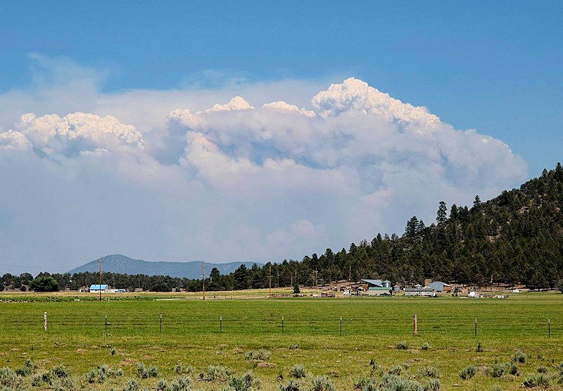
The 569-square-mile (more than 388,000 acres) Bootleg Fire is burning 300 miles southeast of Portland in and around the Fremont-Winema National Forest, a vast expanse of old-growth forest, lakes and wildlife refuges. Evacuations and property losses have been minimal, compared with much smaller blazes in densely populated areas of California.
But eyeing how the Bootleg Fire — fueled by extreme weather — keeps growing by miles each day, officials with the Rogue River-Siskiyou National Forest in southwest Oregon are asking for more outside crews to be ready, should there be a surge in fire activity there.
“Although the lightning activity predicted for early this week is expected to occur east of us, we are prepared for the worst, and hoping for the best,” Mike McCann, an assistant fire staff, said Monday in a statement released by the national forest.
The worry is that dry conditions, a drought and the recent record-breaking heat wave in the region have created tinderbox conditions, so resources like fire engines are being recruited from places like Arkansas, Nevada and Alaska.
Meanwhile, to the east, the Bootleg Fire’s jaw-dropping size contrasted with its relatively small impact on people underscores the vastness of the American West and offers a reminder that Oregon, which is larger than Britain, is still a largely rural state, despite being known mostly for its largest city, Portland.
If the fire were in densely populated parts of California, “it would have destroyed thousands of homes by now,” said James Johnston, a researcher with Oregon State University’s College of Forestry who studies historical wildfires. “But it is burning in one of the more remote areas of the lower 48 states. It’s not the Bay Area out there.”
At least 2,000 homes have been evacuated at some point during the fire and another 5,000 threatened. At least 70 homes and more than 100 outbuildings have gone up in flames. Thick smoke chokes the area where residents and wildlife alike have already been dealing with months of drought and extreme heat. No one has died.
Pushed by strong winds from the southwest, the fire is spreading rapidly to the north and east, advancing toward an area that’s increasingly remote.
Evacuation orders on the fire’s southern edge, closer to more populous areas like Klamath Falls and Bly, have been lifted or relaxed as crews gain control. Now it’s small, unincorporated communities like Paisley and Long Creek — both with fewer than 250 people — and scattered homesteads that are in the crosshairs.
But as big as the Bootleg Fire is, it’s not the biggest Oregon has seen. The fire’s size so far puts it fourth on the list of the state’s largest blazes in modern times, including rangeland fires, and second on the list of infernos specifically burning in forest.
These megafires usually burn until the late fall or even early winter, when rain finally puts them out.
The largest forest fire in modern history was the Biscuit Fire, which torched nearly 780 square miles (2,000 square kilometers) in 2002 in the Rogue River–Siskiyou National Forest in southern Oregon and Northern California.
On Monday, flames forced the evacuation of a wildlife research station as firefighters had to retreat for the ninth consecutive day due to erratic and dangerous fire behavior. Sycan Marsh hosts thousands of migrating and nesting birds and is a key research station on wetland restoration in the upper reaches of the Klamath Basin.
The Bootleg Fire was one of many fires burning in a dozen states, most of them in the U.S. West. Sixteen large uncontained fires burned in Oregon and Washington state alone on Monday.
Read more at: https://apnews.com/article/science-fires-environment-and-nature-oregon-weather-9a8021b4073fc50309ddf9bad479d956
Bootleg Fire Daily Update July 20
Location: 28 miles northeast of Klamath Falls, OR
Size: 388,359 acres
Personnel: 2,250
Containment: 30%
(Klamath Falls, OR) – For ten days in a row, extreme fire behavior in the afternoon and evening has resulted in firefighters moving to safety zones. Yesterday evening, parts of the fire received a trace amount of rain from thunderstorms in the area. The main Bootleg Fire merged with the Log Fire as anticipated. Fire activity in this area was moderated by smoke cover decreasing fire intensity, so firefighters took advantage of conditions to improve the northeastern firelines. Toward the east, significant fire movement resulted in the fire spotting over Forest Road 28 (Trunk Road) toward Summer Lake. On the north edge, firefighters made progress constructing dozer line during the night and early morning while temperatures were cooler and winds calmer. By the afternoon, with increasing winds and temperature, the fire moved across Coyote Creek and refocused on protecting the Sycan Marsh Nature Conservancy structures. Night operations were able to construct dozer line to Long Creek and establish an anchor point near Nature Conservancy structures.
Firefighters continue to patrol 40+ miles of fireline on the southern and western flanks of the fire. There continues to be areas of heat in several locations on the west and south of the fire including the Preacher Flats area. As crews patrol, they look for places to mitigate risks to the controlled line of the fire. Property owners are reminded to use caution when returning; hazardous hot spots and fire-weakened trees remain throughout the area. Please use an abundance of caution around these areas. Additionally, unburned fuels within the fire perimeter will continue to burn and produce smoke for weeks.
“Fighting this fire is a marathon, not a sprint,” said Rob Allen, Incident Commander for PNW Incident Management Team 2. “We’re in this for as long as it takes to safely confine this monster”.
Today, winds will be from the southwest with a Red Flag Warning from 2 to 8 p.m. for gusty winds and low relative humidity, resulting in continued movement of the fire toward the east. Today, firefighters will work to mitigate risks for by aggressively felling hazard trees. Crews will continue to work on areas where the fire has slopped or spotted over Forest Roads 28 and 34. If they are not successful in the next 24 hours, they will fall back to structure protection in the Summer Lake community, with possible Hwy 31 closure and a burn out operation to remove fuels between the residential areas and the main fire. In the north toward Silver Lake, firefighters plan to close the gap of fireline between Long Creek and the anchor point at Nature Conservancy structures. Firefighters are preparing secondary fireline and scouting for contingency firelines in all areas of fire growth. Structural protection firefighting crews continue to progress and work to mitigate risks to structures. As crews move around the evolving fire, resources are shifted to more active areas of the fire.
Community Meeting: July 20, 2021 at 6:30pm Facebook Live @BootlegFireInfo. The meeting will be live streamed and a recording posted to https://www.facebook.com/bootlegfireinfo
Evacuations: Evacuations are rapidly changing due to the nature of this wildfire. Interactive map of evacuation levels in Lake and Klamath Counties at tinyurl.com/bootlegevac Red Cross Evacuation Shelters: Open 24/7 New Site: Thrive Church - 235 South Laguna St. Klamath Falls, Oregon and Daly Middle School 906 S 3rd St. Lakeview, Oregon for information or assistance: 1-800-Red-Cross, FB @RedCrossCascades , (www.redcrossblog.org/disaster)
Closures: The Fremont-Winema National Forest is closed to the public in the fire area. Map and full order available at inciweb.nwcg.gov/incident/7609/.
Smoke: Smoke impacts will be high in areas north, northeast, and east of the fire, especially in the vicinity of Silver Lake, Summer Lake, and Paisley. See: fires.airfire.org/outlooks/southcentraloregon.
Fire Information Public Phone: 541-482-1331
InciWeb: inciweb.nwcg.gov/incident/7609/
Facebook: www.facebook.com/BootlegFireInfo
Twitter: twitter.com/BootlegFireInfo
Hashtags: #BootlegFire #FireYear2021
