Bootleg Fire tops 400,000 acres, but crews make good progress, now 40% contained
BLY, Ore. (AP) — The nation’s largest wildfire raged through southern Oregon on Friday, but crews were scaling back some night operations as hard work and weaker winds helped reduce the spread of flames even as wildfires continued to threaten homes in neighboring California.
The Bootleg Fire, which has destroyed an area half the size of Rhode Island, was 40% surrounded after burning some 70 homes, mainly cabins, fire officials said.
At least 2,000 homes were ordered evacuated at some point during the fire, and an additional 5,000 were threatened.
In central Montana, five firefighters were injured when a thunderstorm and swirling winds blew a lightning-caused wildfire back on them, federal officials said Friday.
The Bureau of Land Management did not release the extent of the firefighters’ injuries or say where they were being treated.
Read more at: https://apnews.com/article/fires-environment-and-nature-oregon-wildfires-934887d745b74b5bd1bd142d14d42528
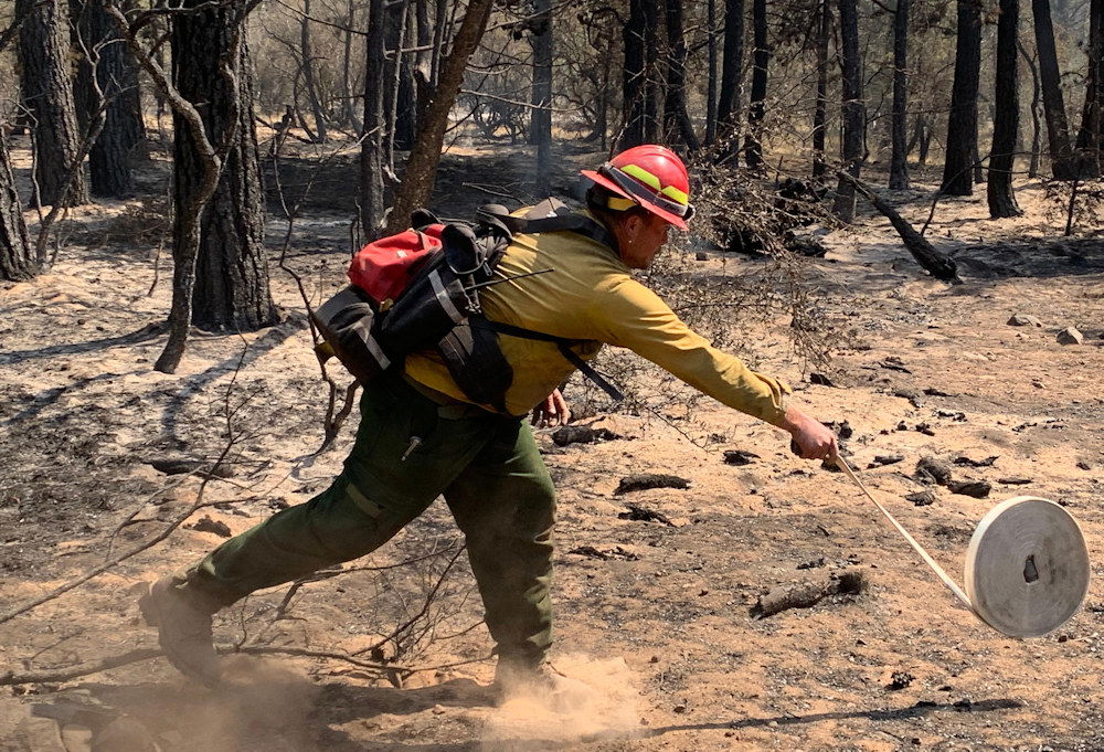
Bootleg Fire Daily Update July 23
Location: 28 miles northeast of Klamath Falls, OR Size: 400,389 acres
Personnel: 2389 Containment: 40%
(Klamath Falls, OR) – The Oregon State Fire Marshall Incident Management Team has transitioned to working with Zone 2 on the north and northeast sections of the fire. Yesterday, the fireline into Long Creek was improved with hose lay and overnight firefighters were able to begin constructing direct line between Long Creek and Coyote Creek. Crews continue to work on the contingency lines in the northern portion of the fire above Sycan Marsh. Fire activity picked up in the eastern portion of the fire and spotted over Forest Service Road 2901. Last night crews and equipment worked using natural barriers and changes in fuel to contain the spot and protect the Summer Lake community. Crews will work today to hold those areas and scout for additional spots. Due to the fire’s movement to the east, additional Level 3 evacuations were issued for a portion of Lake County, from the Paisley Airport to mile post 82, and from Picture Rock Pass to mile post 77, including the Ana Subdivision. This area is in addition to the previous Level 3 notification.
“Our firefighters have put in an incredible amount of hard work on this fire,” said Joe Hessel, Incident Commander for the Oregon Department of Forestry Incident Management Team. “The fire continues to throw challenges at us, and we are going to continue to stay vigilant, work hard, and adapt.”
On the southeastern portion of the fire, crews worked through the night. There were some half-acre slops across the fire line, jackpots of fuel, and unburned islands that actively burned through the night. Today, firefighters will continue to secure the fireline, hold, and improve the control features.
Firefighters are actively patrolling and mopping areas along the southern portion of the fire. This step is necessary to ensure that all heat that could threaten the security of the fire line has been extinguished. Resources continue to be shifted to meet the needs across the fire area. Firefighters from this fire may be called to provide initial attack response to new fire starts that have the potential to rapidly grow, given the extremely dry fuel conditions.
Winds are expected to shift over the fire area today from a westerly flow to winds from the north or northwest. While these winds will be light, any shift in weather is a heads up situation for firefighters.
The Incident Command Post at Chiloquin High School is being dismantled today. Crews and resources have been repositioned to bases near Summer Lake and Paisley. This move will put crews and equipment closer to the active areas of the fire. The Incident Command Post will move to Klamath Falls and will be working out of the Klamath Community College.
Evacuations: Evacuations are dynamic. An interactive map of evacuation levels in Lake and Klamath Counties is available at tinyurl.com/bootlegevac
Red Cross Evacuation Shelters: Thrive Church - 235 South Laguna St. Klamath Falls, Oregon will be closing at 1800 Friday. For information or assistance: 1-800-Red-Cross, (www.redcrossblog.org/disaster)
Closures: The Fremont-Winema National Forest is closed to the public in the fire area. Map and full order available at inciweb.nwcg.gov/incident/7609/.
Smoke: Areas around Silver Lake, Summer Lake, and Paisley are experiencing generally improved air quality with some periods of heavy smoke continuing in the afternoon and evening. See: fires.airfire.org/outlooks/southcentraloregon.
Fire Information Public Phone: 541-482-1331
Inciweb: inciweb.nwcg.gov/incident/7609/ Facebook: www.facebook.com/BootlegFireInfo
Twitter: twitter.com/BootlegFireInfo Hashtags: #BootlegFire #FireYear2021
