Numerous new lightning-sparked fires fought across Oregon as crews still tackle older ones
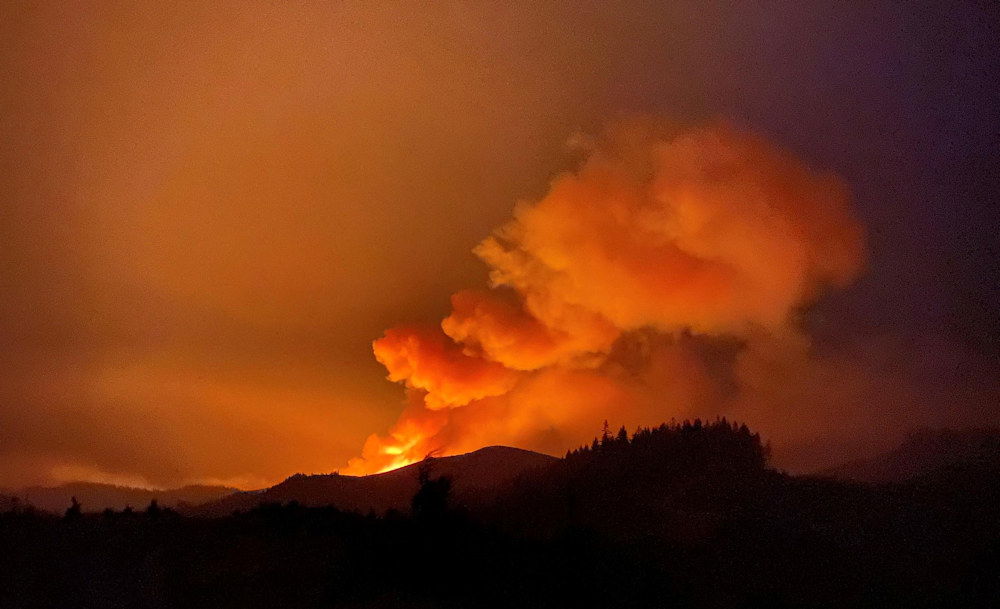
OAKRIDGE, Ore. (KTVZ) -- Dozens of new lightning-sparked wildfires are being tackled by thousands of firefighters across Oregon as large fires up to a month old still have crews working to contain them.
In fact, the state of Oregon fire dashboard, on KTVZ's Fire Alert page, shows 107 active fires in the state as of Tuesday afternoon.
Here are Tuesday's updates on some of the new blazes:
Middle Fork Complex Daily Update 08/03
Twelve individual fires make up the Middle Fork Complex, nine miles north of Oakridge, with seven fires at 100% containment.
Four fires make up the northwest section of the Middle Fork complex. The Gales Creek Fire is located south of the Forest Road 18 near the 1835 road and is now 1,268 acres, with 0% containment. Heavy equipment will be used to remove vegetation along the 1824 and 220 roads.
The six-acre Elephant Rock Fire, which is approximately two miles to the southeast, has held at six acres and is 0% contained. On the 143-acre Ninemile Fire, engines and crews will work along the 1834 Road tying in with 339 Road to obtain a solid containment line. With growth of the fire to the east-northeast, firefighters will evaluate containment opportunities. Crews will monitor and patrol the Journey and Symbol Rock Fires, each at 0.1 acre and both at 100% containment.
The 204-acre Kwis Fire is the closest fire to Oakridge and is located south of Forest Road 24 near Salmon Creek. Burnout will occur along established control lines to remove fuel between the fire and the control line. Hose lays are being established along control lines to aid with mop-up and increasing containment. The one-acre Warble Fire is 100% contained. Crews will patrol and secure line as needed.
South of Forest Road 19, the two-acre Devils Canyon Fire is 100% contained. Firefighters will continue mop-up and patrol in that area. Southwest of the Hill Creek Reservoir, crews secured solid line and plan to reach patrol and monitor status on the three-acre Packard Fire. That fire is 100% contained. The 78-acre Windfall Fire is now at 80% containment. Crews will continue mop-up efforts. Near the Hills Creek Reservoir, firefighters will patrol and monitor the Way and Larison Cove Fires, also at 100% containment.
Aviation: Air assets provide support to ground resources with water and retardant drops to limit the spread of the fire and to help establish and hold containment lines. Air support today includes two Type 1 heavy Blackhawk helicopters, one medium Type 2 helicopter and two light Type 3 helicopters.
Weather and Air Quality: Increasing clouds this afternoon with 90 degree temperatures. Light winds from west-northwest. Air quality Advisory in affect this afternoon for Oakridge, Oregon area today. Air quality index shows unhealthy for sensitive groups. Children, older adults and people with lung disease should avoid outdoor exertion. More information can be found at oakridgeair.org.
Closures: For updates on closures within the Willamette National Forest, go to the Forest webpage at www.fs.usda.gov/willamette or follow on Facebook.
Evacuations: Effective July 30, the following are evacuation levels issued through Lane County. Level 3 (GO NOW) Evacuation Notice: All homes, campgrounds and dispersed recreation along Forest Service Road 18 (Big Fall Creek Road) east of the intersection with Forest Service Road 1821, including Puma Campground and Bedrock Campground, are at a Level 3. A current evacuation map can be found at www.lanecountyor.gov.
Skyline Ridge Complex Tuesday Morning Update 8/3/21
Fire activity increased on several incidents within the Skyline Ridge Complex in Douglas County Monday evening, which resulted in active fire behavior well into the night.
As of Tuesday morning, the combined size of the fires within the complex is estimated to be about 225 acres, with the majority of the burned area coming from the O’Shea Creek Fire, the Poole Creek Fire, and the Ike Butte Fire.
Today, 115 firefighters and four helicopters will be engaged on the various fires within the complex with the objective of fully extinguish several small fires in addition to engaging on the larger incidents. Aviation and ground resources will also be on the lookout for additional fires from Sunday evenings lightning event.
Tuesday is also a day of transition for the Skyline Ridge Complex, as an Incident Management Team from the Oregon Department of Forestry was ordered Monday morning by the Douglas Forest Protective Association to assist with suppression efforts.
ODF Incident Management Team 1 arrived in Douglas County Monday evening and received an in briefing from the district. Members from the Incident Command Team are integrated into today’s operations and will assume command of the complex at 6:00 PM Tuesday evening.
An incident -specific Facebook page and an InciWeb site have been created for the Skyline Ridge Complex and information for the fires will be posted at these locations: Facebook: www.facebook.com/Skyline-Ridge-Complex-110696041255752
InciWeb: https://inciweb.nwcg.gov/incident/7762/
Bootleg Fire Daily Update August 3
Location: 28 miles northeast of Klamath Falls, OR
Fireline total: 323 miles
Size: 413,762 acres, 647 square miles
51 miles active fire edge, 272 miles of contained line
Personnel: 1,617
Containment: 84%
(Klamath Falls, OR) – A Red Flag Warning is in effect for this afternoon and evening. A Fire Weather Watch is in effect for Wednesday. A Red Flag Warning means that critical fire weather conditions are either occurring now or will shortly. Specifically, these conditions include continued warm temperatures, low humidity, and strong winds. Combined, they promote the rapid spread of wildfire and extreme fire behavior that could become life threatening
Out of an abundance of caution and at the recommendation of the Alaska Incident Management Team, Lake County expanded the Level 1 (Get Ready) evacuation boundary to include the area north of Summer Lake. The expanded area extends from Mile Post 73 on Highway 31 north to Picture Rock Pass and east of the highway to include the Ana Subdivision. A Level 2 (Be Set) evacuation remains in place from milepost 73 on Highway 31 south to Monument Rock. A Level 3 (GO NOW!) evacuation remains in place for all areas within and adjacent to the Bootleg Fire perimeter, including Yamsay Mountain, Thompson Reservoir, and the Sycan Marsh to the top of Winter Rim.
The Bootleg Fire containment continues to advance as firefighting crews mop up, improve fire line, and strengthen contingency lines. Crews are working tirelessly to ensure we are as prepared as we can be for the extreme fire weather forecast for the next couple days.
Just as firefighters have been preparing for the weather conditions, you should, too. Fire starts are not just from escaped embers and lightning but can also come from a trailer chain dragged on pavement, a hot catalytic converter in contact with dry grasses, or shooting firearms. “Any accidental or negligent release of sparks or heat can result in a fire that quickly gets out of control,” says Kristian Knutson, Fire Prevention Officer in Palmer, Alaska, and incident Public Information Officer. “Be sure to remove combustibles from around the outside of your home, such as firewood, fuel tanks, and gas grills. Keep shrubs and tree limbs away from your house and off the ground.” At this time of year, one less spark could mean one less wildfire.
Closures: An emergency closure order is in effect for the Bootleg Fire on the Fremont-Winema National Forest to protect public and firefighter safety. All travel or entry into the area is prohibited. The full closure order and map are available on the website under Alerts and Closures at https://www.fs.usda.gov/alerts/fremont-winema/alerts-notices
Red Cross Evacuation Shelters: For information or assistance: 1-800-Red-Cross (www.redcrossblog.org/disaster)
Smoke: A new complex of fires in Northern California sparked by thunderstorms started to put out a lot of smoke in the afternoon yesterday. Winds will likely carry that smoke into Oregon. Critical fire weather conditions later today could also increase fire behavior, putting more smoke into the air. Region wide, today should be generally moderate, though periods of Unhealthy for Sensitive Groups cannot be ruled out. See: fires.airfire.org/outlooks/southcentraloregon
Be aware of the smoke near you and learn about ways to mitigate smoke impacts. See the air quality near you at https://fire.airnow.gov and learn how to keep smoke out of your home at https://www.epa.gov/smoke-ready-toolbox-wildfires
Insurance Assistance: For additional information on submitting insurance claims after losing your home or property to a wildfire, please visit https://dfr.oregon.gov/insure/home/storm/Pages/wildfires.aspx or call the state’s team of consumer advocates at 888-877-4894 (toll-free).
Fire Information Public Phone: 541-482-1331 Fire Information Media Phone: 971-727-7255
Inciweb: inciweb.nwcg.gov/incident/7609/ Facebook: www.facebook.com/BootlegFireInfo
Twitter: twitter.com/BootlegFireInfo
Hashtags: #BootlegFire #FireYear2021
Elsewhere, the nearly month-old, 23,000-acre Jack Fire has more than 550 firefighters still working on the blaze, which is 77% contained. Nearly two-dozen new lightning starts about 10 miles north of the Jack Fire are being managed as the Rough Patch Complex, in limited road access and steep terrain.
