Autumn has arrived, and several large Oregon wildfires are still being battled
DETROIT, Ore. (KTVZ) – Summer has turned to fall, officially, but there’s still plenty of work for firefighters to do on several large wildfires, some of which have been burning for nearly two months.
The Bull Complex Fire, sparked by lightning in early August 12 miles northeast of Detroit, has burned nearly 25,000 acres and is 20% contained, with 346 personnel still on scene as of Sunday. It’s hoped the fire can be fully contained by Oct. 30.
Bull Complex Update for Sunday, September 26, 2021
RIPPLEBROOK, Ore. – Yesterday crews worked to repair areas impacted by fire suppression activities. Crews reinforced and monitored completed primary containment lines. Southwest winds aligned with drainages along the southern boundary of the fire leading to an increase in fire behavior. Firefighters in this area will focus on holding primary line and cooling hot spots around Humbug Creek as well as repairing dozer lines. Air resources successfully slowed the fire’s progression with water drops in key hot spots around Gold Butte.
On the northern edge of the fire, today’s actions will include moving brush to staging areas in preparation for a curtain burner operation. This equipment burns branches and twigs quickly into biochar, a nutrient-rich material that can then easily be spread on the ground to assist in revegetation of the forest. Firefighters working on the eastern edge of the fire will focus on suppression repair.
Weather: Today’s weather will transition from a dry, sunny and warm pattern to wet, rainy and cool conditions. Southwest wind from 10 to 15 mph is forecast today, with gusts up to 25 mph. Clouds will arrive this afternoon, with rain starting around sunset. The high temperature today is forecast to be in the mid to upper 50s. Tomorrow afternoon will bring another cold front with an additional inch of rain. The rain should end Wednesday morning.
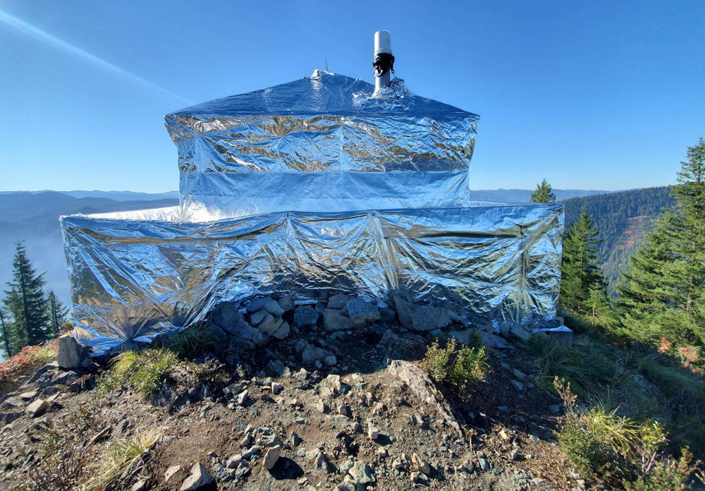
Evacuations: The Marion County Sheriff’s Office has issued a Level 1 “Be Ready” evacuation advisory for Breitenbush Hot Springs. Residents should be aware of the danger that exists in their area, monitor emergency services websites and local media, and make an action plan should the evacuation level rise. The advisory can be viewed at: https://www.flashalert.net/id/MarionSheriff?alert=1.
Closures: For the safety of wildland firefighters and the public, National Forests have enacted area closures that prevent the public from being upon National Forest System lands in the vicinity of the Bull Complex. All Forest lands that are south and west of Forest Road 46, and east of the Riverside Fire perimeter are closed. The entire length of Forest Road 46 is closed. Lands within the 2020 Lionshead and Beachie Creek Fire areas are also closed. See the closure orders and maps at https://inciweb.nwcg.gov/incident/closures/7773/.
Air Quality: For information on air quality, visit https://fire.airnow.gov/ or https://oregonsmoke.blogspot.com/.
The Middle Fork Complex Fire has burned nearly 31,000 acres nine miles north of Oakridge since it broke out in late July and has reached 55% contained. (Full updates on the fire, its cause labeled undetermined, are now being posted on Mondays and Fridays; more info at https://inciweb.nwcg.gov/incident/7745/
COUGAR PEAK FIRE UPDATE
NORTHWEST INCIDENT MANAGEMENT TEAM 12
Incident Commanders: Jeff Dimke and Bobby Shindelar
September 26, 2021
The Cougar Peak Fire was reported Sept. 7, of undetermined origin, and is burning about 15 miles northwest of Lakeview. It has burned nearly 92,000 acres and is 65% contained by the 844 firefighting personnel.
The Incident Command Post at the Lakeview Fairgrounds is closed to all but essential personnel to help ensure the health and safety of community members and firefighters.
Weather
The National Weather Service issued a Red Flag Warning for this afternoon. Strong, gusty winds with low relative humidity and dry vegetation will increase the spread potential of new and existing fires. Please take extra precaution to avoid actions that could ignite new fires. A storm system will move into the area tomorrow, bringing much cooler temperatures and a chance of precipitation tomorrow night.
Operations
Yesterday, firefighters continued work to secure the line near Cougar Peak. Crews began backhauling equipment and ordering resources for suppression repair in secured areas on the southern end of the fire. Throughout the western portion of the fire, crews conducted patrol and mop-up. Backhaul of equipment and repair work by excavators began in secured areas along the western fire perimeter. Firefighters continued to patrol and mop-up around the north end of the fire, also making progress securing line in the peat bog. Backhaul and suppression repair neared completion in the northeast. In southeast, crews continued to grid, patrol, and backhaul equipment. Heavy equipment continued to clear interior access routes by removing hazard trees in the east and west areas of the fire.
Firefighters have been preparing for today’s forecasted wind event for several days. Emphasis will be placed on patrolling existing line combined with a readiness to respond to any increase in fire activity or new fire starts. Firefighters will continue to work today on mop-up and line construction in the remaining unsecured areas of the fire, including around Cougar Peak and in the peat bog. Backhaul and repair work will continue, with a strong focus on patrolling and holding containment lines during the Red Flag conditions this afternoon.
RESOURCES:
Hand Crews: 21
Engines: 32
Dozers: 6
Water Tenders: 22
Helicopters: 4
Fixed Wing: 0
Evacuations
The Lake County Sheriff’s Office decreased evacuation levels on September 24. For further information please see:
Lake County website at https://www.lakecountyor.org/index.php
Lake County Facebook at @Lake-County-Oregon-104435824529906
Interactive map at https://tinyurl.com/InteractiveEvacMap
The Jack Fire, a human-caused blaze that was spotted on July 5 along Highway 138, has burned about 24,000 acres and has 61% of its perimeter contained.
Rough Patch Complex and Jack Fire Daily Update Sept 26
September 26, 2021
FireInformation:541-482-1331
E-mail: 2021.jack@firenet.gov
Incident Summary: Yesterday firefighters successfully checked the spread of fire activity on the northeast and southeast corners of the Chaos Fire. Helicopter bucket drops were used to support on the ground efforts to construct direct fire line. On other areas around the perimeter of the complex of fires, work consisted mainly of suppression and repair operations. This work involves hazard tree felling, removal or redistribution of materials cleared for fire line construction and removing debris from drainage areas.
Firefighters worked to create drainage diversions on hand and dozer fire lines to prevent erosion in the upcoming wet weather, and removed firefighting equipment, pumps and hoses no longer needed. This work is being emphasized ahead of predicted cool and wet weather, which is expected to make some areas of the fire line temporarily inaccessible. The recent warm and dry weather has dried fuels enough to support limited fire spread and smoke production.
Today, the weather is expected to cool considerably and remain dry, with gusty southwest winds ahead of a rainy period beginning Monday. Rainfall amounts of a half inch to an inch and a half are expected over the area, with a chance of light snowfall at higher elevations above 5,000 ft.
Chaos and Little Bend Fires: The Chaos Fire is 28,850 acres, and the Little Bend Fire is 9,429 acres.
Jack Fire: The Jack Fire is 24,165 acres and is 61% contained.
Near Minky and Buckhead Fires: The Near Minky Fire is 4,869 acres, with no significant fire activity reported. The Buckhead Fire is 7,237 acres.
You can find fire information on the Devil's Knob Complex on Inciweb at: https://inciweb.nwcg.gov/incident/7771/.
Evacuations and Closures: Evacuations and closures information is available at https://inciweb.nwcg.gov/incident/closures/7758/.
Umpqua and Willamette National Forests have temporarily closed areas of both forests due to the Jack Fire, Rough Patch Complex, and Devil's Knob Complex.
Amended BLM Roseburg District fire closure: BLM Road 24-1-26 (Francis Creek) from the junction with BLM Road 25-1E-31 (Canton Creek Road) North to the Roseburg District Boundary in Township 24 South Range 1 West Section 1 will remain closed.
Highway 138 between Roseburg and Diamond Lake remains open. Expect short delays for hazard tree removal operations east of Glide. Slow down and be alert.
Smoke: Warmer and drier conditions today will contribute to increased smoke in the vicinity of the fires.
Fire season is not over! Please do all you can to prevent wildland fires.
