SW Oregon’s Flat Fire tops 22,000 acres, has first containment at 3%; firefighting force grows to nearly 1,500
(Update: Monday morning update; Forest gets approval to use heavy equipment in Kalmiopsis Wilderness)
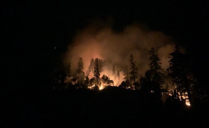
AGNESS, Ore. (KTVZ) -- The Flat Fire that broke out near the southwest Oregon town of Agness just over a week ago has now burned more than 20,000 acres, as burnout operations by some of the more than 1,200 firefighters to slow its spread have also grown the human-caused fire.
Here's the Monday morning update:
Size: 22,066
Start Date: July 15, 2023
Point of origin: 2 miles southeast of Agness, OR
Containment: 3%
Cause: Human caused, under investigation
Total personnel: 1,497
Resources: 40 engines l 36 crews l 8 bulldozers l 26 water tenders l 8 masticators l 8 helicopters
Current Situation: Moderate fire behavior is expected today due to cool weather and slightly higher humidities. The fire continues to be most active in the southwest where it’s burning in the Biscuit Fire scar through thick vegetation and snags and is more moderate in the southeast where the fire is burning within the previous Klondike Fire scar.
Today’s activities: Firefighters are using heavy machinery within an old mining road near Forest Service Trail #1174 in an effort to create a control line to the south of the fire. This was also utilized as a suppression line during the Klondike Fire. The control line starts at Game Lake and heads east, traversing the Kalmiopsis Wilderness at its northern boundary.
Crews have successfully implemented strategic firing operations (burnout) and established control lines along the northern perimeter. Firefighters will continue to assess opportunities and mobilize resources for additional contingency control lines in a proactive manner ahead of dry and windy conditions in the coming weeks. In the northeast, crews plan to continue firing operations followed by mop up and patrol. Resources are being moved around the fire’s edge as work is completed to support firing operations and establish control lines as directly as possible along the fire perimeter. Firefighters plan to use Unstaffed Aerial Systems (UAS) for firing operations in areas that are unsafe to access and will also add depth to control lines.
Evacuations: Curry County is sending evacuation notices utilizing Everbridge. Sign up below https://www.co.curry.or.us/.../emergency.../index.php A Level 2 “Get Set” evacuation notice remains in effect from Agness to Quosatana Creek, Oak Flat, Old House Creek Road, and Spud Road.
Weather: Cool temperatures and higher humidities are expected today.
Smoke: The Smoke Outlooks are available at oregonsmoke.org and airnow.gov
Closures: The Rogue River Siskiyou National Forest has issued a closure order for the fire area including trails, roads, and a portion of the Illinois River. bit.ly/RRSNFClosures
Restrictions: Fire Restrictions are in place fs.usda.gov/rogue-siskiyou
Fire Information:(541)216-4579
Email: 2023.flat.or@firenet.gov
Facebook: facebook.com/flatfireoregon2023
Twitter: twitter.com/FlatFireOR2023
InciWeb: https://inciweb.nwcg.gov/incident-information/xx1002-flat-fire
--
Sunday news release:
Progress Made on Flat Fire Includes a Carefully Considered Decision
Agness, Ore--July 23, 2023-The Rogue River-Siskiyou National Forest, in cooperation with the Pacific Northwest Incident Management Team 3, made a written request to the Pacific Northwest Regional Forester for permission to use heavy equipment in the Kalmiopsis Wilderness for Flat Fire suppression purposes.
The request was approved this morning and fire team operations moved forward with implementation during today’s shift. Firefighters utilized an existing old mining road near Forest Service Trail #1174, which was also utilized as a suppression line for the Klondike Fire. The dozer line starts at Game Lake and heads east, traversing the Kalmiopsis Wilderness at its northern boundary.
The road is located along a ridge (from Game Lake towards Horse Sign Butte) that has minimal to moderate serpentine scrub in combination with rocky, serpentine soils. There will be less impacts by utilizing an existing roadbed versus creating a new disturbance.
“By taking this action, we have an opportunity to check this fire on the south side,” said Acting Forest Supervisor Jake Winn.
This approach reduces risk and exposure to firefighters because the only alternative to utilizing dozer line is to construct handline, which requires considerably more people for a greater amount of time.
In addition, constructing dozer line allows for a REMS (Rapid Extraction Module Support-or off-road medical team) to get in there much more easily in an emergency.
“It can make the difference between life and death in such a challenging environment,” added Winn.
Consequences of not utilizing dozer in the wilderness:
There are minimal viable options to stop the fire on the SSW flank, creating potential for a longer & larger duration fire and associated increased costs.
Increasing the probability of the fire coming into alignment with east winds as the season progresses and potentially putting the communities of Brookings, Hunter Creek, Pistol Creek and Carpenterville at risk.