Crews on Warm Springs Reservation report good progress on 1,249-acre Simnasho Fire, now 40% contained


(Update: Monday morning update)
WARM SPRINGS, Ore. (KTVZ) – More than 120 people working to douse the 1,249-acre Simnasho Fire that broke out Friday on the Warm Springs Indian Reservation now have it 40% contained, officials said Monday morning.
Here's Monday morning's update:
Incident Commander (IC) Gary Sampson is in command of the Simnasho Fire. The Simnasho Fire is located in timber and grasses on the Confederated Tribes of the Warm Springs Reservation about 5 miles west of Simnasho and 2 miles east of Hwy 26. This fire is being managed as a full suppression fire.
Information Websites:
Facebook page “CTWS – Fire Management”
Oregon Smoke Information - http://oregonsmoke.blogspot.com/
Fire App: Watch Duty is free on iPhones
Acreage: 1,249
Containment: 40%
General Updates: The Simnasho Fire’s footprint remains 1249 acres.
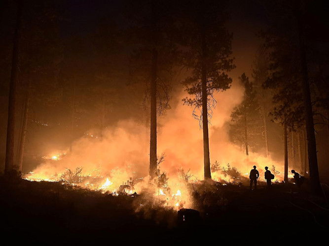
The west, north and Eastern flanks remained solid with firefighters working their way inward with a new goal of 300 feet and addressing hot spots. Crews worked throughout yesterday and evening to maintain the line on the South Flank and there was one more spot fire south of the Warm Springs River during the night that was about 200 square feet. The main area of concern is on the southern flank along the Warm Springs river with 100% mop-up goal and addressing all hotspots because of the spot fire activity the last 2 days.
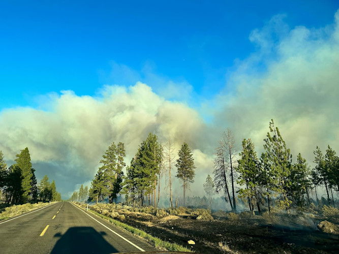
Today the focus will continue to be the southern flank and continuing to watch for spot fires. Firefighters and engine crews will continue the goal to keep it east of Hwy 26, south of Hwy 9, west of Road 450 and north of the Warm Springs River. Fire activity is through grasses and brush with a mix of timbered areas.
Additional resources are still assisting Warm Springs Fire Management including Engine Crews and Hand Crews, and aerial resources. Firefighting resources are prepared to respond to new starts today on the Warm Springs Reservation and surrounding areas.
Weather: Weather will be sunny but with less hot temperatures from 80 to 82 degrees. Winds are from the west from 10 to 15 mph with afternoon wind gusts increasing to 20-30 mph.
Resources: 4 Crews, 11 Engines, 2 Type 2 Dozer, 1 Skidgine, 193 personnel total.
Closures and Evacuations: There are no evacuations at this time. There are no road closures at this time but Hwy 9 is limited to local traffic and fire traffic only. Temporary Flight Restrictions: For the safety of the firefighters and aircraft fighting the Simnasho Fire, wildfires are a “No Drone Zone.”
---
Earlier info:
Warm Springs Police said Simnasho was placed under a Level 2 'Get Ready' evacuation alert Friday night.
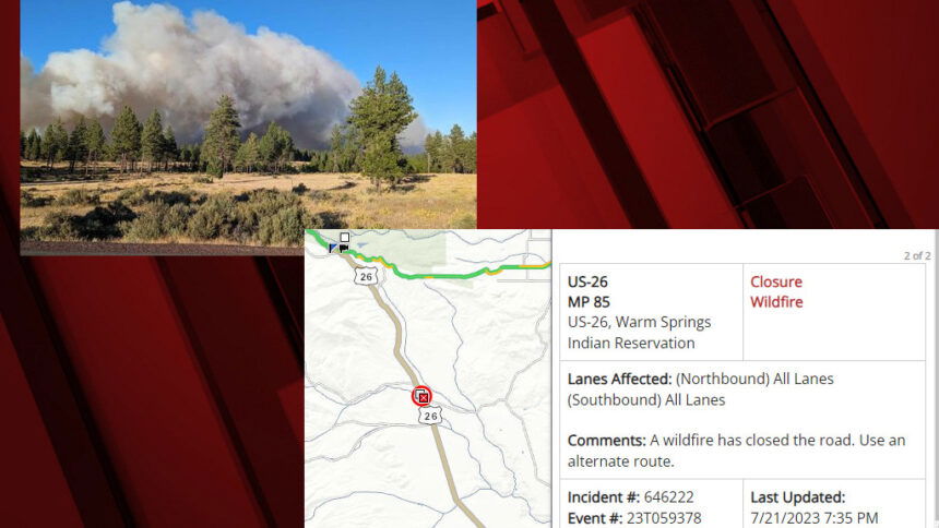
The fire has been held to east of Highway 26, which closed for a time Friday night, south of Highway 9, west of Highway 450 and north of the Warm Springs River, the update said.
The blaze was burning mostly in tall seasonal grasses and bushes, with a mix of juniper and pine trees. Fortunately, officials said, the fire swept mostly through the underbrush an grasses when it was in the area of mature pines.
The Oregon DEQ issued an air quality advisory Saturday for the reservation and Jefferson County, particularly near Madras, due to smoke from the Simnasho Fire.
The fire prompted closure by around 7:30 p.m. Friday of a 25-mile stretch of Highway 26 from the junction with Oregon Highway 216 at milepost 71 to just west of Warm Springs at milepost 96, with detours in place in both directions for over an hour.
ODOT said Highway 26 was reopened by 9:20 p.m., though motorists were advised the fire was still burning in the area and to use caution and watch for firefighting resources and changing road conditions.
Warm Springs radio station KWSO reported the fire began in the area of the water towers along Highway 9, about five miles west of Simnasho, and was moving toward the south-southeast.
Jefferson County Fire & EMS Chief Jeff Blake said a Central Oregon task force of structural engineers was called up and were protecting houses in the area.
