Lookout Fire now at 13,000 acres, 6% contained; Bedrock Fire tops 31,000 acres, N. Calif. fire extends into S. Oregon


(Update: Wednesday updates on Lookout, Bedrock, Wiley Creek, Flat, Smith River Complex fires)
McKENZIE BRIDGE, Ore. (KTVZ) -- Winds cleared out the dense smoke and allowed air operations to resume on the now over 13,000-acre Lookout Fire north of McKenzie Bridge on the Willamette National Forest, now 6%% contained, while the Bedrock Fire grew to over 31,000 acres, at 35% containment -- and the Smith River Complex Fire at the California border prompts Level 2 evacuation alerts in Josephine County.
Here are Wednesday's updates on those and other fires (and you can also find updates on the State f Oregon Wildfires dashboard on our Fire Alert page):
Lookout Fire
August 23, 2023
Morning Update
Size: 13,207 acres
Start Date: August 5, 2023
Cause: Lightning
Containment: 6%
Point of origin: 3 miles North of McKenzie Bridge, OR
Total personnel: 1,213
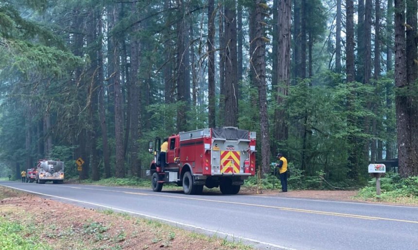
Resources: 72 engines l 23 crews l 14 bulldozers l 31 water tenders l 11 masticators l 6 helicopters
OSFM Resources: 5 task forces assigned to structure protection divisions
A community meeting will be held tonight, Wednesday, from 5:30-6:30 pm at McKenzie River High School. The meeting will be broadcast on the Lookout Fire Facebook page at 8 pm.
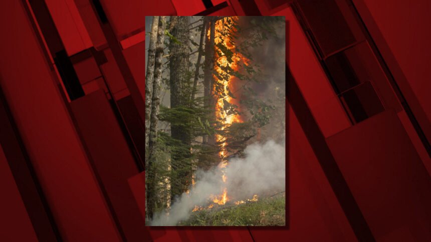
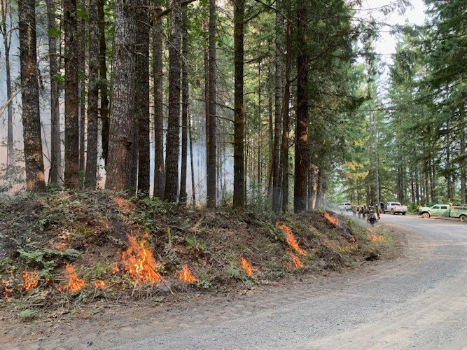
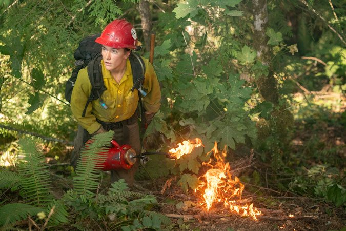
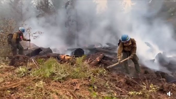
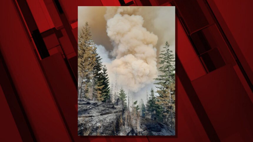
Current Situation: Fire behavior was moderate at the Lookout Fire on Tuesday, with the exception of several spot fires across Deer Creek Road on the fire’s northeast flank. Hand crews and engine crews are making good progress containing the spot fires, assisted by water dropping helicopters.
Gusty winds out of the west cleared out dense smoke lingering over the area yesterday, giving way to clear skies and improved visibility for air operations. A warming trend will begin today, with critical fire weather and a chance of thunderstorms forecast for Thursday.
In the higher elevations along the northwest flank, yesterday’s cooler temperatures and higher humidity inhibited burning operations intended to secure road 2633 (Mill Creek Road). Firing operations will progress in this area today, and along the fire’s southeast flank, in more favorable burning conditions. Above the fire’s northern flank, crews with heavy equipment including bulldozers and masticators are clearing hazard trees and vegetation along roads, preparing for burning operations to prevent the fire’s spread to the north. On the fire’s southern flank, firefighters are progressing with mop-up along the 700 Road, working to the east.
Oregon State Fire Marshal (OSFM) resources are demobilizing this morning and returning to their home agencies. Structural task forces from Clatsop, Tillamook, Lane, Clackamas, Deschutes, Yamhill, and Marion Counties, as well as from California Office of Emergency Services (Cal-OES) responded to this incident. OSFM Task Forces assessed 1023 structures and prepped 560 more for protection while assigned to the Lookout Fire.
The rapid management of this fire would not have been possible without the quick actions of local resources, the support of the community, and the hard work of our response partners. Wildland resources will remain in place, and will continue to provide structural protection, should it become necessary. The local agencies will continue to provide protection to the impacted communities and OSFM resources remain available to return to the area should the need arise.
Evacuation Centers: An evacuation center is moving Westridge Middle School for evacuees and small pets from the Bedrock and Lookout Fires. A large animal shelter is set up at the Lane County Fairgrounds in Eugene.
Evacuations: In Lane County, there is a Level 3 (Go Now) evacuation notice for North Bank Rd., all areas north of Highway 126 between North Bank Rd. and Drury Ln., Mona Campground, Lookout Campground, H.J. Andrews Headquarters and the area west of Highway 126 from Scott Rd. north into Linn County.
There is a Level 2 (Be Set) for areas north of Hwy. 126 west of the .5 mile mark on Mill Creek Rd. to Blue River Reservoir Rd. at the 1501 junction, the areas north of Hwy. 126 east of the .5 mile mark on Mill Creek Rd. to the east end of Taylor Rd, the area south of Hwy 126 to the McKenzie River from the east end of McKenzie River Dr. to the McKenzie River Bridge just east of Taylor Rd, Highway 126 from the Highway 242 junction to Scott Rd, Paradise Campground, FS Rd. 302, Belknap Springs Rd, the area east of Highway 126 from Scott Rd. north into Linn County.
There is a Level 1 (Be Ready) evacuation notice for areas south of Hwy. 126 from Blue River Reservoir Rd. east to the east end of McKenzie River Dr, McKenzie River Dr. and areas directly to the south and east, The area south of Hwy 126 from the McKenzie River Bridge just east of Taylor Rd. to Scott Creek Rd, Belknap Springs Rd. S, Hwy 242 to FS Rd. 220, Yale Ln, Camp Yale Rd, FS Rd. 2643 southeast to the 445 spur.
For Lane County evacuation updates visit: https://www.lanecountyor.gov/cms/one.aspx?pageId=19729054
In Linn County, there is a Level 3 (Go Now) for Olallie Campground, Trail Bridge Reservoir & Campground, and the trail systems and roadways north of the Linn County line, and west of Highway 126, extending north to intersection of National Forest Service Road 730 and Highway 126.
A Level 2 (Be Ready) for the area from the east side of Olallie Campground east to the Willamette National Forest Boundary, north along boundary to Ice Cap Campground and Trailhead, then west to encompass Lakes End Campground and trail system, and south in line with the intersection of National Forest Service Road 730 and Highway 126 (entrance to the Carmen-Smith Hydroelectric facility). Tamolitch Falls/Blue Pool and Smith Reservoir are within this Level 2 (be set) evacuation zone.
Level 1 (Be Ready) evacuation zone for areas north of Ice Cap Campground, extending east to the Willamette National Forest boundary, and north in line with Highway 20. This includes all areas around Clear Lake, and Clear Lake Campground. For current information please see Linn County’s website at: https://www.linnsheriff.org/2023/08/lookout-fire-update-august-17-2023-330-p-m/
Closures: Highway 242, McKenzie Highway, is closed between milepost 61-76, 14 miles west of Sisters, Oregon to just east of the junction with Highway 126. Highway 126 is currently open. Please monitor Trip Check for any updates at: https://tripcheck.com/
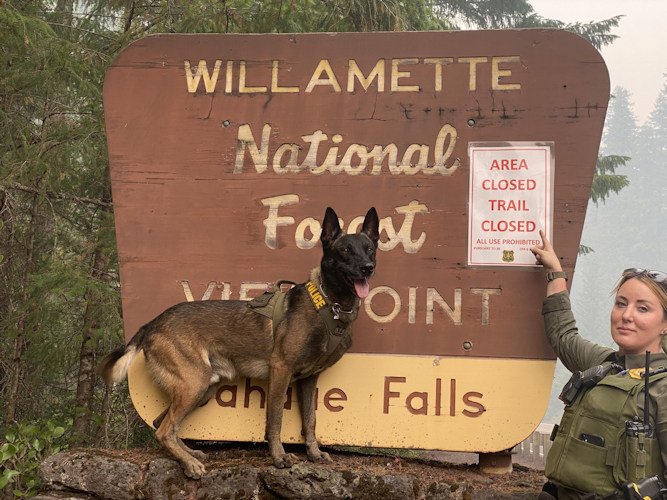
Willamette National Forest closures can be found at: https://www.fs.usda.gov/detail/willamette/alerts-notices/?cid=fseprd552029Restrictions: Fire Restrictions are in place on the Willamette National Forest: https://www.fs.usda.gov/willamette
Smoke Outlook: Available at: https://outlooks.wildlandfiresmoke.net/outlook/4c92bc1a?
Information Line: 541-215-6735 8am-8pm | Email: 2023.lookout@firenet.gov
Facebook: https://www.facebook.com/LookoutFire2023
--
Bedrock Fire
Quick Facts August 23rd
Size: 31,196 acres
Containment: 35%
Start Date: July 22, 2023
Cause: Under Investigation
Origin: Willamette National Forest
Total personnel: 731
Resources: 50 engines; 12 crews; 11 helicopters; 13 dozers, 31 water tenders
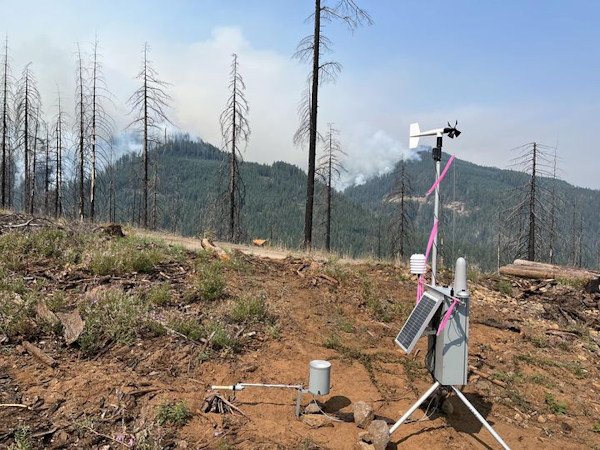
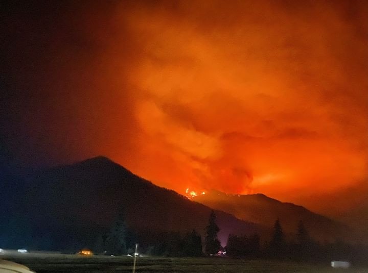
Bedrock Fire: Residents may have observed a large smoke plume in the northwest corner of the fire yesterday. Increased solar radiation and winds from the west contributed to increased fire activity in the areas firefighters were performing burnout operations. Primary containment lines stayed secure, and the fire remained within the perimeter. Crews were prepared to respond if these lines were threatened. Lack of smoke and increased visibility allowed for air operations; helicopters were able to assist firefighters on the ground throughout the day. Incident Commander Jason Loomis said, “Many good decisions are being made at all levels of the organization, resulting in meeting our objectives to limit fire spread.”
Today, warmer, drier weather gradually returns to fire area. As weather conditions remain favorable, firing operations will continue to remove unburned fuels between primary containment lines and the edge of the fire. A smoke plume will likely be visible today with similar weather conditions as yesterday. On contained portions of the fire, crews are increasing the depth of the fire line, and patrolling where lines are confidently secure.
The helicopter base is moving from Oakridge to Creswell because Creswell was determined to have better visibility for our pilots. Air resources are continuing to support all on-ground firefighting activities when visibility allows.
Evacuations: A Level 2 evacuation remains in place on the Bedrock fire. A searchable evacuation map with fire perimeters is on the Bedrock Fire Evacuation Areas (arcgis.com). There is an evacuation center for people and small pets at Lowell High School for evacuees from the Bedrock and Lookout Fires. There is a large animal shelter at the Lane County Fairgrounds in Eugene.
Smoke: The daily West-Central Oregon Smoke Outlook provides a detailed air quality forecast for the Bedrock Fire, as well as other nearby fires. Fire and Smoke Map (fire.airnow.gov/) is another source for air quality information.
Weather: Today’s weather will be comparable to yesterday with a slight increase in temperature, and lower relative humidity levels. Winds will be light out of the northwest. These warm and dry conditions will likely continue into Friday.
Safety and Closures: The Willamette National Forest implemented an Emergency Area Closure to ensure the safety of the public and personnel working on the fire. The closure maps for the Bedrock Fire are available on InciWeb. For information about road closures, please visit TripCheck.com. There is a Temporary Flight Restriction over the Bedrock Fire area.
InciWeb Bedrock:
https://inciweb.wildfire.gov/incident-information/orwif-bedrock-fire
Facebook: https://www.facebook.com/BedrockFire2023/
Fire Information: (541) 414-6272, 8:00 AM – 8:00 PM
Email: 2023.bedrock@firenet.gov
--
WILEY CREEK FIRE DAILY UPDATE
Wednesday, August 23, 2023
Fire Information Line - 541-237-0985
wileycreekfire@gmail.com
Size: 245 acres Location: 9 miles SE of Sweet Home, Oregon County: Linn
Start Date: August 07, 2023 Containment: 75% Cause: Undetermined
Total Personnel: 210
Sweet Home, Oregon — The Wiley Creek Fire under the management of the Southern Area Gray Team remains within the fire perimeter containment lines. There have been a few visible smokes in the fire interior as it creeps and smolders in old growth forest. Crews continue to monitor the fire and ensure containment lines are strong.
Yesterday’s Activities –Resource advisors were out in the fire area working with crews to complete fire suppression repair activities. Operations are still focused on confining the fire to the existing footprint between dozer lines, handline, and existing road systems.
Today’s Activities – Firefighters will continue to actively engage with hot spots as needed. Due to the steep and challenging terrain, crews are watching out for hazard trees, stump holes, flare ups and rolling debris. They are working to minimize impacts to resources with suppression repair activities.
Weather – A high pressure ridge will be building between now and Thursday bringing warmer temperatures and lower relative humidities. Southerly winds and increased moisture aloft will bring a slight chance for showers and thunderstorms Thursday night. Resources are sufficient to hold the fire under these anticipated conditions.
Evacuations - All evacuation levels have been lifted. For more information on evacuations, visit https://www.linnsheriff.org/.
Air quality (smoke) information and maps are always available on https://fire.airnow.gov/, and www.wildlandfiresmoke.net
Know before you go and check for the latest fire closures. The public plays an important role in helping firefighters in the prevention of wildfires by following use restrictions. Currently, there are no campfires of any kind allowed on the Willamette National Forest.
Please help firefighters by following all local regulations, found here: https://www.oregon.gov/odf/fire/pages/restrictions.aspx. Additional wildfire prevention tips are available at www.keeporegongreen.org.
--
Flat Fire
News - 08/23/2023
Size: 34,242 acres
Start Date: July 15, 2023
Point of origin: 2 miles southeast of Agness, OR
Containment: 58%
Total personnel: 443
Resources: 10 crews l 4 helicopters l 16 engines l 3 bulldozers l 17 water tenders l 4 masticators
Highlights: Hot, dry conditions contributed to low rates of fire spread in interior islands of unburned fuels. A small number of torching trees were observed but did not threaten fire lines. Depending on wind direction, smoke may have some limited impact on firefighting efforts and local communities. All firefighting resources remain engaged, patrolling containment lines, and monitoring isolated heat sources on the edge and in the interior. Attention to wind/slope alignment in drainages and ridge-top winds from the NW that could accelerate fire spread is a primary focus. Crews are patrolling and mopping up containment line. Firefighting resources are actively improving all contingency lines at the southern end of the fire with various heavy equipment including engines, dozers, masticators and logging rigs. Several crews have been sent to the Six Rivers National Forest to assist with the Smith River Complex at the Oregon/California border.
Today’s Activities: The objectives for the Flat Fire remain the same with full suppression being the desired end state. Firefighters continue working towards full containment of the fire. Visual assessments of the fire perimeter with ground and/or aviation resources continue. Work is progressing in the interior primarily with helicopters and some engine work depending on access and hazard conditions. Contingency line in the south is complete and line improvement continues. Air resources continue to monitor the fire and remain available to support initial attack efforts and other fires if required.
Weather: Temperatures are warmer and drier than average today. A cooling trend and higher relative humidity is expected to arrive Friday and again slow active fire behavior. The cooling trend will continue into the next week. These conditions should help firefighting efforts. There is a 20% probability of isolated showers or thunderstorms.
Smoke: Smoke may be visible from the surrounding areas. The Smoke Outlook is available at: Current Smoke Outlooks (wildlandfiresmoke.net)
Closures: U.S. Highway 199 has been closed north of Gasquet due to fires on the Six River National Forest, please use U.S. Route 101 to SR 42s for all travel to and from the Rogue Valley. Forest Service and BLM roads should not be used as alternate routes due to emerging fire activity. The Rogue River-Siskiyou National Forest (RRSNF) has issued a closure order for the fire area including trails, roads, and a portion of the Illinois River. Visit https://bit.ly/RRSNFAlerts for more information.
Evacuations: Level 1 “Get Ready” evacuation status in place for areas in the vicinity of the Flat Fire. Link to more information: https://tinyurl.com/currycountyem
Restrictions: Fire danger is currently extreme; the RRSNF is implementing Level 3 Public Use Restrictions. Level 3 PURs on the Wild Section of the Rogue River have been implemented by the RRSF, Medford BLM and ODF. More information: https://tinyurl.com/ueuznr6e\
---
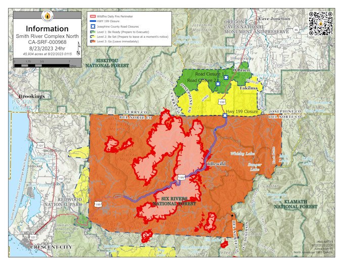
Smith River Complex North update for Wednesday, August 23, 2023
Grants Pass, Ore. – Pushed by gusty winds, the Kelly Fire spread further north into the West Fork of the Illinois River valley yesterday. In response, local firefighters and resources from the Smith River Complex North concentrated on structure protection work around Lone Mountain and Elk, Blue, Dwight, and White Creeks. Protecting structures, powerlines, and resources along Hwy 199 are a high priority for this fire.
Heavy smoke continues to hamper aerial operations. Yesterday, smoke prevented helicopters from dropping water or retardant on the north edge of the Kelly Fire. The smoke also made it difficult to monitor the fire’s spread and exact location using aircraft. Winds from the north are expected today, which should reduce smoke along the north edge of the Kelly Fire. When the smoke lifts, aerial resources are ready to support firefighters on the ground.
Resources assigned to the Complex will assist with initial attack on fires within the Temporary Flight Restriction (TFR) and on the Rogue River-Siskiyou National Forest. Currently assigned resources include seven helicopters for the Complex, nine engines, four crews, and five pieces of heavy equipment for the North, with more on order. With more resources arriving at the fire, the Smith River Complex North has added a night shift. These resources will be working overnight and monitoring the fire vicinity. They can respond quickly if there is an increase in fire activity.
Del Norte County has issued a Level 3 evacuation notice from the Oregon/California border south. Specifics of this closure can be found at https://www.facebook.com/DelNorteOfficeOfEmergencyServices/.
Josephine County has issued a Level 2 evacuation notice along Hwy 199 south of mile post 39 to the California border, and a Level 1 evacuation for the community of O’Brien south of Rough & Ready Creek. For more information and maps, visit the Rogue Valley Emergency Management site at https://www.rvem.org.
The Rogue River-Siskiyou National Forest has implemented an area and road closure order for the Smith River Complex. Visit the forest website for additional information https://tinyurl.com/2s4hymku.
Cooperatively responding agencies include the Rogue River-Siskiyou National Forest, the Oregon Department of Forestry, BLM-Coos Bay District, BLM-Medford District, Josephine County Sheriff’s Office, Josephine County EMS, the Illinois Valley Fire Department and Curry County Sheriff’s Office.
There will be a community meeting on Thursday, August 24 at 6:00 p.m. It will be held at the staging area across from 30159 Redwood Hwy, Cave Junction. The meeting will also be live-streamed on Facebook