More hot, dry conditions help push Crazy Creek Fire to over 48,000 acres, challenging firefighters; 4 miles north of Paulina
(Update: Saturday fire report, map)
PAULINA, Ore. (KTVZ) --The Crazy Creek Fire, now just four miles north of Paulina continues to grow substantially by the day as hot, dry weather brings more extreme fire behavior,
Watch Duty indicated that a perimeter was uploaded to the National Interagency Fire Center (NIFC) from an Infrared flight around 3 a.m. Saturday, showing the fire to be 60,091 acres.
Here's the fire officials' Saturday status map and report, in full:
Firefighters hold northern containment lines, but extreme fire conditions continue to challenge suppression efforts.
Daily Update August 3, 2024
Fire Information Phone: 541-208-1768 (8am-8pm)
Media Information Phone: 541-208-1770 (8am-8pm)
Email: 2024.crazycreek@firenet.gov
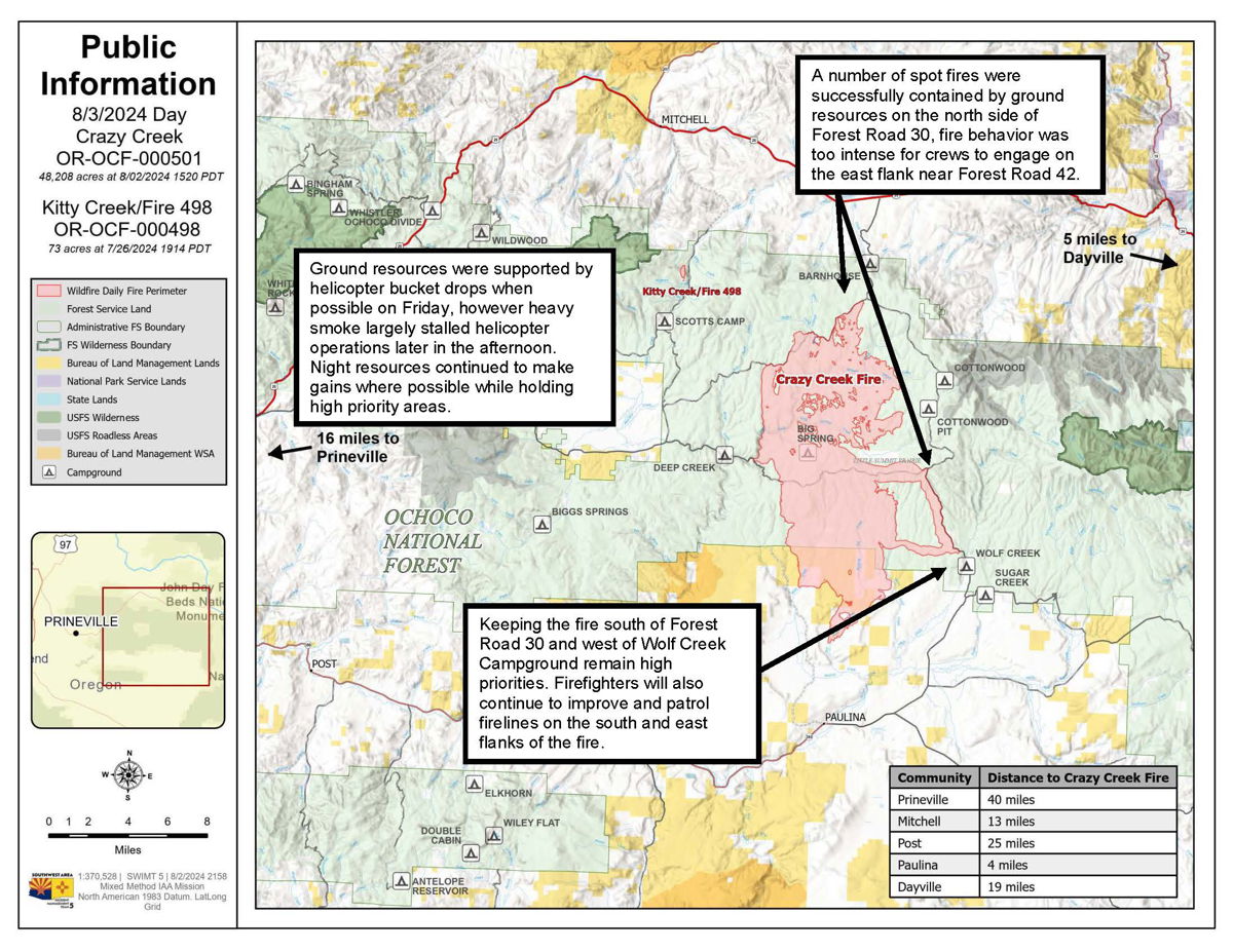
Acres: Crazy Creek – 48,208; 498/Kitty Creek – 73
Acreage changes may occur due to overnight operations and infrared mapping.
Location: Crazy Creek: 5 miles north of Paulina, OR Start Date: July 22, 2024
498/Kitty Creek: 7 miles south of Mitchell, OR Personnel: 622 total for both fires
Containment: Crazy Creek 5%; 498/Kitty Creek 94% Fuels: Timber and short grass
Resources: 15 crews | 29 engines | 9 bulldozers | 12 water tenders | 3 masticator | 13 skid steer
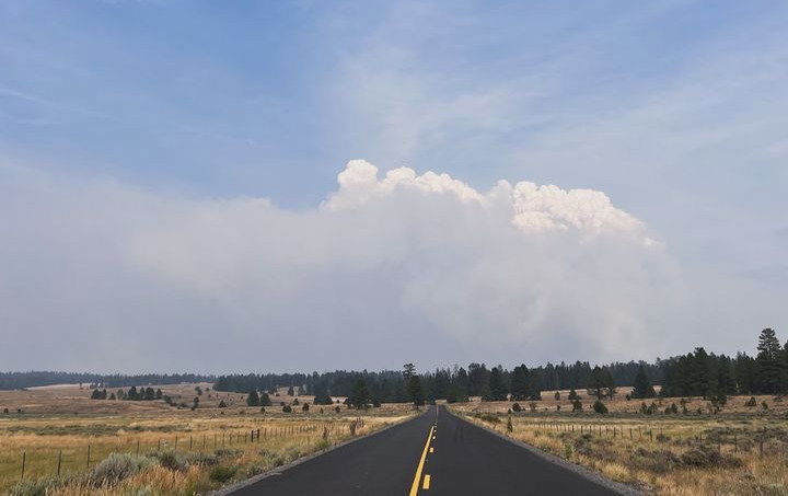
Highlights: Friday’s critically hot and dry conditions resulted in heavy smoke and increased fire activity in the afternoon, primarily on the north and east edges of the Crazy Creek Fire. A red flag warning has been put into effect for today, Saturday, August 3.
Fire Activity: On Friday, extreme fire behavior was observed on the north and east flanks of the Crazy Creek, including crown fires, significant flame lengths and long-range spotting, fueled by a strong south/southwest wind. While number of spot fires were successfully contained by ground resources on the north side of Forest Road 30, fire behavior was too intense for crews to engage on the east flank near Forest Road 42, and the fire made a long run to Wolf Creek Campground in the afternoon. Ground resources were supported by helicopter bucket drops when possible on Friday, however heavy smoke largely stalled helicopter operations later in the afternoon. Night resources continued to make gains where possible while holding high priority areas.
Today, firefighters will continue to hold lines to the north and east while improving existing lines where possible. Keeping the fire south of Forest Road 30 and west of Wolf Creek Campground remain high priorities. Firefighters will also continue to improve and patrol firelines on the south and east flanks of the fire.
Evacuations: Mandatory evacuation orders remain in effect for areas in Crook and Wheeler counties for areas in or near the fire. Level 3 evacuations have extended from the Forest Boundary to Highway 380. Level 2 evacuations have extended south of Highway 380.
Weather: A red flag warning is in effect today, August 3, for the 498/Kitty Creek and Crazy Creek Fires. Critically warm/dry conditions will persist with low humidity and temperatures in the upper 90s. The potential for afternoon thunderstorms could bring high, variable winds over the fire area, and potential for lightning.
Importance of Fire Prevention: All public lands in Central Oregon, to include the Ochoco National Forest are in Stage 2 Public Use (Fire) Restrictions. All open flames, including woodstoves and charcoal briquette fires are prohibited. In times of high fire danger, it is crucial for everyone to follow fire prevention measures to avoid additional strain on overburdened resources. The public's cooperation in adhering to fire bans and restrictions is vital to prevent new fires from starting and to help our firefighters focus on containing the existing fires. Learn more at https://www.fs.usda.gov/alerts/ochoco/alerts-notices/?aid=89068.
Smoke: Smoke from multiple fires in Central Oregon are impacting the region. Additional details available via https://outlooks.wildlandfiresmoke.net/outlook/079f0f73.
Fire Restrictions and Closures: The Ochoco National Forest has implemented a forest closure for the Paulina Ranger District. More information can be found at fs.usda.gov/alerts/ochoco/alerts-notices/?aid=89203. The Bureau of Land Management has issued a temporary closure for public lands in Crook and Grant Counties. More information is available at https://www.blm.gov/sites/default/files/docs/2024-08/orwa-fpo-pri-paulina-080224.pdf.
More Information:
InciWeb: https://inciweb.wildfire.gov/incident-information/orocf-crazy-creek
Facebook: https://www.facebook.com/SWIMT5
Central Oregon Wildfire Information: https://centraloregonfire.org/
Crook County Emergency Information Map: https://arcg.is/1ij0vb