Pacific Northwest to see snow, followed by bitter cold
SEATTLE (AP) — The Pacific Northwest is bracing for a major winter storm with snow expected along the coast, the mountains under a winter weather advisory over the weekend and frigid temperatures expected by early next week.
The Seattle-Tacoma area is likely to see up to 3 inches of snow over the weekend, with a chance of accumulations reaching 6 to 8 inches, according to the National Weather Service.
By early next week, the Pacific Northwest will see temperatures plunge. The Seattle area will dip as low as 18 degrees F (-7.7 C), the lowest in several years. Coeur d’Alene, Idaho, will drop to -5 F (-20 C) by Wednesday.
In Portland in the early part of next week, overnight temperatures will be bitter cold, getting down to the low 20s and high teens.
“Arctic air moving in by the first part of next week, giving us the coldest temperatures we’ve seen in almost 30 years here in western Oregon,” KATU Meteorologist Dave Salesky said.
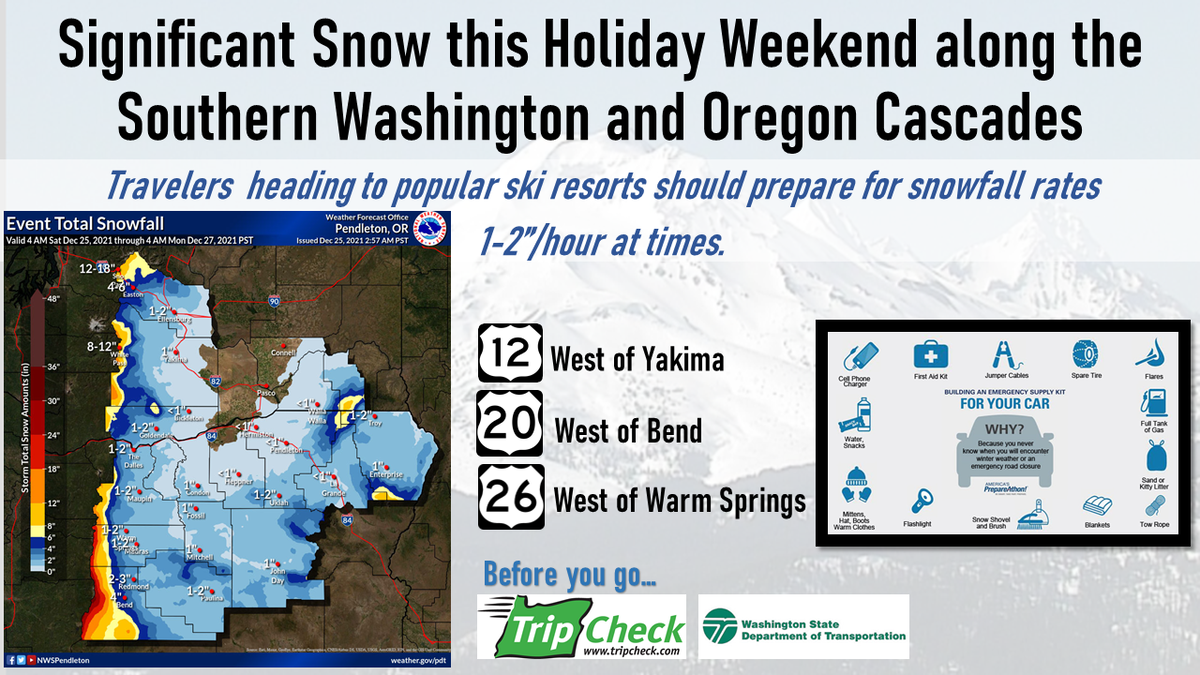
The National Weather Service in Pendleton issued a winter weather advisory for 4 a.m. Sunday to 4 a.m. Monday, predicting 1-5 inches of snow, heaviest near and sout of Bend, with winds gusting up to 35 mph.
"Plan on slippery road conditions," the NWS said. "Slow down and use caution while traveling."
NWS also warned of "dangerously cold temperatures" in coming days across Central and Eastern Oregon as an arctic air mass moves in, dropping lows to single digits and teens Monday through Thursday and wind chills as low as 10 below zero.
With these very cold temperatures, frost bite and hypothermia will occur much faster, forecasters said. If outdoors, remember to dress in layers and cover exposed skin. Uncovered pipes will be susceptible to freezing and bursting.
A slow moderating trend may begin on Thursday, with the potential for wintry weather that will continue into Friday.
The Portland metro area remains under a winter storm warning this Christmas Day, with heavy snow expected in all of western Oregon and southwest Washington Saturday night, The Oregonian/OregonLive reported.
According to the National Weather Service forecast, elevations all the way to the valley floor and to sea level on the Oregon coast will see snow starting Christmas night and into next week. The winter storm warning remains in effect until 7 a.m. Monday.
The National Weather Service is expecting snow accumulations ranging from 2 to 7 inches along the coast all the way to more than 35 inches along the Cascades at the highest elevations. As of early Saturday, anywhere from 2 to 8 inches of snow was expected in the Willamette Valley and Southwest Washington interior lowlands, with generally higher amounts above 500 feet.
