Thanksgiving eve snow keeps roads slick, triggers crashes
Wind-blown snow keeps coming but will taper off by holiday
(Update: Tumalo Road reopens after slide-offs, truck crash)
BEND, Ore. (KTVZ) -- Snow kept falling at a steady clip across much of the High Desert on Thanksgiving eve, causing numerous crashes and slide-offs on area roadways as many pondered or rethought their holiday plans and others got busy shoveling or snow-blowing sidewalks and driveways.
Weather spotters reported 6-8 inches of snow on the ground in the Bend area by late Wednesday morning, 3-6 inches in the Redmond area, 7 1/2 inches at Crooked River Ranch, 6-7 inches in Sisters and La Pine and lesser amounts elsewhere, including four inches in Terrebonne and an inch or two around Prineville and Madras.
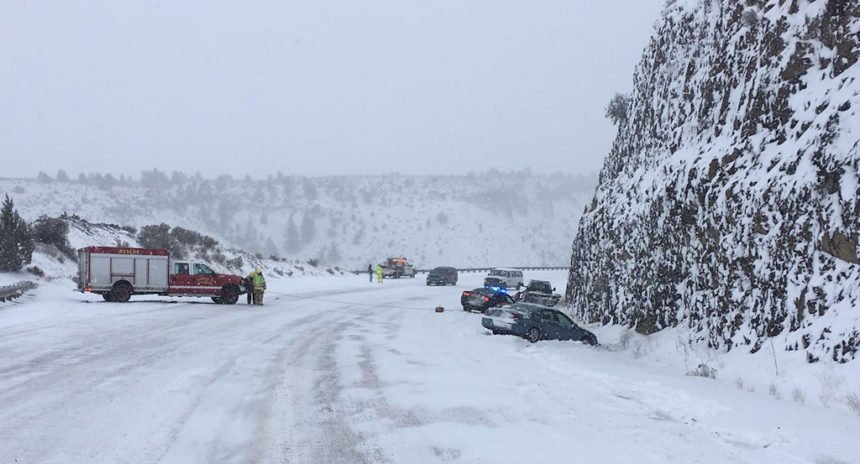
Crashes on snowy roads had police, sheriff's deputies and tow trucks drivers scrambling on Wednesday. Thankfully, most were reported to be non-injury, including one that blocked U.S. Highway 26 about seven miles north of Madras for a time Wednesday morning.
ODOT said state Highway 126 was closed in both directions four miles west of downtown Redmond for a brief time Wednesday afternoon due to several slide-offs and crashes. They urged motorists to avoid the area, if possible.
And Wednesday evening, Deschutes County sheriff's deputies said Tumalo Road between Cline Falls Highway and Swalley Road would be closed for about three hours after a crash involving a large box truck, following an earlier closure due to several vehicle slide-offs. But a citizen's assist got the road cleared much faster, before 7:30 p.m.
Central Oregon's winter storm warning remains in effect until 4 a.m. Thursday, as the National Weather Service predicted 3-5 more inches, for a total from the storm of 4-9 inches, if not more.
The east slopes of the Cascades, including La Pine and Sunriver, also keeps a winter storm warning in place until early Thanksgiving Day, with 3-5 more inches on the way and total snow accumulations of 10-20 inches.
The NWS extended the winter weather advisory for the northern Cascades until 4 a.m. Thursday, predicting another 3-6 inches.
NewsChannel 21 Chief Meteorologist Bob Shaw said the snow showers should subside by mid-morning on Thanksgiving Day, but colder temperatures are also due with late-week clearing, bringing lows in the single digits. Some snow showers are still possible over the weekend, and the chances lessen as the new week begins.
Mt. Bachelor's planned low-snow 'Hopening Friday' has turned into a real opening for Black Friday, as the just-in-tome storm dumped nearly two feet of snow on the slopes. The Little Pine lift will be open for skiers and boarders from 9 a.m. to 4 p.m.
Hoodoo Ski Area near Santiam Pass also got more than a foot of snow and is preparing to open as well.