Winter returns, big-time, to the Cascades, High Desert
Some will measure weekend snowfall in inches - others in feet
The first big blast of winter in 2020 was bearing down on the High Desert on Friday, promising several inches to a foot or more of snowfall in the Bend area and 2-3 feet in La Pine and Sunriver by the end of the weekend, depending on the elevation.
The National Weather Service's winter weather advisory for Central Oregon took effect at 10 a.m. Friday and continues through 4 p.m. Saturday. Forecasters predicted 3-5 inches over the region, with the heaviest accumulation south of Redmond.
But the NWS also said Bend could get 7-15 inches of snow by Monday, with winds gusting to 30 mph Friday and over 20 mph on Saturday.
A winter storm warning is posted for the east slopes of the Cascades, including La Pine and Sunriver, with 2-3 feet of snow expected by Monday morning and winds gusting as high as 50 mph.
A similar warning was issued through noon Saturday for the Cascades, with snow falling "at least 1-2 inches per hour" Friday afternoon to Saturday morning.
After a lean start to winter, with the snowpack about half of average, the "very potent winter weather storm system" promises to make up for at least some lost time -- a big boost to area ski/snowboard resorts -- but create hazardous travel conditions over the passes, NewsChannel 21 Chief Meteorologist Bob Shaw warned.
ODOT also was out Friday with a familiar winter safety message in its news release:
ODOT Advises of Winter Weather Conditions Across State
BEND - Snow, cold, wind and ice may conspire in the days ahead to create extremely hazardous traveling conditions throughout much of the state. Heavy snow in the Cascades and in Central Oregon, high winds and tidal flooding on the Coast, and cold and low elevation snow in the Willamette Valley are all possible over the next week starting today.
ODOT wants travelers to think twice before trying to drive over the mountain passes which are expected to get several feet of snow this weekend. Also, with the predicted snow and ice in the Willamette Valley starting next week, ODOT suggests that travelers not drive in these extreme winter conditions.
If you do drive, use plenty of caution and observe a few common sense rules for navigating hazardous weather conditions:
- Get safely situated. Don’t wait until after a storm hits to get on the road. Get to your destination before conditions turn nasty and unsafe.
- Travel smart. Consider waiting until a storm passes to get on your bike or in your car. Look out for each other. If you must drive, remember cyclists and pedestrians are harder to see in a storm. If you’re biking or walking remember that cars don’t stop quickly on snow and ice.
- Leave early. It’s smart to allow plenty of time to get where you’re going. In severe weather, closures and crashes can cause long delays.
- Check on any appointments you have before you leave. Offices and businesses may close due to the weather.
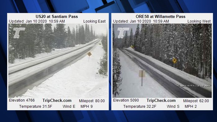
- Know before you go. Plan your route. Visit Tripcheck.com in advance to look at ODOT cameras and check conditions.
- Don’t abandon your vehicle. It prevents us from clearing the road and emergency services from getting to the people who need them.
- Carrying an emergency kit that includes supplies of water and food, and blankets. Have a full tank of gas and charge your phone.
- Beware of outages. If a storm knocks out power to traffic signals, treat intersections like an all-way stop. The driver who stops first goes first.
- Watch for plows. ODOT sand trucks, plows and deicer trucks can’t clear roads clogged with traffic. The more traffic stays off the road, the quicker roads can be treated. Stay at least three car lengths back. Everybody benefits the sooner ODOT can get the road cleared.
In severe weather, ODOT deploys all available tools in its winter arsenal, including plows, sanders, and deicers as appropriate. Crews and equipment have been prepositioned to respond.
As necessary, ODOT crews will be working 12-hour shifts around the clock. If conditions allow, crews will pre-treat roads with de-icer -- magnesium chloride with rust inhibitor – on area roads with plows and sanding trucks on standby for use as needed. Mountain passes are receiving heavy amounts of snow and travelers over higher elevations should be prepared for extreme winter driving conditions by carrying chains and knowing how to use them.
Remember, driving on ice and snow pack is never a safe choice. The safest thing to do is stay off the road.