Crazy Creek Fire now tops 75,000 acres, still 19% contained despite wind, low humidity fanning the flames
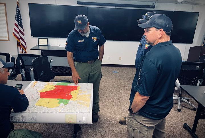
PAULINA, Ore. (KTVZ) -- Wind and "critically low humidity" fueled fire behavior Tuesday on the eastern flank of the more than 75,000-acre Crazy Creek Fire, resulting in spot fires and more challenging conditions for crews, officials said Wednesday.
Wednesday's Crazy Creek Fire update:
Wind and critically low humidity increase fire activity on east flank of Crazy Creek Fire
Daily Update August 7, 2024
Fire Information Phone:541-208-1768 (8am-8pm)
Media Information Phone:541-208-1770 (8am-8pm)
Email: 2024.crazycreek@firenet.gov
Acres: Crazy Creek – 75,024; 498/Kitty Creek – 73
Acreage changes may occur due to overnight operations and infrared mapping.
Location: Crazy Creek: 5 miles north of Paulina, OR Start Date: July 22, 2024
498/Kitty Creek: 7 miles south of Mitchell, OR Personnel: 645
Containment: Crazy Creek 19%; 498/Kitty Creek 100% Fuels: Timber and short grass
Resources: 15 crews | 1 helicopter | 28 engines | 15 bulldozers | 14 water tenders | 3 masticators | 23 skid steers
Highlights: Critically low humidity fueled an increase in fire behavior across the eastern flank of the Crazy Creek Fire in the afternoon Tuesday, resulting in numerous spots across the line and challenging conditions for firefighters.
Fire Activity: Fire behavior increased Tuesday as conditions tip-toed around red flag territory, resulting in spots across lines on the east flank of the fire and a notable increase in fire behavior along Forest Service Roads 12 and 5810. While these spots were quickly contained by firefighters with assistance from aircraft, the fire’s movement in this area continues to present challenges in the steep, complex topography and thick vegetation present in the Wolf Creek drainage. Critical conditions combined with tough topography may challenge containment in this area, but crews have completed extensive structure protection measures where needed and are prepared to conduct strategic firing operations if conditions require.
Today, crews will continue to explore containment options on the southeast corner of the fire. Elsewhere around the fire—including on the south, west and northwest perimeters—firefighters will perform mop-up to knock down remaining hot spots, followed by holding, patrolling and monitoring where fire behavior has moderated.
Evacuations: Mandatory evacuation orders remain in effect for areas in Crook and Wheeler Counties for areas in or near the fire. Level 3 evacuations have extended from the Forest Boundary to Highway 380. Level 2 evacuations have extended south of Highway 380. For further information, please refer to the Crook County Office of Emergency Management evacuation map, linked at the bottom of this update.
Weather: Critically hot, dry weather will persist today, with slightly moderated winds out of the northwest at 10 mph and gusts to 20 mph.
Importance of Fire Prevention: All public lands in Central Oregon, to include the Ochoco National Forest are in Stage 2 Public Use (Fire) Restrictions. All open flames, including woodstoves and charcoal briquette fires are prohibited. In times of high fire danger, it is crucial for everyone to follow fire prevention measures to avoid additional strain on overburdened resources. The public's cooperation in adhering to fire bans and restrictions is vital to prevent new fires from starting and to help our firefighters focus on containing the existing fires. Learn more at https://www.fs.usda.gov/alerts/ochoco/alerts-notices/?aid=89068.
Smoke: Smoke from multiple fires in Central Oregon are impacting the region. Additional details are available via https://outlooks.wildlandfiresmoke.net/outlook/079f0f73.
Fire Restrictions and Closures: The Ochoco National Forest has implemented a forest closure for the Paulina Ranger District. More information can be found at fs.usda.gov/alerts/ochoco/alerts-notices/?aid=89203. Bureau of Land Management has issued a temporary closure for public lands in Crook and Grant counties. More information is available at https://www.blm.gov/sites/default/files/docs/2024-08/orwa-fpo-pri-paulina-080224.pdf.
More Information:
InciWeb: https://inciweb.wildfire.gov/incident-information/orocf-crazy-creek
Facebook: https://www.facebook.com/SWIMT5
Central Oregon Wildfire Information: https://centraloregonfire.org/
Crook County Emergency Information Map: https://arcg.is/1ij0vb
