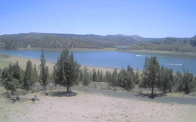
‘A long walk to get to the water’: Prineville Reservoir visitors warned of low levels

These low levels usually aren't seen until late in the year
PRINEVILLE, Ore. (KTVZ) —Visitors should plan for unusually low water levels on Prineville Reservoir this summer, the Oregon Department of Parks and Recreation, federal Bureau of Reclamation and Oregon Marine Board announced Friday.
The reservoir is more accessible for small watercraft, such as canoes, kayaks, paddle boards and inflatables. Officials warn the ramp slope and drop-off pose a risk to trailered motorboats for safe launching and retrieving.
“We don’t typically see water levels this low until November or December,” said Prineville Reservoir State Park Manager Chris Gerdes. “It’s going to be a long walk to get to the water.”
Low water levels also mean fewer places to launch a boat. The boat ramps at Powderhouse Cove and Jasper Point are closed, and only one lane of the boat ramp in the main day-use area at Prineville Reservoir is open.
The Roberts Bay East and County boat ramps are open, but only safe for small, non-motorized watercraft to launch.
At Prineville Reservoir State Park, visitors will notice the swimming area is no longer protected by floating docks. “We had to remove them when the water level dropped so low. The usual swim area is dry, exposing the rocks and muddy bottom beneath,” Gerdes said.
Low water levels also have limited availability of potable water in the Prineville Reservoir campground. Campground showers are on limited hours, and the flush restroom facilities in the day-use area are closed (vault toilets available). If the water shortages continue, park officials may need to close additional flush restrooms and showers and limit water to RV sites.
The reservoir is about 40% full due to severe drought conditions in central Oregon. Gov. Kate Brown declared a drought emergency in Crook County on May 5.
Planning resources are available on the Marine Board’s website for reservoir water levels and an interactive boating access map.


