Fires update: Warmer, drier weather, wind shift may test lines, send up smoke
(Update: Adding ODOT note of another daily pilot car on Hwy. 22E)
A return of warmer and drier weather, with a shift to easterly winds, could test some fire lines on the large blazes still burning around Oregon in coming days, also burning unburned areas within perimeters, but fire managers still see good progress being made.
Here are Sunday's updates:
Lionshead Fire Update
Sunday, September 27, 2020 – 10 a.m.
Firefighters Anticipate Warming & Drying Weather
Special Notes: This will be the last update prepared by the Rocky Mountain Area Type 1 Incident Management Team. Pacific Northwest Incident Management Team 13 will assume command of the fire this evening at 8 p.m.
Current Situation:
Work on the Lionshead Fire is proceeding well. Overnight, there was good moisture recovery, but the cool wet weather of the past few days is expected to be replaced today by a warming and drying trend. Shifting winds are also possible. This could result in a slight increase in fire behavior. Winds will likely be out of the east. The changing wind direction could test control lines in some new places. With the drying trend, there could be some fire movement, but a more likely scenario is for most fire activity to continue primarily in green, interior islands.
The high winds yesterday tested some areas of the fire that had been inactive, but the control lines passed that test. There was interior burning, but no fire spread. The acreage remained the same as it was on Friday, but containment increased to 34%. The more immediate problem was the need to pull crews and equipment back momentarily in areas where the windy conditions presented a danger due to hazard trees falling.
Firefighting Efforts by Division:
Very little movement has occurred on the north edge of the fire in Division A over the past several days. As weather allows, firefighters will continue their work to secure the fire’s edge and reinforce the contingency line to the north. Firefighters will be watching for deep burning stumps and underground holes during mop up operations.
In Division E, G, K, and south to N, firefighters are working on mopping up hot spots along the fire line and doing more chipping.
The fire is still hung up in the lava fields in Divisions R but is not spreading there. The contingency line on Road 12 is substantially complete, but hazard tree removal continues. In Division S, chipping operations will also continue today. The long straight portion of control line has held for several days and crews continue to work direct on the fire’s edge where possible. Hazard tree removal continues along the 22 Road.
On the southern part of Division T, crews continue work to improve direct handline. Indirect line is also being constructed. Work continues in the Idahana and Detroit areas, with hazard tree work a priority. Additional control line has been added in the Stahlman area. The Structure Group will be working at Stahlman today.
In conjunction with Beachie Creek and Riverside fire managers, Division W remains closely monitored, but is still unstaffed due to difficult, unsafe terrain.
The long narrow finger in Division Y traverses some very steep rugged country. Firefighters are still looking for direct or indirect control opportunities. The spot fire areas at the north end of the finger have been extensively worked, with special emphasis east of the 46 Road. Fuel breaks and other indirect line preparation continues, and considerable heavy equipment will be working on the 46 Road. This road remains closed to the public. Crews continue to search for opportunities to work directly on the fire perimeter, as the terrain allows, throughout these divisions.
There were no flights made on Saturday, due to windy conditions. Expect an increase in flights and bucket work if wind continues to decrease.
Weather & Fuel Conditions: Scattered showers brought a little rain to the fire on Saturday, but today decreasing cloud cover and patchy morning fog could usher in a temperature rise into the 60s. Tonight, expect temperatures to stay relatively warmer, increasing the drying trend. The wind is expected to shift to out of the east. Monday’s outlook is predicated to be warmer with highs in the 70s.
Closures and Evacuations: The evacuation levels around Detroit, Idanha, and the Elkhorn community along North Fork Road have been reduced to a Level 2 – “Be Set” evacuation level. While residents have been able to return to these communities under strict safety conditions, many hazards remain. Due to the remaining hazards in the cities of Detroit and Idanha and lack of basic services, people who are not residents should avoid travel to this area. The Marion County Sheriff’s Office continues to coordinate with partner law enforcement agencies to maintain an enhanced presence in the Detroit and Idanha communities as residents return to the area.
Community members who reside in Linn County may find up to date information at www.LinnSheriff.org. A map of evacuations in Marion County is available here. There are no longer any evacuation notices for the Sidwalter/Miller Flats areas of the Warm Springs Reservation.
Roads and trails near the fire remain closed for public safety. The 12 Road and the 46 Road will remain closed to the public for the near future. This includes roads and trails on the Confederated Tribes of Warm Spring lands adjacent to the fire and the Pacific Crest Trail in the Deschutes National Forest. The Willamette National Forest, Bureau of Land Management, and State lands around the fire remain closed to the public. Go to InciWeb.gov for more information about closures in the area. Deschutes NF Alerts Willamette NF Alerts Mt. Hood NF Alerts.
Temporary Flight Restrictions: A Temporary Flight Restriction is in place over the Lionshead Fire and surrounding fires. Wildfires are a No Drone Zone. If you fly, we can’t. Whenever a drone is spotted near the fire all aircraft are grounded until we can be sure the drone is clear of the area. For more information, visit knowbeforeyoufly.org.
| Lionshead Fire Statistics: Size: 204,340 acres Containment: 34% Total Personnel: 1,436 Location: 14 miles west of Warm Springs Reported: 8/16/20, approximately 8:44 p.m. Cause: Lightning | For More Information: Information Office: 971-277-5075, 8 a.m. to 8 p.m. Media Inquiries: 541-904-0542 Email: 2020.lionshead@firenet.gov InciWeb: https://inciweb.nwcg.gov/incident/7049/ You Tube: http://www.youtube.com/channel/UCHSR6_yJRQkHyGjvvqX99gw Facebook: facebook.com/LionsheadFire |
ODOT alert - Sunday:
The Oregon Department of Transportation is adding an additional pilot car to the schedule for OR 22E through the Santiam Canyon starting tomorrow. On Monday, ODOT will be piloting vehicles from Detroit to Gates at 7:30 a.m. This is to help those residents who are spending the night in their communities. ODOT has been piloting cars to and from Detroit and Idanha since Friday. Pilot cars are scheduled twice daily but will now add the additional pilot car. The number of work zones where we are removing hazardous trees require that pilot cars be used to safely get resident to and from their communities.
BEACHIE CREEK FIRE UPDATE – September 27, 2020
Acres: 192,838 acres
Percent Containment: 56%
Start Date: August 16, 2020
Cause: Under Investigation
Origin Location: Opal Creek Wilderness: two miles south of Jawbone Flats, six miles north of Detroit
Flights: Temporary Flight Restriction on east side
Resources: 628
Fuels: Timber and logging slash
Firefighters transition to rehabilitation tasks, monitoring - but mission not over
Residents Advised that Wind Shift Results in More Smoke
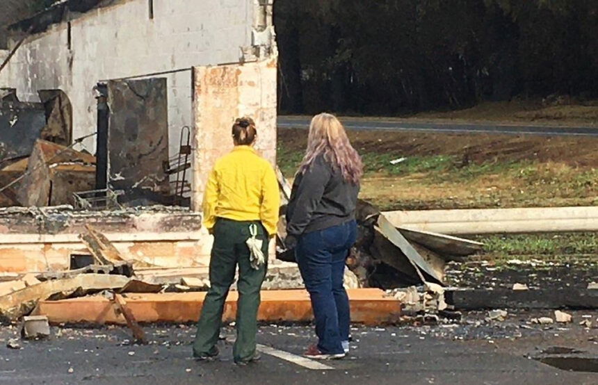
Salem, Ore. – Sunday’s weather brings much drier air and pushes winds from the north to the south. This means residents just returning to their homes along the Highway 22 corridor will see and smell more smoke. This is not new fire; it’s a shift of wind direction. There is no need to call 911; each call takes firefighters away from their work. There has been no new fire growth from the current footprint, only interior tree stumps are smoldering. Creeping and smoldering will continue; smoke will continue, but communities are protected.
With the Beachie Creek fire 55 percent contained – especially around communities – firefighters turn attention Sunday to monitoring the fire edge and ensuring any hot spots are destroyed. Rehabilitation on federal lands includes crews removing hose and pumps and clearing debris. Excavators and other types of heavy equipment are being used to finish direct and indirect lines, with a focus east of the Silver Falls State Park. On private and state lands, the Oregon Department of Forestry conducts repairs which entail water bars and fixing fences cut during suppression. Engines will be used to patrol and mop up areas of heat and hazard trees adjacent to private property and associated infrastructure.
In the coming weeks, warmer weather, low humidity and winds will dry small sticks and organic material which, if next to burning tree stumps, could ignite and creep inside of the fire’s boundary in the northeast, towards the Bull of the Woods Wilderness. These heat sources will continue to smolder, and smoke will remain within the perimeter for weeks, but not affecting the perimeter.
There is a lot of work going on around the Beachie Creek fire and property owners are repopulating the area. It is imperative to drive slowly and defensibly.
The Marion and Linn County Sherriff Offices continue to evaluate and lower evacuation levels; check updates on their websites:
- Marion County Sherriff’s website / evacuation maps: https://marioncounty.maps.arcgis.com/apps/webappviewer/index.html?id=5202b602f99647b9a16d488c545113b5
- Linn County Sheriff’s website here: https://linngis.maps.arcgis.com/apps/webappviewer/index.html?id=56668b1f57cf4bec9be88420a37e1183
The Willamette National Forest, Bureau of Land Management, and State lands around the fire remain closed to the public. Go to InciWeb.gov for more information about closures in the area.
| Public Contact Information: https://www.facebook.com/BeachieCreekFire2020 Email: 2020.beachiecreek@firenet.gov Phone: 541-583-0526, 8 a.m. to 8 p.m. | Inciweb https://inciweb.nwcg.gov/incident/7001/ Smoke and Air Quality http://oregonsmoke.blogspot.com/p/air quality-now.html https://wildlandfiresmoke.net/outlooks |
Holiday Farm Fire Information
September 27, 2020
Springfield, Ore. – With containment reaching 50 percent, firefighters on the Holiday Farm Fire are once again preparing for another change in the weather.
After days of wetting rain and cool temperatures, warm and dry east winds will enter the area later today pushing temperatures into the mid 80’s through Wednesday. Fire managers are cautiously optimistic that work accomplished so far will result in similar results from the last time these conditions tested control lines just four days ago. That east wind event fanned flames and stirred up embers deep inside the fire’s interior, but did not create any problems outside established containment lines.
The incident management team and local fire agencies are receiving several inquiries regarding small columns of smoke coming out of the Holiday Farm Fire that appear to be outside containment lines. Please be assured that these “smokes” are well within the perimeter of the fire and pose minimal threat to crossing containment lines or threatening homes.
Over 500 firefighters are still working on the fire, gridding areas and extinguishing hot spots. Reconnaissance helicopters and engine patrols are also being used to monitor the fire area throughout the day, and should something of concern flare up, suppression helicopters are still available to respond at a moment’s notice.
These small columns of smoke within the interior of the fire could continue to be visible well into the winter months, but again, pose no threat. Please do not report these smokes to emergency services as they overload the system and create unnecessary response.
Hazard tree and debris removal will continue along Highway 126, but local motor vehicle traffic will be allowed through with a pilot car along a 10-mile stretch between mileposts 28 and 38.
For more information regarding road closures and delays, visit https://www.oregon.gov/odot/Pages/Wildfire.aspx or www.tripcheck.com.
Estimated Size: 173,094 acres
Containment: 50%
Start Date/Time: 9/7/2020 8:20 p.m.
Expected
Containment Date: 10/29/2020
Location: Lane County
Cause: Unknown
Personnel: 742
Assigned Resources:
Hand Crews: 17
Engines: 52
Dozers: 18
Water Tenders: 8
Other Heavy
Equipment: 3
Assigned Aircraft: 4
Structure Task Forces: 0
Firefighter Injuries: 6
Structures
Threatened: 0
Structures Destroyed
Residences: 431
Non-Residential
Commercial: 24
Evacuations: Not in Effect
BRATTAIN FIRE UPDATE
September 27, 2020 @ 2 PM
Overview:
Most divisions on the Brattain Fire have been combined, and most tactical resources have been released to their home units or states or reassigned to other more critical incidents. Remaining divisions are focused heavily on patrolling and scouting additional repair work since mop up operations are mostly complete. Fire activity is minimal and is expected to remain so. The suppression repair group is working with the host unit to identify and prioritize the needed work, resources and equipment required to best accomplish repair and rehabilitation. A long-duration dry and very warm pattern returns today and is expected to last through the week. Final transition of the Brattain Fire takes place on Monday, September 28, with the Fremont-Winema National Forest Paisley Ranger District resuming command at 0700 Tuesday.
Fire Suppression Repair/Rehabilitation:
Wildfires cause complex problems from water quality, loss of vegetation and soil stability, and loss of habitat and cultural resources. Identifying post-wildfire threats to human life and safety, property and critical natural and cultural resources is a top priority for public land managers. Restoring pre-fire conditions is not always possible, but the primary goal of suppression repair is to minimize long-term impacts caused by personnel and equipment over the course of fire suppression activities.
On roads and dozer lines within the Brattain Fire area, crews and special resource teams are constructing water bars to ensure proper drainage, grading roads and firelines to minimize impacts to vehicles, and pulling in berms and woody debris developed in the construction of fire lines. In areas where dozer lines were driven on by vehicles, resource advisors are determining whether areas need to be tilled to reduce soil compaction. Blocking and/or camouflaging interior lines from intersections discourages future motorized use, thus increasing public safety.
Ditches and road drainage features are affected by fire suppression activities, so Brattain Fire crews are actively cleaning out debris and other drainage blockages as they work their way down firelines. Often, signs, gates and barriers are damaged by fire or burnout activities, creating public safety concerns. In the Brattain Fire area, these are being inventoried and will require repair/replacing.
Special Considerations:
Know before you go! Hunting season has started in the area, and hunters are urged to recreate safely. Before heading out, check with your local Forest Service or BLM office to confirm closure orders, fire use restrictions, and other safety or legal considerations. Ensure your vehicles and trailers are properly maintained. Sparks thrown from improperly maintained vehicles or trailers can cause devastating fires without the knowledge of the driver.
Forest Closure:
From Forest Road 29 southeast to Forest Road 3510 and the 28 Road east, all National Forest System lands and facilities are closed per Forest Closure Order 06-02-03-20-03. Forest Road 3315 is closed.
Summary:
The Brattain fire started on September 7, 2020, on the Paisley Ranger District of the Fremont-Winema National Forest. Firefighters have battled winds, extremely dry conditions and shortages of firefighting resources.
SIZE: 50,951 acres
CONTAINMENT: 95%
CAUSE: Human
PERSONNEL: 184
FIRE INFORMATION:
541-947-6243
INCIWEB:
inciweb.nwcg.gov
search “Brattain Fire”
Facebook:
facebook.com, search:
Fremont-Winema National Forest @R6FWNF
South Central Oregon Fire Management Partnership @SCOFMPFIREINFO
Twitter:
Fremont-Winema National Forest @fremontwinemanf
South Central Oregon Fire Management Partnership @SCOFMPFIREINFO
EVACUATIONS:
No active evacuations.
SAFETY:
Hwy 31 is open but be mindful of emergency response traffic.
Temporary Flight Restrictions are in effect. Avoid drone use and report drones to law enforcement.
