Rain, cooldown benefit crews battling Oregon wildfires, but still more work to do
OAKRIDGE, Ore. (KTVZ) -- The weekend cooldown and rainy weather -- up to three inches in places -- assisted hundreds of firefighters still battling some large fires around Oregon, but officials said it will take more to end the blazes.
Here are Sunday's updates on the Middle Fork Complex, Cougar Peak and Bull Complex fires:
Middle Fork Complex Daily Update – September 19, 2021
Northwest Incident Management Team 6
Shawn Sheldon, Incident Commander
Phone: 425-324-1267 (8am-8pm)
Email: 2021.middlefork@firenet.gov
InciWeb: inciweb.nwcg.gov/incident/7745
Facebook: facebook.com/MiddleForkComplex
Twitter: twitter.com/willametteNF
Size: 30,761 acres Origin/Location: North of Oakridge, OR
Contained: 43% Date/Time Detected: July 29, 2021, 2:00 p.m.
Number of Personnel: 622 Cause: Lightning
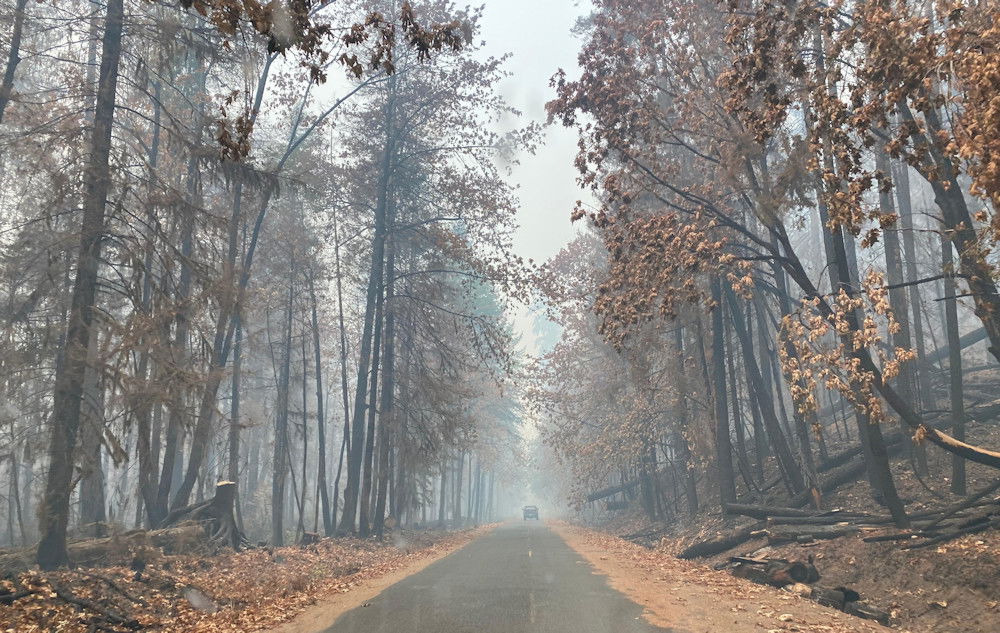
Westfir, OR – Crews spent yesterday monitoring the fire; minimal fire behavior was reported. The fire received anywhere between 1.6 to 3 inches of rain from yesterday until this morning. Even with the increase in moisture from heavy rains, heat will remain in the heavy fuels, large diameter logs, and burned root systems. Firefighters will continue to mop up and improve lines today, where safely possible. Crews will address a small area near Drop Point 55 that crossed the fireline probably occurring Friday evening before the rain.
Weather: Expect scattered rain showers continuing through today, tapering off by Sunday evening. Fire behavior will be limited to isolated pockets of heat and heavy fuels smoldering with no movement or perimeter growth expected today.
Smoke: Although fire activity will be minimal, heavy, critically dry fuels will continue to smolder and consume, and smoke will continue to be generated. To what degree air quality is impacted will depend on location and, how much smoke is generated, and where winds will take it. Widely scattered small pockets of heavy fuels smoldering shouldn’t result in large amounts of smoke accumulation.
Safety: Be aware of wet roads and fire equipment traveling on roadways. Unpaved roads in the areas that received heavy rains are muddy, and travel on them is expected to cause extensive damage to the road and present safety hazards for any driver. Always drive with your headlights on and maintain extra distance between vehicles.
Closures: Some National Forest Systems lands near the Middle Fork Complex fires are temporarily closed to provide for public safety. Please be sure to check current conditions before planning your trip to the Willamette National Forest. More here: https://www.fs.usda.gov/alerts/willamette/alerts-notices
Cougar Peak Fire Update
Northwest Incident Management Team 8, Incident Commander Kevin Stock
September 19, 2021
Lakeview Ore. – The weather event predicted for the past several days moved over the fire yesterday. Up to one-third of an inch of rain fell on the fire, dampening exposed fuels and reducing fire intensity. However, it was not enough moisture to keep the fire from continuing to burn. In the afternoon, the southwest corner of the fire had a spot fire that firefighters stopped at one-tenth of an acre. Large drought-stricken trees and fuels under thick canopies continued to feed the fires through the afternoon.
As the rain subsided in the afternoon, crews were cautious of working in the heavily timbered areas, as fire and drought weakened trees fell across the fire lines and roadways.
Mop-up on the eastern side of the fire continued all day. Crews continued progress on containment line work. From the south end up the east side of the fire around to the north end, crews completed 25-100 feet mop-up. This work secured containment lines and allowed for an increase in the percentage of containment. In many spots, firefighters could control the fire and clear out underbrush and light fuels on the ground without any tree mortality. Crews will be patrolling for hot spots and preparing unneeded equipment for back-hauling.
Today, crews will continue efforts on the western fire edge, working to secure more containment lines. The light rain forecasted throughout the day will allow firefighters to do direct line construction on the fire.
Weather permitting, air assets are available to assist the ground crews today. While the eastern edge has been tested with the winds the last few days, there are still some areas of concern that crews will continue to monitor and, if needed, aggressively attack any spot fires or hot spots.
Behavior: As the lighter fuel models dry out, wind conditions could support spotting distances of .4 miles. This morning's precipitation and high relative humidity will reduce fire behavior drastically. Fire will be isolated in burning heavy fuels, stump holes, and duff under thick canopy.
Today's Operational update, by Operations Section Chief Rod Bonacker, can be found on the "Cougar Peak Fire 2021" Facebook page.
Acreage: 90,614
Containment: 41%
Cause: Undetermined
Fire Information: (541) 900-5788 (8:00 am to 8:00 pm) E-mail: 2021.cougarpeak@firenet.gov
Information websites:
Facebook: "Cougar Peak Fire 2021"
Inciweb: https://inciweb.nwcg.gov/incident/7835/
Air Quality: oregonsmoke.blogspot.com
Weather: Isolated showers are expected mainly before noon. Only a few more hundredths of rain is expected. Otherwise, cloud cover will gradually diminish through the afternoon. Cool and stable conditions are expected over the fire area today, with highs only reaching the 50s in valleys. Gusty southwest ridgetop winds will slowly diminish through the day, becoming northwest by 6 PM. Relative humidity will remain above at least 30% across the area this afternoon after excellent recoveries this morning. Relatively calm and cold conditions are forecasted tonight, with a hard freeze possible in sheltered valleys and Goose Lake Valley.
Resources-1226: 3 - type 1 hand crews, 5 - type 2 IA hand crews, 27 - type 2 hand crews, 4 - camp crews, 3 - heavy-lift helicopters, 2 - medium-lift helicopters, 2 - light lift helicopter, 47 - engines, 20 - dozers, 32 - water tenders, 2 – masticators, and 10 - skidgines.
Evacuations: We are anticipating the Lake County Sheriff's Office evacuation levels to change. There will still be Level 1, Level 2, and Level 3 evacuations in and around the Cougar Peak Fire. For further information please see:
Lake County website https://www.lakecountyor.org/index.php
Lake County Facebook https://www.facebook.com/Lake-County-Oregon-104435824529906
and an interactive map: https://tinyurl.com/InteractiveEvacMap
Temporary Flight Restrictions: A Temporary Flight Restriction is in place over the Cougar Peak Fire.Please consult the Notice to Airman for specifics.
Wildfires are a No Drone Zone. If you fly, we can't. Whenever a drone is spotted near the fire, all aircraft are grounded until we can be sure the drone is clear of the area. For more information, visit http://knowbeforeyoufly.org.
For the latest restrictions and regulations, including Oregon Department of Forestry and federal agencies,visit https://scofmp.org/restrictions.shtml. Make sure to Know Before You Go.
While most of Oregon had some wetting rain yesterday, it was not enough to be a season-ending event for wildfires. The trees and even the grasses are still extremely dry. The chance of ignition on most fuel models is still around 70%. Please don't park a vehicle on dry grass. Check ahead of time for permitted activities if you plan to be in recreation areas.
Bull Complex Update for Sunday, September 19, 2021
| Cause | Lightning |
| Date of Origin | Monday August 02nd, 2021 approx. 12:00 AM |
| Location | 12 miles NE of Detroit, OR |
| Incident Commander | Brian Gales, Northwest IMT13 |
| Incident Description | Complex |
| Coordinates | 44.879 latitude, -122.009 longitude |
Current Situation
| Total Personnel | 440 |
| Size | 22,432 Acres |
| Percent of Perimeter Contained | 15% |
| Estimated Containment Date | Saturday October 30th, 2021 approx. 12:00 AM |
RIPPLEBROOK, Ore. -- Firefighters took advantage of the rain and cooler temperatures yesterday to patrol and monitor for hot spots near the fire line. Additionally, firefighters removed vegetation near the fire perimeter to reduce the chance of fire spread. Today, firefighters continue to establish containment line on the northwest side of the Bull Complex. This plan will allow the fire to stay in a smaller footprint.
Following yesterday’s heavy rain, firefighters are assessing the fire today to see where it is most active in order to make the most strategic and effective plan over the next few days. Additionally, firefighters are mitigating erosion from the rain by cleaning ditch lines.
Heavy equipment will repair washed out roads and help maintain culverts on forest roads. Travel may be difficult in the coming days as heavy rains impact forest infrastructure.
Weather: Over one inch of rain fell over the Bull Complex yesterday. An additional inch of rain is in the forecast for today, with high temperatures in the mid-50s. The rain is forecast to stop later this evening, with a drying and warming trend through early this week.
Evacuations: The Marion County Sheriff has issued a Level 1 “Be Ready” evacuation advisory for Breitenbush Hot Springs. Residents should be aware of the danger that exists in their area, monitor emergency services websites and local media, and make an action plan should the evacuation level rise. The advisory can be viewed at: https://www.flashalert.net/id/MarionSheriff?alert=1.
Closures: For the safety of wildland firefighters and the public, National Forests have enacted area closures that prevent the public from being upon National Forest System lands in the vicinity of the Bull Complex Fire. All Forest lands that are south and west of Forest Road 46, and east of the Riverside Fire perimeter are closed. The entire length of Forest Road 46 is closed. Lands within the 2020 Lionshead and Beachie Creek Fire areas are also closed. See the closure orders and maps at https://inciweb.nwcg.gov/incident/closures/7773/.
Air Quality: For information on air quality, visit https://fire.airnow.gov/ or https://oregonsmoke.blogspot.com/.
