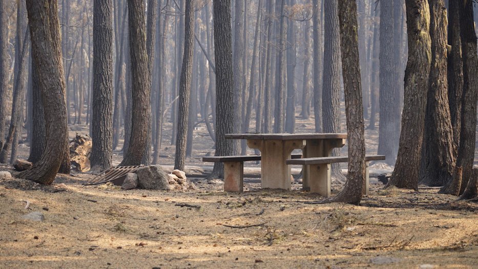
Rain slows growth of Cedar Creek Fire, brings shift in risks to firefighters

OAKRIDGE, Ore. (KTVZ) -- The Cedar Creek Fire barely grew on Monday, as rain and cooler temperatures continued to have positive impacts, but fire officials said Tuesday the danger to firefighters continues and shifts in wetter weather to the potential for falling rocks or trees in burned areas.
Cedar Creek Fire
September 20, 2022
Daily Update at 8:15 AM
Cedar Creek Fire Quick Facts
Size: 113,637 acres
Contained: 11%
Start Date: August 1, 2022
Origin: 15 miles east of Oakridge, Oregon
Cause: Lightning
Total personnel: 2,451
Resources: 91 engines, 53 crews, 97 heavy equipment, 12 helicopters
Status: The fire is 11% contained, with containment line on the west side of the fire between Forest Service Road 24 and Fifth Creek, the stretch from Charlton Lake west to the shore of Waldo Lake, and the north and west shores of Waldo Lake. Oakridge and communities west of the fire will experience the most smoke as southeast winds continue today.
The West Zone of the fire is currently burning with low-intensity creeping, and smoldering. Fire spread is occurring in areas with deep, dry litter and heavy fuels. The East Zone is experiencing fire behavior including creeping, smoldering, and single-tree torching. Fire growth is minimal. Sheltered heat may reemerge after the rain if fuels continue to be dry enough.
West Zone Operations: Heavy smoke and fog lingered through much of the fire area on Monday morning. This inhibited fire growth during the day but also limited firing operations in the morning. Along the south and southwestern edges, firefighters were able to make progress on firing operations along Forest Service Road 5871 and near Eagle Creek. Visibility cleared enough by afternoon for aerial ignitions by helicopter near Kwiskwis Butte. These operations reduce fuels between the fireline and the main fire. Crews continued mopping up along Forest Service Road 2409 and Forest Service Road 1928 where previous firing operations occurred on the western edge of the fire.
As the wetter weather comes into the fire area, firefighter and public safety remains top priority. After steep terrain has burned, rocks once held in place by root systems or vegetation loosen and pose a hazard to firefighters. Dead or fire weakened trees (snags) can fall, compromising the fireline and presenting a risk to firefighters. Firefighters will continue cutting snags and extinguishing hot spots to secure the fire line where previous burning operations occurred. If the weather clears and conditions allow, crews are poised to take advantage of windows of opportunity for continued burning operations.
East Zone Operations: Hotshot crews are wrapping up their work on the fireline and containment line along Forest Service Road 4290. Charlton Lake west to Waldo Lake has been contained and the east side of Charlton Lake to the Cascade Lakes Highway is being improved as a fire break. On the east side of Waldo Lake, crews have completed 6 miles of fuel break, 75 feet deep, along Forest Service Road 5896 and Forest Service Road 5897 from Charlton Lake to Highway 58. More than 170 structures have been prepped on the north side of Odell Lake and near Crescent Junction, and some engines will be released today. Most of the protection work has been completed in campgrounds.
Crews continue work to join Forest Service Road 4668 and Forest Service Road 4660 to create a break between Odell Lake, Davis Lake, and the Cascade Lakes Highway. Between Little Cultus Lake and Deer Lake, crews are brushing, chipping, and removing snags along Forest Service Road 640 to protect Cultus Mountain from future fire advancement. Final clean up is happening on the Forest Service Road 700 fuel break connecting Little Cultus Lake and the Cascade Lakes Highway. Heavy equipment including feller bunchers, masticators, and hydro axes continue work along the Cascade Lakes highway building a shaded fuel break 100 feet wide. This improvement not only protects values at risk from the Cedar Creek fire, but it will remain a valuable tool for managing fire in the future.
Weather: For the next few days, scattered showers and rain are forecasted for much of the fire area. The wet weather is currently slowing fire behavior. However, the amount of rain accumulation expected, especially in areas of thick forest canopy, is not considered a season-ending event.
Evacuations: An updated map of the evacuation areas is available at www.LaneCountyOR.gov/CedarCreek. Sign-up for emergency mobile alerts by going to oralert.gov. Please check with Lane County Sheriff’s Office at 541-682-4150 and Deschutes County Sheriff’s Office at 541-693-6911 for updates and changes. Lane County residents can use the Lane County Sheriff’s Office Flash Alert site for information to support insurance claims for reimbursement for lodging https://flashalert.net/id/LaneSheriff.
Closures: Elijah Bristow State Park and Dexter Boat Launch are closed to the public since they are being used by firefighters. The Deschutes National Forest and Willamette National Forest both have closures in effect to protect the public and firefighters. Please visit Willamette National Forest and Deschutes National Forest for the most recent closure orders and maps. A Temporary Flight Restriction (TFR) is in place. The use of drones is prohibited in the fire area, please make it safe for our firefighters to use aircraft on the fire. Pacific Crest Trail hikers should visit pcta.org for current information. See a map of the fire area with both forest closures here: https://inciweb.nwcg.gov/incident/map/8307/0/137083
Restrictions: Fire restrictions are in place on the Willamette National Forest and Deschutes National Forest.
Smoke: For current conditions, see Fire.airnow.gov, oakridgeair.org, and LRAPA - Today's Current Air Quality. Smoke Forecast Outlooks are available at https://outlooks.wildlandfiresmoke.net/outlook.
Online: https://inciweb.nwcg.gov/incident/8307/ | https://www.facebook.com/CedarCreekFire2022/ |
YouTube: https://www.tinyurl.com/cedarcreekfireyoutube
Fire Information Line: 541-201-2335, 8:00 AM – 8:00 PM |
Email: 2022.cedarcreek@firenet.gov