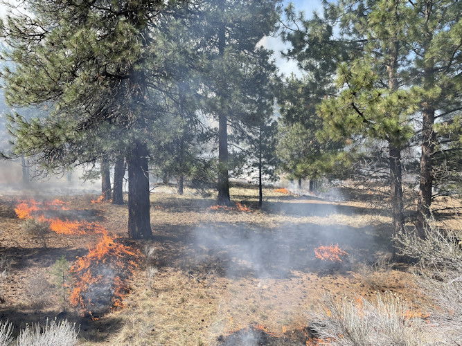
Firefighters plan 2 prescribed burns Monday totaling 314 acres along Paulina Lake Road NE of La Pine

(Update: Details of planned burns NE of La Pine on Monday)
La PINE, Ore. (KTVZ) -- Firefighters on the Bend-Fort Rock Ranger District plan to prescribe burn up to 314 acres on Monday, four miles northeast of La Pine along Paulina Lake Road (Forest Service Road 21).
Ignitions are slated for 11 a.m. Monday, officials said Sunday. Firefighters will start ignitions with Odin North Unit 2 for a total of 155 acres on the south side of Paulina Lake Road, east of Prairie Campground.
If conditions remain favorable and time allows, firefighters will continue with ignitions on Odin North 16 Unit for an additional 159 on the north side of Paulina Lake Road.
Bend-Fort Rock Ranger District firefighters are conducting these burns with support from Central Oregon TREX Prescribed Fire Training participants.
Intermittent smoke impacts are possible for Paulina Lake Road. Flagging and signage will be in place. Motorists should slow down and use caution if driving in the area and watch for firefighters and firefighting engines, officials said.
On Sunday, Sisters Ranger District firefighting crews conducted a 61-acre prescribed burn a mile south of Sisters. The burn took place along Forest Service Road 1605 near the Edgington Road pedestrian bridge over Whychus Creek.
Firefighters transitioned to mop-up by the noon hour and will use water and digging to cool down the area within 30 feet of the perimeter, officials said.
Firefighters use weather and wind conditions to help minimize smoke impacts to roadways and communities. In an alert sent Saturday, officials said smoke will be visible from the town of Sisters and surrounding communities. Sisters Ranger District firefighters also conducted the burn with support from Central Oregon TREX Prescribed Fire Training participants.
On Saturday, firefighters conducted a more than 100-acre prescribed burn, SAFR145, about four miles southwest of Sisters, also including the TREX Prescribed Fire Training participants and the Prineville Hotshots from the Ochoco National Forest.
On Friday, the 57-acre SAFR13 prescribed burn took place three miles southeast of Sisters and the nearly 400-acre East Maintenance burn 20 miles southeast of La Pine.
Prescribed burning reintroduces and maintains fire within a fire-dependent ecosystem helping to stabilize and improve the resiliency of forest conditions while increasing public and firefighter safety. Once firefighters ignite prescribed burns, they monitor and patrol the units until they declare the burn out.
Prescribed burns can protect homes from tragic wildfires. Fire management officials work with Oregon Department of Forestry smoke specialists to plan prescribed burns. Prescribed burns are conducted when weather is most likely to move smoke up and away from our communities. Sometimes, weather patterns change, and some smoke will be present during prescribed burns.
What does this mean for you?
During prescribed burns, smoke may settle in low-lying areas overnight.
- All residents are encouraged to close windows at night to avoid smoke impacts
- When driving in smoky areas, drivers should slow down and turn on headlights
- If you have heart or lung disease, asthma, or other chronic conditions, ask your doctor about how to protect yourself from smoke
- Go to centraloregonfire.org to learn more about smoke safety and prescribed burning in Central Oregon
For more information on prescribed burning in Central Oregon, visit centraloregonfire.org/ and for information specific to the Deschutes National Forest visit www.fs.usda.gov/deschutes. Follow us on Twitter @CentralORFire. Text “COFIRE to 888-777 to receive wildfire and prescribed fire text alerts.