Containment grows to 27% on nearly 19,000-acre Larch Creek Fire in Wasco County as crews expand mop-up work
(Update: Wednesday morning fire update; fire weather watch issued)
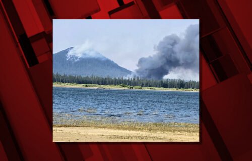
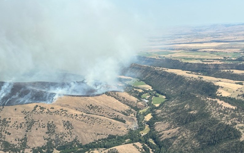
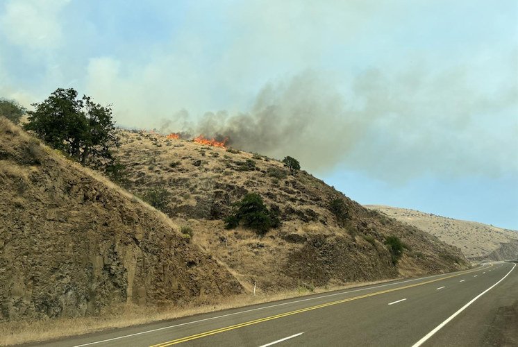
DUFUR, Ore. (KTVZ) – Firefighters have brought the nearly 19,000-acre Larch Creek Fire in Wasco County to 27% containment, officials said Wednesday as crews expand mop-up activities and watch for any new starts caused by Tuesday night's lightning strikes.
Here's the Wednesday morning update on the fire:
(For the latest information, visit the fire's Facebook page):
Larch Creek Fire Morning Update - July 17
Crews expand mop-up activities overnight
Dufur, Ore. – Scattered thunderstorms and gusty winds impacted Southeast Wasco County and other parts of the state early this morning and only minimally impacted the Larch Creek Fire area. Night crews improved containment and mop-up activities continue to expand. Fire personnel remain on stand-by to monitor for any starts caused by lightning strikes.
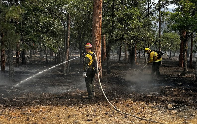
Crews are focused on extinguishing hot spots that may arise from burning root systems as well as monitoring for smoldering snags and spot fires in unburned fuels, both outside of and within the fire’s perimeter. Firefighters are building off the excellent work OSFM did to protect structures, expanding mop-up into the woodlands on the southwest segment of the fire.
The Red Flag Warning for the area ended at 9 a.m. this morning, July 17. The Heat Advisory for Wasco County and surrounding areas will remain until this evening around 10 p.m. High temperatures up to 100 degrees are expected.
Fire crews are still in the area and on local roadways. We ask the community to please give them space and patience as they continue to work on the incident.
Wasco County Sheriff’s Office lowered evacuation levels in some areas yesterday evening, July 16. They will reassess evacuation levels this evening.
Recreation on Pine Hollow Reservoir remains closed as fire operations continue. For more evacuation information and resources for returning home, please continue to check with the Wasco County Sheriff’s Office. Evacuation details are available at: www.facebook.com/WascoCountySheriff
FIRE AT A GLANCE
Estimated Size: 18,690 acres
Containment: 27%
Cause: Human Caused
Estimated Cost: $11,500,000
Total Personnel: 806
Hand Crews: 23
Engines: 41
Water Tenders: 14
Dozers: 9
Helicopters: 12
Evacuations:
Larch Creek Fire Evacuations Update | 6:00 PM Tuesday
LEVEL 3 - GO NOW: From Friend Rd in the north, south to Happy Ridge Rd. east to Elliott Rd and the intersection of Dufur Gap Rd and Hwy 197. From the intersection of Dufur Gap Rd and Hwy 197 south to the Shadybrook Rd and west Mc Corkle.
LEVEL 2 - GET SET
• **NEW** From the intersection of Shadybrook Rd. and Hwy 197 west to the intersection of Shadybrook Rd and Tygh Creek Rd, south to Happy Ridge Rd. and east to Fairgrounds Rd. This area was lowered from Level 3.
• Wamic & Pine Hollow area from Happy Ridge Rd in the north down to Rock Creek Dam Rd/Wamic Market Rd. in the south, west to Threemile Rd. The intersection of Threemile Rd & Campbell Ln. in the west to Hwy 197 in the east.
• From the intersection of Threemile Rd & Campbell Ln. west to Rock Creek Reservoir and south to the White River and east to Campbell Ln.
LEVEL 1 - GET READY
• From the west side of the City of Tygh Valley east to the intersection of Rock Creek Dam Rd. and Campbell Ln., south to the White River, east the intersection to Juniper Flat Rd. and Hwy 197., north to the intersection of Hwy 197 and Tygh Valley Rd. This area was lowered from Level 2.
• From Hwy 197, south to Hulse Rd, east to the Deschutes River, and from the intersection of Hwy 197 and Tygh Valley Market Rd, southeast to the Deschutes River.
• From Elliott Rd. east to Hwy 197, south to the intersection of Hwy 197 and Dufur Gap Rd., and due west to Elliott Rd.
Although residences in Pine Hollow have been lowered to Level 2, recreation on the reservoir remains closed because of continued operations and weather. We will reassess the morning of Wednesday, July 17, 2024.
Fire crews are still in the area. Please give them space and patience as they continue to work on the incident.
The evacuation shelter at the Wy'East Middle School is closed.
Initial info:
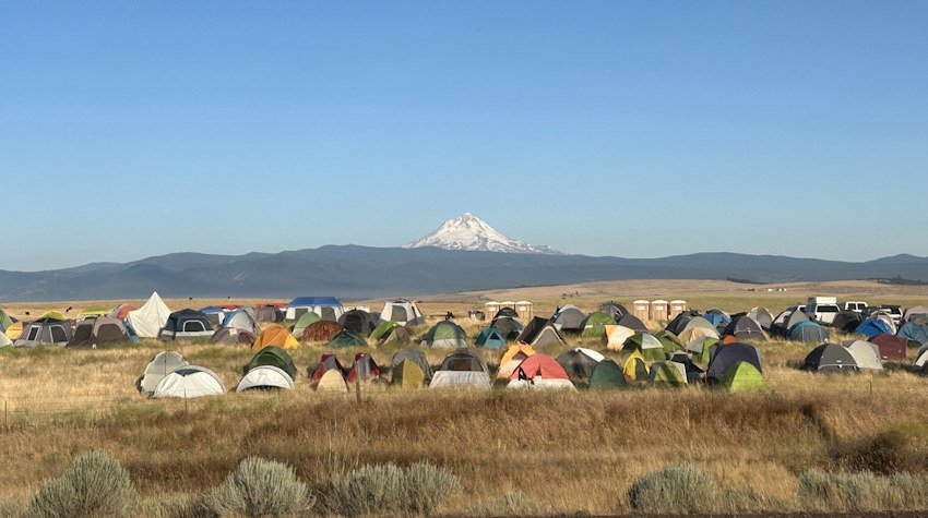
Shortly after the fire was reported last Tuesday, the Waco County Sheriff’s Office asked people to stay away from the Larch Creek Fire on Winslow Road. A Red Cross Evacuation Shelter was opened at Maupin High School. The Wasco County Fairgrounds was designated a temporary evacuation point for livestock.
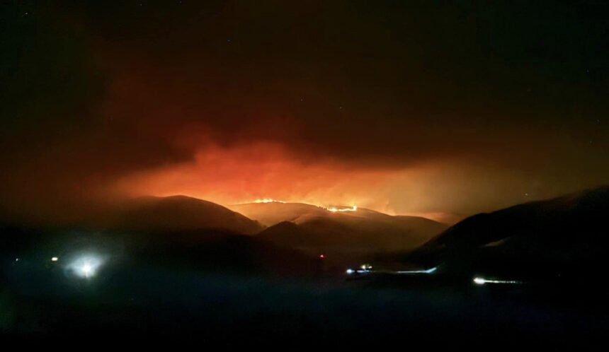
Watch Duty indicated the fire had grown to about 7,000 acres by late Tuesday night.
ODOT said Wednesday that Highway 197 will be closed at times due to the windfire activity between Maupin and Dufur, milepost 22 to 33.
"Expect long delays or use an alternate route," an advisory said, warning that "the highway could fully close at any time, depending on fire activity. Crews are flagging traffic for fire crews and planes working close to the highway."
Check the latest conditions at our ODOT TripCheck page.
--
OSFM mobilizes resources to Larch Creek Fire in Wasco County
Oregon State Fire Marshal - 07/09/24 9:23 PM
SALEM, Ore. – The Oregon State Fire Marshal is mobilizing four structural task forces and its green incident management team to the Larch Creek Fire burning in Wasco County, 16 miles south of The Dalles.
The fire sparked between Dufur and Tygh Valley around 3 p.m. Tuesday and has quickly grown. The fire is estimated at 2,500 acres. The Wasco County Sheriff’s Office has levels 1, 2, and 3 evacuations in place.
The area remains under a Red Flag Warning for critical fire weather. On Tuesday, temperatures reached 107 degrees. Gusty winds are expected to continue into Wednesday.
Three structural task forces will be briefed at 6:00 a.m. Wednesday morning with another task force joining later in the afternoon.
“The heat wave that has gripped Oregon significantly increased the fire danger across the state. The continued hot, dry conditions, and gusty winds are a dangerous combination,” Chief Deputy State Fire Marshal Travis Medema said. “I am asking everyone to do what they can to prevent sparking a wildfire.”
Tuesday night, Oregon Governor Tina Kotek invoked the Emergency Conflagration Act for the fire, which allows the state fire marshal to mobilize state resources to protect life and property.
Following ORS 476.510-476.610, Governor Kotek determined that threats to life, safety, and property exist because of the fire, and the threats exceed the capabilities of local firefighting personnel and equipment.
For the latest on evacuations, follow the Wasco County Sheriff’s Office.